Campground List
CAMPGROUND NAME: Alto Pit
VISIT DATE: 02/03/2009
UPDATE DATE: 3/6/2024
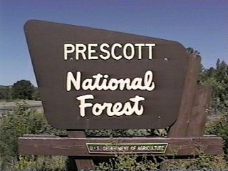
STATE: Arizona
REGION: Southwestern
RANGER DISTRICT: Bradshaw
NEAREST CITY/TOWN: Prescott
RESERVATIONS: 1-877-444-6777 or make on-line reservation
DIRECTIONS:
In Prescott, AZ, at the intersection of State Rts. 69 and 89S,
take Rt. 89S west 1.3 miles to Montezuma St./N 3rd St. Turn
right onto Montezuma St. (becomes Whipple St.) and go 1.4 miles
to where Montezuma/Whipple Streets become Iron Springs Rd.
Continue on Iron Springs Rd. 5.2 miles to campground on right.
GENERAL COMMENTS:
The elevation is 6,000 ft.
This OHV campground seems lopsided with lazy single loops
meandering through a stand of towering Ponderosa pine.
Separation rather than middlestory of White and scrub oak
provide fair privacy between campsites. The campground winds
up and around a dell, so that finding a level spot to pitch a
tent can be a challenge. In the center of the campground is
a pavilion with picnic tables, large barbeques and a small
pedestal barbeque - all well suited for large gatherings. The
campground is centrally located to access about 20 miles of OHV
trails that wind through 400 acres. These trails are closed
to all vehicles larger than 50-inches in width. Unique features
of Alto Pit campground are the granite "bowls" or pits.and
separate areas for children and beginners to ride. OHV riding
in the campground is limited to accessing and returning from
trails.
NOTE: Campground's interior roads can be rough, with erosion
causing significant divots. Low clearance recreation vehicles,
particularly motorhomes, may have problems.
SEASONS
Open Seasonal: No
Open All Year: Yes
RATE AND MAXIMUM STAY PERMITTED
Rate: $14 per day - single
$28 per day - double
Maximum Stay Permitted (days): 14
CAMPGROUND SITE CONFIGURATION
No. RV Sites: 0
No. Tent Sites: 0
No. Combined Sites (Tent or RV): 11
Total Sites: 11
Tent Pads: No
Open Sites: Yes
Wooded Sites: Yes
No. Tables on Sites: 11
No. Grilles on Sites: 11
Equestrian Camping: No
RV INFORMATION
Hookups: None
No. RV Pull Throughs: 10
Waste Station: No
Average Parking Apron Size: See RV Comments
Comments:
The parking aprons are dirt and will accommodate large RVs.
However, erosion of some places on the interior road may give
low clearance RVs problems. A RV dump station, with no potable
water, is available at Many Trails RV, 6850 E. State Rt. 69,
Prescott Valley.
FACILITIES
Vaults: Yes
Flush Toilets: No
Hot Showers: No
Wheelchair Friendly Toilets: Yes
Public Phone: No
Playground: No
No. Water Spigots (non-site): 0
WATER SPORTS None
HIKING
A 20-mile network of trails is available for OHV riders directly
from the campground. However, trails are closed to all vehicles
larger than 50 inches in width. Contact the Bradshaw Ranger
District office for map and more detailed information.
FISHING No

CAMPGROUND NAME: Groom Creek Horse Camp
VISIT DATE: 06/16/1998
UPDATE DATE: 3/6/2024
STATE: Arizona
REGION: Southwestern
RANGER DISTRICT: Bradshaw
NEAREST CITY/TOWN: Prescott
RESERVATIONS: 1-877-444-6777 or make on-line reservation
DIRECTIONS:
In Prescott, AZ, at the intersection of Sheldon Rd. (State
Rd. 89) and Mt. Vernon Ave., turn south onto S. Mt. Vernon Ave.
(Mt. Vernon Ave. becomes Senator Hwy) and continue 6.8 miles
to campground sign. Turn right at sign into campground.
GENERAL COMMENTS:
The elevation is 6,300 ft.
Only campers with horses are permitted in the campground. The
campground has three loops named A, B. and C, winding through
a stand of mixed Ponderosa pine and oaks. There are watering
troughs scattered throughout campground. Each campsite has a
highline and a 16' X 16' horse corral. Most of the sites are
pull throughs which will accommodate most any RV or horse
trailer. However, due to the tight configuration of the
campground's interior roads, the Forest Service has a 40-foot
maximum length on RVs. Campers are asked to bag manure and
place in provided dumpster. Bags, shovel, and wheelbarrows
are also provided.
For additional information about the campground's trails,
events and activities, go to Backcountry Horsemen of Central
Arizona (www.BCHCAZ.org), Prescott Saddle Club
(www.prescottsaddleclub.com), and Prescott Frontier Days
(www.worldsoldestrodeo.com).
SEASONS
Open Seasonal: Yes
Open All Year: No
Seasonal Comment:
Open May 1 through October 30
RATE AND MAXIMUM STAY PERMITTED
Rate: $18 per day
Maximum Stay Permitted (days): 14
CAMPGROUND SITE CONFIGURATION
No. RV Sites: 0
No. Tent Sites: 0
No. Combined Sites (Tent or RV): 37
Total Sites: 37
Tent Pads: No
Open Sites: Yes
Wooded Sites: Yes
No. Tables on Sites: 37
No. Grilles on Sites: 37
Equestrian Camping: Yes
RV INFORMATION
Hookups: None
No. RV Pull Throughs: 33
Waste Station: No
Average Parking Apron Size: 15' X 40'
Comments:
The parking aprons are dirt. The Forest Service recommends
total RV length not exceed 40-feet.
FACILITIES
Vaults: Yes
Flush Toilets: No
Hot Showers: No
Wheelchair Friendly Toilets: Yes
Public Phone: No
Playground: No
No. Water Spigots (non-site): 6
No. Threaded: 0
Comments:
There are watering troughs for stock scattered throughout
campground.
WATER SPORTS None
HIKING
Groom Creek Horse Camp Trail #307 (loop) - 8.7 miles (foot,
horse, and mountain bike)
Inter Loop #383 (loop) - 2.5 miles (foot, horse, and mountain
bike)
Wolf Creek Loop #384 - 6 miles (lfoot, horse, mountain bike
& OHV)
FISHING No
CAMPGROUND NAME: Hazlett Hollow
VISIT DATE: 06/12/1998
UPDATE DATE: 3/6/2024
STATE: Arizona
REGION: Southwestern
RANGER DISTRICT: Bradshaw
NEAREST CITY/TOWN: Crown King
RESERVATIONS: No
DIRECTIONS:
In Crown King, AZ, take dirt road (Forest Rt. 52) south for 0.6
miles to "Y" intersection (Horsethief sign). Bear left and go
6.9 miles to campground sign. Turn left into campground.
NOTE: (1) The road (Forest Rt. 52) from Crown King is dirt and
"unimproved primitive." It is single-lane, rocky, VERY rough and
not RV friendly. In fact, about the first 3 miles would be rough
on family sedans, but with caution, the road is passable. High
clearance vehicles will do best on this road. (2) No matter how
the town of Crown King is accessed, there are over 20 miles of
dirt roads to get there. The roads vary from two-lane to single-lane.
GENERAL COMMENTS:
The elevation is 6,000 ft.
The campground is located in a stand of Ponderosa pines and is
one of four (two do not meet our criteria) in the Horsethief
Basin Recreation Area. Horsethief Lake is nearby. Each site has
a wooden lean-to shelter (with cement floor) in which up to five
adults can sleep. Each site is also landscaped with attractive
stonework and was built by the Civilian Conservation Corps (CCC)
in the 1930s. The understory is grassy and covered with pine
needles. The campground has an "Appalachian Mountains" feel to it.
Although the roads accessing this campground are less than
desirable, the campground and the town of Crown King are worth
the trip. Crown King was a gold mining town, then a ghost town,
now a community of 80 to 100 permanent residents, most of whom
tool around in quads. There are two saloons and a general store
(with regular gasoline and limited groceries). One of the
saloons has been open for 92 years. Its walls are covered with
photos of the old days. The other saloon, besides offering a
variety of beverages, serves a $.99 breakfast seven days a week.
Visit the town and take in its history.
SEASONS
Open Seasonal: Yes
Open All Year: No
Seasonal Comment:
Open May 1 through October 30
RATE AND MAXIMUM STAY PERMITTED
Rate: $10 per day
Maximum Stay Permitted (days): 14
CAMPGROUND SITE CONFIGURATION
No. RV Sites: 0
No. Tent Sites: 5
No. Combined Sites (Tent or RV): 10
Total Sites: 15
Tent Pads: No
Open Sites: No
Wooded Sites: Yes
No. Tables on Sites: 15
No. Grilles on Sites: 15
Equestrian Camping: No
RV INFORMATION
Hookups: None
No. RV Pull Throughs: 0
Waste Station: No
Average Parking Apron Size: 10' X 32'
Comments:
Some parking aprons are dirt and others are paved.
FACILITIES
Vaults: Yes
Flush Toilets: No
Hot Showers: No
Wheelchair Friendly Toilets: No
Public Phone: No
Playground: No
No. Water Spigots: 3
No. Threaded: 0
WATER SPORTS
Lake: Yes
Swimming (provided): No
Sailing: No
Boat Ramp: No
Boat Carry Down Access: No
Power Boating: Yes
Boating (no power): Yes
Water Skiing: No
Rafting (whitewater): No
Kayaking (whitewater): No
Comments:
Horsethief Lake is 3.5 acres. Only electric motors are permitted
on power boats.
HIKING - No
FISHING
Bass, Catfish (stocked) and Redear Sunfish
CAMPGROUND NAME: Hilltop
VISIT DATE: 06/17/1998
UPDATE DATE: 3/6/2024
STATE: Arizona
REGION: Southwestern
RANGER DISTRICT: Bradshaw
NEAREST CITY/TOWN: Prescott
RESERVATIONS: 1-877-444-6777 or make on-line reservation
DIRECTIONS:
In Prescott, AZ, at the intersection of State Rts. 69S and 89N,
take Rts. 69S 2.9 miles to Lynx Lake sign. Turn right after sign
onto Walker Rd. and go 3.1 miles to campground sign. Turn left
after sign and go 0.1 miles to campground on left.
GENERAL COMMENTS:
The elevation is 5,600 ft.
NOTE: This campground is very popular. Expect it to fill
rapidly on weekends and holidays.
The campground, one of three in the Lynx Lake Recreation Area,
has three loops (A through C) winding over hilltops above Lynx
Lake. It is thickly wooded with Ponderosa pine, junipers, oak,
manzanita and other shrubs. Separation between campsites,
rather than the understory of dirt and pine needles, provides
good to excellent privacy. Lynx Lake is about a mile drive from
the campground, However, short trails from Loops B (#313) and
C (#312) go to Lynx Lake Southshore. Many campsites are
terraced providing ample space for tents. The interior road
has wide areas providing room for vehicles to pull into a
campsite rather than the more traditional back-in parking aprons.
A third of the campsites are single sites while the remaining
two-thirds are considered double campsites. Because Lynx Lake
is home to a wide variety of wildlife including bald eagles,
coyote, deer, great blue heron and others, wildlife viewing is
super. The campground is the general location of a gold find;
recreational gold panning is permitted. The Lynx Lake Cafe,
with boat rentals is located adjacent to the Lynx Northshore
Day Use area and offers, along with boats rentals, fishing
supplies, some groceries, and a cook's night out (the Saturday
night German menu is a treat). For more information go to
ynxLakePrescott.com.
There are two designated dispersed camping areas located south
of the Lynx Lake Recreation Area off Walker Road. One area is
located along Forest Developement Road (FDR) 23, Enchanted
Forest Trail, and another on FDR 30, Bannie Mine Road.
Possible day trips from the campground are exploring the city
of Prescott, Prescott Valley, the Highland Center for Natural
History, and hiking in the nearby Granite Mountain Wilderness.
SEASONS
Open Seasonal: Yes
Open All Year: No
Seasonal Comment:
Open April 1 through October 31
RATE AND MAXIMUM STAY PERMITTED
Rate: $18 per day - single
$36 per day - double
Maximum Stay Permitted (days): 14
CAMPGROUND SITE CONFIGURATION
No. RV Sites: 0
No. Tent Sites: 0
No. Combined Sites (Tent or RV): 37
Total Sites: 37
Tent Pads: No
Open Sites: No
Wooded Sites: Yes
No. Tables on Sites: 37
No. Grilles on Sites: 37
Equestrian Camping: No
RV INFORMATION
Hookups: None
No. RV Pull Throughs: 21
Waste Station: No
Potable Water at Waste Station: No
Average Parking Apron Size: 12' X 35'
Comments:
The parking aprons are paved. Most pull throughs are parallel
to road. An RV dump station, with no potable water, is available
at Many Trails RV, 6850 E. State Rt. 69, Prescott Valley.
FACILITIES
Vaults: Yes
Flush Toilets: No
Hot Showers: No
Wheelchair Friendly Toilets: Yes
Public Phone: No
Playground: No
No. Water Spigots (non-site): 7
No. Threaded: 0
WATER SPORTS
Lake: Yes
Swimming (provided): No
Sailing: Yes
Boat Ramp: Yes
Boat Carry Down Access: No
Power Boating: Yes
Boating (no power): Yes
Water Skiing: No
Rafting (whitewater): No
Kayaking (whitewater): No
Comments:
Lynx Lake is 55 acres. Electric motors only for power boats.
Sailboats up to 18-ft permitted. The store on the lake has bait,
rents row boats, canoes and paddle boats. Electric motors are
also available for rent.
HIKING
Homestead trail #305 (foot and mountain bike) - 7 miles
Lakeshore Trail # 311 (loop - foot) - 2.3 miles
The westside of the Shoreline trail #311 is the wheelchair-friendly.
The eastside of this trail is minimally developed and is not
wheelchair-friendly.
A few other trails in the Lynx Lake Recreation Area are"
Sevenmile #9854 (multi-use) - 3.1 miles
Lynx Creek Ruim #301 (foot only) - .5 mile
Salida Gulch #95 (foot, horse, mountain bike) - 4.2
FISHING
Trout
CAMPGROUND NAME: Lower Wolf Creek Forest Camp
VISIT DATE: 06/16/1998
UPDATE DATE: 3/6/2024
STATE: Arizona
REGION: Southwestern
RANGER DISTRICT: Bradshaw
NEAREST CITY/TOWN: Prescott
RESERVATIONS: No
DIRECTIONS:
In Prescott, AZ, at the intersection of Sheldon Rd (State Rt. 89)
and Mt. Vernon Ave., turn south onto S. Mt. Vernon Ave. (which
becomes Senator Hwy) and go 7.3 miles to the pavement's end.
Continue straight on dirt 0.1 miles to a "T" intersection and
Lower Wolf Cr. CG sign. Turn right at sign and go 1.1 miles to
campground sign. Turn left at sign into RV-friendly section or
right into tent-friendly section.
NOTE: Last 1.2 miles can be rough with potholes
GENERAL COMMENTS:
The elevation is 5,900 ft.
The campground has two sections separated by the access road,
Wolf Creek Rd. One section is recommended tent-only and is
located on a hillside. The other section stretches beside
Wolf Creek and has numerous examples of the campground's
Civilian Conservation Corps (CCC) 1930s construction -
stonework in the retaining walls and picnic tables. The
campsites are tucked in among Arizona Walnut, Ponderosa pine
and Live oaks which provide some shade. Separation between
campsites, rather than the understory of grassy and pine
needles, provide fair privacy. There are dispersed campsites
west of the campground along Wolf Creek Road.
SEASONS
Open Seasonal: Yes
Open All Year: No
Seasonal Comment:
Open May 1 through October 30
RATE AND MAXIMUM STAY PERMITTED
Rate: $10 per day
Maximum Stay Permitted (days): 14
CAMPGROUND SITE CONFIGURATION
No. RV Sites: 0
No. Tent Sites: 8
No. Combined Sites (Tent or RV): 11
Total Sites: 19
Tent Pads: No
Open Sites: No
Wooded Sites: Yes
No. Tables on Sites: 19
No. Grilles on Sites: 19
Equestrian Camping: No
RV INFORMATION
Hookups: None
No. RV Pull Throughs: 1
Waste Station: No
Average Parking Apron Size: 14' X 36'
Comments:
The parking aprons are paved.
FACILITIES
Vaults: Yes
Flush Toilets: No
Hot Showers: No
Wheelchair Friendly Toilets: No
Public Phone: No
Playground: No
No. Water Spigots (non-site): 0
WATER SPORTS None
HIKING No
FISHING No
CAMPGROUND NAME: Lynx Lake
VISIT DATE: 06/17/1998
UPDATE DATE: 3/6/2024
STATE: Arizona
REGION: Southwestern
RANGER DISTRICT: Bradshaw
NEAREST CITY/TOWN: Prescott
RESERVATIONS: 1-877-444-6777 or make on-line reservation
DIRECTIONS:
In Prescott, AZ, at the intersection of State Rts. 69S and 89N,
take Rt 69S 2.9 miles to Lynx Lake sign. Turn right after
sign onto Walker Rd. and go 2.8 miles to campground sign.
Turn left at the sign into campground.
GENERAL COMMENTS:
The elevation is 5,600 ft.
NOTE: The campground fills early for weekends and holidays;
all campsites are available for reservation, which is
recommended.
The campground, one of three in the Lynx Lake Recreation Area,
has eight loops (A through H) winding over hillsides above Lynx
Lake. It is thickly wooded with Ponderosa pine, junipers, oak,
manzanita, and other shrubs. The separation between campsites,
rather than vegetation, provides good privacy. Many of them are
terraced providing ample space for tents. Loop H has the
campground's only tent-only campsites. A third of the campsites
are single sites while the remaining two-thirds are considered
double sites for which you pay more.
Lynx Lake is home to a wide variety of wildlife including bald
eagles, coyote, deer, great blue heron and others. It is about
a mile drive from the campground but six trails (#401, 402, 403,
404, 405, and 406) connect the lake and the wheelchair-friendly
(on west side) Shoreline trail (#311) to the campground. The
Shoreline trail continues along the eastside of Lynx Lake but is
minimally developed and not wheelchair-friendly. The campground
is the general location of a gold find; recreational gold panning
is permitted. The Lynx Lake Cafe, with boat rentals is located
adjacent to the Lynx Northshore Day Use area and offers, along
with boats rentals, fishing supplies, some groceries, and a cook's
night out (the Saturday night German menu is a treat). For more
information go to LynxLakePrescott.com.
There are two designated dispersed camping areas located south
of the Lynx Lake Recreation Area off Walker Road. One area is
located along Forest Development Road (FDR) 23, Enchanted Forest
Trail, and another on FDR 30, Bannie Mine Road.
Possible day trips from the campground are exploring the city of
Prescott, the Highland Center for Natural History, and hiking
in the nearby Granite Mountain Wilderness.
SEASONS
Open Seasonal: Yes
Open All Year: No
Seasonal Comment:
Open April 1 through October 31
RATE AND MAXIMUM STAY PERMITTED
Rate: $18 per day - single
$36 per day - double
Maximum Stay Permitted (days): 14
CAMPGROUND SITE CONFIGURATION
No. RV Sites: 0
No. Tent Sites: 2
No. Combined Sites (Tent or RV): 33
Total Sites: 35
Tent Pads: No
Open Sites: No
Wooded Sites: Yes
No. Tables on Sites: 35
No. Grilles on Sites: 35
Equestrian Camping: No
RV INFORMATION
Hookups: None
No. RV Pull Throughs: 17
Waste Station: No
Average Parking Apron Size: 12' X 39'
Comments:
The parking aprons are paved. Most pull throughs are parallel
to road. An RV dump station, with no potable water, is available
at Many Trails RV, 6850 E. State Rt. 69, Prescott Valley.
FACILITIES
Vaults: Yes
Flush Toilets: Yes
Hot Showers: No
Wheelchair Friendly Toilets: No
Public Phone: No
Playground: No
No. Water Spigots (non-site): 9
No. Threaded: 0
Comments:
Flush toilets are in Loops B and E.
WATER SPORTS
Lake: Yes
Swimming (provided): No
Sailing: No
Boat Ramp: Yes
Boat Carry Down Access: No
Power Boating: Yes
Boating (no power): Yes
Water Skiing: No
Rafting (whitewater): No
Kayaking (whitewater): No
Comments:
Lynx Lake is 55 acres. Power boats are limited to electric
motors The store on the lake has bait, rents row boats,
canoes and paddle boats. Electric motors are also available
for rent.
HIKING
Lakeside Trail #311 (loop - foot) - 2.3 miles.
Homestead Trail #305 (foot and mountain bike) - 7 miles
A few other trails in the Lynx Lake Recreation Area are"
Sevenmile #9854 (multi-use) - 3.1 miles
Lynx Creek Ruin #301 (foot only) - 0.5 miles
Salida Gulch #95 (foot, horse, mountain bike) - 4.2
FISHING
Trout
CAMPGROUND NAME: Mingus Mtn.
VISIT DATE: 06/11/1998
UPDATE DATE: 3/6/2024
STATE: Arizona
REGION: Southwestern
RANGER DISTRICT: Verde
NEAREST CITY/TOWN: Clarkdale
RESERVATIONS: No
DIRECTIONS:
In Clarkdale, AZ, at the intersection of State Rt. 89A and Cement Plant Rd.,
take Rt. 89A (toward Jerome, AZ) south 12.1 miles to Mingus Recreation Area
sign (and Summit Picnic Area sign). Turn left onto dirt road (Summit Picnic
Area on left) and go 2.5 miles to campground. The latter road is rough and
steep in places.
NOTE: This paved route (State Rt. 89A) runs right through historic Jerome, AZ
(no gas station) and up Mingus Mtn. Scenic Byway. The entire route from Cement
Plant Rd. is a mountain road in every sense of the word - steep, many hairpin
15/20 mph curves, narrow two-lane in several places, and might be considered
"white knuckle" by some drivers.
Suggested alternative route: From Prescott Valley, AZ take State Rt. 89A north
13.5 miles to Mingus Recreation Area sign and Summit Picnic Area signs. Turn
right onto dirt road (Summit Picnic Area on left) and go 2.5 miles to campground.
The latter road is rough and steep in places. This alternate route does have
some mountain curves, but it is far more RV friendly than the other way through
Jerome. It is recommended by the authors.
GENERAL COMMENTS:
The elevation is 7,600 ft.
The campground is located in the pines on top of Mingus Mtn. It has two
unnamed sections, one with electric hook-ups and the other best suited for
tent campers. The latter section has three spurs stretching up the
mountainside under towering Ponderosa pines that provide ample shade. The
other section is one large loop in a stand of younger Ponderosa pine that
provide some shade but don't get in the way of the spectacular views of Verde
Valley, below. The sites with a view fill early and quickly. The campground's
volcanic origin can be seen in the many lava tuff rocks scattered all around.
Possible day trip: A visit to historic Jerome, AZ. There, one can also visit
the privately owned Gold King Mine and Ghost Town. It's lots of fun for the
young and "old" alike. For old car car/truck/machinery enthusiasts, it is truly
a "gold mine." There is even a very old, working saw mill. The drive up Mingus
Mtn. Scenic Byway offers some spectacular vistas.
This is bear country; practice safe food storage techniques.
SEASONS
Open Seasonal: Yes
Open All Year: No
Seasonal Comment:
Open May 1 through October 31
RATE AND MAXIMUM STAY PERMITTED
Rate: $10 per day - no electric hookups
$14 per day - w/ electric hookups
NOTE: 2/7/2024 - Campground has no electricity due to lightning damage.
No specific date when electricity will be restored. Contact ranger district office
for status.
Maximum Stay Permitted (days): 14
CAMPGROUND SITE CONFIGURATION
No. RV Sites: 0
No. Tent Sites: 10
No. Combined Sites (Tent or RV): 19
Total Sites: 29
Tent Pads: No
Open Sites: No
Wooded Sites: Yes
No. Tables on Sites: 29
No. Grilles on Sites: 29
Equestrian Camping: No
RV INFORMATION
No. Full Hookups (includes waste): 0
No. Water and Electric Only: 0
No. Water Only: 0
No. Electric Only: 19
No. RV Pull Throughs: 8
Waste Station: No
Average Parking Apron Size: 12' X 50'
Comments:
The parking aprons are gravel.
FACILITIES
Vaults: Yes
Flush Toilets: No
Hot Showers: No
Wheelchair Friendly Toilets: Yes
Public Phone: No
Playground: No
No. Water Spigots: 2
No. Threaded: 0
WATER SPORTS - None
HIKING
Mingus Interpretive Trail (foot) - 0.3 miles
Trail #106 (loop - foot) - 6 miles
Gaddes Can #110 (foot, mountain bike & OHV) - 1.5 miles
FISHING
Stocked Rainbow Trout available for bank fishing at Mingus Lake -
0.25 miles before the campground.
CAMPGROUND NAME: Potato Patch
VISIT DATE: 06/11/1998
UPDAYE DATE: 3/6/2024
STATE: Arizona
REGION: Southwestern
RANGER DISTRICT: Verde
NEAREST CITY/TOWN: Clarkdale
$28 per day - double
DIRECTIONS:
In Clarkdale, AZ, at the intersection of State Rt. 89A and Cement
Plant Rd., take Rt. 89A (toward Jerome, AZ) south 12.1 miles to
Mingus Recreation Area sign (and Summit Picnic Area sign). Turn
right (across from Summit Picnic Area - no campground sign) and
go 0.3 miles to campground.
NOTE: This paved route (State Rt. 89A) runs right through
historic Jerome, AZ (no gas station) and up Mingus Mtn. Scenic
Byway. The entire route from Cement Plant Rd. is a mountain road
in every sense of the word - steep, many hairpin 15/20 mph
curves, narrow two-lane in several places, and might be
considered "white knuckle" by some drivers.
Suggested alternative route: From Prescott Valley, AZ take State
Rt. 89A north 13.5 miles to Mingus Recreation Area sign and
Summit Picnic Area signs. Turn left (across from picnic area -
no campground sign) and go 0.3 miles to campground. This
alternate route does have some mountain curves, but it is far
more RV friendly than the other way through Jerome. It is
recommended by the authors.
GENERAL COMMENTS:
The elevation is 7,000 ft.
The campground is located in Ponderosa pine near the top of
Mingus Mtn. It is configured in two loops, A and B. Loop B has
the electric hookups, all pull-through parking aprons, and is
dedicated to RVs only; there is no place to pitch a tent. This
loop features a pleasant blend of Aspen, Cottonwood, and various
planted shrubs. The lack of middlestory means poor privacy
between sites. Loop A accommodates both tents and RVs in a stand
of mature Ponderosa pines sprinkled with tall junipers. Rt 89A
can be seen from many sites in Loop A. Although there is a lack of
middlestory, ample separation between sites provides fair to good
privacy. Loop A has the campground's only threaded spigots.
Historic Jerome, AZ is a nice day trip. There, one can also
visit the privately owned Gold King Mine and Ghost Town. It's
lots of fun for the young and "old" alike. For old car
car/truck/machinery enthusiasts, it is truly a "gold mine."
There is even a very old, working saw mill. The drive up the
Mingus Mtn. Scenic Byway offers some spectacular mountain vistas.
Another day trip is touring scenic Sedona, AZ.
This bear country; practice safe food storage techniques.
SEASONS
Open Seasonal: Yes
Open All Year: No
Seasonal Comment:
Open May 1 through October 31
RATE AND MAXIMUM STAY PERMITTED
Rate: $14 per day - single (no electric hookups)
$18 per day - single (electric hookups)
$28 per day - double (no electric hookups)
Maximum Stay Permitted (days): 14
CAMPGROUND SITE CONFIGURATION
No. RV Sites: 12
No. Tent Sites: 0
No. Combined Sites (Tent or RV): 28
Total Sites: 40
Tent Pads: Yes
Open Sites: Yes
Wooded Sites: Yes
No. Tables on Sites: 40
No. Grilles on Sites: 40
Equestrian Camping: No
RV INFORMATION
No. Full Hookups (includes waste): 0
No. Water and Electric Only: 0
No. Water Only: 0
No. Electric Only: 12
No. RV Pull Throughs: 12
Waste Station: No
Average Parking Apron Size: 20' X 45'
Comments:
The parking aprons are paved. Loop B has all the pull-throughs
and aprons are all about the same width. Potable water is hauled
in; RVrs fill tank before arrival.
FACILITIES
Vaults: Yes
Flush Toilets: No
Hot Showers: No
Wheelchair Friendly Toilets: Yes
Public Phone: No
Playground: No
No. Water Spigots (non-site): 3
No. Threaded: 2
Comments:
See RV Comments about potable water. The vaults are compost
toilets
WATER SPORTS - None
HIKING
Woodchute Trail #102 (foot) - 2.5 miles
FISHING - No
CAMPGROUND NAME: Powell Springs
VISIT DATE: 06/11/1998
UPDATE DATE: 3/6/2024
STATE: Arizona
REGION: Southwestern
RANGER DISTRICT: Verde
NEAREST CITY/TOWN: Camp Verde
RESERVATIONS: No
DIRECTIONS:
In Camp Verde, AZ, take Interstate 17 south 8.2 miles to Exit 278
(State Rt. 169). At end of exit ramp, turn right onto Rt. 169
(west) and go 5.5 miles to Cherry road sign (Forest Rt. 372).
Turn right onto Rt. 372 (dirt) and go 4.5 miles to campground
sign. Turn left at sign into campground.
GENERAL COMMENTS:
The elevation is 5,300 ft.
The campground is located in a pocket of Ponderosa pines,
Juniper, Oaks, Manzanita and other shrubs, which provide privacy
between some sites. The campground was constructed by the
Civilian Conservation Corps (CCC) in the early 1930s. Chains can
be seen at the ground level of some of the Ponderosa pines.
Rumor has it that the CCC planted the chains to introduce iron
nourishment into the soil. Others say the chains were attached
to treasure. Whatever, the chains are there. A trip to the
nearby town of Cherry provides a glimpse of an old mining town
(no services).
SEASONS
Open Seasonal: No
Open All Year: Yes
RATE AND MAXIMUM STAY PERMITTED
Rate: No charge
Maximum Stay Permitted (days): 14
CAMPGROUND SITE CONFIGURATION
No. RV Sites: 0
No. Tent Sites: 3
No. Combined Sites (Tent or RV): 8
Total Sites: 11
Tent Pads: No
Open Sites: No
Wooded Sites: Yes
No. Tables on Sites: 11
No. Grilles on Sites: 11
Equestrian Camping: No
RV INFORMATION
Hookups: None
No. RV Pull Throughs: 0
Waste Station: No
Average Parking Apron Size: 9' X 29'
Comments:
The parking aprons are dirt some of which are eroded.
FACILITIES
Vaults: Yes
Flush Toilets: No
Hot Showers: No
Wheelchair Friendly Toilets: No
Public Phone: No
Playground: No
No. Water Spigots: 0
WATER SPORTS - None
HIKING - No
FISHING - No
CAMPGROUND NAME: White Spar
VISIT DATE: 06/16/1998
UPDATE DATE: 3/6/2024
STATE: Arizona
REGION: Southwestern
RANGER DISTRICT: Bradshaw
NEAREST CITY/TOWN: Prescott
RESERVATIONS: 1-877-444-6777 or make on-line reservation
DIRECTIONS:
From Prescott, AZ, at the intersection of State 89S (Montezuma St.)
and Sheldon St. (State Rt 69), take State Rt. 89 south 3 miles to
campground sign. Turn left at sign into campground.
GENERAL COMMENTS:
The elevation is 5,600 ft.
The campground, stretching above the seasonal Granite Creek, has
seven unnamed mini-loops and is adjacent to State Rt. 89 among
Ponderosa pine. Campsites 33 throught 42 are tent-only. Other
campsites can accommodate RV and/or tent campers. However, a
serious pitch of the parking aprons could make leveling an RV
challenging. Privacy between campsites is good and the Ponderosa
pine provides a good overstory and ample shade. The campground
is conveniently located for day trips to Prescott.
SEASONS
Open Seasonal: No
Open All Year: Yes
Comment:
November 1 through March 31 - no water
RATE AND MAXIMUM STAY PERMITTED
Rate: $10 - $14 per day depending on season
Maximum Stay Permitted (days): 14
CAMPGROUND SITE CONFIGURATION
No. RV Sites: 0
No. Tent Sites: 18
No. Combined Sites (Tent or RV): 40
Total Sites: 58
Tent Pads: Yes
Open Sites: Yes
Wooded Sites: Yes
No. Tables on Sites: 58
No. Grilles on Sites: 58
Equestrian Camping: No
RV INFORMATION
Hookups: None
No. RV Pull Throughs: 6
Waste Station: No
Average Parking Apron Size: 15' X 38'
Comments:
The parking aprons are paved. An RV dump station, with no
potable water, is available at Many Trails RV, 6850 E. State
Rt. 69, Prescott Valley.
FACILITIES
Vaults: Yes
Flush Toilets: No
Hot Showers: No
Wheelchair Friendly Toilets: Yes
Public Phone: No
Playground: No
No. Water Spigots (non-site): 7
No. Threaded: 0
WATER SPORTS None
HIKING
Coldwater Lakes trail #396 (foot and mountain bike) - 4.6
miles
School House Gulch #67 (motorized only - 50" or less)
White Spar Loop Trail #371/372/373/374 (foot and mountain bike)
- 2.6 miles total
FISHING No
CAMPGROUND NAME: Yavapai
VISIT DATE: 06/16/1998
UPDATE DATE: 3/8/2024
STATE: Arizona
REGION: Southwestern
RANGER DISTRICT: Bradshaw
NEAREST CITY/TOWN: Prescott
RESERVATIONS: 1-877-444-6777 or make on-line reservation
DIRECTIONS:
In Prescott, AZ, at the intersection of State Rts. 69 and 89S,
take Rt 89S west 1.3 miles to Montezuma St./N. 3rd St. Turn
right onto Montezuma St (becomes Whipple St.) and go 1.4 miles
to where the road becomes Iron Springs Rd. Continue on Iron
Springs Rd. for 2.7 miles to Granite Basin sign at mile marker 3.
Turn right at mile marker onto Granite Basin Rd. and go 2.1
miles to campground sign. Turn left at sign into campground.
GENERAL COMMENTS:
The elevation is 5,600 ft.
The campground is the only one in the Granite Basin Recreation
Area and is a short drive from Granite Basin Lake and the Granite
Basin Wilderness. A large single loop, campsite are tucked in
among Ponderosa pine, Junipers, Manzanita and Rhyolite granite
boulders which provide fair shade and good privacy. Some sites
have a limited view of Granite Mountain and all are within
walking distance of a network of hiking and mountain bike trails.
Construction of Granite Basin Lake was a Civilian Conservation
Corps (CCC) project so it now have an established and interesting
shoreline making it a good canoe lake. The campground is
convenient to Prescott and offers a delightful forest camping
experience. The campground was originally a CCC project, but it
reflects little of its origin. Trash receptacle in the Wekuvde
day use area have retained their CCC characteristics.
SEASONS
Open Seasonal: No
Open All Year: Yes
RATE AND MAXIMUM STAY PERMITTED
Rate: $18 per day - single
$36 per day - double
Maximum Stay Permitted (days): 14
CAMPGROUND SITE CONFIGURATION
No. RV Sites: 0
No. Tent Sites: 0
No. Combined Sites (Tent or RV): 20
Total Sites: 20
Tent Pads: Yes
Open Sites: Yes
Wooded Sites: Yes
No. Tables on Sites: 20
No. Grilles on Sites: 20
Equestrian Camping: No
RV INFORMATION
Hookups: None
No. RV Pull Throughs: 0
Waste Station: No
Average Parking Apron Size: 10' X 45'
Comments:
The parking aprons are paved and all about the same size. An
RV dump station, with no potable water, is available at Many
Trails RV, 6850 E. State Rt. 69, Prescott Valley.
FACILITIES
Vaults: Yes
Flush Toilets: No
Hot Showers: No
Wheelchair Friendly Toilets: Yes
Public Phone: No
Playground: No
No. Water Spigots (non-site): 2
No. Threaded: 2
WATER SPORTS
Lake: Yes
Swimming (provided): No
Sailing: No
Boat Ramp: Yes
Boat Carry Down Access: No
Power Boating: No
Boating (no power): Yes
Water Skiing: No
Rafting (whitewater): No
Kayaking (whitewater): No
Comments:
Granite Basin Lake is 5 acres and is 1.3 miles from campground.
HIKING
The Yavapai Connector #355 (foot, horse and mountain bike)
- 0.25 miles
Provides access to the Granite Basin Recreation Area network of
trails and Grainite Mountain Wilderness. Contact the Bradshaw
District Ranger's Office for details and maps.
FISHING
Crappie, Catfish and Sunfish
|