Campground List
CAMPGROUND NAME: Apache
VISIT DATE: 05/12/1999
UPDATE DATE: 3/6/2024
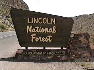
STATE: New Mexico
REGION: Southwestern
RANGER DISTRICT: Sacramento
NEAREST CITY/TOWN: Cloudcroft
RESERVATIONS: No
DIRECTIONS:
From Cloudcroft, NM, take US Rt. 82 east 0.5 miles to State Rt.
244. Turn left onto Rt. 244 and go 1.9 miles to campground sign.
Turn right at sign and go 0.9 miles to the Apache campground
sign. Turn left at sign into campground.
GENERAL COMMENTS:
The elevation is 9,000 ft.
This peaceful and tranquil campground is one of three in a
"recreation area." Furthest of the three campgrounds from
State Rt. 244, it is located in a grove of mature Douglas fir.
The campground is configured in a single loop with sites in
the center tending to be closer together than those on the
outside. Privacy between sites is poor to fair. Interpretive
programs are offered each Saturday evening at the amphitheater.
Four pleasant day trips are visiting the town of Cloudcroft,
Sunspot Observatory, Bluff Springs and Trestle Recreation Area.
Firewood is available for a fee.
Cloudcroft has several craft and variety shops to include a
miniature golf course. The Sunspot Observatory is at the end of
the 16-mile Sunspot Highway or Scenic Byway. You can take a free
self-guided tour of the various observatories and watch the
scientists at work - a great place for the whole family. Bring a
picnic lunch. The Trestle Recreation Area has the Cloud-Climbing
Rail Trail with several scenic overlooks and a replica of a train
depot. Bluff Springs is a trail leading to a waterfall. Pick up
literature at the Chamber of Commerce in Cloudcroft.
This is bear country; practice safe food storage techniques.
SEASONS
Open Seasonal: Yes
Open All Year: No
Seasonal Comment:
Open May 13 through September 15
RATE AND MAXIMUM STAY PERMITTED
Rate: $28 per day
Maximum Stay Permitted (days): 14
CAMPGROUND SITE CONFIGURATION
No. RV Sites: 0.
No. Tent Sites: 0.
No. Combined Sites (Tent or RV): 24
Total Sites: 24
Tent Pads: No
Open Sites: No
Wooded Sites: Yes
No. Tables on Sites: 24
No. Grilles on Sites: 24
Equestrian Camping: No
RV INFORMATION
Hookups: None
No. RV Pull Throughs: 3
Waste Station: Yes
Potable Water at Waste Station: Yes
Average Parking Apron Size: 12' X 43'
Comments:
The parking aprons are paved. Fee required for dumping
at RV waste station located at the Silver Overflow. Water must
be hauled to the campground so each camper is limited to 5 gallons.
RVrs should consider filling water tank before arrival.
FACILITIES
Vaults: Yes
Flush Toilets: No
Hot Showers: Yes
Wheelchair Friendly Toilets: Yes
Public Phone: No
Playground: No
No. Water Spigots (non-site): 1
No. Threaded: 1
Comments:
Hot showers are available for a fee.
WATER SPORTS - None
HIKING
Apache Nature Trail #231 (loop - foot) - 1.6 miles
FISHING - No

CAMPGROUND NAME: Deerhead
VISIT DATE: 05/12/1999
Update Date: 3/6/2024
STATE: New Mexico
REGION: Southwestern
RANGER DISTRICT: Sacramento
NEAREST CITY/TOWN: Cloudcroft
RESERVATIONS: No
DIRECTIONS:
In Cloudcroft, NM, take State Rt. 130 south 1.2 miles to
campground sign. Turn right at sign into campground.
GENERAL COMMENTS:
The elevation is 8,800 ft.
The campground, with two spurs that end in loops, is
adjacent to State Rt. 130 nestled among Ponderosa pine
and Douglas fir. The shorter spur, to the left of fee board,
is tucked up against Rt. 130. Campsites along this spur
experience more traffic noise and because sites are
close together, less privacy. However, it is a good spur
for multi-family camping. The spur to the right stretches
down a draw, away from the highway. This spur is quieter
and a little more sunny. The separation between campsite
rather than vegetation accounts for fair privacy. The narrow
interior road makes the parallel parking pull-through aprons
inadvisable for recreation vehicles with slideouts. Elk are
frequent visitors along with an occasional black bear.
Gophers abound, so much so that one should be careful
not to twist an ankle on one of the many mounds. Day trips
are visiting the town of Cloudcroft, Sunspot Observatory, Bluff
Springs and Trestle Recreation Area.
Cloudcroft has several craft and variety shops to include a
miniature golf course. The Sunspot Observatory is at the end of
the 16-mile Sunspot Highway or Scenic Byway. You can take a free
self-guided tour of the various observatories and watch the
scientists at work - a great place for the whole family. Bring a
picnic lunch. The Trestle Recreation Area has the Cloud-Climbing
Rail Trail with several scenic overlooks and a replica of a train
depot. Bluff Springs is a trail leading to a waterfall. Pick up
literature at the Chamber of Commerce in Cloudcroft.
This is bear country; practice safe food storage techniques.
SEASONS
Open Seasonal: Yes
Open All Year: No
Seasonal Comment:
Open April 1 through October 10
RATE AND MAXIMUM STAY PERMITTED
Rate: $28 per day
Maximum Stay Permitted (days): 14
CAMPGROUND SITE CONFIGURATION
No. RV Sites: 0
No. Tent Sites: 0
No. Combined Sites (Tent or RV): 19
Total Sites: 19
Tent Pads: No
Open Sites: Yes
Wooded Sites: Yes
No. Tables on Sites: 19
No. Grilles on Sites: 19
Equestrian Camping: No
RV INFORMATION
Hookups: None
No. RV Pull Throughs: 3
Waste Station: No
Average Parking Apron Size: See RV comments
Comments:
The parking aprons are paved. Maximum RV rig size should
not exceed 35-ft. A waste station, with potable water, is
available for a fee at the Silver campground (National Forest)
off State Rt. 244. Water must be hauled to the campground so
each camper is limited to 5 gallons. RVrs should consider
filling water tank before arrival.
FACILITIES
Vaults: Yes
Flush Toilets: No
Hot Showers: No
Wheelchair Friendly Toilets: Yes
Public Phone: No
Playground: No
No. Water Spigots (non-site): 1
No. Threaded: 1
Comments:
Hot showers are available for a fee at the Silver campground
(National Forest) off State Rt. 244.
WATER SPORTS - None
HIKING
An unmarked connector trail provides access to the 22-mile Rim
National Recreation Trail - foot, horse, mountain bike and ATV
(50" wide or less).
FISHING - No
CAMPGROUND NAME: Oak Grove
VISIT DATE: 05/13/1999
UPDATE DATE: 3/6/2024
STATE: New Mexico
REGION: Southwestern
RANGER DISTRICT: Smokey Bear
NEAREST CITY/TOWN: Ruidoso
RESERVATIONS: No
DIRECTIONS:
In Ruidoso, NM, at the intersection of US 70 and State Rt. 48,
take Rt. 48 north 8.9 miles to Skyline and Oak Grove Picnic
Ground sign. Turn left at sign and go 5.2 miles to Oak Grove
campground sign. Turn right at sign into campground.
GENERAL COMMENTS:
The elevation is 8,400 ft.
The campground is on top of a mountain ridge nestled under mature
Gamble oaks and Douglas fir. It offers quiet and secluded walk-in
tent sites, some of which are a challenge to find.
CAUTION: This is bear country. Practice safe food storage
techniques.
SEASONS
Open Seasonal: Yes
Open All Year: No
Seasonal Comment:
Open May 8 through September 15
RATE AND MAXIMUM STAY PERMITTED
Rate: $6 per vehicle per day
Maximum Stay Permitted (days): 14
CAMPGROUND SITE CONFIGURATION
No. RV Sites: 0
No. Tent Sites: 25
No. Combined Sites (Tent or RV): 2
Total Sites: 27
Tent Pads: No
Open Sites: Yes
Wooded Sites: Yes
No. Tables on Sites: 27
No. Grilles on Sites: 27
Equestrian Camping: No
RV INFORMATION
Hookups: None
No. RV Pull Throughs: 2
Waste Station: No
Average Parking Apron Size: Not Applicable
Comments:
The Forest Service says: ". . . campground is not recommended for
trailers or RVs over 18 feet due to the grades and curves of the
access roads."
FACILITIES
Vaults: Yes
Flush Toilets: No
Hot Showers: No
Wheelchair Friendly Toilets: No
Public Phone: No
Playground: No
No. Water Spigots (non-site): 0
WATER SPORTS - None
HIKING - No
FISHING - No
CAMPGROUND NAME: Pines
VISIT DATE: 05/12/1999
UPDATE DATE: 3/6/2024
STATE: New Mexico
REGION: Southwestern
RANGER DISTRICT: Sacramento
NEAREST CITY/TOWN: Cloudcroft
RESERVATIONS: No
DIRECTIONS:
From Cloudcroft, NM, take US Rt. 82 east 0.2 miles to State Rt.
244. Turn left onto Rt. 244 and go 0.5 miles to campground sign.
Turn left at sign into campground.
GENERAL COMMENTS:
The elevation is 8,700 ft.
The campground has two loops named Butterfly and Chipmunk. In
the middle of Butterfly Loop is a fenced meadow. This protected area
is the home of the Checkerspot Butterfly found only here and in a few
other areas around Cloudcroft. The Checkerspot is dependant on the
New Mexico Penstemon and Orange Sneezeweed growing within the
fenced area. Several campsites in this loop overlook the fenced area.
The only tent pads in the campground are located on this loop.
Chipmunk Loop, on the left of fee board and up an incline has a limited
turn around. Motorhomes should detach dingy before exploring this
loop. Towering Ponderosa pines provide some shade but most sites
will be sunny for part of the day. The lack of middlestory results in fair
to good privacy. Firewood is available for a fee. This is a good
campground for hikers who want to explore the forest via the Osha Trail.
Day trips are visiting the town of Cloudcroft, Sunspot Observatory,
Bluff Springs and Trestle Recreation Area.
Cloudcroft has several craft and variety shops to include a miniature
golf course. The Sunspot Observatory is at the end of the 16-mile
Sunspot Highway or Scenic Byway. You can take a free self-guided
tour of the various observatories and watch the scientists at work - a
great place for the whole family. Bring a picnic lunch. The Trestle
Recreation Area has the Cloud-Climbing Rail Trail with several scenic
overlooks and a replica of a train depot. Bluff Springs is a trail leading
to a waterfall. Pick up literature at the Chamber of Commerce in
Cloudcroft.
This is bear country; practice safe food storage techniques.
SEASONS
Open Seasonal: Yes
Open All Year: No
Seasonal Comment:
Open May 12 through September 5
RATE AND MAXIMUM STAY PERMITTED
Rate: $28 per day - single
$35 per day - double
$42 per day - triple
Maximum Stay Permitted (days): 14
CAMPGROUND SITE CONFIGURATION
No. RV Sites: 0
No. Tent Sites: 0
No. Combined Sites (Tent or RV): 23
Total Sites: 23
Tent Pads: Yes
Open Sites: Yes
Wooded Sites: Yes
No. Tables on Sites: 23
No. Grilles on Sites: 23
Equestrian Camping: No
RV INFORMATION
Hookups: None
No. RV Pull Throughs: 3
Waste Station: No
Potable Water at Waste Station: No
Average Parking Apron Size: 13' X 38'
Comments:
The parking aprons are paved. A waste station,
with potable water, is available for a fee at the
Silver campground (National Forest) off State Rt. 244.
Pull-throughs are parallel parking style. A sign
posted at entrance to the Chipmonk section states:
"Maximum vehicle length 40 ft."
FACILITIES
Vaults: Yes
Flush Toilets: No
Hot Showers: No
Wheelchair Friendly Toilets: Yes
Public Phone: No
Playground: No
No. Water Spigots (non-site): 4
No. Threaded: 4
Comments:
Hot showers are available for a fee.
WATER SPORTS - None
HIKING
Osha Trail (loop - foot, mountain bike & horse) - 2.2 miles
FISHING - No
CAMPGROUND NAME: Saddle
VISIT DATE: 05/12/1999
UPDATE DATE: 3/6/2024
STATE: New Mexico
REGION: Southwestern
RANGER DISTRICT: Sacramento
NEAREST CITY/TOWN: Cloudcroft
RESERVATIONS: No
DIRECTIONS:
From Cloudcroft, NM, take US Rt. 82 east 0.5 miles to State Rt.
244. Turn left onto Rt. 244 and go 1.9 miles to campground sign.
Turn right at sign and go 0.6 miles to the Saddle campground
sign. Turn left at sign into campground.
GENERAL COMMENTS:
The elevation is 9,000 ft.
The campground is the smallest of three in a "recreation area."
It is nicely wooded with a mixture of Douglas fir, pine and
deciduous trees. The campground is configured as a figure eight
with the only water located at campground entrance. Privacy between
campsites is poor to fair. Firewood is available for a fee.
Interpretive programs are offered each Saturday evening at the
amphitheater. Four pleasant day trips are visiting the town of
Cloudcroft, Sunspot Observatory, Bluff Springs and Trestle
Recreation Area.
Cloudcroft has several craft and variety shops to include a
miniature golf course. The Sunspot Observatory is at the end of
the 16-mile Sunspot Highway or Scenic Byway. You can take a free
self-guided tour of the various observatories and watch the
scientists at work - a great place for the whole family. Bring a
picnic lunch. The Trestle Recreation Area has the Cloud-Climbing
Rail Trail with several scenic overlooks and a replica of a train
depot. Bluff Springs is a trail leading to a waterfall. Pick up
literature at the Chamber of Commerce in Cloudcroft.
CAUTION: This is bear country; practice safe food storage
techniques.
SEASONS
Open Seasonal: Yes
Open All Year: No
Seasonal Comment:
Open May 12 through September 5
RATE AND MAXIMUM STAY PERMITTED
Rate: $28 per day
Maximum Stay Permitted (days): 14
CAMPGROUND SITE CONFIGURATION
No. RV Sites: 0
No. Tent Sites: 0
No. Combined Sites (Tent or RV): 16
Total Sites: 16
Tent Pads: No
Open Sites: No
Wooded Sites: Yes
No. Tables on Sites: 16
No. Grilles on Sites: 16
Equestrian Camping: No
RV INFORMATION
Hookups: None
No. RV Pull Throughs: 4
Waste Station: Yes
Potable Water at Waste Station: Yes
Average Parking Apron Size: 12' X 45'
Comments:
The parking aprons are paved. A fee is required for use
of RV waste station. Water must be hauled to the
campground so each camper is limited to 5 gallons.
RVrs should consider filling water tank before arrival.
FACILITIES
Vaults: Yes
Flush Toilets: No
Hot Showers: Yes
Wheelchair Friendly Toilets: Yes
Public Phone: No
Playground: No
No. Water Spigots (non-site): 1
No. Threaded: 1
Comments:
Hot showers are available for a fee.
WATER SPORTS - None
HIKING
Saddle Nature Trail (foot - loop) - 1 mile
FISHING - No
CAMPGROUND NAME: Silver
VISIT DATE: 05/12/1999
UPDATE DATE: 3/6/2024
STATE: New Mexico
REGION: Southwestern
RANGER DISTRICT: Sacramento
NEAREST CITY/TOWN: Cloudcroft
RESERVATIONS: No
DIRECTIONS:
From Cloudcroft, NM, take US Rt. 82 east 0.5 miles to State Rt.
244. Turn left onto Rt. 244 and go 1.9 miles to campground sign.
Turn right at sign and go 0.3 miles to the Silver campground
sign. Turn left at sign into campground.
GENERAL COMMENTS:
The elevation is 9,000 ft.
The campground is one of three in a "recreation area." Most
sites are nicely wooded with a mixture of fir, pine and other
trees. Privacy between campsites is poor to fair. Firewood is
available for a fee. Interpretive programs are offered each
Saturday evening at the amphitheater. Four pleasant day trips
are visiting the town of Cloudcroft, Sunspot Observatory, Bluff
Springs and Trestle Recreation Area.
Cloudcroft has several craft and variety shops to include a
miniature golf course. The Sunspot Observatory is at the end of
the 16-mile Sunspot Highway or Scenic Byway. You can take a free
self-guided tour of the various observatories and watch the
scientists at work - a great place for the whole family. Bring a
picnic lunch. The Trestle Recreation Area has the Cloud-Climbing
Rail Trail with several scenic overlooks and a replica of a train
depot. Bluff Springs is a trail leading to a waterfall. Pick up
literature at the Chamber of Commerce in Cloudcroft.
CAUTION: This is bear country. Practice safe food storage
techniques.
SEASONS
Open Seasonal: Yes
Open All Year: No
Seasonal Comment:
Open May 12 through October 10 - weather dependent
RATE AND MAXIMUM STAY PERMITTED
Rate: $28 per day
Maximum Stay Permitted (days): 14
CAMPGROUND SITE CONFIGURATION
No. RV Sites: 0
No. Tent Sites: 0
No. Combined Sites (Tent or RV): 30
Total Sites: 30
Tent Pads: No
Open Sites: Yes
Wooded Sites: Yes
No. Tables on Sites: 30
No. Grilles on Sites: 30
Equestrian Camping: No
RV INFORMATION
Hookups: None
No. RV Pull Throughs: 1
Waste Station: Yes
Potable Water at Waste Station: Yes
Average Parking Apron Size: 11' X 49'
Comments:
The parking aprons are paved. There is a fee to dump
at RV waste station. Water must be hauled to the
campground so each camper is limited to 5 gallons.
RVrs should consider filling water tank before arrival.
FACILITIES
Vaults: Yes
Flush Toilets: No
Hot Showers: Yes
Wheelchair Friendly Toilets: Yes
Public Phone: No
Playground: No
No. Water Spigots (non-site): 1
No. Threaded: 1
Comments:
Hot showers are available for a fee.
WATER SPORTS - No
HIKING
Silver Nature Trail (foot - loop) #259 - 0.5 miles
FISHING - No
CAMPGROUND NAME: Skyline
VISIT DATE: 05/13/1999
UPDATE DATE: 3/6/2024
STATE: New Mexico
REGION: Southwestern
RANGER DISTRICT: Smokey Bear
NEAREST CITY/TOWN: Ruidoso
RESERVATIONS: No
DIRECTIONS:
In Ruidoso, NM, at the intersection of US 70 and State Rt. 48,
take Rt. 48 north 8.9 miles to Skyline and Oak Grove Picnic
Ground sign. Turn left at sign and go 0.9 miles to Skyline
Campground sign. Turn right at sign onto Forest Rt. 117 (dirt)
and go 0.7 miles to "Y" intersection. Bear left at intersection
and go 3.9 miles to campground sign. Turn left at sign into
campground.
NOTE: A second parking area and sites are 0.1 miles further down
the road on left. Forest Rt. 117 is washboard and rocky.
GENERAL COMMENTS:
The elevation is 9,000 ft.
This rustic campground, primarily in an open area on top of a
mountain, has a delightful view of the Sierra Blanca Mountains
and White Mountain Wilderness. It is pack it in, pack it out.
CAUTION: This is bear country. Practice safe food storage
techniques.
SEASONS
Open Seasonal: No
Open All Year: Yes
Seasonal Comment:
During snow packed season, gate is closed for access to campground.
But, campers may hike to the campground.
RATE AND MAXIMUM STAY PERMITTED
Rate: No charge
Maximum Stay Permitted (days): 14
CAMPGROUND SITE CONFIGURATION
No. RV Sites: 0
No. Tent Sites: 15
No. Combined Sites (Tent or RV): 0
Total Sites: 15
Tent Pads: No
Open Sites: Yes
Wooded Sites: Yes
No. Tables on Sites: 15
No. Grilles on Sites: 15
Equestrian Camping: No
FACILITIES
Vaults: Yes
Flush Toilets: No
Hot Showers: No
Wheelchair Friendly Toilets: No
Public Phone: No
Playground: No
No. Water Spigots (non-site): 0
WATER SPORTS - None
HIKING - No
FISHING - No
CAMPGROUND NAME: Sleepy Grass
VISIT DATE: 05/12/1999
UPDATE DATE: 3/6/2024
STATE: New Mexico
REGION: Southwestern
RANGER DISTRICT: Sacramento
NEAREST CITY/TOWN: Cloudcroft
RESERVATIONS: No
DIRECTIONS:
In Cloudcroft, NM, take State Rt. 130 south 1.3 miles to
Recreation Site sign. Bear left at sign and go 0.8 miles to
campground.
GENERAL COMMENTS:
The elevation is 8,800 ft.
The campground is located along a grassy valley cradled between
Douglas fir, Ponderosa and Aspen-covered mountain sides. The
scent of Ponderosa pine fills the area. This is a very pretty,
rustic campground with an abundance of walk-in tent sites. Four
pleasant day trips are visiting the town of Cloudcroft, Sunspot
Observatory, Bluff Springs and Trestle Recreation Area.
Cloudcroft has several craft and variety shops to include a
miniature golf course. The Sunspot Observatory is at the end of
the 16-mile Sunspot Highway or Scenic Byway. You can take a free
self-guided tour of the various observatories and watch the
scientists at work - a great place for the whole family. Bring a
picnic lunch. The Trestle Recreation Area has the Cloud-Climbing
Rail Trail with several scenic overlooks and a replica of a train
depot. Bluff Springs is a trail leading to a waterfall. Pick up
literature at the Chamber of Commerce in Cloudcroft.
CAUTION: This is bear country. Practice safe food storage
techniques.
SEASONS
Open Seasonal: Yes
Open All Year: No
Seasonal Comment:
Open May 12 through September 5
RATE AND MAXIMUM STAY PERMITTED
Rate: $26 per day - single
$33 per day - double
$41 per day - triple
Maximum Stay Permitted (days): 14
CAMPGROUND SITE CONFIGURATION
No. RV Sites: 0
No. Tent Sites: 36
No. Combined Sites (Tent or RV): 8
Total Sites: 44
Tent Pads: No
Open Sites: Yes
Wooded Sites: Yes
No. Tables on Sites: 44
No. Grilles on Sites: 43
Equestrian Camping: No
RV INFORMATION
Hookups: None
No. RV Pull Throughs: 8
Waste Station: No
Average Parking Apron Size: Not Applicable
Comments:
The parking aprons are dirt. An RV waste station,
with potable water, is available for a fee at Silver
campground (National Forest) off State Rt. 244.
FACILITIES
Vaults: Yes
Flush Toilets: No
Hot Showers: No
Wheelchair Friendly Toilets: No
Public Phone: No
Playground: No
No. Water Spigots (non-site): 2
No. Threaded: 2
Comments:
Water spigots are co-located at far end of campground.
For a fee, hot showers are available at Silver campground
(National Forest) off State Rt. 244.
WATER SPORTS - None
HIKING
La Pasada Encantada (enchanted path), foot - 0.4 miles
This trail features braille interpretive signs.
FISHING - No
CAMPGROUND NAME: South Fork
VISIT DATE: 05/13/1999
UPDATE DATE: 3/6/2023
STATE: New Mexico
REGION: Southwestern
RANGER DISTRICT: Smokey Bear
NEAREST CITY/TOWN: Ruidoso
RESERVATIONS: No
DIRECTIONS:
In Ruidoso, NM, at the intersection of US 70 and State Rt. 48,
take Rt. 48 north 13.1 miles to State Rt. 37. Turn left onto Rt.
37 and go 1.3 miles to Bonito Lake sign. Turn left at sign and
go 4.9 miles to campground sign. Turn left at sign and go 0.5
miles into campground.
GENERAL COMMENTS:
The elevation is 7,500 ft.
The campground is convenient to Bonito Lake and adjacent to the
White Mountain Wilderness. Many of the camp sites are scattered
up a mountainside among Ponderosa pine. Others are walk-in tent
sites distributed along the South Fork of the Rio Bonito. This
is a pretty campground offering a wilderness experience with few
of the difficulties. The understory is grass.
CAUTION: This is bear country. Practice safe food storage
techniques.
SEASONS
Open Seasonal: Yes
Open All Year: No
Seasonal Comment:
Open May 15 through September 15.
RATE AND MAXIMUM STAY PERMITTED
Rate: $10 per licensed, motorized vehicle per day
Maximum Stay Permitted (days): 14
CAMPGROUND SITE CONFIGURATION
No. RV Sites: 0
No. Tent Sites: 19
No. Combined Sites (Tent or RV): 35
Total Sites: 54
Tent Pads: No
Open Sites: Yes
Wooded Sites: Yes
No. Tables on Sites: 54
No. Grilles on Sites: 54
Equestrian Camping: No
RV INFORMATION
Hookups: None
No. RV Pull Throughs: 3
Waste Station: No
Average Parking Apron Size: 12' X 56'
Comments:
There is a mix of paved and gravel parking aprons. A waste
station is located at the Westlake Campground a short distance
before South Fork campground. There is no potable water and
expect to pay a fee to dump.
FACILITIES
Vaults: No
Flush Toilets: Yes
Hot Showers: No
Wheelchair Friendly Toilets: Yes
Public Phone: No
Playground: No
No. Water Spigots (non-site): 9
No. Threaded: 8
WATER SPORTS - None
HIKING
South Fork Trail #19 (foot and horse) - 6 miles
Intersects with Trails #25 and #33 and provides access to the
White Mountain Wilderness.
FISHING
Brook Trout in the South Fork and other trout in the nearby
Bonito Lake.
CAMPGROUND NAME: Three Rivers
VISIT DATE: 05/14/1999
UPDATE DATE: 3/6/2024
STATE: New Mexico
REGION: Southwestern
RANGER DISTRICT: Smokey Bear
NEAREST CITY/TOWN: Tularosa
RESERVATIONS: No
DIRECTIONS:
In Tularosa, NM, at the intersection of US Rts. 54 and 70, take
Rt. 54 north 17.2 miles to a Petroglyphs and Picnic Area sign
(County Rt. B030). Turn right at sign onto Rt. B030 and go 13
miles to campground.
NOTE: County Rt. B030 becomes gravel after 5.5 miles.
GENERAL COMMENTS:
The elevation is 6,400 ft.
The campground, located in a Pinyon/Juniper habitat, provides
gorgeous (close-up) views of the Sacramento Mountain range and
White Mountain Wilderness. It is located adjacent to two
seasonal creeks, Dry and Fall, and the year-round Three Rivers.
Although the sites are all in an open area, some have ramadas
covering the picnic tables. Horses are permitted in the
campground but must be housed in the several provided corrals.
Located on the west side of the White Mountain Wilderness, the
campground is an excellent home base to explore the mountains and
wilderness. Elk and other wildlife are frequent visitors. The
campground is nicely laid out and should be a pleasant experience
for most every type of camper.
An excellent day trip for the whole family is visiting the Three
Rivers Petroglyph Site, 8.4 miles west of the campground on
County Rt. B030. There are over 20,000 petroglyphs scattered
throughout the site. Bring a picnic lunch, lots of water and
wear sturdy shoes. The self-guided trail through the site is a
moderate climb and rocky.
CAUTION: This is bear country. Practice safe food storage
techniques.
SEASONS
Open Seasonal: No
Open All Year: Yes
RATE AND MAXIMUM STAY PERMITTED
Rate: $6 per day
Maximum Stay Permitted (days): 14
CAMPGROUND SITE CONFIGURATION
No. RV Sites: 0
No. Tent Sites: 3
No. Combined Sites (Tent or RV): 9
Total Sites: 12
Tent Pads: Yes
Open Sites: Yes
Wooded Sites: No
No. Tables on Sites: 12
No. Grilles on Sites: 12
Equestrian Camping: Yes
RV INFORMATION
Hookups: None
No. RV Pull Throughs: 1
Waste Station: No
Average Parking Apron Size: 14' X 48'
Comments:
The parking aprons are gravel.
FACILITIES
Vaults: Yes
Flush Toilets: No
Hot Showers: No
Wheelchair Friendly Toilets: Yes
Public Phone: No
Playground: No
No. Water Spigots (non-site): 1
No. Threaded: 0
Comments:
Drinking water is available at the host site.
WATER SPORTS - None
HIKING
Three Rivers Trail (foot and horse) - 6 miles.
The trail provides access to the White Mountain Wilderness.
FISHING - No
|