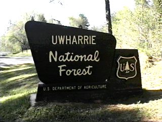
Campground List
CAMPGROUND NAME: Arrowhead

VISIT DATE: 04/16/1996

UPDATE DATE: 1/22/2025

STATE: North Carolina

REGION: Southern

RANGER DISTRICT: Uwharrie

NEAREST CITY/TOWN: Uwharrie

RESERVATIONS: 1-877-444-6777 or make on-line reservation

DIRECTIONS:
From Uwharrie, NC, take State Rt. 109 north 2.8 miles to second Badin
Lake Recreation Area sign (Mullinex Rd./State Rt. 1154).  Turn left at
sign onto Mullinex Rd. and go 1.5 miles to McLeans Creek Rd. (Forest
Rt. 544) sign; last 0.4 miles are gravel.  Turn right onto Rt. 544 (paved)
and go 1.7 miles to a "T" intersection (Badin Lake/Forest Rt. 597).  Turn
left onto Badin Lake (gravel) and go 0.5 miles to campground sign
(Cove Rd./Forest Rt. 597B) and go 0.3 miles to campground.

GENERAL COMMENTS:
The elevation is 520 feet.

The campground is comprised of a single spur and two loops.  The spur leads
from the campground's entrance to the large single loop which can accommodate
both tent and RV campers.  Located on a bluff above Badin Lake, some of the
large loop's camp sites have a pleasant view of the lake, especially in late
fall and winter.  The second, small loop, for tents only, is off by itself in
a wooded area.  The campground features delightfully modern toilet and shower
facilities with individual and family-style bathrooms and hand-wash laundry
facility.  Although nicely wooded (Virginia pine, oak, and a variety of hickory),
there is little privacy between camp sites.  There is a lantern post at each camp
site.  The entrance gate is locked from 10PM to 6AM.

SEASONS
Open Seasonal: No
Open All Year: Yes

RATE AND MAXIMUM STAY PERMITTED
Rate: $20 per day - single, no hookups
$27 per day - single w/ electric hookups
$40 per day - double, no hookups
$54 per day - double w/ electric hookups

NOTE:  No Discount on electric surcharge
Maximum Stay Permitted (days): 14

CAMPGROUND SITE CONFIGURATION
No. RV Sites: 0
No. Tent Sites: 4
No. Combined Sites (Tent or RV): 44

   Total Sites: 48

Tent Pads: No
Open Sites: No
Wooded Sites: Yes

No. Tables on Sites: 48
No. Grilles on Sites: 48
Equestrian Camping: No

RV INFORMATION
No. Full Hookups (includes waste): 0
No. Water and Electric Only: 0
No. Water Only: 0
No. Electric Only: 33

No. RV Pull Throughs: 6
Waste Station: Yes
Potable Water at Waste Station: Yes
Average Parking Apron Size: 12' X 58'

Comments:
The parking aprons are paved and tend to have an upward or
downward slope.

BATH AND SHOWER FACILITIES
Vaults: No
Flush Toilets: Yes
Hot Showers: Yes

Comments:
The showers are wheelchair friendly.

OTHER FACILITIES
Playground: No
Public Phone: Yes
No. Water Spigots (non-site): 6
  No. Threaded: 5
Wheelchair Friendly Toilets: Yes

WATER SPORTS
Lake: Yes
Swimming (provided): No
Sailing: Yes
Boat Ramp: Yes
Boat Carry Down Access: No
Power Boating: Yes
Boating (no power): Yes
Water Skiing: Yes
Rafting (whitewater): No
Kayaking (whitewater): No

Comments:
Badin Lake is 5,000 acres.  Maximum vessel height is 26 ft.

HIKING
Badin Lake Trail (foot) - 2.5 miles (short loop) and
5.4 miles (long loop)

FISHING
Bass, Bream, Crappie and catfish

CAMPGROUND NAME: Badin Lake

VISIT DATE: 04/16/1998

UPDATE DATE: 1/22/2025

STATE: North Carolina

REGION: Southern

RANGER DISTRICT: Uwharrie

NEAREST CITY/TOWN: Uwharrie

RESERVATIONS: 1-877-444-6777 or make on-line reservation

DIRECTIONS:
From Uwharrie, NC, take State Rt. 109 north 2.8 miles to second Badin
Lake Recreation Area sign (Mullinex Rd./State Rt. 1154).  Turn left at
sign onto Mullinex Rd. and go 1.5 miles to McLeans Creek Rd. (Forest
Rt. 544) sign; last 0.4 miles are gravel.  Turn right onto Rt. 544 (paved)
and go 1.7 miles to a "T" intersection (Badin Lake Rd./Forest Rt. 597).
Turn right onto Badin Lake Rd. (gravel) and go 0.2 miles to a "Y" intersection
(Forest Rt. 597A).  Bear left onto Rt. 597A and go 0.5 miles to another "Y"
intersection.  Bear left, staying on Rt. 597A, and go 0.4 miles to campground.

GENERAL COMMENTS:
The elevation is 520 ft.

The campground, older with lots of character, is composed of two separate
loops.  One loop touches the Badin (bay-din) Lake shoreline while the other
is on a bluff overlooking the lake.  The bluff loop has no potable water and
slightly shorter parking aprons.  The shoreline loop features camp sites
adjacent to the lake and only water spigots in the campground.  Virginia pine,
oak and a variety of hickory trees provide lots of shade to the campground.
Privacy between camp sites is good.  The entrance gate is locked at 10PM and
opened at 6PM.

SEASONS
Open Seasonal: No
Open All Year: Yes

RATE AND MAXIMUM STAY PERMITTED
Rate: $20 per day - single
$40 per day - double
Maximum Stay Permitted (days): 14

CAMPGROUND SITE CONFIGURATION
No. RV Sites: 0
No. Tent Sites: 0
No. Combined Sites (Tent or RV): 35

   Total Sites: 35

Tent Pads: No
Open Sites: No
Wooded Sites: Yes

No. Tables on Sites: 35
No. Grilles on Sites: 35
Equestrian Camping: No

RV INFORMATION
Hookups: None
No. RV Pull Throughs: 0
Waste Station: No
Average Parking Apron Size: 13' X 60'

BATH AND SHOWER FACILITIES
Vaults: No
Flush Toilets: Yes
Hot Showers: Yes

OTHER FACILITIES
Playground: No
Public Phone: No
No. Water Spigots (non-site): 3
  No. Threaded: 0
Wheelchair Friendly Toilets: Yes

WATER SPORTS
Lake: Yes
Swimming (provided): No
Sailing: Yes
Boat Ramp: No
Boat Carry Down Access: Yes
Power Boating: Yes
Boating (no power): Yes
Water Skiing: Yes
Rafting (whitewater): No
Kayaking (whitewater): No

Comments:
Badin Lake is 5,000 acres.  No access is available at campground.
However, there is a boat ramp 2 miles south at Cove Landing in the
Arrowhead campground (National Forest).  Maximum vessel height is 26 ft.

HIKING
Badin Lake Trail (foot) - 2.5 miles (short loop) and 5.4 miles (long loop)

FISHING
Bass, Bream, Crappie and catfish.

CAMPGROUND NAME: Canebrake Horse Camp

VISIT DATE: 12/08/2001

UPDATE DATE: 1/22/2025

STATE: North Carolina

REGION: Southern

RANGER DISTRICT: Uwharrie

NEAREST CITY/TOWN: Uwharrie

RESERVATIONS: 1-877-444-6777 or make on-line reservation

DIRECTIONS:
From Uwharrie, NC, take State Rt. 109 north 2.8 miles to second
Badin Lake Recreation Area sign (Mullinex Rd./State Rt. 1154).
Turn left at sign onto Mullinex Rd. and go 1.5 miles to McLeans
Creek Rd. (Forest Rt. 544) sign; last 0.4 miles are gravel.  Turn
right onto Rt. 544 (paved) and go 0.3 miles to campground sign.
Turn right at sign into campground.

GENERAL COMMENTS:
The elevation is 1,000 ft.

The campground is composed of two loops with Virginia pine, oak
and a variety of hickory trees.  One loop is larger and sparsely
wooded with modern bathrooms.  The smaller loop is more heavily
wooded and has a higher percentage of double and pull-through
camp sites.  A lead line is provided for horses at each camp site
in the campground.  In addition, there is a lantern pole, a
cypress work table and the usual picnic table and grille at each
site.  A trail encircles the campground and provides access to
some 38 miles of horse trails.  For those interested in giving a
shower to their horses, there is a facility for them too - quite
a campground.  Entrance gate is locked at 10PM and opened at 6AM.

SEASONS
Open Seasonal: No
Open All Year: Yes

RATE AND MAXIMUM STAY PERMITTED
Rate: $27 per day - single w/ electric hookups
$54 per day - double w/ electric hookups

NOTE:  No Discount on surcharge
Maximum Stay Permitted (days): 14

CAMPGROUND SITE CONFIGURATION
No. RV Sites: 0
No. Tent Sites: 0
No. Combined Sites (Tent or RV): 28

   Total Sites: 28

Tent Pads: No
Open Sites: Yes
Wooded Sites: Yes

No. Tables on Sites: 28
No. Grilles on Sites: 28
Equestrian Camping: Yes

RV INFORMATION
No. Full Hookups (includes waste): 0
No. Water and Electric Only: 0
No. Water Only: 0
No. Electric Only: 28

No. RV Pull Throughs: 8
Waste Station: Yes
Potable Water at Waste Station: Yes
Average Parking Apron Size: 17' X 50'

Comments:
The parking aprons are gravel.

FACILITIES
Vaults: Yes
Flush Toilets: Yes
Hot Showers: Yes
Wheelchair Friendly Toilets: Yes

Public Phone: No
Playground: No
No. Water Spigots (non-site): 4
  No. Threaded: 4

Comments:
The showers are wheelchair friendly and heated.

WATER SPORTS - None

HIKING
An unnamed loop trail around the campground provides access to 38
miles of horse trails.  Contact the Uwharries Ranger District
Office for details.

FISHING - No

CAMPGROUND NAME:  West Morris
VISIT DATE: 04/16/1996

UPDATE DATE: 1/22/2025

STATE: North Carolina

REGION: Southern

RANGER DISTRICT: Uwharrie

NEAREST CITY/TOWN: Uwharrie

RESERVATIONS: No

DIRECTIONS:
In Uwharrie, NC, at the intersection of State Rt. 109 and Ophir Rd.
(State Rt. 1303), turn onto Ophir Rd. and go 1 mile to campground sign.
Turn right at sign onto a gravel, single-lane road and go 0.1 miles to
campground.

GENERAL COMMENTS:
The elevation is 420 ft.

The campground, a.k.a. West Morris Mountain and adjacent to the Uwharrie
National Recreation Trail, was constructed in 1994 by the Uwharrie Senior
Citizen Crew.  It is a single loop, surrounded by a stand of conifer and
deciduous trees.  This is a quiet and rustic campground - a good location
for those seeking solitude.  Closely spaced camp sites and widely spaced
trees provide only fair privacy.

SEASONS
Open Seasonal: No
Open All Year: Yes

RATE AND MAXIMUM STAY PERMITTED
Rate: $10 per day - single
Maximum Stay Permitted (days): 14

CAMPGROUND SITE CONFIGURATION
No. RV Sites: 0
No. Tent Sites: 0
No. Combined Sites (Tent or RV): 16

   Total Sites: 16

Tent Pads: No
Open Sites: No
Wooded Sites: Yes

No. Tables on Sites: 16
No. Grilles on Sites: 16
Equestrian Camping: No

RV INFORMATION
Hookups: None
No. RV Pull Throughs: 1
Waste Station: No
Potable Water at Waste Station: No
Average Parking Apron Size: 13' X 55'

Comments:
The parking aprons are gravel.

BATH AND SHOWER FACILITIES
Vaults: Yes
Flush Toilets: No
Hot Showers: No

OTHER FACILITIES
Playground: No
Public Phone: No
No. Water Spigots (non-site): 0
  No. Threaded: 0
Wheelchair Friendly Toilets: Yes

WATER SPORTS - None

HIKING
Uwharrie Trail (foot) - 20 miles

FISHING - No
|