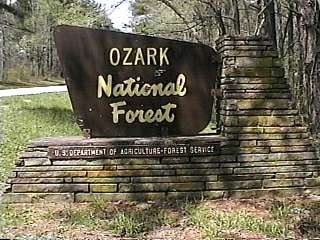
Campground List
CAMPGROUND NAME: Blanchard Springs

VISIT DATE: 04/13/1997

UPDATE DATE: 2/15/2025

STATE: Arkansas

REGION: Southern

RANGER DISTRICT: Sylamore

NEAREST CITY/TOWN: Fifty Six

RESERVATIONS: No

DIRECTIONS:
From Fifty Six, AR, take State Rt. 14 east 0.4 miles to Blanchard Springs
Cavern sign.  Turn left at sign and go 2.4 miles to a "T" intersection.
Turn left and go 0.4 miles to campground.

GENERAL COMMENTS:
The elevation is 400 ft.

The campground is composed of one loop accessed by fording the North
Sylamore Creek over a low-water bridge (inaccessible during heavy
rains).  The campground is heavily wooded with a mixture of hardwoods
and cedar and quite attractive with Dogwoods blooming in early April.
The campground is rich in scenery and history. Little is left of the
Civilian Conservation Corp (CCC) Camp Hedges, Company 743
but the enrollee's efforts, such as Mirror Lake, continue to provide
a variety of recreational opportunities to the public.

Blanchard Springs is an excellent destination campground. There is
the Blanchard Springs Caverns, a spectacular "living" cave - a must
visit.  Reservations for the tour are recommended.  Then, in the same
Recreation area, there is the walk to Blanchard Springs - a wonderful
spectacle of water pouring out of the mountain side.  Just above and
to the left of it, is the original CCC-built gatehouse - built around
1935.  Also, see the natural amphitheater, towering Sandfield Bluff,
and Shelter Cave near the day use area.

About 15 miles away on State Rt. 14, near Mountain View, AR, is the
Ozark Folk Center State Park.  Here, many folk and gospel concerts
are held.  Another major attraction in the Park are various "cottages"
that house live demonstrations of blacksmithing, knife making, gun
smithing, quilting, etc.  There are also mini-concerts during the
day of "foot stompin" folk music.  This Park, like the Caverns, is
lots of fun for every family member.

SEASONS
Open Seasonal: No
Open All Year: Yes

Maximum stay limit: 5 days - Memorial Day weekend through Labor Day;
14 days for remainder of year.

NOTE: Campground closes when heavy rain is predicted since campground
road fords creek. Contact ranger district office for status.

RATE AND MAXIMUM STAY PERMITTED
Rate: $15 per day
Maximum Stay Permitted (days): 5 and 14

CAMPGROUND SITE CONFIGURATION
No. RV Sites: 0
No. Tent Sites: 0
No. Combined Sites (Tent or RV): 18

   Total Sites: 18

Tent Pads: Yes
Open Sites: No
Wooded Sites: Yes

No. Tables on Sites: 18
No. Grilles on Sites: 18
Equestrian Camping: No

RV INFORMATION
No. Full Hookups (includes waste): 0
No. Water and Electric Only: 0
No. Water Only: 0
No. Electric Only: 1

No. RV Pull Throughs: 1
Waste Station: Yes
Potable Water at Waste Station: Yes
Average Parking Apron Size: 12.5' X 63'

Comments:
The parking aprons are paved.

BATH AND SHOWER FACILITIES
Vaults: No
Flush Toilets: Yes
Hot Showers: Yes

OTHER FACILITIES
Playground: No
Public Phone: No
No. Water Spigots (non-site): 1
  No. Threaded: 0
Wheelchair Friendly Toilets: Yes

WATER SPORTS
Lake: No
Swimming (provided): Yes
Sailing: No
Boat Ramp: No
Boat Carry Down Access: No
Power Boating: No
Boating (no power): No
Water Skiing: No
Rafting (whitewater): No
Kayaking (whitewater): No

Comments:
Swimming and wading in Sylamore Creek

HIKING
North Sylamore Creek Trail
   to Gunner Pool campground - 5 miles
   to Barkshed Recreation Area - 9 miles
Sylamore Mountain Bike Trail (foot & mountain bike) - 21.3 miles

FISHING
Smallmouth bass in North Sylamore Creek and stocked trout in the nearby
Mirror Lake.

CAMPGROUND NAME: Cove Lake

VISIT DATE: 04/03/1997

UPDATE DATE: 2/17/2025

STATE: Arkansas

REGION: Southern

RANGER DISTRICT: Magazine

NEAREST CITY/TOWN: Paris

RESERVATIONS: 1-877-444-6777 or make on-line reservation

DIRECTIONS:
From Paris, AR, take State Rt. 309 for 8 miles to Cove Lake
Recreation Area sign.  Turn left at sign into campground.

GENERAL COMMENTS:
The elevation is 860 ft.

The campground, constructed by the Civilian Conversation Corps (CCC)
and Works Progress Administration (WPA) between 1938 and 1941, is
situated in mature mixed woods.  Some sites overlook Cove Lake.
Paddle boats and water scamps are available for rent.

SEASONS
Open Seasonal: No
Open All Year: Yes

Seasonal Comment:
None

RATE AND MAXIMUM STAY PERMITTED
Rate: $15 per day
Maximum Stay Permitted (days): 14

CAMPGROUND SITE CONFIGURATION
No. RV Sites: 0
No. Tent Sites: 9
No. Combined Sites (Tent or RV): 19

   Total Sites: 28

Tent Pads: Yes
Open Sites: No
Wooded Sites: Yes

No. Tables on Sites: 28
No. Grilles on Sites: 28
Equestrian Camping: No

RV INFORMATION
Hookups: None
No. RV Pull Throughs: 0
Waste Station: Yes
Potable Water at Waste Station: Yes
Largest Parking Apron Size: 11.5' X 66'

Comments:
Parking aprons are gravel.  Some interior roads are narrow.

BATH AND SHOWER FACILITIES
Vaults: Yes
Flush Toilets: No
Hot Showers: No

Comments:
Hot showers are available at the beach.  Bathhouse and
water shut down during winter.

OTHER FACILITIES
Playground: Yes
Public Phone: No
No. Water Spigots (non-site): 5
  No. Threaded: 0
Wheelchair Friendly Toilets: No

WATER SPORTS
Lake: Yes
Swimming (provided): Yes
Sailing: Yes
Boat Ramp: Yes
Boat Carry Down Access: Yes
Power Boating: Yes
Boating (no power): Yes
Water Skiing: Yes
Rafting (whitewater): No
Kayaking (whitewater): No

Comments:
Cove Lake is 160 acres.  No water skiing on weekends and
holidays.  The beach is sandy.

HIKING
Mt. Magazine Trail - 11 miles
Cove Lake Trail - 2.9 miles

FISHING
Smallmouth Bass, Bream and Catfish

CAMPGROUND NAME: Gunner Pool

VISIT DATE: 04/10/1997

UPDATE DATE: 1/21/2025

STATE: Arkansas

REGION: Southern

RANGER DISTRICT: Sylamore

NEAREST CITY/TOWN: Fifty Six

RESERVATIONS: No

DIRECTIONS:
From Fifty Six, AR, take State Rt. 14 west for 0.7 miles to
Gunner Pool Recreation Area sign (Forest Rt. 1102).  Turn right
onto Rt. 1102 and go 2.5 miles into campground.

GENERAL COMMENTS:
The elevation is 530 ft.

The campground, located on Slyamore Creek, is site of the Civilian
Conservation Corps (CCC) Camp Hedges, Company 743 (1933 to
1942).  There were a total of 2,200 enrollees passing through this
camp.  As with the Blanchard Springs campground, many sites are
designed with stone terraces.  Vegetation is comprised primarily of
cedar and a mix of hardwoods.

Gunner Pool is an excellent destination campground not only because
of its CCC history and rustic setting, but also because it's just a few
miles from Blanchard Springs Caverns and the Ozark Folk Center State
Park.  See Blanchard Springs campground General Comments for
further information.

This is bear country; practice safe food storage techniques.

SEASONS
Open Seasonal: No
Open All Year: Yes

Comments:
Water available seasonally from April 1 to November 1

RATE AND MAXIMUM STAY PERMITTED
Rate: $10 per day
Maximum Stay Permitted (days): 14

CAMPGROUND SITE CONFIGURATION
No. RV Sites: 0
No. Tent Sites: 6
No. Combined Sites (Tent or RV): 21

   Total Sites: 27

Tent Pads: Yes
Open Sites: No
Wooded Sites: Yes

No. Tables on Sites: 27
No. Grilles on Sites: 27
Equestrian Camping: No

RV INFORMATION
Hookups: None
No. RV Pull Throughs: 0
Waste Station: No
Average Parking Apron Size: 11' X 58'

Comments:
The parking aprons are gravel and most are same size.  Erosion and low
hanging branches may be a problem at some parking aprons.  An Rv waste
station is located at Blanchard Springs campground.

BATH AND SHOWER FACILITIES
Vaults: Yes
Flush Toilets: No
Hot Showers: No

OTHER FACILITIES
Playground: No
Public Phone: No
No. Water Spigots (non-site): 5
  No. Threaded: 2
Wheelchair Friendly Toilets: Yes

WATER SPORTS - None

Comments:
Wading is possible in Slyamore Creek

HIKING
North Sylamore Creek Trail:
  to Barkshed Recreation Area - 4 miles
  to Blanchard Springs - 5 miles

FISHING
Smallmouth Bass

CAMPGROUND NAME: Horsehead Lake

VISIT DATE: 04/08/1997

UPDATE DATE: 1/21/2025

STATE: Arkansas

REGION: Southern

RANGER DISTRICT: Pleasant Hill

NEAREST CITY/TOWN: Clarksville

RESERVATIONS: No

DIRECTIONS:
In Clarksville, AR, at intersection of US Rt. 64 (Main St.) and State
Rt. 103, take Rt. 103 north 8.5 miles to Horsehead Lake and State
Rt. 164 signs.  Turn left onto Rt. 164 and go 3.6 miles to Horsehead
Lake Public Fishing (County Rt. 4100) sign.  Turn right onto Rt. 4100
and go 0.6 miles to campground sign (County Rt. 3198).  Turn left at
sign and go 1.3 miles to campground on left.

GENERAL COMMENTS:
The elevation is 690 ft.

The campground stretches along the banks of Horsehead Lake which
is good for canoeing.  The campsites are tucked under a scattering of
mature hardwoods, such as maple and oak.  The variety of hardwoods
gives the campground an attractive Fall foliage and pleasant cooling
shade.  Lantern poles and stone terraces provide additional character.
Each campsite has a view of the lake and many have a short adjacent
spur for a car or boat trailer.  A manicured grass understory offers poor
privacy between campsites.  The lake contains a healthy population of
beavers, which is the reason for chicken wire around the bottom tree
trunks.  This is a nice family campground.  Limited groceries and gas
are available at the intersection of State Rts. 103 and 164.

SEASONS
Open Seasonal: Yes
Open All Year: No

Comments:
Open March 1 to November 1

RATE AND MAXIMUM STAY PERMITTED
Rate: $15 per day
Maximum Stay Permitted (days): 14

CAMPGROUND SITE CONFIGURATION
No. RV Sites: 0
No. Tent Sites: 0
No. Combined Sites (Tent or RV): 10

   Total Sites: 10

Tent Pads: Yes
Open Sites: Yes
Wooded Sites: Yes

No. Tables on Sites: 10
No. Grilles on Sites: 10
Equestrian Camping: No

RV INFORMATION
Hookups: None
No. RV Pull Throughs: 0
Waste Station: No
Average Parking Apron Size: 11' X 53'

Comments:
The parking aprons are paved and all about same size.

BATH AND SHOWER FACILITIES
Vaults: Yes
Flush Toilets: Yes
Hot Showers: Yes

Comments:
Hot showers and flush toilets are located in day-use area.

OTHER FACILITIES
Playground: Yes
Public Phone: No
No. Water Spigots (non-site): 1
  No. Threaded: 0
Wheelchair Friendly Toilets: No

WATER SPORTS
Lake: Yes
Swimming (provided): Yes
Sailing: No
Boat Ramp: No
Boat Carry Down Access: Yes
Power Boating: Yes
Boating (no power): Yes
Water Skiing: No
Rafting (whitewater): No
Kayaking (whitewater): No

Comments:
Horsehead Lake is 98 acres.  Power boats limited to 10HP.  A boat ramp,
provided by the Arkansas Game and Fish Commission, is located before
campground.  The beach is large and grassy.  Submerged objects in lake
require caution.

HIKING - No

FISHING
Largemouth Bass, Bluegill, Crappie and Channel Catfish

CAMPGROUND NAME: Lake Wedington

VISIT DATE: 04/09/1997

UPDATE DATE: 2/17/2025

STATE: Arkansas

REGION: Southern

RANGER DISTRICT: Boston Mountain

NEAREST CITY/TOWN: Fayetteville

RESERVATIONS:  1-877-444-6777 or make on-line reservation

DIRECTIONS:
From Fayettville, AR, take State Rt. 16 west 13 miles to
campground.  Watch for campground entrance; there is no sign.
About a 1/4 mile further up the road, there is a sign for the
Lake Wedington Recreation Area.  However, it leads to day-use
area and rental cabins.

GENERAL COMMENTS:
The elevation is 720 ft.

The campground is situated in mature pine and hardwoods.  Some sites
are adjacent to Lake Wedington.

Visit the day-use area and cabins above.  The cabins were
built by the Works Progress Administration (WPA) in the 1930s.
Most are constructed of native oak and stone.  Many of the cabins
were recently renovated and repaired by the Friends of Lake
Wedington.  For its efforts, this organization received the 1997
Arkansas Heritage Award for Volunteerism.  Cabins are availabe for rent;
see Recreation.gov for more information and to make reservations.

SEASONS
Open Seasonal: No
Open All Year: Yes

NOTE: 2/13/25 - Campground temporarily closed due to location closure
notice. Contact ranger district office for current status.

RATE AND MAXIMUM STAY PERMITTED
Rate: $20 per day
Maximum Stay Permitted (days): 14

CAMPGROUND SITE CONFIGURATION
No. RV Sites: 0
No. Tent Sites: 11
No. Combined Sites (Tent or RV): 7

   Total Sites: 18

Tent Pads: Yes
Open Sites: No
Wooded Sites: Yes

No. Tables on Sites: 18
No. Grilles on Sites: 18
Equestrian Camping: No

RV INFORMATION
Hookups: None
No. RV Pull Throughs: 0
Waste Station: Yes
Potable Water at Waste Station: Yes
Average Parking Apron Size: 12' X 40'

Comments:
Parking aprons are dirt, gravel and irregular.

BATH AND SHOWER FACILITIES
Vaults: No
Flush Toilets: Yes
Hot Showers: Yes

Comments:
Wheelchair friendly showers

OTHER FACILITIES
Playground: Yes
Public Phone: Yes
No. Water Spigots (non-site): 3
  No. Threaded: 0
Wheelchair Friendly Toilets: Yes

WATER SPORTS
Lake: Yes
Swimming (provided): Yes
Sailing: No
Boat Ramp: Yes
Boat Carry Down Access: No
Power Boating: Yes
Boating (no power): Yes
Water Skiing: No
Rafting (whitewater): No
Kayaking (whitewater): No

Comments:
Lake Wedington is 120 acres.  Power boats limited to 10HP.

HIKING
Wedington Trail - 7 miles
Lakeshore Trail - 3 miles

FISHING
Largemouth Bass, Catfish and pan fish.  There is wheelchair
friendly fishing pier.

CAMPGROUND NAME: Long Pool

VISIT DATE: 04/04/1997

UPDATE DATE: 1/21/2025

STATE: Arkansas

REGION: Southern

RANGER DISTRICT: Big Piney

NEAREST CITY/TOWN: Dover

RESERVATIONS: No

DIRECTIONS:
From Dover, AR, take State Rt. 7 north 4.9 miles to campground sign
(State Rt. 164).  Turn left onto Rt. 164 and go about 3 miles to
campground sign (County Rt. 14).  Turn right and go 4 miles to
campground.

GENERAL COMMENTS:
The elevation is 800 ft.

The campground, composed of three loops - A, B, and C, is adjacent to Big
Piney Creek, a National Scenic River and is situated in mature mixed hardwoods
and pine.  Some sites are terraced and overlook the creek.  Loop C consists of
21 sites, all with electric and water hookups.  In addition to grilles and
tables, every camp site has a lantern post.

SEASONS
Open Seasonal: Yes
Open All Year: Yes

Seasonal Comment:
Water available in Loop C (hookups) year round - weather permitting.

RATE AND MAXIMUM STAY PERMITTED
Rate: $15 per day - single, no hookups
$20 per day - single w/ electric hookups
$35 per day - double with electric hookups

Maximum Stay Permitted (days): 14

CAMPGROUND SITE CONFIGURATION
No. RV Sites: 0
No. Tent Sites: 2
No. Combined Sites (Tent or RV): 39

   Total Sites: 41

Tent Pads: Yes
Open Sites: No
Wooded Sites: Yes

No. Tables on Sites:  41
No. Grilles on Sites: 41
Equestrian Camping: No

RV INFORMATION
No. Full Hookups (includes waste): 0
No. Water and Electric Only: 21
No. Water Only: 0
No. Electric Only: 0

No. RV Pull Throughs: 1
Waste Station: Yes
Potable Water at Waste Station: Yes
Average Parking Apron Size: 11' X 54'

Comments:
Parking aprons are paved.

BATH AND SHOWER FACILITIES
Vaults: Yes
Flush Toilets: Yes
Hot Showers: Yes

Comments:
Hot showers available at day-use area.

OTHER FACILITIES
Playground: No
Public Phone: No
No. Water Spigots (non-site): 4
  No. Threaded: 4
Wheelchair Friendly Toilets: Yes

WATER SPORTS
Lake: No
Swimming (provided): Yes
Sailing: No
Boat Ramp: No
Boat Carry Down Access: Yes
Power Boating: No
Boating (no power): Yes
Water Skiing: No
Rafting (whitewater): No
Kayaking (whitewater): Yes

Comments:
Swimming available in Long Pool of Piney Creek.

HIKING - No

FISHING
Smallmouth Bass

CAMPGROUND NAME: Moccasin Gap Horse Camp

VISIT DATE: 04/04/1997

UPDATE DATE: 2/17/2025

STATE: Arkansas

REGION: Southern

RANGER DISTRICT: Big Piney

NEAREST CITY/TOWN: Dover

RESERVATIONS: No

DIRECTIONS:
From Dover, AR, take State Rt. 7 north for 15.1 miles to
campground.

GENERAL COMMENTS:
The elevation is 1,600 ft.

Well water is provided for horses only.  Hitching posts are located at most sites.
Both equestrian and non-equestrian campers are welcomed.

SEASONS
Open Seasonal: No
Open All Year: Yes

Comment:
Services provide April 1 through October 31

RATE AND MAXIMUM STAY PERMITTED
Rate: $20 per day - single w/ electric hookups

Maximum Stay Permitted (days): 14

CAMPGROUND SITE CONFIGURATION
No. RV Sites: 0
No. Tent Sites: 0
No. Combined Sites (Tent or RV): 13

   Total Sites: 13

Tent Pads: No
Open Sites: No
Wooded Sites: Yes

No. Tables on Sites: 13
No. Grilles on Sites: 0
Equestrian Camping: Yes

RV INFORMATION
No. Full Hookups (includes waste): 0
No. Water and Electric Only: 0
No. Water Only: 0
No. Electric Only: 13

No. RV Pull Throughs: 0
Waste Station: No
Average Parking Apron Size: 12' X 35'

Comments:
Parking aprons are gravel.

BATH AND SHOWER FACILITIES
Vaults: Yes
Flush Toilets: No
Hot Showers: No

OTHER FACILITIES
Playground: No
Public Phone: No
No. Water Spigots (non-site): 5
  No. Threaded: 3
Wheelchair Friendly Toilets: No

WATER SPORTS - None

HIKING
Moccassin Gap Horse Trail (foot, horse, dirt bike, mountain bike, & ATV) - 28 miles

FISHING - No

CAMPGROUND NAME: Redding

VISIT DATE: 04/08/1997

UPDATE DATE: 1/21/2025

STATE: Arkansas

REGION: Southern

RANGER DISTRICT: Pleasant Hill

NEAREST CITY/TOWN: Ozark

RESERVATIONS: No

DIRECTIONS:
From Ozark, AR, take State Rt. 23 north for 16.2 miles to
campground sign (just past Cass, AR).  Turn right at sign and go
2.8 miles to campground sign (Forest Rt. 1003-N).  Turn right
onto Rt. 1003-N and proceed to campground.

GENERAL COMMENTS:
The elevation is 380'

The campground, located on the Mulberry River (designated a
National Wild and Scenic River), is an excellent canoe and
kayak base camp.  Easy access to Mulberry River is provided
by beautiful rock work stairs and portage.  There are lots of
dogwoods and redbuds during early April.  Heavily wooded
with hardwoods.

Possible daytrip is a scenic drive along State Rt 215.  This
route was renovated by the state and features stone work of
local rock.  The route has become very popular with
motorcyclists for its fall color display.

SEASONS
Open Seasonal: No
Open All Year: Yes

RATE AND MAXIMUM STAY PERMITTED
Rate: $15 per day
Maximum Stay Permitted (days): 14

CAMPGROUND SITE CONFIGURATION
No. RV Sites: 0
No. Tent Sites: 0
No. Combined Sites (Tent or RV): 24

   Total Sites: 24

Tent Pads: Yes
Open Sites: No
Wooded Sites: Yes

No. Tables on Sites: 24
No. Grilles on Sites: 24
Equestrian Camping: No

RV INFORMATION
Hookups: None
No. RV Pull Throughs: 0
Waste Station: No
Average Parking Apron Size: 13' X 54'

Comments:
Parking aprons are gravel.

BATH AND SHOWER FACILITIES
Vaults: No
Flush Toilets: Yes
Hot Showers: Yes

OTHER FACILITIES
Playground: No
Public Phone: No
No. Water Spigots (non-site): 5
  No. Threaded: 0
Wheelchair Friendly Toilets: Yes

WATER SPORTS
Lake: No
Swimming (provided): No
Sailing: No
Boat Ramp: No
Boat Carry Down Access: Yes
Power Boating: No
Boating (no power): Yes
Water Skiing: No
Rafting (whitewater): No
Kayaking (whitewater): Yes

Comments:
Mulberry River is a Class II and III whitewater river for
canoeing and kayaking.

HIKING
Ozark Highlands Trail - 155 miles
Redding Loop Trail - 8 miles

FISHING
Native Smallmouth Bass.  Considered a premier Native Bass river.

CAMPGROUND NAME: Richland Creek

VISIT DATE: 04/04/1997

UPDATE DATE: 1/21/2025

STATE: Arkansas

REGION: Southern

RANGER DISTRICT: Big Piney

NEAREST CITY/TOWN: Witts Spring

RESERVATIONS: No

DIRECTIONS:
From Witts Spring, AR, take State Rt. 16 south 1.3 miles to
County Rt. 265.  Turn right onto Rt. 265 and go 4.3 miles to stop
sign.  Turn right and go 3.5 miles to campground sign.  Turn left
into campground.

GENERAL COMMENTS:
The elevation 1,220 ft.

The campground is adjacent to Richland Creek Wilderness.  Some sites
overlook Richland Creek.  The campground is a single loop and located
on rugged terrain in hardwoods best suited to tent and car camping.
The access road is rough and one lane in some places. RV's are not recommended.

SEASONS
Open Seasonal: No
Open All Year: Yes

Comments:
Services provided March 1 through October 31

RATE AND MAXIMUM STAY PERMITTED
Rate: $15 per day
Maximum Stay Permitted (days): 14

CAMPGROUND SITE CONFIGURATION
No. RV Sites: 0
No. Tent Sites: 17
No. Combined Sites (Tent or RV): 0

   Total Sites: 17

Tent Pads: Yes
Open Sites: No
Wooded Sites: Yes

No. Tables on Sites: 17
No. Grilles on Sites: 17
Equestrian Camping: No

BATH AND SHOWER FACILITIES
Vaults: Yes
Flush Toilets: No
Hot Showers: No

OTHER FACILITIES
Playground: No
Public Phone: No
No. Water Spigots (non-site): 0
Wheelchair Friendly Toilets: Yes

WATER SPORTS - None

HIKING
Access spur to the 155-mile Ozark Highlands Trail
Twin Falls in Richland Creek Wilderness - 3 miles

FISHING
Smallmouth Bass

CAMPGROUND NAME: Sam's Throne

VISIT DATE: 10/21/2004

UPDATE DATE: 1/22/2025

STATE: Arkansas

REGION: Southern

RANGER DISTRICT: Big Piney

NEAREST CITY/TOWN: Mt. Judea

RESERVATIONS: No

DIRECTIONS:
In Mt. Judea, AR, at intersection of State Rts. 74 and 123, take Rt.
123 south 4.1 miles to Sam's Throne sign.  Turn right at sign
into campground.

GENERAL COMMENTS:
The elevation is 2,050 ft.

Stone fire rings with no grilles and some lantern posts are the
only amenities found on the campsites.  This scenic pack it in
pack it out campground is very basic and designed primarily for
rock climbers.  All of the campsites are walk-in, some of which
may be hard to find.  Oak, maple, and hickory trees grow among
short-needle pines providing excellent shade and privacy.  A
network of trails totaling 6 miles, provide access for campers
to some 400 different climbing trails; technical rock climbing
is but a short walk from the campground.

SEASONS
Open Seasonal: No
Open All Year: Yes

RATE AND MAXIMUM STAY PERMITTED
Rate: No charge
Maximum Stay Permitted (days): 14

CAMPGROUND SITE CONFIGURATION
No. RV Sites: 0
No. Tent Sites: 20
No. Combined Sites (Tent or RV): 0

   Total Sites: 20

Tent Pads: No
Open Sites: No
Wooded Sites: Yes

No. Tables on Sites: 0
No. Grilles on Sites: 0
Equestrian Camping: No

FACILITIES
Vaults: Yes
Flush Toilets: No
Hot Showers: No
Wheelchair Friendly Toilets: Yes

Public Phone: No
Playground: No
No. Water Spigots (non-site): 0

WATER SPORTS - None

HIKING
Sam's Loop Trail - (accesses Chickenhead Wall, foot) - 0.4 miles
Catecomb Trail (foot) - 0.2 miles

FISHING - No

CAMPGROUND NAME: Shores Lake

VISIT DATE: 04/08/1997

UPDATE DATE: 2/17/2025

STATE: Arkansas

REGION: Southern

RANGER DISTRICT: Boston Mountain

NEAREST CITY/TOWN: Mulberry

RESERVATIONS: No

DIRECTIONS:
From Mulberry, AR, take State Rt. 215 north for 13.3 miles to
Shores Lake sign (County Rt. 75).  Bear left onto Rt. 75 and go
1.3 miles to campground.

GENERAL COMMENTS:
The elevation is 300 ft.

The campground, adjacent to Shores Lake, is comprised of mixed
hardwood, pine and lots of dogwoods.  Some camp sites have
electric hookups.  Very scenic campground.  Many sites are close
together.

The fishing piers were designed with wheelchair use in mind.
Underwater structures were built to attract fish to the fishing piers.

SEASONS
Open Seasonal: No
Open All Year: Yes

RATE AND MAXIMUM STAY PERMITTED
Rate: $20 per day - no hookups
$30 per day - with electric hookups

NOTE: Water available from march to November - weather dependent.
Maximum Stay Permitted (days): 14

CAMPGROUND SITE CONFIGURATION
No. RV Sites: 0
No. Tent Sites: 0
No. Combined Sites (Tent or RV): 22

   Total Sites: 22

Tent Pads: Yes
Open Sites: No
Wooded Sites: Yes

No. Tables on Sites: 22
No. Grilles on Sites: 22
Equestrian Camping: No

RV INFORMATION
No. Full Hookups (includes waste): 0
No. Water and Electric Only: 0
No. Water Only: 0
No. Electric Only: 5

No. RV Pull Throughs: 0
Waste Station: No
Largest Parking Apron Size: 11.5' X 61.5'

Comments:
Parking aprons are dirt and gravel.

BATH AND SHOWER FACILITIES
Vaults: Yes
Flush Toilets: Yes
Hot Showers: Yes

Comments:
Wheelchair friendly showers

OTHER FACILITIES
Playground: No
Public Phone: No
No. Water Spigots (non-site): 4
  No. Threaded: 1
Wheelchair Friendly Toilets: Yes

WATER SPORTS
Lake: Yes
Swimming (provided): Yes
Sailing: No
Boat Ramp: Yes
Boat Carry Down Access: Yes
Power Boating: Yes
Boating (no power): Yes
Water Skiing: No
Rafting (whitewater): No
Kayaking (whitewater): No

Comments:
Shores Lake is 82 acres.  Power boats limited to 10HP.

HIKING
Shores Lake White Rock Trail - 13 miles

FISHING
Largemouth Bass, Catfish and pan fish

CAMPGROUND NAME: Sorghum Hollow Horse Camp

VISIT DATE: 04/05/1997

UPDATE DATE: 3/10/2025

STATE: Arkansas

REGION: Southern

RANGER DISTRICT: Magazine

NEAREST CITY/TOWN: Delaware

RESERVATIONS: No

DIRECTIONS:
From Delaware, AR, take State Rt. 22 west 12.7 miles Sorghum
Hollow Horse Camp sign (Forest Rt. 1614).  At sign, turn left
onto Rt. 1614 and go 4.7 miles to campground sign.  Turn left
into campground.

GENERAL COMMENTS:
The elevation is 980 ft.

The campground opened April, 1997.  Pond water is available for
horses.  Otherwise, there is no potable water.  Construction of
the campground and horse trail was a joint effort of the
community and Forest Service.  There are hitching rails and
tie lines available.  Forty miles of trails for the equestrian,
hiker, ATVer and mountain biker are also available.

SEASONS
Open Seasonal: No
Open All Year: Yes

Comments:
Services provide April 1 through October 31

RATE AND MAXIMUM STAY PERMITTED
Rate: $10 per day
Maximum Stay Permitted (days): 14

CAMPGROUND SITE CONFIGURATION
No. RV Sites: 0
No. Tent Sites: 0
No. Combined Sites (Tent or RV): 15

   Total Sites: 15

Tent Pads: No
Open Sites: No
Wooded Sites: Yes

No. Tables on Sites: 15
No. Grilles on Sites: 0
Equestrian Camping: Yes

RV INFORMATION
Hookups: None
No. RV Pull Throughs: 4
Waste Station: No
Average Parking Apron Size: 12' X 58'

Comments:
Parking aprons are gravel.

BATH AND SHOWER FACILITIES
Vaults: Yes
Flush Toilets: No
Hot Showers: No

OTHER FACILITIES
Playground: No
Public Phone: No
No. Water Spigots (non-site): 0
  No. Threaded: 0
Wheelchair Friendly Toilets: Yes

WATER SPORTS - None

HIKING
Huckleberry Mountain Loop (foot, horse, mountain bike
& ATV) - 22.4 miles
Apple Loop (foot, horse, mountain bike & ATV) - 11.9 miles

FISHING - No

CAMPGROUND NAME: Spring Lake

VISIT DATE: 04/03/1997

UPDATE DATE: 1/22/2025

STATE: Arkansas

REGION: Southern

RANGER DISTRICT: Magazine

NEAREST CITY/TOWN: Belleville

RESERVATIONS: No

DIRECTIONS:
From Belleville, AR, take State Rt. 307 north for 5.5 miles to
"Y" intersection.  At intersection, bear right onto Forest Rt.
1602 and go 1.1 miles to Spring Lake Recreation Area sign.  Turn
right at sign and proceed into campground.

GENERAL COMMENTS:
The elevation is 440 ft.

The campground is located next to the picturesque Spring Lake.  Some
sites are terraced and adjacent to lake.

SEASONS
Open Seasonal: Yes
Open All Year: No

Seasonal Comment:
Open Memorial Day through Labor Day.

RATE AND MAXIMUM STAY PERMITTED
Rate: $15 per day
Maximum Stay Permitted (days): 14

CAMPGROUND SITE CONFIGURATION
No. RV Sites: 0
No. Tent Sites: 4
No. Combined Sites (Tent or RV): 9

   Total Sites: 13

Tent Pads: Yes
Open Sites: No
Wooded Sites: Yes

No. Tables on Sites: 13
No. Grilles on Sites: 13
Equestrian Camping: No

RV INFORMATION
Hookups: None
No. RV Pull Throughs: 0
Waste Station: No
Average Parking Apron Size: 12' X 57'

Comments:
The parking aprons are gravel

BATH AND SHOWER FACILITIES
Vaults: Yes
Flush Toilets: No
Hot Showers: No

Comments:
Hot showers available at the swim beach bathhouse.

OTHER FACILITIES
Playground: Yes
Public Phone: No
No. Water Spigots (non-site): 2
  No. Threaded: 0
Wheelchair Friendly Toilets: No

WATER SPORTS
Lake: Yes
Swimming (provided): Yes
Sailing: No
Boat Ramp: Yes
Boat Carry Down Access: Yes
Power Boating: Yes
Boating (no power): Yes
Water Skiing: No
Rafting (whitewater): No
Kayaking (whitewater): No

Comments:
Spring Lake is 82 acres and is no-wake.

HIKING
Spring Lake Trail - 2 miles

FISHING
Bream, Smallmouth Bass and Catfish
|