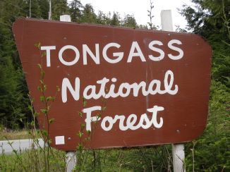
Campground List
CAMPGROUND NAME: Auke Village
VISIT DATE: 05/31/2008
UPDATE DATE: 3/22/2019
STATE: Alaska
REGION: Alaska
RANGER DISTRICT: Juneau
NEAREST CITY/TOWN: Juneau
RESERVATIONS: 1-877-444-6777 or make on-line reservation
(NOTE: A reservation MUST be made to stay at this campground.)
DIRECTIONS:
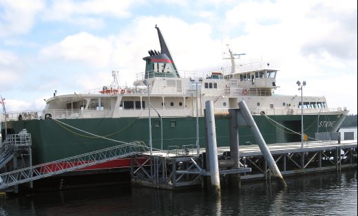
NOTE: Access to most campgrounds in the Tongass National Forest
is initially by plane or boat. These directions assume access is by
ferry, specifically via either the Alaska Marine Highway System or
Inter-Island Ferry Authority. For a price, any size RV can be
transported by the ferry systems.
From the Alaska Marine Hwy. ferry terminal in Juneau, AK, turn
left onto Glacier Hwy. and go 0.8 miles to campground sign. Turn
left after sign and go 0.9 miles to another campground sign.
Bear left at sign into campground.
GENERAL COMMENTS:
The elevation is 45 ft.
The campground has two overlapping loops on Auke Bay in a stand
of hemlock and Sitka spruce. The small parking aprons discourage
large motorhomes and travel trailers and give the campground a
pleasant tent campground feel. Located on Auke Bay, which flows
into Lynne Channel, which flows eventually to the Gulf of Alaska,
the campground can serve as a resting point for sea kayakers.
The dense vegetation provides only limited views of Auke Bay.
This is bear country; practise safe food storage techniques.
SEASONS
Open Seasonal: Yes
Open All Year: No
Seasonal Comment:
Open May 1 through September 30
RATE AND MAXIMUM STAY PERMITTED
Rate: $10 per day
Maximum Stay Permitted (days): 14
NOTE: Cash and checks are no longer accepted. Payment is made through
recreation.gov with a credit or debit card. Payment/reservations can be made
upon arrival at campground or in advance at recreation.gov.
CAMPGROUND SITE CONFIGURATION
No. RV Sites: 0
No. Tent Sites: 3
No. Combined Sites (Tent or RV): 8
Total Sites: 11
Tent Pads: No
Open Sites: No
Wooded Sites: Yes
No. Tables on Sites: 11
No. Grilles on Sites: 11
Equestrian camping: No
RV INFORMATION
Hookups: None
No. RV Pull Throughs: 0
Waste Station: No
Average Parking Apron Size: 12' X 27'
Comments:
The parking aprons are gravel.
FACILITIES
Vaults: Yes
Flush Toilets: No
Hot Showers: No
Wheelchair Friendly Toilets: Yes
Public Phone: Yes
Playground: No
No. Water Spigots (non-site): 6
No. Threaded: 6
WATER SPORTS
Auke Bay offers a wide variety of water sports but there is no
direct boating access at the campground.
HIKING
Pt. Louisa Trail (foot only) - 0.75 mile
FISHING
Pink, Coho, and Chum salmon

CAMPGROUND NAME: Eagles Nest
VISIT DATE: 05/19/2008
UPDATE DATE: 3/22/2019
STATE: Alaska
REGION: Alaska
RANGER DISTRICT: Craig
NEAREST CITY/TOWN: Thorne Bay
RESERVATIONS: 1-877-444-6777 or make on-line reservation
DIRECTIONS:
NOTE: Access to most campgrounds in the Tongass National Forest
is initially by plane or boat. These directions assume access is by
ferry, specifically via either the Alaska Marine Highway System or
Inter-Island Ferry Authority. For a price, any size RV can be
transported by the ferry systems.
From the Inter-Island Ferry Association terminal in Clark Bay,
near Hollis, AK (no gas), take paved road 23.3 miles to Thorn Bay
sign at intersection in Klawock, AK. Turn right at sign, onto
Boundary Rd and go 16 miles to "T" intersection. Turn right at
intersection and go 1.7 mile to campground on left.
GENERAL COMMENTS:
The elevation is 400 ft.
Although this spacious and tranquil campground stretches out
along Balls Lake, thick vegetation limits views of this
attractive lake. The campsites are organized in three small
clusters. The first cluster is for walk-in tent campers while
the other clusters accommodate tent, car, and RV campers.
Hemlock and Sitka spruce provide ample shade. Canoe enthusiasts
will enjoy many hours paddling around Balls Lake while hikers can
explore the lakeshore from a boardwalk trail. Thorne Bay, with
gas and groceries, is 14.9 miles east of campground.
Possible day trips are Kasaan Totem Park, Beaver Falls, El
Capiton Cave, Cavern Lake, Dog Salmon Fish Pass and Sarka Canoe
Route just to mention a few. Contact the Craig Ranger District
Office for details and more information.
This is bear country; practise safe food storage techniques.
SEASONS
Open Seasonal: Yes
Open All Year: Yes
Seasonal Comment:
Services provided mid-May through mid-September
RATE AND MAXIMUM STAY PERMITTED
Rate: $8 per day
Maximum Stay Permitted (days): 14
CAMPGROUND SITE CONFIGURATION
No. RV Sites: 0
No. Tent Sites: 2
No. Combined Sites (Tent or RV): 9
Total Sites: 11
Tent Pads: No
Open Sites: Yes
Wooded Sites: Yes
No. Tables on Sites: 11
No. Grilles on Sites: 11
Equestrian camping: No
RV INFORMATION
Hookups: None
No. RV Pull Throughs: 0
Waste Station: No
Average Parking Apron Size: See RV comments
Comments:
The parking aprons are gravel and will accommodate any size RV.
A locked RV waste station, with no potable water, is available
for a fee in Thorne Bay on Shoreline Dr, across from the
Community Boat Ramp. The key is available at City Hall.
FACILITIES
Vaults: Yes
Flush Toilets: No
Hot Showers: No
Wheelchair Friendly Toilets: No
Public Phone: No
Playground: No
No. Water Spigots (non-site): 1
No. Threaded: 0
Comments:
The water spigot is a handpump.
WATER SPORTS
Lake: Yes
Swimming (provided): No
Sailing: No
Boat Ramp: No
Boat Carry Down Access: Yes
Power Boating: Yes
Boating (no power): Yes
Water Skiing: No
Rafting (whitewater): No
Kayaking (whitewater): No
Comments:
Balls Lake is approximately 250 acres and popular for canoeing.
Power boats are limited to electric motors.
HIKING
Interpretive trail (foot) - 0.5 miles
Balls Lake trail (foot) - 2.2 miles
FISHING
Coho, Sockeye and Pink salmon, Dolly Varden, Rainbow and Steelhead
trout
CAMPGROUND NAME: Harris River
VISIT DATE: 05/20/2008
UPDATE DATE: 3/22/2019
STATE: Alaska
REGION: Alaska
RANGER DISTRICT: Craig
NEAREST CITY/TOWN: Hollis
RESERVATIONS: 1-877-444-6777 or make on-line reservation
DIRECTIONS:
NOTE: Access to most campgrounds in the Tongass National Forest
is initially by plane or boat. These directions assume access is by
ferry, specifically via either the Alaska Marine Highway System or
Inter-Island Ferry Authority. For a price, any size RV can be
transported by the ferry systems.
From the Inter-Island Ferry Association terminal in Clark Bay near
Hollis, AK (no gas), take paved road (Hollis/Klawock Hwy. a.k.a.
Hollis Rd.) west 11.1 miles to campground on left.
GENERAL COMMENTS:
The elevation is 290 ft.
This delightful campground is a single loop between Harris River
and Hollis/Klawock Hwy. around a muskeg bog. Especially pretty
when spring flowers are in bloom, the open space provided by the
bog permits viewing of Harris Peak and other surrounding
mountains. Privacy between campsites is fair to good. Expect
bear and eagle sightings along access roads. A shed is stocked with
wood near entrance to campground. The walk to picnic area across
wooden bridge, provides visitors with a good view of roaring
"shute" of Harris River. The nearest gas station and groceries
are in Klawock, 11.6 miles west of campground on the
Hollis/Klawock Hwy. An excellent day trip is visiting the Haida
People's "totem pole park" in Kasaan (53 miles north and east of
campground). It is a short walk from the "town center," which
has no store or gas. Ask for directions.
This is bear country; practice safe food storage techniques.
SEASONS
Open Seasonal: Yes
Open All Year: Yes
Seasonal Comment:
Services provided between mid-May and mid-September.
RATE AND MAXIMUM STAY PERMITTED
Rate: $8 per day
Maximum Stay Permitted (days): 14
CAMPGROUND SITE CONFIGURATION
No. RV Sites: 0
No. Tent Sites: 0
No. Combined Sites (Tent or RV): 14
Total Sites: 14
Tent Pads: Yes
Open Sites: Yes
Wooded Sites: Yes
No. Tables on Sites: 14
No. Grilles on Sites: 14
Equestrian camping: No
RV INFORMATION
Hookups: None
No. RV Pull Throughs: 0
Waste Station: No
Average Parking Apron Size: 12' X 48'
Comments:
The parking aprons are gravel and all about same size. An RV
waste station with no potable water, is available for a fee (paid
at city hall) in Thorne Bay on Shoreline Dr., across from the
community boat ramp.
FACILITIES
Vaults: Yes
Flush Toilets: No
Hot Showers: No
Wheelchair Friendly Toilets: Yes
Public Phone: No
Playground: No
No. Water Spigots (non-site): 2
No. Threaded: 0
Comments:
The water spigots are handpumps.
WATER SPORTS - None
HIKING
Muskeg Trail (foot) - 0.1 miles
There are numerous other trails in the immediate area, such as:
Trocadero (foot) - 1 mile
Harris River (foot) - 1.3 miles
FISHING
Coho, Chum and Pink Salmon; Dolly Varden, Rainbow, Steelhead
(catch & release) and Cutthroat trout
CAMPGROUND NAME: Last Chance
VISIT DATE: 05/14/2008
UPDATE DATE: 3/22/2019
STATE: Alaska
REGION: Alaska
RANGER DISTRICT: Ketchikan-Misty Fiords
NEAREST CITY/TOWN: Ketchikan
RESERVATIONS: 1-877-444-6777 or make on-line reservation
DIRECTIONS:
NOTE: Access to most campgrounds in the Tongass National Forest
is initially by plane or boat. These directions assume access is by
ferry, specifically via either the Alaska Marine Highway System or
Inter-Island Ferry Authority. For a price, any size RV can be
transported by the ferry systems.
From the Alaska Marine Hwy. ferry terminal in Ketchikan, turn
left onto Tongass Ave and go 4.7 miles to Ward Lake sign. Turn
right at sign onto Revilla Rd and go 2.2 miles to campground on
right.
GENERAL COMMENTS:
The elevation is 230 ft.
This attractive campground is one loop through a stand of old-
growth hemlock, alder and Sitka spruce. The campsites are either
on Ward Creek or an intermittent creek that flows through
campground. Although less than a mile from Signal Creek
campground, this campground has a more open, more spacious feel
to its sites. Away from Ward Lake, it should be less crowded
with a more tranquil atmosphere. The 134-acre Ward Lake
offers boating (no motors), bird watching and additional fishing
opportunities. Ketchikan offers a variety of sights for day
trips.
This is bear country; practise safe food storage techniques.
SEASONS
Open Seasonal: Yes
Open All Year: No
Seasonal Comment:
Open Friday before Memorial Day through Wednesday after Labor Day
RATE AND MAXIMUM STAY PERMITTED
Rate: $10 per day
Maximum Stay Permitted (days): 14
CAMPGROUND SITE CONFIGURATION
No. RV Sites: 0
No. Tent Sites: 0
No. Combined Sites (Tent or RV): 18
Total Sites: 18
Tent Pads: No
Open Sites: Yes
Wooded Sites: Yes
No. Tables on Sites: 18
No. Grilles on Sites: 18
Equestrian camping: No
RV INFORMATION - None
Hookups: None
No. RV Pull Throughs: 0
Waste Station: No
Average Parking Apron Size: 15' X 40'
Comments:
The parking aprons are gravel. An RV waste station with no
potable water and no fee, is available at Ketchikan Waste Water
Treatment Plant, 3921 Tongass Ave, Ketchikan.
FACILITIES
Vaults: Yes
Flush Toilets: No
Hot Showers: No
Wheelchair Friendly Toilets: Yes
Public Phone: No
Playground: No
No. Water Spigots (non-site): 2
No. Threaded: 0
Comments:
The water spigots are handpumps.
WATER SPORTS - None
HIKING
Ward Lake Nature Trail (foot) - 2.5 miles
provides access to a network of trails
FISHING
Steelhead and Cutthroat trout in the Spring, and Coho salmon in
Fall
CAMPGROUND NAME: Mendenhall
VISIT DATE: 06/10/2008
UPDATE DATE: 3/22/2019
STATE: Alaska
REGION: Alaska
RANGER DISTRICT: Juneau
NEAREST CITY/TOWN: Juneau
RESERVATIONS: 1-877-444-6777 or make on-line reservation
(NOTE: A reservation MUST be made to stay at this campground.)
DIRECTIONS:
NOTE: Access to most campgrounds in the Tongass National Forest
is initially by plane or boat. These directions assume access is by
ferry, specifically via either the Alaska Marine Highway System or
Inter-Island Ferry Authority. For a price, any size RV can be
transported by the ferry systems.
From the Alaska Marine Hwy ferry terminal in Juneau, turn right
onto Glacier Hwy and go 1.6 miles to Mendenhall Loop Rd. sign.
Turn left at sign onto Loop Rd. and go 2.4 miles to Montana Creek
Rd. sign. Turn left after sign onto Montana Crk Rd. and go 0.7
miles to campground on right.
GENERAL COMMENTS:
The elevation is 50 ft.
This attractive campground is located below the Mendenhall
Glacier providing some campsites with views of this mass of
moving ice, Mendenhall Lake and River, or one of the numerous
ponds scattered around the campground. Sitka spruce, hemlock,
alder and a variety of shrubs provide good to excellent privacy
as well as ample shade. The campground has three defined
sections offering backpackers, car, tent, and truck campers,
along with the recreational vehicle camper, with an experience
geared to their camping style. This may be the only Forest
Service campground where campers can actually watch icebergs
float by. Spring brings a variety of wildflowers including large
showy lupines along with mosquitoes - industrial strength bug
repellant recommended.
A day trip to the Mendenhall Glacier Visitor Center is a must.
Another possible day trip is exploring the sights and history of
Juneau. And the hiking in the area is noteworthy.
This is bear country; practise safe food storage techniques.
SEASONS
Open Seasonal: Yes
Open All Year: No
Seasonal Comment:
Open May 15 through September 15.
RATE AND MAXIMUM STAY PERMITTED
Rate: $10 per day - no hookups
$26 per day - electric and water only
$28 per day - full hook-ups
Maximum Stay Permitted (days): 14
NOTE: Cash and checks are no longer accepted. Payment is made through
recreation.gov with a credit or debit card. Payment/reservations can be made
upon arrival at campground or in advance at recreation.gov.
CAMPGROUND SITE CONFIGURATION
No. RV Sites: 0
No. Tent Sites: 7
No. Combined Sites (Tent or RV): 62
Total Sites: 69
Tent Pads: No
Open Sites: Yes
Wooded Sites: Yes
No. Tables on Sites: 69
No. Grilles on Sites: 69
Equestrian camping: No
RV INFORMATION
No. Full Hookups (includes waste): 9
No. Water and Electric Only: 10
No. Water Only: 0
No. Electric Only: 0
No. RV Pull Throughs: 5
Waste Station: Yes
Potable Water at Waste Station: Yes
Average Parking Apron Size: 11' X 40'
Comments:
The parking aprons are paved. The pull-throughs are large and
can accomodate any size RV.
FACILITIES
Vaults: Yes
Flush Toilets: Yes
Hot Showers: Yes
Wheelchair Friendly Toilets: Yes
Public Phone: No
Playground: No
No. Water Spigots (non-site): 13
No. Threaded: 0
Comments:
The showers are wheelchair friendly.
WATER SPORTS
Lake: Yes
Swimming (provided): No
Sailing: No
Boat Ramp: No
Boat Carry Down Access: Yes
Power Boating: No
Boating (no power): Yes
Water Skiing: No
Rafting (whitewater): Yes
Kayaking (whitewater): Yes
Comments:
There are numerous ponds scattered through-out the campground.
Mendenhall River has Class III rapids and recommended for only
experienced kayakers.
HIKING
Forest Ecology Trail (foot and wheelchair friendly) - 0.5 miles
FISHING
Fishing is available nearby
CAMPGROUND NAME: Ohmer Creek
VISIT DATE: 05/24/2008
UPDATE DATE: 3/22/2019
STATE: Alaska
REGION: Alaska
RANGER DISTRICT: Petersburg
NEAREST CITY/TOWN: Petersburg
RESERVATIONS: No
DIRECTIONS:
NOTE: Access to most campgrounds in the Tongass National Forest
is initially by plane or boat. These directions assume access is by
ferry, specifically via either the Alaska Marine Highway System or
Inter-Island Ferry Authority. For a price, any size RV can be
transported by the ferry systems.
From the Alaska Marine Hwy ferry terminal in Petersburg, AK, turn
right onto South Nordic Dr (becomes Mitkof Hwy) 20.1 miles to
campground sign. Turn right at sign and go 0.1 miles to
campground.
GENERAL COMMENTS:
The elevation is 50 ft.
The campground stretches along Ohmer Creek with sites tucked in
among a thick and pleasant mixture of Sitka spruce, hemlock and
alder. It is near enough to South Blind Slough for a canoe or
kayak trip. One campsite may be occupied by a host.
Possible day trips are the Man-made Hole Picnic Area, Blind
Slough Rapids and the many sights in Petersburg.
This is bear country; practise safe food storage techniques.
SEASONS
Open Seasonal: Yes
Open All Year: Yes
Seasonal Comment:
Services provided Friday before Memorial Day weekend through
Labor Day weekend
RATE AND MAXIMUM STAY PERMITTED
Rate: $6 per day
Maximum Stay Permitted (days): 14
CAMPGROUND SITE CONFIGURATION
No. RV Sites: 0
No. Tent Sites: 0
No. Combined Sites (Tent or RV): 10
Total Sites: 10
Tent Pads: No
Open Sites: No
Wooded Sites: Yes
No. Tables on Sites: 10
No. Grilles on Sites: 10
Equestrian camping: No
RV INFORMATION
Hookups: None
No. RV Pull Throughs: 0
Waste Station: No
Average Parking Apron Size: 15' X 48'
Comments:
The parking aprons are gravel.
FACILITIES
Vaults: Yes
Flush Toilets: No
Hot Showers: No
Wheelchair Friendly Toilets: Yes
Public Phone: No
Playground: No
No. Water Spigots (non-site): 1
No. Threaded: 0
Comments:
The water spigot is a handpump.
WATER SPORTS - None
HIKING
Ohmer Creek trail #603 (foot only) - 1.0 mile
There are a number of other trails nearby such as:
Blind River Rapids trail #454 (foot) - 0.25 miles
Three Lakes Loop trail #600 (foot) - 4 miles
Raven Roost trail #607 (foot) - 4.5 miles
FISHING
Pink and Coho salmon, Dolly Varden, Steelhead and Cutthroat
trout
CAMPGROUND NAME: Signal Creek
VISIT DATE: 05/14/2008
UPDATE DATE: 3/22/2019
STATE: Alaska
REGION: Alaska
RANGER DISTRICT: Ketchikan-Misty Fiords
NEAREST CITY/TOWN: Ketchikan
RESERVATIONS: 1-877-444-6777 or make on-line reservation
DIRECTIONS:
NOTE: Access to most campgrounds in the Tongass National Forest
is initially by plane or boat. These directions assume access is by
ferry, specifically via either the Alaska Marine Highway System or
Inter-Island Ferry Authority. For a price, any size RV can be
transported by the ferry systems.
From the Alaska Marine Hwy ferry terminal in Ketchikan, AK, turn
left onto Tongass Ave and go 4.7 miles to Ward Lake sign. Turn
right at sign onto Revilla Rd. and go 1.3 miles to another Ward
Lake sign. Turn right at sign and go 1 mile to campground on
right.
GENERAL COMMENTS:
The elevation is 100 ft.
The campground, one of two in the Ward Lake Recreation Area, has
two unnamed loops in an old-growth (100-plus year old) forest
between Ward Lake and Signal Creek. The smaller loop (next to
the fee board) is open year round while the second, larger loop
is gated in the off-season. The campground wanders through a
muskeg-bog environment with Sitka spruce and hemlock providing
ample shade. Convenient to town but retaining a feeling of
remoteness, the campground offers all types of campers a good
forest experience. Outstanding birdwatching, fishing and day
hikes are available along with day trips to explore the sights
and history of Ketchikan.
This is bear country; practise safe food storage techniques.
SEASONS
Open Seasonal: Yes
Open All Year: Yes
Seasonal Comment:
Services provided April 15 through first Tuesday after Labor Day.
RATE AND MAXIMUM STAY PERMITTED
Rate: $10 per day
Maximum Stay Permitted (days): 14
CAMPGROUND SITE CONFIGURATION
No. RV Sites: 0
No. Tent Sites: 1
No. Combined Sites (Tent or RV): 22
Total Sites: 23
Tent Pads: No
Open Sites: No
Wooded Sites: Yes
No. Tables on Sites: 23
No. Grilles on Sites: 23
Equestrian camping: No
RV INFORMATION
Hookups: None
No. RV Pull Throughs: 0
Waste Station: No
Average Parking Apron Size: 15' X 38'
Comments:
The parking aprons are gravel. An RV waste station with no
potable water or fee, is available at Ketchikan Waste Water
Treatment Plant, 3921 Tongass Ave., Ketchikan.
FACILITIES
Vaults: Yes
Flush Toilets: No
Hot Showers: No
Wheelchair Friendly Toilets: Yes
Public Phone: No
Playground: No
No. Water Spigots (non-site): 2
No. Threaded: 0
Comments:
The water spigots are handpumps.
WATER SPORTS
Lake: Yes
Swimming (provided): No
Sailing: No
Boat Ramp: No
Boat Carry Down Access: Yes
Power Boating: No
Boating (no power): Yes
Water Skiing: No
Rafting (whitewater): No
Kayaking (whitewater): No
Comments:
The 34-acre Ward Lake is natural.
HIKING
Ward Lake Nature Trail (foot) - 1.3 miles
Frog Pond trail (foot) - 0.3 miles
Ward Creek trail (foot) - 2.5 miles
These trails also access a network of trails.
FISHING
Steelhead, Cutthroat and Dolly Varden trout and Coho, Pink, Chum
and Sockeye salmon
CAMPGROUND NAME: Starrigavan Recreation Area
VISIT DATE: 06/03/2008
UPDATE DATE: 3/22/2019
STATE: Alaska
REGION: Alaska
RANGER DISTRICT: Sitka
NEAREST CITY/TOWN: Sitka
RESERVATIONS: 1-877-444-6777 or make on-line reservation
DIRECTIONS:
NOTE: Access to most campgrounds in the Tongass National Forest
is initially by plane or boat. These directions assume access is by
ferry, specifically via either the Alaska Marine Highway System or
Inter-Island Ferry Authority. For a price, any size RV can be
transported by the ferry systems.
From the Alaska Marine Hwy ferry terminal in Sitka, AK, turn left
onto paved road and go 0.6 miles to campground's Estuary Loop on
the right and Bayside Loop on left.
GENERAL COMMENTS:
The elevation is 30 ft.
The campground, located north of the Alaskan Marine Hwy ferry
terminal on Starrigavan Bay, has three loops, Bayside,
Backpacker, and Estuary. Estuary Loop has two loops and sites
that will accommodate both RVs and tent campers. Large mature
Sitka spruce and hemlock provide ample shade and good privacy.
The Backpacker Loop has only walk-in tent sites with a communal
cook shelter. Bayside Loop has three campsites that are walk-in
or boat/kayak-in only which have views of Starrigavan Bay and the
ferry's coming and going. Bayside Loop's campsites are very
popular - reservations for these sites are recommend. The
campground also has two tent-only group areas, not included in this
review; contact the Ranger District office for more information.
Starrigavan is Russian for "old harbor." The campground is said to
be adjacent to the Old Sitka Historic Site, the location used by the
retreating Russians after the Tlingit attack on Redoubt Saint Michael
in 1802.
Possible day trips from campground are: Alaska Raptor Center,
Sitka National Historic Park, Sitka Walking Tour, and the Russian
Bishop's House.
Bear country; practise safe food storage techniques..
SEASONS
Open Seasonal: No
Open All Year: Yes
Seasonal Comment:
Full services provided May 1 through September 15.
NOTE: Gates open daily from 9AM to 9PM.
RATE AND MAXIMUM STAY PERMITTED
Rate: $14 or $16 per day - May 1 through September 15
$12 per day - September 16 through April 30
Maximum Stay Permitted (days): 14
CAMPGROUND SITE CONFIGURATION
No. RV Sites: 0
No. Tent Sites: 12
No. Combined Sites (Tent or RV): 20
Total Sites: 32
Tent Pads: No
Open Sites: Yes
Wooded Sites: Yes
No. Tables on Sites: 32
No. Grilles on Sites: 32
Equestrian camping: No
RV INFORMATION
Hookups: None
No. RV Pull Throughs: 1
Waste Station: No
Average Parking Apron Size: 19' X 48'
Comments:
The parking aprons are gravel. An RV waste station with no
potable water or fee, is available in Sitka Water Treatment Plant
on Japonski Island.
FACILITIES
Vaults: Yes
Flush Toilets: No
Hot Showers: No
Wheelchair Friendly Toilets: Yes
Public Phone: Yes
Playground: No
No. Water Spigots (non-site): 6
No. Threaded: 0
WATER SPORTS
Lake: No
Swimming (provided): No
Sailing: Yes
Boat Ramp: No
Boat Carry Down Access: Yes
Power Boating: Yes
Boating (no power): Yes
Water Skiing: No
Rafting (whitewater): No
Kayaking (whitewater): No
Comments:
A boat ramp is available at the state-operated Sitka Historic
Site on Starrigavan Bay, 0.2 miles from campground.
HIKING
Estuary Life trail (foot and wheelchair friendly) - 0.25 miles
Mosquito Cove trail (foot) - 1.25 miles
Forest and Muskeg trail (foot and wheelchair friendly) - 0.75
miles
FISHING
Pink and Coho (catch and release) salmon and Dolly Varden trout
NOTE: Salmon spawn in August when a smell may be noticeable.
|


