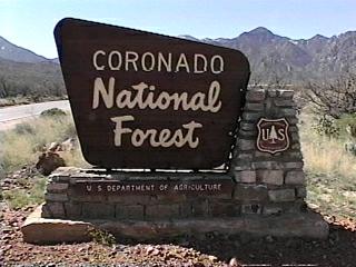
Campground List
CAMPGROUND NAME: Arcadia

VISIT DATE: 6/3/2002

UPDATE DATE: 2/22/2024

STATE: Arizona

REGION: Southwestern

RANGER DISTRICT: Safford

NEAREST CITY/TOWN: Safford

RESERVATIONS: No

DIRECTIONS:
In Safford, AZ, at intersection of US Hwys 191 and 70, take Rt. 191
south for 7.9 miles to Mt. Graham signs. At sign, turn right onto
Rt. 366 and go 11.3 miles to campground on right.

NOTE: Although paved and well maintained, State Rt. 366 is steep
and curvy with switchbacks.  An official state sign, near the beginning
of Rt. 366, recommends vehicle total length not exceed 40 feet; the
authors concur.

GENERAL COMMENTS:
The elevation is 6,700 ft.

The campground, located in the Pinaleno Mountains among mature
Ponderosa pines, Gambel Oaks and Arizona Walnut trees, is a large single
loop.   The native rock walls and other stone work are very attractive
and give the campground lots of character.    It is a
good location for bird watching.  The campground is comfortable,
nicely shaded and covered with a bed of pine needles.  Enjoy the many
vistas along State Rt. 366.

This is bear country; practice safe food storage techniques.

SEASONS
Open Seasonal: Yes
Open All Year: Yes

Seasonal Comment:
Services provided May 27 through September 2.

RATE AND MAXIMUM STAY PERMITTED
Rate: $20 per day - single
$40 per day - double
Maximum Stay Permitted (days): 14

CAMPGROUND SITE CONFIGURATION
No. RV Sites: 0
No. Tent Sites: 10
No. Combined Sites (Tent or RV): 8

   Total Sites: 18

Tent Pads: No
Open Sites: No
Wooded Sites: Yes

No. Tables on Sites: 18
No. Grilles on Sites: 18
Equestrian Camping:  No

RV INFORMATION
Hookups: None
No. RV Pull Throughs: 0
Waste Station: No
Average Parking Apron Size: 10' X 21'

Comments:
The parking aprons are paved.  There is a free
RV waste station (no potable water) at Safford
Wastewater Treatment Plant, 1395 W. Reclamation Way,
Safford, AZ.

FACILITIES
Vaults: Yes
Flush Toilets: No
Hot Showers: No
Wheelchair Friendly Toilets: Yes

Public Phone: No
Playground: No
No. Water Spigots: 1
  No. Threaded: 0

WATER SPORTS - None

HIKING
Arcadia Trail (foot, mountain bike & horse) - 5.1 miles
    The Arcadia Trail is designated a National
    Recreation Trail.

FISHING - No

CAMPGROUND NAME: Bog Springs

VISIT DATE: 04/13/1998

UPDATE DATE: 2/22/2024

STATE: Arizona

REGION: Southwestern

RANGER DISTRICT: Nogales

NEAREST CITY/TOWN: Green Valley

RESERVATIONS: No

DIRECTIONS:
In Green Valley, AZ, take Continental Rd., Exit 63 off Interstate
19, east  to White House Canyon Rd.  Turn right onto White House
Canyon Rd. and go 12.2 miles to Bog Springs campground sign
(Forest Rt. 70A).  Turn left at sign onto Rt. 70A and go 0.5
miles to campground.  Signs to Madera Canyon (in which this
campground is located) are posted along the route.

NOTE: Forest Rt. 70A is a narrow, winding and paved (with
potholes) roadway.

GENERAL COMMENTS:
The elevation is 5,600 ft.

The campground is located in Madera Canyon under mature Evergreen
Oak and Alligator Juniper trees.  There are excellent views of
the Santa Rita Mountains.  Bird watching is the main attraction
of this primitive campground; over 200 species have been
identified.  Terraced sites make excellent platforms for the
amateur and professional alike to set up their photographic
equipment.  At the time of our visit, there were no less then
four sites set up with some of the most elaborate photographic
equipment we have seen.

SEASONS
Open Seasonal: No
Open All Year: Yes

RATE AND MAXIMUM STAY PERMITTED
Rate: $20 per day
Maximum Stay Permitted (days): 14

CAMPGROUND SITE CONFIGURATION
No. RV Sites: 0
No. Tent Sites: 4
No. Combined Sites (Tent or RV): 9

   Total Sites: 13

Tent Pads: No
Open Sites: No
Wooded Sites: Yes

No. Tables on Sites: 13
No. Grilles on Sites: 13
Equestrian Camping:  No

RV INFORMATION
Hookups: None
No. RV Pull Throughs: 1
Waste Station: No
Average Parking Apron Size: 17' X 39'

Comments:
The parking aprons are paved with some being irregular and
eroded.

FACILITIES
Vaults: Yes
Flush Toilets: No
Hot Showers: No
Wheelchair Friendly Toilets: No

Public Phone: No
Playground: No
No. Water Spigots: 8
  No. Threaded: 8

WATER SPORTS - None

HIKING
Bog Springs Trail - 2.7 miles
Dutch John Springs - 1.8 miles
Super Trail - 8.1 miles
Old Baldy - 4.5 miles
Very Steep Trail - 1.8 miles

Above trails are foot & horse only and access the Mt. Wrightson
Wilderness.

Nature (interpretive - foot only) - 2.7 miles
Series of paved trails along the Madera Canyon Creek (foot only)

FISHING - No
CAMPGROUND NAME: Cunningham

VISIT DATE: 6/3/2002

UPDATE DATE: 2/22/2024

STATE: Arizona

REGION: Southwestern

RANGER DISTRICT: Safford

NEAREST CITY/TOWN: Safford

RESERVATIONS: No

DIRECTIONS:
In Safford, AZ, at intersection of US Hwys 191 and 70, take Rt. 191
south for 7.9 miles to Mt. Graham signs.  At sign, turn right onto
Rt. 366 and go 25.6 miles to campground sign.  Turn left at sign
into campground.

NOTE: Although paved and well maintained, State Rt. 366 is steep and
curvy with switchbacks.  The last 3.6 miles are dirt, rocky, rough,
and mostly wide single lane with some switchbacks.  An official state
sign, near the beginning of Rt. 366, recommends vehicle TOTAL length
not exceed 40 feet; the authors concur.  Because of the design and
condition of the dirt portion of Rt. 366, the authors do not recommend
towing a travel trailer to this campground.

GENERAL COMMENTS:
The elevation is 8,700 ft.

The campground, located in the Pinaleno Mountains in a stand of
Aspen and Douglas firs, offers a rustic camping experience.  There
are four contiguous pipe stalls for horses located in the center of a
turn-around loop.  Other than the stalls, there are no horse facilities,
including stock water, in the campground.  It is a good location for
horseback riding, hiking and mountain biking.

This is bear country; practice safe food storage techniques.

SEASONS
Open Seasonal: Yes
Open All Year: No

Seasonal Comment:
Open April 15 through November 14 - weather dependent

RATE AND MAXIMUM STAY PERMITTED
Rate: $15 per day
Maximum Stay Permitted (days): 14

CAMPGROUND SITE CONFIGURATION
No. RV Sites: 0
No. Tent Sites: 1
No. Combined Sites (Tent or RV): 9

   Total Sites: 10

Tent Pads: No
Open Sites: Yes
Wooded Sites: Yes

No. Tables on Sites: 10
No. Grilles on Sites: 10
Equestrian Camping: Yes

RV INFORMATION
Hookups: None
No. RV Pull Throughs: 0
Waste Station: No
Average Parking Apron Size: 13' X 30'

Comments:
The parking aprons are gravel.  There is a free RV waste
station (no potable water) at Safford Wastewater Treatment
Plant, 1395 W. Reclamation Way, Safford, AZ.

FACILITIES
Vaults: Yes
Flush Toilets: No
Hot Showers: No
Wheelchair Friendly Toilets: Yes

Public Phone: No
Playground: No
No. Water Spigots: 0
  No. Threaded: 0

WATER SPORTS - None

HIKING
Grant Hill Loop #322 - 4.2 miles
Cunningham Loop Trail #310  - 5.6 miles
Grant Creek Trail #305 - 5.5 miles
     All trails are foot, horse and mountain bike

FISHING - No
CAMPGROUND NAME: General Hitchcock

VISIT DATE: 04/05/1998

UPDATE DATE: 2/22/2024

STATE: Arizona

REGION: Southwestern

RANGER DISTRICT: Santa Catalina

NEAREST CITY/TOWN: Tucson

RESERVATIONS: No

DIRECTIONS:
In Tucson, AZ, on Interstate 10, take the Speedway Blvd. exit
(exit 257) to Speedway Blvd.  Turn east onto Speedway Blvd. and
go 9.2 miles (passed University of Arizona) to Pantano Rd.  Turn
left onto Pantano Rd. and go 1.1 miles to the Tanque Verde Rd.
ramp.  Bear right onto the ramp and go 1.6 miles (on Tanque Verde
Rd.) to Catalina Hwy.  Turn left onto Catalina Hwy. and go 16.7
miles to General Hitchcock campground sign.  Turn right at sign
onto General Hitchcock Rd. into campground.

GENERAL COMMENTS:
The elevation is 5,700 ft.

This is an attractive, heavily wooded campground nestled in a
dell beside a seasonal creek.  The trees are Evergreen Oak and
mixture of mature pines.  Lantern poles and bear-proof food storage
boxes provided.

The campground is convenient for many things to see and do in and
around Tuscon.  Notable among these are the Saguaro National Park,
Sabino Canyon, Colossal Cave, and a drive along Catalina Scenic
Byway to Mt. Lemmon, all explained below.

1. The Saguaro National Park is divided into two districts - Saguaro
East and Saguaro West.  Saguaro East is the closest to the campground
and is the district the authors visited.  It is located at the foot of
the Rincoon Mountains and is comprised of an aging Saguaro forest.
There is an interesting 8-mile loop drive and 128 miles of trails.

2. Sabino Canyon is referred to as a "desert oasis" in the Coronado National
Forest.  Part of it can be viewed from a privately owned open-air shuttle bus.
The ride is 45 minutes and departs from the Sabino Canyon Visitor Center.
Call (520) 749-2861 for information and tour schedules.

3. Explore the Colossal Cave, which is on the National Register of Historic
Places.  The cave was discovered in 1879 and is dry or dormant.  In other
words, due to lack of water, the formations are not growing.  Call (520)
647-3299 for additional information.

4. Experience an amazing drive up the Catalina Scenic Byway (a.k.a. Sky
Island Scenic Byway/General Hitchcock Hwy.) to Mt. Lemmon.  The trip
". . . can be compared to a trip from Mexico to Canada, with vegetation
ranging from Saguaro cactus in the lowland deserts to pine, fir, and spruce
at the highest elevations."  The drive has many gorgeous views of the Santa
Catalina Mountains and rises some 5,000 feet above Tucson.

SEASONS
Open Seasonal: Yes
Open All Year: No

Comments:
Open May 1 through September 15 - weather dependent

RATE AND MAXIMUM STAY PERMITTED
$20 per day
Maximum Stay Permitted (days): 14

CAMPGROUND SITE CONFIGURATION
No. RV Sites: 0
No. Tent Sites: 10
No. Combined Sites (Tent or RV): 0

   Total Sites: 10

Tent Pads: No
Open Sites: No
Wooded Sites: Yes

No. Tables on Sites: 10
No. Grilles on Sites: 10
Equestrian Camping:  No

FACILITIES
Vaults: Yes
Flush Toilets: No
Hot Showers: No
Wheelchair Friendly Toilets: Yes

Public Phone: No
Playground: No
No. Water Spigots: 0

WATER SPORTS - None

HIKING
Green Mountain Trail (foot, horse & mountain bike) - 3.6 miles

FISHING - No
CAMPGROUND NAME: Gordon Hirabayashi

VISIT DATE: 04/20/2016

UPDATE DATE: 2/22/2024

STATE: Arizona

REGION: Southwest

RANGER DISTRICT: Santa Catalina

NEAREST CITY/TOWN: Tucson

RESERVATIONS: No

DIRECTIONS:
In Tucson, AZ, at the intersection of I-10 and Houghton Rd (Exit 275), take
Houghton Rd north 15.1 miles to Catalina Hwy.  Turn right onto Catalina Hwy.
and go 10 miles to campground sign.  Turn left after the campground sign into
campground.

NOTE:  Catlina Hwy. is also known as General Hitchcock Rd. and later Sky Island
Scenic Hwy.

GENERAL COMMENTS:
The elevation is 4,700 ft.

The campground is a single spur stretching up a seasonal stream, that could
flood in heavy rains, and ends in a large loop.  Inside the loop are a number
of small pole corrals for horses.  This means equestrian campers can camp in
the nearby campsites while their horses are kept close by in the corrals.
Several campsites are in clusters of two giving a community  or family camping
feel.  Although campsites can accommodate both tent and recreational vehicles,
placement might require some creative leveling. Lantern poles and bear-proof
food storage containers are provided.

Previously called "Prison Camp," in 1937 it became known as Federal Honor
Camp.  It housed federal prisoners and supplied laborers to build a road
providing
access into the Santa Catalina Mountains.  Occupants of the Camp were
essentially both conscientious objectors and Japanese Americans protesting the
"Japanese American Relocation."  One of those protestors was Gordon
Hirabayashi, at the time a senior at the University of Washington,  In 1987,
Hirabayashi's case was overturned. Then, in 1999, the Coronado National Forest
renamed the site in honor of Dr. Hirabayashi and the other resisters of
conscience whose imprisonment was based on "racial prejudice and wartime
hysteria."

The campground is convenient for many things to see and do in and around
Tuscon.  Notable among these are the Saguaro National Park, Sabino Canyon,
Colossal Cave, and a drive along Catalina Scenic Byway up to Mt. Lemmon, all
explained below.

1. The Saguaro National Park is divided into two districts - Saguaro East and
Saguaro West.  Saguaro East is the closest to the campground and is the district
the authors visited.  It is located at the foot of the Rincoon Mountains and is
comprised of an aging Saguaro forest.  There is an interesting 8-mile loop drive
and 128 miles of trails.

2. Sabino Canyon is referred to as a "desert oasis" in the Coronado National
Forest.  Part of it can be viewed from a privately owned open-air shuttle bus.
The ride is 45 minutes and departs from the Sabino Canyon Visitor Center.  Call
(520) 749-2861 for information and tour schedules.

3. Explore the Colossal Cave, which is on the National Register of Historic
Places.  The cave was discovered in 1879 and is dry or dormant.  In other words,
due to lack of water, the formations are not growing.  Call (520) 647-3299 for
additional information.

4. Experience an amazing drive up the Catalina Scenic Byway (a.k.a. Sky Island
Scenic Byway/General Hitchcock Hwy.) to Mt. Lemmon.  The trip ". . . can be
compared to a trip from Mexico to Canada, with vegetation ranging from Saguaro
cactus in the lowland deserts to pine, fir, and spruce at the highest
elevations."  The drive has many gorgeous views of the Santa Catalina Mountains
and rises some 5,000 feet above Tucson.

SEASONS
Open Seasonal: Yes
Open All Year: No

Seasonal Comment:
Open October 1 through April 30

RATE AND MAXIMUM STAY PERMITTED
Rate: $20 per day
Maximum Stay Permitted (days): 14

CAMPGROUND SITE CONFIGURATION
No. RV Sites: 0
No. Tent Sites: 0
No. Combined Sites (Tent or RV): 11

   Total Sites: 11

Tent Pads: No
Open Sites: Yes
Wooded Sites: No

No. Tables on Sites: 11
No. Grilles on Sites: 11
Equestrian Camping: No

RV INFORMATION
Hookups: None
No. RV Pull Throughs: 2
Waste Station: No
Average Parking Apron Size: 15' X 30'

Comments:
The parking aprons are gravel.  Leveling might be a challenge on some
campsite parking aprons.

FACILITIES
Vaults: Yes
Flush Toilets: No
Hot Showers: No
Wheelchair Friendly Toilets: Yes

Public Phone: No
Playground: No
No. Water Spigots (non-site): 0

WATER SPORTS None

HIKING
Molino Basin trail (foot, horse and mountain bike) - 2.3 miles
Bug Springs trail (foot, horse, and mountain bike) - 4.6 miles

Both trails access the 800 mile Arizona Trail and Pusch Ridge Wilderness
(no dogs permitted in the wilderness).

FISHING - No
CAMPGROUND NAME: Hospital Flat

VISIT DATE: 6/3/2002

UPDATE DATE: 2/22/2024

STATE: Arizona

REGION: Southwestern

RANGER DISTRICT: Safford

NEAREST CITY/TOWN: Safford

RESERVATIONS: No

DIRECTIONS:
In Safford, AZ, at intersection of US Rt. 70 (5th St.) and US Rt. 191,
take Rt. 191 south for 7.9 miles to Mt Graham signs.  At signs, turn right
onto Rt. 366 and go 23.2 miles to campground sign.  Turn left into campground.

NOTE: Although paved and well maintained, State Rt. 366 is steep and
curvy with switchbacks.  The last 1.1 miles is dirt, rocky, rough, and
mostly wide single lane with some switchbacks.  An official state sign,
near the beginning of  Rt. 366, recommends vehicle TOTAL length not
exceed 40 feet; the authors concur.

GENERAL COMMENTS:
The elevation is 9,000 ft.

The campground, located in the Pinaleno Mountains on an open
meadow, was once used by nearby Fort Grant as a field hospital
and summer retreat for Army officers during the late 1880s.  All
camp sites rim the meadow and are walk-ins.  Some sites are
tucked in among Douglas fir.  Each site has a bear-proof food container.

This is bear country; practice safe food storage techniques.

SEASONS
Open Seasonal: Yes
Open All Year: No

Seasonal Comment:
Open April 15 through November 14 - weather dependent

RATE AND MAXIMUM STAY PERMITTED
Rate: $15 per day
Maximum Stay Permitted (days): 14

CAMPGROUND SITE CONFIGURATION
No. RV Sites: 0
No. Tent Sites: 11
No. Combined Sites (Tent or RV): 0

   Total Sites: 11

Tent Pads: No
Open Sites: Yes
Wooded Sites: Yes

No. Tables on Sites: 11
No. Grilles on Sites: 11
Equestrian Camping:  No

FACILITIES
Vaults: Yes
Flush Toilets: No
Hot Showers: No
Wheelchair Friendly Toilets: No

Public Phone: No
Playground: No
No. Water Spigots: 0

WATER SPORTS - None

HIKING
Hospital Flat Nature Trail (foot) - 0.75 miles

FISHING - No
CAMPGROUND NAME: Lakeview

VISIT DATE: 04/16/1998

UPDATE DATE: 2/22/2024

STATE: Arizona

REGION: Southwestern

RANGER DISTRICT: Sierra Vista

NEAREST CITY/TOWN: Sonoita

RESERVATIONS: No

DIRECTIONS:
In Sonita, AZ, take State Rt. 83 south 29.6 miles to campground.

GENERAL COMMENTS:
The elevation is 5,400 ft.

The campground, comprised of two loops, is located above
Parker Canyon Lake.  Most walk-in tent sites have a view of
the lake.  One loop favors tents (with several wheelchair friendly
sites) and the other RVs.  The area is known for bird watching
to include Bald Eagles during the winter months.  Privacy
between campsites is poor to fair.  Most campsites are in the
open with some shade provided by juniper and Live oak trees.

There is a general store near the boat ramp, both of which are
about 0.8 miles from campground entrance.  There are limited
groceries, boat rentals and fishing licenses.

SEASONS
Open Seasonal: No
Open All Year: Yes

RATE AND MAXIMUM STAY PERMITTED
Rate: $20 per day
Maximum Stay Permitted (days): 14

CAMPGROUND SITE CONFIGURATION
No. RV Sites: 0
No. Tent Sites: 33
No. Combined Sites (Tent or RV): 31

   Total Sites: 64

Tent Pads: No
Open Sites: Yes
Wooded Sites: Yes

No. Tables on Sites: 64
No. Grilles on Sites: 64
Equestrian Camping:  No

RV INFORMATION
Hookups: None
No. RV Pull Throughs: 14
Waste Station: No
Average Parking Apron Size: 12' X 44'

Comments:
The parking aprons are paved.

FACILITIES
Vaults: Yes
Flush Toilets: No
Hot Showers: No
Wheelchair Friendly Toilets: Yes

Public Phone: No
Playground: No
No. Water Spigots: 6
  No. Threaded: 1

WATER SPORTS
Lake: Yes
Swimming (provided): No
Sailing: No
Boat Ramp: Yes
Boat Carry Down Access: No
Power Boating: Yes
Boating (no power): Yes
Water Skiing: No
Rafting (whitewater): No
Kayaking (whitewater): No

Comments:
Parker Canyon Lake is 160 acres.  Power boats are
limited to 10hp.  The boat ramp is about 0.8 miles from
campground entrance.

HIKING
Lakeshore Trail (loop - foot) - 5 miles

There is a trail head to the Arizona Trail south of the
campground off Forest Rt. 48.

FISHING
Largemouth Bass, Rainbow Trout, Sunfish and Catfish
CAMPGROUND NAME: Molino Basin

VISIT DATE: 04/05/1998

UPDATE DATE: 2/22/2024

STATE: Arizona

REGION: Southwestern

RANGER DISTRICT: Santa Catalina

NEAREST CITY/TOWN: Tucson

RESERVATIONS: 1-877-444-6777 or make on-line reservation

DIRECTIONS:
In Tucson, AZ, on Interstate 10, take the Speedway Blvd. exit
(exit 257) to Speedway Blvd.  Turn east onto Speedway Blvd. and
go 9.2 miles (passed University of Arizona) to Pantano Rd.  Turn
left onto Pantano Rd. and go 1.1 miles to the Tanque Verde Rd.
ramp.  Bear right onto the ramp and go 1.6 miles (on Tanque Verde
Rd.) to Catalina Hwy.  Turn left onto Catalina Hwy. and go 10.3
miles to Molino Basin sign.  Turn left into campground.

GENERAL COMMENTS:
The elevation is 4,100 ft.

The campground is next to Catalina Hwy. in Molino Canyon.  Some
sites are shaded by Evergreen Oaks, but most are open.  Sites 1
through 10 are located along a seasonal stream.  Most tent sites
are walk-ins.  The sites are generally scattered along the canyon
with some parking aprons somewhat sloped.  Many sites are rocky,
with some so rocky that pitching a tent could be a challenge.  Some
campsites are shaded with ramada-covered picnic tables.  Lantern
poles and bear-proof food storage boxes provided.

This is bear country; practice safe food storage techniques.

The campground is convenient for many things to see and do in and
around Tuscon.  Notable among these are the Saguaro National Park,
Sabino Canyon, Colossal Cave, and a drive along Catalina Scenic
Byway to Mt. Lemmon, all explained below.

1. The Saguaro National Park is divided into two districts - Saguaro
East and Saguaro West.  Saguaro East is the closest to the campground
and is the district visited by the authors.  It is located at the foot
of the Rincoon Mountains and is comprised of an aging Saguaro forest.
There is an interesting 8-mile loop drive and 128 miles of trails.

2. Sabino Canyon is referred to as a "desert oasis" in the Coronado National
Forest.  Part of it can be viewed from a privately owned open-air shuttle bus.
The ride is 45 minutes and departs from the Sabino Canyon Visitor Center.
Call (520) 749-2861 for information and tour schedules.

3. Explore the Colossal Cave, which is on the National Register of Historic
Places.  The cave was discovered in 1879 and is dry or dormant.  In other
words, due to lack of water, the formations are not growing.  Call (520)
647-3299 for additional information.

4. Experience an amazing drive up the Catalina Scenic Byway (a.k.a. Sky
Island Scenic Byway/General Hitchcock Hwy.) to Mt. Lemmon.  The trip
". . . can be compared to a trip from Mexico to Canada, with vegetation
ranging from Saguaro cactus in the lowland deserts to pine, fir, and spruce
at the highest elevations."  The drive has many gorgeous views of the Santa
Catalina Mountains and rises some 5,000 feet above Tucson.

SEASONS
Open Seasonal: Yes
Open All Year: No

Seasonal Comment:
Open October 1 through April 30 - weather dependent

RATE AND MAXIMUM STAY PERMITTED
Rate: $20 per day
Maximum Stay Permitted (days): 14

CAMPGROUND SITE CONFIGURATION
No. RV Sites: 0
No. Tent Sites: 28
No. Combined Sites (Tent or RV): 6

   Total Sites: 34

Tent Pads: No
Open Sites: Yes
Wooded Sites: Yes

No. Tables on Sites: 34
No. Grilles on Sites: 29
Equestrian Camping:  No

RV INFORMATION
Hookups: None
No. RV Pull Throughs: 1
Waste Station: No
Average Parking Apron Size: 22' X 20'

Comments:
Forest Service recommends trailers up to 22 ft.  The parking
aprons are paved.

FACILITIES
Vaults: Yes
Flush Toilets: No
Hot Showers: No
Wheelchair Friendly Toilets: Yes

Public Phone: No
Playground: No
No. Water Spigots: 0

Comments:
Wheelchair friendly toilet is located at campground entrance.

WATER SPORTS - None

HIKING
Bellota Trail #5 - 4.4 miles
Molino Trail - 2.6 miles (to Sycamore Trail and Pusch Ridge
Wilderness)

Above are accessible by foot, horse and mountain bike.  But,
access to the wilderness is foot only.

Access is also available to the Arizona Trail.  Contact the Santa
Catalina District Ranger Office for details.

FISHING - No
CAMPGROUND NAME: Peppersauce

VISIT DATE: 05/04/1998

UPDATE DATE: 2/22/2024

STATE: Arizona

REGION: Southwestern

RANGER DISTRICT: Santa Catalina

NEAREST CITY/TOWN: Oracle

RESERVATIONS: No

DIRECTIONS:
In Oracle, AZ, take Mt. Lemon (a road) south 3.3 miles to end of
paved roadway and "Y" intersection.  Bear right onto a dirt road
(becomes Forest Rt. 38) and go 5.1 miles to campground on the
left.

GENERAL COMMENTS:
The elevation is 4,700 ft.

The campground is located along a seasonal creek among very
large, mature Sycamores and Walnut trees.  Campground is known as
a base camp for 4-wheelers.  The Arizona Boys Ranch has one of its
camps located at the far end of Peppersauce campground.

SEASONS
Open Seasonal: No
Open All Year: Yes

RATE AND MAXIMUM STAY PERMITTED
Rate: $15 per day
Maximum Stay Permitted (days): 14

CAMPGROUND SITE CONFIGURATION
No. RV Sites: 0
No. Tent Sites: 2
No. Combined Sites (Tent or RV): 15

   Total Sites: 17

Tent Pads: No
Open Sites: No
Wooded Sites: Yes

No. Tables on Sites: 17
No. Grilles on Sites: 16
Equestrian Camping:  No

RV INFORMATION
Hookups: None
No. RV Pull Throughs: 0
Waste Station: No
Average Parking Apron Size: 15.5' X 37.5'

Comments:
The parking aprons are dirt.  There is no RV turn around and the
interior road is rough and eroded.  Forest Service does not
recommend trailers over 22 feet; we agree.  Some parking aprons
are eroded and irregular.

FACILITIES
Vaults: Yes
Flush Toilets: No
Hot Showers: No
Wheelchair Friendly Toilets: No

Public Phone: No
Playground: No
No. Water Spigots: 3
  No. Threaded: 3

WATER SPORTS - None

HIKING - No

Comments:
There is a trail head for the Arizona Trail - about 5 miles from
the campground on Forest Rt. 38.

FISHING - No
CAMPGROUND NAME: Reef Townsite

VISIT DATE: 04/16/1998

UPDATE DATE: 2/22/2024

STATE: Arizona

REGION: Southwestern

RANGER DISTRICT: Sierra Vista

NEAREST CITY/TOWN: Sierra Vista

RESERVATIONS: No

DIRECTIONS:
From Sierra Vista, AZ, take State Rt. 92 south 3.1 miles to Carr
Canyon Rd.  Turn right onto Carr Canyon Rd. and go 6.7 miles to
campground.

NOTE 1: Carr Canyon Rd. becomes rough, winding (w/switchbacks),
single lane dirt road.  The elevation rises dramatically by over
2,000 ft.

GENERAL COMMENTS:
The elevation is 7,200 ft.

This is a "sweet" little rustic campground located on top of Carr
Reef formation and nestled among mature Ponderosa pine, White pine,
Silver Leaf oak, Douglas fir, Alligator Junipers and lots of Manzanita.
On the drive up, the views from Carr Canyon Rd. are spectacular.  On a
clear day, one can see the Santa Rita to the west, Whetstone to the north
and Mule Mountains to the east.  For tenters who want peace and tranquility
and listen to the sounds of (and smell) a forest, this is the place to go.
There is one site in particular that is located on a hill at the far end of
the campground.  There, one can sit at the picnic table and consume the
valley below and surrounding mountains - truly, a site to behold.

The campground is built on an old mining town called Reef.  The name comes
from Carr Reef, a tall band of quartzite-bearing cliffs that form the
Huachuca Mountains' eastern front.  Mining began in 1893 for silver and
gold, but was not a significant success.  Tungsten was another available
mineral which became heavily mined during and after World War I.  In 1956,
the Federal Government stopped subsidizing the tungsten mining operations,
which resulted in closure of the mines.  In 1970, the last miner's wife sold
her claim to the Forest Service.  Signs in the campground and along an
interpretive trail tell the story of the town and mining operations.

SEASONS
Open Seasonal: Yes
Open All Year: No

Comments:
Open April 1 through November 30.

RATE AND MAXIMUM STAY PERMITTED
Rate: $15 per day
Maximum Stay Permitted (days): 14

CAMPGROUND SITE CONFIGURATION
No. RV Sites: 0
No. Tent Sites: 16
No. Combined Sites (Tent or RV): 0

   Total Sites: 16

Tent Pads: Yes
Open Sites: No
Wooded Sites: Yes

No. Tables on Sites: 16
No. Grilles on Sites: 16
Equestrian Camping:  No

FACILITIES
Vaults: Yes
Flush Toilets: No
Hot Showers: No
Wheelchair Friendly Toilets: Yes

Public Phone: No
Playground: No
No. Water Spigots: 3
  No. Threaded: 0

WATER SPORTS - None

HIKING
Nature Trail (interpretive loop - foot) - 0.7 miles
Old Saw Mill Trail - accesses:
Carr Peak Trail (foot & horse) - 2.3 miles, which, in turn
accesses the Miller Peak Wilderness network of trails

Crest or Arizona Trail (foot & horse) - 3.5 miles

FISHING - No
CAMPGROUND NAME: Riggs Lake

VISIT DATE: 6/3/2002

UPDATE DATE: 2/22/2024

STATE: Arizona

REGION: Southwestern

RANGER DISTRICT: Safford

NEAREST CITY/TOWN: Safford

RESERVATIONS: No

DIRECTIONS:
In Safford, AZ, at intersection of US Rt. 70 (5th St.) and US Rt. 191,
take Rt. 191 south for 7.4 miles to State Rt. 366.  Turn right onto
Rt. 366 and go 33.7 miles to campground sign.  Turn left at sign onto
Forest Rt. 287 and go 0.9 miles to campground.

NOTE: Although paved and well maintained, State Rt. 366 is steep and
curvy with switchbacks.  Last 11.4 miles are dirt, rocky, rough, and
mostly wide single lane with some switchbacks.  An official state sign,
near the beginning of Rt. 366, recommends vehicle TOTAL length
not exceed 40 feet; the authors concur.

GENERAL COMMENTS:
The elevation is 8,800 ft.

The campground, located in the Pinaleno Mountains, is a single loop
stretching over a hillside on the southwest side of the picturesque
Riggs Flat Lake. The terraced walls of native rock at each camp site.
Douglas fir and Ponderosa pine provide ample shade and campers should
be prepared to share the campground with tuff-ear squirrels.  Although
there is little understory, widely spaced camp sites provide good privacy.
This is an excellent tenters campground with most sites being walk-ins.
There are bear proof food containers at some camp sites.

This is bear country; practice safe food storage techniques.

SEASONS
Open Seasonal: Yes
Open All Year: No

Seasonal Comment:
Open April 15 through November 14 - weather dependent

RATE AND MAXIMUM STAY PERMITTED
Rate: $20 per day
Maximum Stay Permitted (days): 14

CAMPGROUND SITE CONFIGURATION
No. RV Sites: 0
No. Tent Sites: 26
No. Combined Sites (Tent or RV): 0

   Total Sites: 26

Tent Pads: No
Open Sites: No
Wooded Sites: Yes

No. Tables on Sites: 26
No. Grilles on Sites: 26
Equestrian Camping:  No

FACILITIES
Vaults: Yes
Flush Toilets: No
Hot Showers: No
Wheelchair Friendly Toilets: Yes

Public Phone: No
Playground: No
No. Water Spigots: 1

WATER SPORTS
Lake: Yes
Swimming (provided): No
Sailing: No
Boat Ramp: Yes
Boat Carry Down Access: No
Power Boating: Yes
Boating (no power): Yes
Water Skiing: No
Rafting (whitewater): No
Kayaking (whitewater): No

Comments:
Riggs Flat Lake is 11 acres.  Only electric motors are permitted
on power boats.

HIKING
Lakeshore Trail #340 (foot) - 0.6 miles
Jesus Babcock Trail #321 (foot) - 1.1 miles

FISHING
German Brown trout

There is a fish cleaning station.
CAMPGROUND NAME: Rose Canyon

VISIT DATE: 05/03/1998

UPDATE DATE: 2/22/2024

STATE: Arizona

REGION: Southwestern

RANGER DISTRICT: Santa Catalina

NEAREST CITY/TOWN: Tucson

RESERVATIONS: 1-877-444-6777 or make on-line reservation

DIRECTIONS:
In Tucson, AZ, on Interstate 10, take the Speedway Blvd. exit
(exit 257) to Speedway Blvd.  Turn east onto Speedway Blvd. and
go 9.2 miles (passed University of Arizona) to Pantano Rd.  Turn
left onto Pantano Rd. and go 1.1 miles to the Tanque Verde Rd.
ramp.  Bear right onto the ramp and go 1.6 miles (on Tanque Verde
Rd.) to Catalina Hwy.  Turn left onto Catalina Hwy. and go 13.1
miles to Rose Canyon Lake sign (Rose Canyon Rd.).  Turn left onto
Rose Canyon Rd. into campground.

GENERAL COMMENTS:
The elevation is 7,000 ft.

The campground stretches along Rose Canyon among Ponderosa pine,
Douglas fir and Evergreen oaks near Rose Canyon Lake.  Many sites
have attractive stonework.  It is composed of seven numbered loops
(loop 3 is closed to the public).  Loops 4 and 5 are designated for RVs
only.  Some sites include bear-proof food containers.  Although the Aspen
Wildfire did not destroy the campground, numerous "hazard" trees have
been removed, somewhat changing the campground's appearance. Many tent
sites are walk-in.  Lantern poles and bear-proof food storage boxes provided.

This is bear country; practice safe food storage techniques.

The campground is convenient for many things to see and do in and
around Tuscon.  Notable among these are the Saguaro National Park,
Sabino Canyon, Colossal Cave, and a drive along Catalina Scenic
Byway to Mt. Lemmon, all explained below.

1. The Saguaro National Park is divided into two districts - Saguaro
East and Saguaro West.  Saguaro East is the closest to the campground
and is the district visited by the authors.  It is located at the foot
of the Rincoon Mountains and is comprised of an aging Saguaro forest.
There is an interesting 8-mile loop drive and 128 miles of trails.

2. Sabino Canyon is referred to as a "desert oasis" in the Coronado National
Forest.  Part of it can be viewed from a privately owned open-air shuttle bus.
The ride is 45 minutes and departs from the Sabino Canyon Visitor Center.
Call (520) 749-2861 for information and tour schedules.

3. Explore the Colossal Cave, which is on the National Register of Historic
Places.  The cave was discovered in 1879 and is dry or dormant.  In other
words, due to lack of water, the formations are not growing.  Call (520)
647-3299 for additional information.

4. Experience an amazing drive up the Catalina Scenic Byway (a.k.a. Sky
Island Scenic Byway/General Hitchcock Hwy.) to Mt. Lemmon.  The trip
". . . can be compared to a trip from Mexico to Canada, with vegetation
ranging from Saguaro cactus in the lowland deserts to pine, fir, and spruce
at the highest elevations."  The drive has many gorgeous views of the Santa
Catalina Mountains and rises some 5,000 feet above Tucson.

SEASONS
Open Seasonal: Yes
Open All Year: No

Seasonal Comment:
Open April 12 through October 26

RATE AND MAXIMUM STAY PERMITTED
Rate: $26 per day - single
$42 per day - double
Maximum Stay Permitted (days): 14

CAMPGROUND SITE CONFIGURATION
No. RV Sites: 6
No. Tent Sites: 43
No. Combined Sites (Tent or RV): 18

   Total Sites: 67

Tent Pads: No
Open Sites: Yes
Wooded Sites: Yes

No. Tables on Sites: 59
No. Grilles on Sites: 67
Equestrian Camping:  No

RV INFORMATION
Hookups: None
No. RV Pull Throughs: 0
Waste Station: No
Average Parking Apron Size: 11.5' X 36'

Comments:
The parking aprons are mostly gravel.

FACILITIES
Vaults: Yes
Flush Toilets: No
Hot Showers: No
Wheelchair Friendly Toilets: Yes

Public Phone: No
Playground: No
No. Water Spigots: 9
  No. Threaded: 9

WATER SPORTS
Lake: Yes
Swimming (provided): No
Sailing: No
Boat Ramp: No
Boat Carry Down Access: No
Power Boating: No
Boating (no power): No
Water Skiing: No
Rafting (whitewater): No
Kayaking (whitewater): No

Comments:
Rose Canyon Lake is 7 acres.

HIKING
There are two trails associated with Rose Lake:

    On the east shore (foot only) - 0.3 miles
    On the west shore (foot only) - 0.4 miles

These trails are separated by the lake's dam.

FISHING
Rainbow Trout
CAMPGROUND NAME: Rucker Forest Camp

VISIT DATE: 04/30/1998

UPDATE DATE: 2/12/2025

STATE: Arizona

REGION: Southwestern

RANGER DISTRICT: Douglas

NEAREST CITY/TOWN: Elfrida

RESERVATIONS: No

DIRECTIONS:
From Elfrida, AZ, take US Rt. 191 north 4.9 miles to Rucker
Canyon Rd. (a dirt road).  Turn right (east) onto Rucker Canyon
Rd. and go 15.3 miles to a "T" intersection (Forest Rt. 74).  Turn
left onto Rt. 74 and go 3.6 miles to a "Y" intersection (W. Rucker
Canyon Rd.).  Bear right onto W. Rucker Canyon Rd. and go 3.2
miles to Forest Rt. 74E.  Turn left onto Rt. 74E and go 5.5 miles
to campground.

NOTE: Starting with Rucker Canyon Rd., all access roads to the
campground are well maintained dirt roads.  On Forest Rt. 74E,
there are several creeks crossing the road, which, depending on
the time of year, may have to be forded.  There is one dip on Rt.
74E that may cause the rear end of some travel trailers to drag.

GENERAL COMMENTS:
The elevation is 6,120 ft.

This rustic campground is located on the edge of the Chiricahua
Wilderness next to Rucker Creek.  It is heavily forested with
Apache and Ponderosa pine, Evergreen oaks, and Alligator juniper.
The campground is aromic with the smell of pine and is a delightful
place to camp.  There are bear-proof food containers at each site.

Bear country; practice safe food storage technique.

SEASONS
Open Seasonal: No
Open All Year: Yes

NOTE: 2/12/2025 - Campground permanently closed. New campground
Walnut Grove constructed nearby.

RATE AND MAXIMUM STAY PERMITTED
Rate: $10 per day
Maximum Stay Permitted (days): 14

CAMPGROUND SITE CONFIGURATION
No. RV Sites: 0
No. Tent Sites: 5
No. Combined Sites (Tent or RV): 8

   Total Sites: 13

Tent Pads: No
Open Sites: No
Wooded Sites: Yes

No. Tables on Sites: 13
No. Grilles on Sites: 13
Equestrian Camping:  No

RV INFORMATION
Hookups: None
No. RV Pull Throughs: 1
Waste Station: Yes
Potable Water at Waste Station: No
Average Parking Apron Size: 10.5' X 39'

Comments:
The parking aprons are dirt.  The waste station is 0.1 miles in
from the beginning of Forest Rt. 74E, on the right.  The Forest
Service does not recommend RVs with a total length more then 16 ft.

FACILITIES
Vaults: Yes
Flush Toilets: No
Hot Showers: No
Wheelchair Friendly Toilets: No

Public Phone: No
Playground: No
No. Water Spigots: 1
  No. Threaded: 0

Comments:
Although there is potable water, its availability is not
dependable.  Suggest calling the Douglas Ranger District Office
to confirm.

WATER SPORTS - None

HIKING
Raspberry Ridge Trail (#228) - 4.6 miles
Rucker Trail (#222) - 4.6 miles

Both trails are horse and foot only and access the Chiricahua
Wilderness (and other trails).

FISHING - No
CAMPGROUND NAME: Rustler Park

VISIT DATE: 04/29/1998

UPDATE DATE: 2/22/2024

STATE: New Mexico

REGION: Southwestern

RANGER DISTRICT: Douglas

NEAREST CITY/TOWN: Rodeo

RESERVATIONS: No

DIRECTIONS:
From Rodeo, NM, take State Rt. 80 east 21 miles to State Rt. 533.
Turn left onto Rt. 533 and go 7.8 miles to "Y" intersection
(Forest Rt. 42).  Bear left onto Rt. 42 and go 12.4 miles to
another "Y" intersection on top of Onion Saddle (Forest Rt. 42D).
Bear left onto Rt. 42D and go 2.4 miles to campground.

NOTE: Campground is actually located in Arizona, but access is
best from Rodeo, NM.  The last 11.9 miles of this access are
curvy, rough and single-lane dirt road.  The nearest gas and
groceries is available in Animas, NM (N31 56.890, W108 49.018)
16.3 miles east of the intersection
of State Rt.80 and State Rt. 533.

GENERAL COMMENTS:
The elevation is 8,500 ft.

Campground is located close to Chiricahua Wilderness in
magnificent Ponderosa and Douglas-Fir and is pack it in,
pack it out.  As the name implies, location was hideout for
rustlers during the latter half of the 19th century.  During May
and early June, Iris bloom in abundance in a meadow within the
campground.  Some sites overlook the "iris meadow" while others
are terraced up on the hillsides.  Altitude and abundant
trees make this campground very popular during the summer.  The
drive up to the campground has some excellent vistas of the
valley below along with visible signs of recovery from the 1994
"Rattlesnake Fire."  Another interesting item is a cluster of
cabins can be viewed off to the side of the "Iris meadow."  These
were built in the 1930s by the Civilian Conservation Corps (CCC)
as outposts for Forest Rangers.  At the Information Center, in the
community of Portal, asked for the Portal Birding Spots map.

This is bear country; practise safe food storage practise.  Bear
boxes are provided.

SEASONS
Open Seasonal: Yes
Open All Year: No

Seasonal Comment:
Open April 1 through October 31.

RATE AND MAXIMUM STAY PERMITTED
Rate: $15 per day, per vehicle
Maximum Stay Permitted (days): 14

CAMPGROUND SITE CONFIGURATION
No. RV Sites: 0
No. Tent Sites: 19
No. Combined Sites (Tent or RV): 0

   Total Sites: 19

Tent Pads: No
Open Sites: No
Wooded Sites: Yes

No. Tables on Sites: 19
No. Grilles on Sites: 19
Equestrian Camping:  No

FACILITIES
Vaults: Yes
Flush Toilets: No
Hot Showers: No
Wheelchair Friendly Toilets: Yes

Public Phone: No
Playground: No
No. Water Spigots: 0

Comments:
Wheelchair friendly toilet is located at entrance to campground.

WATER SPORTS - None

HIKING
Spur trail in campground provides access to Chiricahua Wilderness
and a network of trails.

FISHING - No
CAMPGROUND NAME: Shannon

VISIT DATE: 6/3/2002

UPDATE DATE: 2/27/2024

STATE: Arizona

REGION: Southwestern

RANGER DISTRICT: Safford

NEAREST CITY/TOWN: Safford

RESERVATIONS: No

DIRECTIONS:
In Safford, AZ, at intersection of US Rt. 70 and US Rt. 191, take
Rt. 191 south 7.9 miles to Mt. Graham signs.  At signs, turn right
onto Rt. 366 and go 21.7 miles to campground sign.  Turn right at
sign and go 0.1 miles to campground.

NOTE: Although paved and well maintained, State Rt. 366 is steep
and curvy with switchbacks.  An official state sign, near the
beginning of Rt. 366, recommends vehicle total length not exceed
40 feet; the authors concur.

GENERAL COMMENTS:
The elevation is 9,200 ft.

The campground, located in the Pinaleno Mountains among
Engelmann spruce and massive Douglas firs, stretches along
Marijilda Creek.  Some camp sites overlook the creek while
others meander up the mountainside.  Rumex, a relative of
rhubarb and unique to the Pinaleno, Chiricahua, and Huachuca
mountains, can be found along the creek.  A few camp sites
have Adirondeck-type log shelters.  Bear-proof food containers
are located at some site.

This is bear country; practice safe food storage techniques.

SEASONS
Open Seasonal: Yes
Open All Year: No

Seasonal Comment:
Open April 15 through October 31

RATE AND MAXIMUM STAY PERMITTED
Rate: $15 per day
Maximum Stay Permitted (days): 14

CAMPGROUND SITE CONFIGURATION
No. RV Sites: 0
No. Tent Sites: 6
No. Combined Sites (Tent or RV): 4

   Total Sites: 10

Tent Pads: No
Open Sites: No
Wooded Sites: Yes

No. Tables on Sites: 10
No. Grilles on Sites: 10
Equestrian Camping:  No

RV INFORMATION
Hookups: None
No. RV Pull Throughs: 0
Waste Station: No
Average Parking Apron Size: 10' X 26'

Comments:
The parking aprons are dirt.  There is a free RV waste station
(no potable water) at Safford Wastewater Treatment Plant, 1395
W. Reclamation Way, Safford, AZ.

FACILITIES
Vaults: Yes
Flush Toilets: No
Hot Showers: No
Wheelchair Friendly Toilets: No

Public Phone: No
Playground: No
No. Water Spigots: 0

WATER SPORTS - None

HIKING
Arcadia Trail # 5318 (foot, horse & mountain bike) - 5 miles
  The Arcadia Trail is designated a National Recreation Trail
Heliograph Lookout (foot & mountain bike) - 7 miles
Noon Creek Ridge trail (foot) - 3 miles

FISHING - No
CAMPGROUND NAME: Soldier Creek

VISIT DATE: 6/3/2002

UPDATE DATE: 2/27/2024

STATE: Arizona

REGION: Southwestern

RANGER DISTRICT: Safford

NEAREST CITY/TOWN: Safford

RESERVATIONS: No

DIRECTIONS:
In Safford, AZ, at intersection of US Rt. 70 (5th St.) and US Rt. 191,
take Rt. 191 south for 7.9 miles to Mt. Graham sign.  At sign, turn
right onto Rt. 366 and go 29.5 miles to campground sign.  Turn left
at sign and go 0.1 miles to campground.

NOTE: Although paved and well maintained, State Rt. 366 is steep and
curvy with switchbacks.  The last 7.3 miles are dirt, rocky, rough, and
mostly wide single lane with some switchbacks.  An official state sign,
near the beginning of Rt. 366, recommends vehicle TOTAL length not
exceed 40 feet; the authors concur.

GENERAL COMMENTS:
The elevation is 9,300 ft.

The campground, located in the Pinaleno mountains, is a single loop among
Douglas fir and huge boulders.  The parking aprons tend to be irregular in
shape and somewhat eroded making parking at some sites a challenge for RV
campers.  The vistas from State Rt. 366 are awesome.

This is bear country; practice safe food storage techniques.

SEASONS
Open Seasonal: Yes
Open All Year: No

Seasonal Comment:
Open April 15 through November 14 - weather dependent

RATE AND MAXIMUM STAY PERMITTED
Rate: $20 per day
Maximum Stay Permitted (days): 14

CAMPGROUND SITE CONFIGURATION
No. RV Sites: 0
No. Tent Sites: 5
No. Combined Sites (Tent or RV): 8

   Total Sites: 13

Tent Pads: No
Open Sites: Yes
Wooded Sites: Yes

No. Tables on Sites: 13
No. Grilles on Sites: 13
Equestrian Camping:  No

RV INFORMATION
Hookups: None
No. RV Pull Throughs: 1
Waste Station: No
Average Parking Apron Size: 14' X 27'

Comments:
The parking aprons are dirt.  There is a free RV waste station
(no potable water) at Safford Wastewater Treatment Plant, 1395
W. Reclamation Way, Safford, AZ.

FACILITIES
Vaults: Yes
Flush Toilets: No
Hot Showers: No
Wheelchair Friendly Toilets: Yes

Public Phone: No
Playground: No
No. Water Spigots: 0

WATER SPORTS - None

HIKING
Grant Goudy Ridge Trail #310 (foot & horse) - 6.4 miles

FISHING - No
CAMPGROUND NAME: Spencer Canyon

VISIT DATE: 05/03/1998

UPDATE DATE: 2/27/2024

STATE: Arizona

REGION: Southwestern

RANGER DISTRICT: Santa Catalina

NEAREST CITY/TOWN: Tucson

RESERVATIONS: No

DIRECTIONS:
In Tucson, AZ, on Interstate 10, take the Speedway Blvd. exit
(exit 257) to Speedway Blvd.  Turn east onto Speedway Blvd. and
go 9.2 miles (passed University of Arizona) to Pantano Rd.  Turn
left onto Pantano Rd. and go 1.1 miles to the Tanque Verde Rd.
ramp.  Bear right onto the ramp and go 1.6 miles (on Tanque Verde
Rd.) to Catalina Hwy.  Turn left onto Catalina Hwy. and go 17.6
miles to campground sign (Spencer Canyon Rd.).  Turn left onto
Spencer Canyon Rd. and go 0.1 miles to campground entrance.

GENERAL COMMENTS:
The elevation is 8,000 ft.

The campground is located in a nice wooded canyon under mature
Ponderosa pines.  A thick carpet of pine needles provides a
comfortable and fragrant mattress and the elevation assures
cooler temperatures in the summer then nearby Tucson.  Some sites
have bear-proof food containers.

The campground is composed of four sections: Ponderosa, East Fork,
Spencer and Turkey Track.  Most of the sites are walk-in.  The Forest
Service indicates there are eight RV sites.  We found these sites to
be restrictive and not RV friendly.  However, pop-up tents and trailers
up to 16 ft. could possibly fit on some sites.  Lantern poles and
bear-proof food storage boxes provided.

This is bear country; practice safe food storage techniques.

The campground is convenient for many things to see and do in and
around Tuscon.  Notable among these are the Saguaro National Park,
Sabino Canyon, Colossal Cave, and a drive along Catalina Scenic
Byway to Mt. Lemmon, all explained below.

1. The Saguaro National Park is divided into two districts - Saguaro
East and Saguaro West.  Saguaro East is the closest to the campground
and is the district visited by the authors.  It is located at the foot
of the Rincoon Mountains and is comprised of an aging Saguaro forest.
There is an interesting 8-mile loop drive and 128 miles of trails.

2. Sabino Canyon is referred to as a "desert oasis" in the Coronado National
Forest.  Part of it can be viewed from a privately owned open-air shuttle bus.
The ride is 45 minutes and departs from the Sabino Canyon Visitor Center.
Call (520) 749-2861 for information and tour schedules.

3. Explore the Colossal Cave, which is on the National Register of Historic
Places.  The cave was discovered in 1879 and is dry or dormant.  In other
words, due to lack of water, the formations are not growing.  Call (520)
647-3299 for additional information.

4. Experience an amazing drive up the Catalina Scenic Byway (a.k.a. Sky
Island Scenic Byway/General

 Hwy.) to Mt. Lemmon.  The trip
". . . can be compared to a trip from Mexico to Canada, with vegetation
ranging from Saguaro cactus in the lowland deserts to pine, fir, and spruce
at the highest elevations."  The drive has many gorgeous views of the Santa
Catalina Mountains and rises some 5,000 feet above Tucson.

SEASONS
Open Seasonal: Yes
Open All Year: No

Seasonal Comment:
Open April 1 through October 31.

RATE AND MAXIMUM STAY PERMITTED
Rate: $26 per day - single
$42 per day - double
Maximum Stay Permitted (days): 14

CAMPGROUND SITE CONFIGURATION
No. RV Sites: 0
No. Tent Sites: 62
No. Combined Sites (Tent or RV): 0

   Total Sites: 62

Tent Pads: No
Open Sites: No
Wooded Sites: Yes

No. Tables on Sites: 61
No. Grilles on Sites: 62
Equestrian Camping:  No

FACILITIES
Vaults: Yes
Flush Toilets: No
Hot Showers: No
Wheelchair Friendly Toilets: No

Public Phone: No
Playground: No
No. Water Spigots: 9
  No. Threaded: 7

WATER SPORTS - None

HIKING - No

FISHING - No
CAMPGROUND NAME: Sunny Flat

VISIT DATE: 04/29/1998

UPDATE DATE: 02/29/2024

STATE: New Mexico

REGION: Southwestern

RANGER DISTRICT: Douglas

NEAREST CITY/TOWN: Rodeo

RESERVATIONS: No

DIRECTIONS:
From Rodeo, NM, take State Rt. 80 east 21 miles to State Rt. 533.
Turn left onto Rt. 533 and go 7.8 miles to "Y" intersection
(Forest Rt. 42).  Bear left onto Rt. 42 and go 2.9 miles to Sunny
Flat sign.  Turn right into campground.

NOTE: Campground is actually located in Arizona, but access is
best from Rodeo, NM.  A creek must be crossed at campground
entrance; it may be impassible during wet weather.  The Forest
Service does not recommend RVs with a total length more then 28 ft.

GENERAL COMMENTS:
The elevation is 5,200 ft.

The campground is next to the seasonal Cave Creek among Evergreen
Oaks and Alligator Junipers.  It is popular location for bird
watchers.  Some sites have a wonderful view of Cathedral Rock.  It
is close to the Cave Creek Visitor Information Center which has
interpretive programs.  There is no gas or groceries available in
Rodeo, NM.  The nearest gas and groceries is available in Animas,
NM (N31 56.890, W108 49.018) 16.3 miles east of the intersection
of State Rt.80 and State Rt. 533.  The Information Center also offers
an excellent map for birdwatching in the area.

SEASONS
Open Seasonal: No
Open All Year: Yes

RATE AND MAXIMUM STAY PERMITTED
Rate: $20 per day, per vehicle
Maximum Stay Permitted (days): 14

CAMPGROUND SITE CONFIGURATION
No. RV Sites: 0
No. Tent Sites: 2
No. Combined Sites (Tent or RV): 10

   Total Sites: 12

Tent Pads: No
Open Sites: Yes
Wooded Sites: Yes

No. Tables on Sites: 12
No. Grilles on Sites: 12
Equestrian Camping:  No

RV INFORMATION
Hookups: None
No. RV Pull Throughs: 0
Waste Station: No
Average Parking Apron Size: 18' X 35'

Comments:
The parking aprons are dirt and irregular.

FACILITIES
Vaults: Yes
Flush Toilets: No
Hot Showers: No
Wheelchair Friendly Toilets: Yes

Public Phone: No
Playground: No
No. Water Spigots: 4
  No. Threaded: 0

Comments:
Water available during winter months from the first spigot in the
campground.

WATER SPORTS - None

HIKING - No

Comments:
There are some unmarked trails nearby.

FISHING - No
CAMPGROUND NAME: White Rock

VISIT DATE: 04/13/1998

UPDATE DATE: 2/29/2024

STATE: Arizona

REGION: Southwestern

RANGER DISTRICT: Nogales

NEAREST CITY/TOWN: Nogales

RESERVATIONS: No

DIRECTIONS:
From Nogales, AZ, take Interstate 19 north 2.2 miles to Ruby Rd.
(Exit 12).  Take Exit 12 to Ruby Rd./State Rt. 289 and turn west
onto Ruby Rd.  Follow Ruby Rd./Rt. 289 for 9.7 miles to
campground sign (Forest Rt. 39).  Turn left onto Rt. 39 and
proceed into campground.

GENERAL COMMENTS:
The elevation is 4,000 ft.

Campground is located 0.4 miles from Pena Blanca Lake and is
divided by Forest Rt. 39.  Sites 7 through 13 are located on
north side of Rt. 39, across from seasonal stream in a semi-parking
lot configuration.  Most of these sites have ramadas and
little natural shade.  Sites 1 through 6 are located across Rt.
39 on a hillside beneath white rock and are shaded by Evergreen
Oaks.  There is a public phone located at Pena Blanca Lodge
(closed) about 0.9 miles from the campground.  Interesting rock
formations can be viewed from the campground.  There is dispersed
camping along Forest Rt. 39 passed the campground.

Sites 14 and 15 are off by themselves just passed the campground.
Bear right at campground entrance as if going to the boat ramp
and Pena Blanca Lodge.  They are on the left.  Although there is
a vault, there is no water at these two sites.  Both sites will
accommodate an RV or tent.

SEASONS
Open Seasonal: No
Open All Year: Yes

RATE AND MAXIMUM STAY PERMITTED
Rate: $15 per day
Maximum Stay Permitted (days): 14

CAMPGROUND SITE CONFIGURATION
No. RV Sites: 0
No. Tent Sites: 4
No. Combined Sites (Tent or RV): 11

   Total Sites: 15

Tent Pads: No
Open Sites: Yes
Wooded Sites: Yes

No. Tables on Sites: 15
No. Grilles on Sites: 15
Equestrian Camping:  No

RV INFORMATION
Hookups: None
No. RV Pull Throughs: 0
Waste Station: No
Average Parking Apron Size: 17' X 39'

Comments:
The parking aprons are dirt and irregular.

FACILITIES
Vaults: Yes
Flush Toilets: No
Hot Showers: No
Wheelchair Friendly Toilets: No

Public Phone: Yes
Playground: No
No. Water Spigots: 0
  No. Threaded: 0

WATER SPORTS
Lake: Yes
Swimming (provided): No
Sailing: No
Boat Ramp: Yes
Boat Carry Down Access: No
Power Boating: Yes
Boating (no power): Yes
Water Skiing: No
Rafting (whitewater): No
Kayaking (whitewater): No

Comments:
Pena Blanca Lake is 49 acres.

HIKING - No

FISHING
Rainbow Trout (stocked), Crappie, Catfish, Sunfish and Largemouth
Bass.  The catch and release rule applies because of mercury
contamination found in the fish.
|