Forest Information
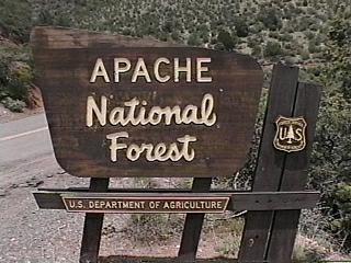
The Apache National Forest is located in eastern Arizona and
western New Mexico and is comprised of 1,197,655 acres in Arizona
and 614,202 acres in New Mexico. There are twenty-four developed
campgrounds, of which sixteen meet the selection criteria. The
Apache National Forest and Sitgreaves National Forest are
administered together and are referred to as the Apache-Sitgreaves
National Forests.
The Apache National Forest is a place of magnificent scenery,
rugged beauty, and many recreational activities. The Forest is
not convenient to a large community and access to this area has
never been easy. These two factors allow the Apache National
Forest to boast it is the most pristine forest in Arizona with a
great diversity of recreational opportunities.
The Coronado Trail Scenic Byway runs north to south in the Apache
National Forest and offers a delightful view of the Forest. The
idea of building this route through the rugged forest of the Blue
Range was thought to be quite ridiculous. "There ain't even a
good horse trail," was the response of one old-timer. Once the
first roadway, a ten foot wide dirt track, was completed it took
only three days to travel from Duncan, Arizona to Springerville,
Arizona. Over the years, the Coronado Trail Scenic Byway (US
Highway 191) has been widened, paved, and improved. Today this
trip requires two or three hours!
From Duncan to Clifton, the Byway passes through dry, arid land.
The Gila River presents a narrow ribbon of green but creosote
bushes that seem to be the only plants growing. In Clifton, the
route passes through a steep-sided canyon (notice the "baby
locomotive" in front of the Cliff Jail) and than you are climbing
into Morenci with its enormous open-pit copper mine (tours of the
mine are available Monday thru Friday). At a Byway vista on the
northern side of the mine, the visitor gain a sense of the mine's
size and complexity of operation.
Past the mine, the topography remains rugged but there is a change:
sparse desert becomes Evergreen oaks and Pinyon pines and soon
Ponderosa pines begin to appear. This is the Apache National
Forest with its stands of virgin Ponderosa pine groves, fabulous
scenery, varied wildlife, and pristine wilderness.
It is said there are 400 curves on the Coronado Trail Scenic
Byway so take your time and enjoy the magnificent vistas,
fabulous scenery, and possible wildlife sightings. (Ask at
either the Springerville or Clifton District Ranger Offices about
a Talking Tour Tape for the Coronado Trail.) This tape will
enhance your journey with lots of information about the Byway,
the land, the people, and the Forest.) A couple of "must-sees"
along the way are the "Arrow Tree" (near mile marker 223) and
Blue Vista at the top of Five-mile Hill. From here the view
reaches almost to Mexico and is "totally awesome."
From Blue Vista, the Coronado Trail begins its descent into
beautiful Hannagan Meadow, the town of Alpine, and ends in
Springerville. A wonderful stand of Quaking Aspen is located
north of Blue Vista and a few Maples can be seen scattered among
the pines. The forest soon begins to open up along the Byway and
elk, deer, and turkeys might be seen grazing in the meadows.
This northern section of the Coronado Trail has two developed
campgrounds. Alpine Divide, adjacent to the Byway and north of
Alpine, and Luna Lake, just west of Alpine. Either are good for
overnight camping or as a base from which to explore more of this
rugged and interesting section of the Apache National Forest.
Before reaching Springerville, the pines and deciduous tree
disappear and are replaced by grasslands dotted by Juniper and
Pinyon pines. The rugged topography also changes to gentle,
rolling hills that reach toward the horizon. In places it
appears some giant hand has built stonewalls to terrace the land.
These great stone retaining walls are in fact a product of the
ancient volcanic activity that formed the surrounding mountains.
As you approach Springerville, look to the east. That is
Escudilla Mountain. This ancient volcano, the center piece of
Arizona's smallest National Wilderness, was an important force in
forming what is now the Apache National Forest. West of
Springerville, easily viewed from Arizona Rt. 260, are many
Maar Volcanos. Appearing as rounded hills scattered across the
plains, these mounds provide more evidence of the Apache National
Forest's volcanic history.
South of the Maar Volcanos, the Apache National Forest offers
some of the best trout fishing (Rainbow and Brown along with
Native Apache) in Arizona, outstanding mountain bike/cross-country
skiing trails, and fabulous wildlife viewing areas all
accessible from developed campgrounds. The campgrounds are
roughly located in three sections: the Big Lake/Crescent
Lake area, East Fork of the Black River corridor, and the Greer
Lakes area.
The Big Lake Recreation Area offers four campgrounds, each
designed for a different camping experience. Rainbow is the
largest and most RV-friendly while Brookchar is located among a
young stand of mixed pines and is designed with only walk-in tent
sites. Cutthroat is also a tent-only campground with limited
views of a large meadow and Big Lake. Grayling has both tent and
RV-campsites among large pines. The Big Lake Recreation Area
also offers campers during the summer regular interpretative
programs, guided nature walks, and a hot shower facility.
Nearby, Winn campground is located at the edge of Lee Valley.
While Winn does not have all the amenitities found at Big Lake,
it does offer spacious RV-friendly sites, outstanding wildlife
viewing opportunities, and a tranquil setting.
Along the East Fork of the Black River are several more rustic
campgrounds. Scenery and fishing are the main attractions of
these campgrounds. Water is available only during the summer
season at Horse Springs and Diamond Rock. Raccoon and Buffalo
Crossing do have vault toilets, tables and grilles on site.
For those who want the feeling of rustic camping but not the
challenges, there is the Rolfe C. Hoyer campground. This special
campground is dedicated to a former Forest Service who lost his
life in a forest fire. Located near the resort community of
Greer, Hoyer is not only set among a grove of mature Ponderosa
pines, it offers the delightful luxury of hot showers, regular
interpretative programs, and guided nature walks. The nearby
community of Greer offers the additional luxury of a meal out at
one of the several good cafes and restaurants.
Apache National Forest is located in lightly populated, mountain
country. High elevations, cool temperatures, a rich forest,
expansive mountain meadows, numerous lakes and streams, abundant
and varied wildlife, and breath-taking scenery make for a
memorable outdoor experience for visitors. The Apache National
Forest is not the easiest forest to get to but one trip will have
you planning for your next visit.
ADDRESSES
SUPERVISOR ADDRESS
30 S. Chiricahua Dr.
P.O.B. 640
Springerville, Arizona 85938
928-333-4301

RANGER DISTRICT ADDRESSES
Alpine
42634 Hwy. 180/191z
Alpine, Arizona 85920
928-339-5000

Clifton
397240 AZ 75
Duncan, Arizona 85534
928-687-8600

Springerville
165 S. Mountain Ave.
Springerville, Arizona 85938
928-333-6200 |