Campground List
CAMPGROUND NAME: American Forks
VISIT DATE: 08/16/2007
UPDATE DATE: 8/22/2024
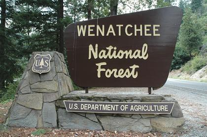
STATE: Washington
REGION: Pacific Northwest
RANGER DISTRICT: Naches
NEAREST CITY/TOWN: Cliffdell
RESERVATIONS: 1-877-444-6777 or make on-line reservation
DIRECTIONS:
From Cliffdell, WA take State Rt. 410 west 7 miles to Bumping
Lake Recreation Area sign. Turn left at sign, crossing the
bridge, turn left at sign, and go 0.1 miles to the campground.
GENERAL COMMENTS:
The elevation is 2,800 ft.
This rustic campground stretches beside the American River in a
dense stand of mixed conifers including Grand fir and cedar.
Although not seen, the river can be heard throughout the
campground. Convenient to State Rt. 410, campground could be a
good overnight stop. Privacy between sites is only fair. Late
August brings spawning salmon up the river - an interesting
activity.
Possible day trips are Mt. Rainier National Park, Boulder Cave,
and the historic Whistlin' Jack Restaurant for a cook's night out
and general store (try the homemade donuts).
SEASONS
Open Seasonal: Yes
Open All Year: No
Seasonal Comment:
Open May 22 through September 4.
RATE AND MAXIMUM STAY PERMITTED
Rate: $15 per day
Maximum Stay Permitted (days): 14
CAMPGROUND SITE CONFIGURATION
No. RV Sites: 0
No. Tent Sites: 0
No. Combined Sites (Tent or RV): 12
Total Sites: 12
Tent Pads: No
Open Sites: No
Wooded Sites: Yes
No. Tables on Sites: 12
No. Grilles on Sites: 12
Equestrian Camping: No
RV INFORMATION
Hookups: None
No. RV Pull Throughs: 1
Waste Station: No
Average Parking Apron Size: 17' X 40'
Comments:
Parking aprons are dirt. A waste station with no potable water
is available for a fee at JR Tire Factory, 10160 S. Naches Rd,
Naches, WA.
FACILITIES
Vaults: Yes
Flush Toilets: No
Hot Showers: No
Wheelchair Friendly Toilets: Yes
Public Phone: No
Playground: No
No. Water Spigots (non-site): 0
WATER SPORTS - None
HIKING - No
FISHING
Whitefish, Brook, Rainbow, Cutthroat, Rainbow, & Steelhead trout

CAMPGROUND NAME: Beverly

VISIT DATE: 07/23/2007

UPDATE DATE:  8/22/2024

STATE: Washington

REGION: Pacific Northwest

RANGER DISTRICT: Cle Elum

NEAREST CITY/TOWN: Cle Elum

RESERVATIONS: No

DIRECTIONS:
From Cle Elum, WA take State Rt. 90 south (which becomes State
Rt. 970 east) 6.8 miles to Teanaway Rd.  Turn left onto Teanaway
Rd. and go 13 miles to Forest Rt. 9737 and the end of pavement.
Continue straight on Forest Rt 9737 (gravel/dirt surface) and go
4 miles to campground on left

GENERAL COMMENTS:
The elevation is 3,100 ft.

This rustic, pack-it-in, pack-it-out campground is a lazy loop
stretching between Forest Rt. 9737 and Teanaway River (more like
creek size at the campground).  White fir, Douglas fir, and other
conifers provide shade.  Separation rather then vegetation
provides good privacy to sites.  Some sites back-up on river,
offering campers a small beach.  The sound of the river can be
heard throughout campground.  There are several secluded
dispersed campsites on the way to campground.

SEASONS
Open Seasonal: Yes
Open All Year: No

Seasonal Comment:
Open May 15 through October 31.

RATE AND MAXIMUM STAY PERMITTED
Rate: $10 per day
Maximum Stay Permitted (days): 14

CAMPGROUND SITE CONFIGURATION
No. RV Sites: 0
No. Tent Sites: 0
No. Combined Sites (Tent or RV): 14

   Total Sites: 14

Tent Pads: No
Open Sites: Yes
Wooded Sites: Yes

No. Tables on Sites: 14
No. Grilles on Sites: 14
Equestrian Camping:  No

RV INFORMATION
Hookups: None
No. RV Pull Throughs: 0
Waste Station: No
Average Parking Apron Size: 14' X 30'

Comments:
The parking aprons are dirt and gravel.

FACILITIES
Vaults: Yes
Flush Toilets: No
Hot Showers: No
Wheelchair Friendly Toilets: Yes

Public Phone: No
Playground: No
No. Water Spigots (non-site): 0

Comments:
The campground appears to be under-maintained - bring toilet
paper.

WATER SPORTS
Wading possible in Teanaway River.

HIKING - No

FISHING - No
CAMPGROUND NAME: Black Pine Horse Camp

VISIT DATE: 07/16/2007

UPDATE DATE:  8/22/2024

STATE: Washington

REGION: Pacific Northwest

RANGER DISTRICT: Wenatchee River

NEAREST CITY/TOWN: Leavenworth

RESERVATIONS: No

DIRECTIONS:
In Leavenworth, WA, at the intersection of US Rt. 2 and Icicle
Rd. (Leavenworth Nat'l Fish Hatchery), take Icicle Rd. south 18
miles to campground on left.

NOTE:  After 12.5 miles, Icicle Rd becomes Forest Rt. 76; it is a
dirt, single-lane road with washboard surface.

GENERAL COMMENTS:
The elevation is 2,800 ft.

The campground is a large single loop for equestrian campers
only, at the edge of Alpine Lakes Wilderness.  The seasonal Black
Pine Creek flows along one side of campground with sites on the
creek side more open and sunny.  Other sites enjoy ample shade
from large Douglas fir, cedar, hemlock and other conifers.
Maples and a variety of shrubs provide excellent privacy.  All
the campsites have pull-through parking aprons many of which can
accommodate small portable corrals even though most have hitching
rails.

SEASONS
Open Seasonal: Yes
Open All Year: No

Seasonal Comment:
Open May 1 through October 15.

RATE AND MAXIMUM STAY PERMITTED
Rate: $18 per day
Maximum Stay Permitted (days): 14

CAMPGROUND SITE CONFIGURATION
No. RV Sites: 0
No. Tent Sites: 0
No. Combined Sites (Tent or RV): 14

   Total Sites: 14

Tent Pads: No
Open Sites: Yes
Wooded Sites: Yes

No. Tables on Sites: 14
No. Grilles on Sites: 14
Equestrian Camping:  Yes

RV INFORMATION
Hookups: None
No. RV Pull Throughs: 14
Waste Station: No
Average Parking Apron Size: See Comments

Comments:
The parking aprons are dirt.  These pull-through sites will
accommodate most any size tow vehicle/stock trailer combination.

FACILITIES
Vaults: Yes
Flush Toilets: No
Hot Showers: No
Wheelchair Friendly Toilets: No

Public Phone: No
Playground: No
No. Water Spigots (non-site): 1
  No. Threaded: 0

Comments:
The water system is solar powered.

WATER SPORTS - None

HIKING
Jack Pine Trail # 1597 (foot and horse) - 2.5 miles
Black Pine Trail #6728 (foot and horse) - 6 miles
   These trails provide access to a network of trails in
   Alpine Lakes Wilderness.

FISHING - No
CAMPGROUND NAME: Cayuse Horse Camp

VISIT DATE: 07/24/2007

UPDATE DATE: 8/22/2024

STATE: Washington

REGION: Pacific Northwest

RANGER DISTRICT: Cle Elum

NEAREST CITY/TOWN: Cle Elum

RESERVATIONS: No

DIRECTIONS:
In Cle Elum, WA, at intersection of Oakes Ave and First St.
(State Rt. 903), take Oakes Ave/State Rt. 903 north one block
to stop sign.  Turn left onto State Rt. 903 north and go 18.5
miles to campground on right.

GENERAL COMMENTS:
Elevation is 2,400 ft.

The campground is a single loop for equestrian campers only.
Horses can be kept only at sites on outside of the loop.
However, there are large communal corrals available for all
near the host site.  Douglas fir offer shade.  With limited
shrubs and
end-to-end parking, privacy is poor to fair.

SEASONS
Open Seasonal: Yes
Open All Year:

Seasonal Comment:
Open June 1 through September 15 - weather dependent

RATE AND MAXIMUM STAY PERMITTED
Rate: $24 per day - single
$45 per day - double
Maximum Stay Permitted (days): 14

CAMPGROUND SITE CONFIGURATION
No. RV Sites: 0
No. Tent Sites: 0
No. Combined Sites (Tent or RV): 14

   Total Sites: 14

Tent Pads: No
Open Sites: Yes
Wooded Sites: Yes

No. Tables on Sites: 14
No. Grilles on Sites: 14
Equestrian Camping:  Yes
Equestrian Camping:  No

RV INFORMATION
Hookups: None
No. RV Pull Throughs: 3
Waste Station:
Potable Water at Waste Station:
Average Parking Apron Size: 15' X 50

Comments:
The parking aprons are gravel and all about same size.
Some campsites have end-to-end parking aprons.

FACILITIES
Vaults: Yes
Flush Toilets: No
Hot Showers: No
Wheelchair Friendly Toilets: No

Public Phone: No
Playground: No
No. Water Spigots (non-site): 0

Comments:
The water spigot is a handpump for stock only (not operational at
time of authors' visit).

WATER SPORTS - None

HIKING
Jolly Mtn. Trail #1307 (foot, horse & mountain bike) - 10 miles

FISHING - No
CAMPGROUND NAME: Cedar Springs

VISIT DATE: 08/16/2007

UPDATE DATE:  8/22/2024

STATE: Washington

REGION: Pacific Northwest

RANGER DISTRICT: Naches

NEAREST CITY/TOWN: Cliffdell

RESERVATIONS: 1-877-444-6777 or make on-line reservation

DIRECTIONS:
From Cliffdell, WA take State Rt. 410 west 7 miles to Bumping
Lake Recreation Area sign.  Turn left at sign and go 0.5 miles to
campground on left.

GENERAL COMMENTS:
The elevation is 2,800 ft.

The campground is a single loop beside Bumping River in a stand
of mixed conifers including Grand fir and Douglas fir.  Sounds of
the river can be heard throughout campground.  Spacing rather
then vegetation provides fair privacy to most sites.  Close to
State Rt. 410, the campground offers a peaceful location for an
overnight stop.  Late August brings spawning salmon up the river
- an interesting activity.

Possible day trips are Mt. Rainier National Park, Boulder Cave,
and the historic Whistlin' Jack Restaurant for a cook's night out
and general store (and try the homemade donuts).

SEASONS
Open Seasonal: Yes
Open All Year: No

Seasonal Comment:
Open May 17 through October 6

RATE AND MAXIMUM STAY PERMITTED
Rate: $20 per day
Maximum Stay Permitted (days): 14

CAMPGROUND SITE CONFIGURATION
No. RV Sites: 0
No. Tent Sites: 0
No. Combined Sites (Tent or RV): 15

   Total Sites: 15

Tent Pads: No
Open Sites: Yes
Wooded Sites: Yes

No. Tables on Sites: 15
No. Grilles on Sites: 15
Equestrian Camping:  No

RV INFORMATION
Hookups: None
No. RV Pull Throughs: 1
Waste Station: No
Average Parking Apron Size: 14' X 32'

Comments:
The parking aprons are paved.  A waste station with no potable
water is available for a fee at JR Tire Factory, 10160 S. Naches
Rd, Naches, WA.

FACILITIES
Vaults: Yes
Flush Toilets: No
Hot Showers: No
Wheelchair Friendly Toilets: No

Public Phone:
Playground:
No. Water Spigots (non-site): 1
  No. Threaded: 0

Comments:
The water spigot is a hand pump.

WATER SPORTS - None

HIKING - No

FISHING
Whitefish, Brook, Rainbow, and Steelhead trout
CAMPGROUND NAME: Chiwawa Horse Camp

VISIT DATE: 07/19/2007

UPDATE DATE:  8/22/2024

STATE: Washington

REGION: Pacific Northwest

RANGER DISTRICT: Wenatchee River

NEAREST CITY/TOWN: Leavenworth

RESERVATIONS: No

DIRECTIONS:
From Leavenworth, WA, take U.S. Rt. 2 west 14.1 miles to
Recreation Area /State Route 207 signs.  Turn right at signs onto
State Rt. 207 north and go 4.3 miles to a "Y" intersection.  Bear
right onto Chiwawa Loop Rd (Forest Rt. 62) and go 1.2 miles to
Chiwawa River Rd.  Turn left and go 14.8 miles to campground on
right.

NOTE:  Forest Rt. 62 becomes Forest Rt. 6200, single-lane and
then gravel at 10.9 miles.

GENERAL COMMENTS:
Elevation is 2,500 ft.

A single loop campground designed for equestrian campers, but all
are welcomed, is next to the Rock Creek Trailhead in a pleasant
mix of trees.  White pine, Douglas fir, and willows offer ample
shade to sites.  Hitching rails or high-line posts are provided
at most sites. There isn't much room for portable corrals.
Except for end-to-end parking aprons, privacy is good between
sites.  This pack-it-in, pack-it-out campground has the
appearance of a delightful undiscovered location.

SEASONS
Open Seasonal: Yes
Open All Year: No

Seasonal Comment:
Open Memorial Day through October 1 - weather dependent

RATE AND MAXIMUM STAY PERMITTED
Rate: $18 per day
Maximum Stay Permitted (days): 14

CAMPGROUND SITE CONFIGURATION
No. RV Sites: 0
No. Tent Sites: 0
No. Combined Sites (Tent or RV): 21

   Total Sites: 21

Tent Pads: No
Open Sites: Yes
Wooded Sites: Yes

No. Tables on Sites: 21
No. Grilles on Sites: 21
Equestrian Camping:  Yes

RV INFORMATION
Hookups: None
No. RV Pull Throughs: 2
Waste Station: No
Average Parking Apron Size: 13' X 55'

Comments:
The parking aprons are gravel and all about same size.

FACILITIES
Vaults: Yes
Flush Toilets: No
Hot Showers: No
Wheelchair Friendly Toilets: Yes

Public Phone: Yes
Playground: No
No. Water Spigots (non-site): 1
  No. Threaded: 0

Comments:
The water system is solar powered.

WATER SPORTS - None

HIKING
Bridle Trail  (foot & horse) - 1 mile
Estes Butte Trail #1527 (foot & horse) - 4 miles
Rock Creek Trail #1509 (foot & horse) - 11.5 miles
  Provides access to Glacier Peak Wilderness and its
  network of trails.

FISHING - No
CAMPGROUND NAME: Cle Elum River

VISIT DATE: 07/24/2007

UPDATE DATE:  8/22/2024

STATE: Washington

REGION: Pacific Northwest

RANGER DISTRICT: Cle Elum

NEAREST CITY/TOWN: Cle Elum

RESERVATIONS: No

DIRECTIONS:
In Cle Elum, WA, at intersection of Oakes Ave. and First St.
(State Rt. 903), take Oakes Ave./State Rt 903 north one block to
stop sign.  Turn left onto State Rt. 903 north and go 15 miles to
campground on left

GENERAL COMMENTS:
Elevation is 2,300 ft.

The campground stretches along the east bank of Cle Elum Lake.
This lake is used for irrigation so, as the summer progresses,
the lake recedes from the campground.  A vast grass prairie
appears where the lake had been and provides a pleasant view of
the tall grass and surrounding mountains.  Douglas fir provide
some shade.  Two spurs branch off, and with no turn-arounds, are
recommended for tent campers.

SEASONS
Open Seasonal: Yes
Open All Year: No

Seasonal Comment:
Open May 15 through September 15

RATE AND MAXIMUM STAY PERMITTED
Rate: $20 per day - single
$36 per day - double
Maximum Stay Permitted (days): 14

CAMPGROUND SITE CONFIGURATION
No. RV Sites: 0
No. Tent Sites: 6
No. Combined Sites (Tent or RV): 11

   Total Sites: 17

Tent Pads:
Open Sites: Yes
Wooded Sites: Yes

No. Tables on Sites: 17
No. Grilles on Sites: 17
Equestrian Camping:  No

RV INFORMATION
Hookups: None
No. RV Pull Throughs: 1
Waste Station: No
Average Parking Apron Size: 15' X 45'

Comments:
The parking aprons are gravel.

FACILITIES
Vaults: Yes
Flush Toilets: No
Hot Showers: No
Wheelchair Friendly Toilets: Yes

Public Phone: No
Playground: No
No. Water Spigots (non-site): 1
  No. Threaded: 0

Comments:
The water spigot is a handpump.

WATER SPORTS - No

HIKING
Howson Creek Trail #1349 (foot, horse & mountain bike)  - 4 miles

FISHING - No
CAMPGROUND NAME: Cottonwood (1)

VISIT DATE: 07/17/2007

UPDATE DATE:  3/1/2018

STATE: Washington

REGION: Pacific Northwest

RANGER DISTRICT: Entiat

NEAREST CITY/TOWN: Ardenvoir

RESERVATIONS: No

DIRECTIONS:
From Ardenvoir, WA take Entiat River Rd west 27.3 miles into
campground.

NOTE:  The last 4.3 miles are single-lane gravel roadway.

GENERAL COMMENTS:
The elevation is 3,000 ft.

The campground straddles Entiat River and has three separate
sections.  The largest section is on the south side of the river
in a stand of Lodgepole pine and has several small (3 to 4 site)
spurs radiating off the interior road.  The other two sections,
on the river's north bank, are clusters tucked in among Douglas
fir and White pine.  Access to these clusters is just before the
campground's entrance - bear left at Cottonwood Ranger Station
sign.  The campground is close to the Glacier Peak Wilderness
with most camp sites along the river.  Although the campground
has a wilderness feel, vegetation is limited as is shade and
privacy.  Bug spray is recommended.

This is bear country; practise safe food storage techniques.

SEASONS
Open Seasonal: Yes
Open All Year: No

Seasonal Comment:
Open the weekend after Memorial Day through Labor Day.

RATE AND MAXIMUM STAY PERMITTED
Rate: $10 per day
Maximum Stay Permitted (days): 14

CAMPGROUND SITE CONFIGURATION
No. RV Sites: 0
No. Tent Sites: 14
No. Combined Sites (Tent or RV): 11

   Total Sites: 25

Tent Pads: No
Open Sites: Yes
Wooded Sites: Yes

No. Tables on Sites: 25
No. Grilles on Sites: 25
Equestrian Camping:  No

RV INFORMATION
Hookups: None
No. RV Pull Throughs: 0
Waste Station: No
Average Parking Apron Size: 13' X 35'

Comments:
Some parking aprons are gravel and others are dirt.  Sites 1 and
2 are on a dead-end spur with limited turn-around.

FACILITIES
Vaults: Yes
Flush Toilets: No
Hot Showers: No
Wheelchair Friendly Toilets: Yes

Public Phone: No
Playground: No
No. Water Spigots (non-site): 2
  No. Threaded: 0

Comments:
The water spigot is a handpump.

WATER SPORTS - None

HIKING
Shetipo Trail #1429 (dirt bike) - 4.7 miles
  provides access to a network of multi-use trails
Myrtle Lake Trail #1400 (foot and horse) - 3.5 miles
  "portal" trail to Glacier Peak Wilderness

FISHING
Native Cutthroat and Rainbow trout
CAMPGROUND NAME: Cottonwood (2)

VISIT DATE: 08/18/2007

UPDATE DATE:  3/18/2018

STATE: Washington

REGION: Pacific Northwest

RANGER DISTRICT: Naches

NEAREST CITY/TOWN: Cliffdell

RESERVATIONS: No

DIRECTIONS:
From Cliffdell, WA take State Rt. 410 east 2.8 miles to
campground on right.

GENERAL COMMENTS:
The elevation is 2,300 ft.

The campground, located on the west bank of the Naches River, has
two unnamed sections in a riparian environment.  Cottonwood and
Ponderosa pine provide some shade and the thick middlestory
offers good privacy between sites.  The section to left of fee
board, with its pull-throughs, is more RV-friendly.  The right
hand section is closer to the river, has some nice sites for
tenters, and a turn around too tight for RVs to use.  Traffic
noise can be distracting.  Salmon watching in late August is a
possible campground activity.

Possible day trips are Mt. Rainier National Park, Boulder Cave,
and the historic Whistlin' Jack Restaurant for a cook's night out
and the adjacent General Store for what was forgotten (and try
the homemade donuts).

SEASONS
Open Seasonal: Yes
Open All Year: No

Seasonal Comment:
Open May 17 through September 27

RATE AND MAXIMUM STAY PERMITTED
Rate: $16 per day
Maximum Stay Permitted (days): 14

CAMPGROUND SITE CONFIGURATION
No. RV Sites: 0
No. Tent Sites: 0
No. Combined Sites (Tent or RV): 13

   Total Sites: 13

Tent Pads: No
Open Sites: Yes
Wooded Sites: Yes

No. Tables on Sites: 13
No. Grilles on Sites: 13
Equestrian Camping:  No

RV INFORMATION
Hookups: None
No. RV Pull Throughs: 2
Waste Station: No
Average Parking Apron Size: 14' X 28'

Comments:
Parking aprons are dirt and gravel.  Waste station with no
potable water is available for a fee at JR Tire Factory, 10160 S.
Naches Rd, Naches, WA.

FACILITIES
Vaults: Yes
Flush Toilets: No
Hot Showers: No
Wheelchair Friendly Toilets: No

Public Phone: No
Playground: No
No. Water Spigots (non-site): 1
  No. Threaded: 0

WATER SPORTS - None

HIKING - No

FISHING
Whitefish, Brook, Rainbow & Steelhead, and Chinook salmon
CAMPGROUND NAME: Cougar Flat

VISIT DATE: 08/17/2007

UPDATE DATE:  8/22/2024

STATE: Washington

REGION: Pacific Northwest

RANGER DISTRICT: Naches

NEAREST CITY/TOWN: Cliffdell

RESERVATIONS: 1-877-444-6777 or make on-line reservation

DIRECTIONS:
From Cliffdell, WA, take State Rt. 410 west 7 miles to Bumping
Lake Recreation Area sign.  Turn left at sign and go 5.9 miles to
campground on left.

GENERAL COMMENTS:
The elevation is 3,100 ft.

This rustic campground has two unnamed sections on the west bank
of Bumping River.  The section on right of entrance is a small
dead-end spur with walk-in tent sites near the water.  The left
side section also has sites near the river but more are tucked
into the older stand of mixed conifers which include cedar and
White fir. Deciduous trees line the river's bank suggesting nice
fall color.  The campsites have good separation but a lack of
vegetation provides only fair privacy.  The left side section
also has the campground's wheelchair-friendly vault and handpump.

Possible day trips are Mt. Rainier National Park, Boulder Cave,
and the historic Whistlin' Jack Restaurant for a cook's night out
and General Store (and try the homemade donuts).

SEASONS
Open Seasonal: Yes
Open All Year: No

Seasonal Comment:
Open May 17 through October 6

RATE AND MAXIMUM STAY PERMITTED
Rate: $20 per day
Maximum Stay Permitted (days): 14

CAMPGROUND SITE CONFIGURATION
No. RV Sites: 0
No. Tent Sites: 3
No. Combined Sites (Tent or RV): 9

   Total Sites: 12

Tent Pads: No
Open Sites: Yes
Wooded Sites: Yes

No. Tables on Sites: 12
No. Grilles on Sites: 10
Equestrian Camping:  No

RV INFORMATION
Hookups: None
No. RV Pull Throughs: 0
Waste Station: No
Average Parking Apron Size: 13' X 34'

Comments:
The parking aprons are dirt.  A waste station with no potable
water is available for a fee at Lower Bumping Lake campground,
5.3 miles south.

FACILITIES
Vaults: Yes
Flush Toilets: No
Hot Showers: No
Wheelchair Friendly Toilets: Yes

Public Phone: No
Playground: No
No. Water Spigots (non-site): 1
  No. Threaded: 0

Comments:
The water spigot is a handpump.

WATER SPORTS - None

HIKING
Goat Creek trail #959 (foot) - 2 miles
   Provides access to a network of trails in William
   O. Douglas Wilderness

FISHING
Whitefish, Brook, Rainbow, Cutthroat, Steelhead & Rainbow trout
CAMPGROUND NAME: Crow Creek

VISIT DATE: 08/20/2007

UPDATE DATE:  3/18/2018

STATE: Washington

REGION: Pacific Northwest

RANGER DISTRICT: Naches

NEAREST CITY/TOWN: Naches

RESERVATIONS: 1-877-444-6777 or make on-line reservation

DIRECTIONS:
From Cliffdell, WA, take State Rt. 410 west 3.3 miles to Little
Naches Rd. sign.  Turn right at sign, onto Forest Rt. 19, and go
2.6 miles to Raven Roost sign.  Turn left at sign and go 0.4
miles to an intersection (Raven Roost sign).  Turn right at sign,
crossing bridge, to a "Y" intersection.  Bear right, onto Forest
Rt. 1921, and immediately right into campground.

GENERAL COMMENTS:
The elevation is 2,700 ft.

The campground meanders through a sparse stand of mixed conifers
between Naches River and Crow Creek.  This rough and rugged
campground is basically a developed trailhead for the numerous
OHV trails in the area.  Sites are free-formed and can
accommodate multiple units.  Only site 10 is on a dead end spur.
The majority of sites could be pull-through.  With no understory
or middlestory, there is no privacy between sites.  Douglas fir
and Jeffrey pine provide some shade.

Possible day trips are Mt. Rainier National Park, Boulder Cave,
and Whistin' Jack Restaurant & Lodge in Cliffdell for a cook's
night out and general store (and try the homemade donuts).

SEASONS
Open Seasonal: Yes
Open All Year: No

Seasonal Comment:
Open weekend before Memorial Day through Labor Day

RATE AND MAXIMUM STAY PERMITTED
Rate: $10 per day
Maximum Stay Permitted (days): 14

CAMPGROUND SITE CONFIGURATION
No. RV Sites: 0
No. Tent Sites: 0
No. Combined Sites (Tent or RV): 15

   Total Sites: 15

Tent Pads: No
Open Sites: Yes
Wooded Sites: Yes

No. Tables on Sites: 15
No. Grilles on Sites: 3
Equestrian Camping:  No

RV INFORMATION
Hookups: None
No. RV Pull Throughs: 0
Waste Station: No
Average Parking Apron Size: See comments

Comments:
The parking aprons are rock and dirt, free-formed and irregular
in shape, and lumpy.  A waste station with no potable water is
available for a fee at JR Tire Factory, 10160 S. Naches Rd,
Naches, WA.

FACILITIES
Vaults: Yes
Flush Toilets: No
Hot Showers: No
Wheelchair Friendly Toilets: Yes

Public Phone: No
Playground: No
No. Water Spigots (non-site): 0

Comments:
Water is available at Kaner Flat campground on Forest Rt. 19.

WATER SPORTS - None

HIKING
West Quartz Creek trail #952 (Dirt Bike) - 13.2 miles
Sand Creek trail #963 (Dirt Bike) - 10.5 miles
  These trails are part of an estimated 130 mile network for
  OHVs.

FISHING
Cutthroat, Rainbow, and Steelhead trout
CAMPGROUND NAME: Eightmile

VISIT DATE: 07/16/2007

UPDATE DATE:  8/22/2024

STATE: Washington

REGION: Pacific Northwest

RANGER DISTRICT: Wenatchee River

NEAREST CITY/TOWN: Wenatchee River

RESERVATIONS: 1-877-444-6777 or  make on-line reservation

DIRECTIONS:
In Leavenworth, WA, at the intersection of US Rt. 2 and Icicle
Rd. (Leavenworth Nat'l Fish Hatchery), take Icicle Rd. south 7
miles to campground on left.

GENERAL COMMENTS:
The elevation is 1,900 ft.

The campground has two unnamed loops.  One loop is on a slight
incline above Icicle Creek while the other stretches beside the
Creek.  Douglas fir, Wenatchee pine, and Big Leaf maple offer some
shade.  It is separation between sites, not vegetation, that
provides good privacy.  The campground has lots of room for
children to ride bikes and play.

This is bear country; practice safe food storage techniques.

SEASONS
Open Seasonal: Yes
Open All Year: No

Seasonal Comment:
Open May 17 through October 6 - weather dependent

RATE AND MAXIMUM STAY PERMITTED
Rate: $25 per day - single
$50 per day - double
Maximum Stay Permitted (days): 14

CAMPGROUND SITE CONFIGURATION
No. RV Sites: 0
No. Tent Sites: 2
No. Combined Sites (Tent or RV): 39

   Total Sites: 41

Tent Pads: No
Open Sites: Yes
Wooded Sites: Yes

No. Tables on Sites: 41
No. Grilles on Sites: 41
Equestrian Camping:  No

RV INFORMATION
Hookups: None
No. RV Pull Throughs: 1
Waste Station: No
Average Parking Apron Size: 12' X 45'

Comments:
The parking aprons are paved and all about same size

FACILITIES
Vaults: Yes
Flush Toilets: No
Hot Showers: No
Wheelchair Friendly Toilets: Yes

Public Phone: No
Playground: No
No. Water Spigots (non-site): 4
  No. Threaded: 0

WATER SPORTS - None

HIKING

FISHING
Rainbow trout
CAMPGROUND NAME: Fox Creek

VISIT DATE: 07/18/2007

UPDATE DATE:  8/22/2024

STATE: Washington

REGION: Pacific Northwest

RANGER DISTRICT: Entiat

NEAREST CITY/TOWN: Ardenvoir

RESERVATIONS: No

DIRECTIONS:
From Ardenvoir, WA, take Entiat River Rd west 13 miles to
campground on left.

GENERAL COMMENTS:
The elevation is 2,000 ft.

This single loop campground hugs the north bank of Entiat River
with sites tucked in among grand old cedar, Ponderosa pine, and
other conifers.  It is the separation more than vegetation that
provides excellent privacy.  The sound of flowing water can be
heard throughout.  This is the most RV-friendly campground in the
Entiat River corridor.  Possible day trip from campground is the
Silver Falls National Recreation Trail.

This is bear country; practice safe food storage techniques.

SEASONS
Open Seasonal: Yes
Open All Year: No

Seasonal Comment:
Open May 15 through October 31.

RATE AND MAXIMUM STAY PERMITTED
Rate: $15 per day
Maximum Stay Permitted (days): 14

CAMPGROUND SITE CONFIGURATION
No. RV Sites: 0
No. Tent Sites: 0
No. Combined Sites (Tent or RV): 16

   Total Sites: 16

Tent Pads: No
Open Sites: Yes
Wooded Sites: Yes

No. Tables on Sites: 16
No. Grilles on Sites: 16
Equestrian Camping:  No

RV INFORMATION
Hookups: None
No. RV Pull Throughs: 0
Waste Station: No
Average Parking Apron Size: 12' X 42'

Comments:
The parking aprons are paved.

FACILITIES
Vaults: Yes
Flush Toilets: No
Hot Showers: No
Wheelchair Friendly Toilets: Yes

Public Phone: No
Playground: No
No. Water Spigots (non-site): 1
  No. Threaded: 0

Comments:
The water spigot is a handpump.

WATER SPORTS - None

HIKING - No

FISHING - No
CAMPGROUND NAME: Glacier View

VISIT DATE: 07/17/2007

UPDATE DATE: 8/22/2024

STATE: Washington

REGION: Pacific Northwest

RANGER DISTRICT: Wenatchee River

NEAREST CITY/TOWN: Leavenworth

RESERVATIONS: No

DIRECTIONS:
From Leavenworth, WA take US Rt. 2 west 14.1 miles to Recreation
Area/State Rt. 207 signs.  Turn right at sign onto Rt. 207 North
and go 3.5 miles to campground sign.  Turn left onto Cedar Brae
Rd and go 0.3 miles to campground sign.  Turn left at sign and go
3.4 miles to Forest Rt. 6607.  Continue straight onto Rt. 6607
(gravel) and go 1.2 miles into campground.

GENERAL COMMENTS:
The elevation is 1,900 ft.

On the southern shore of Lake Wenatchee, this tent only
campground has two sections.  One section is a loop with terraced
sites above the lakeshore.  The other section stretches along the
shoreline through a stand of cedar and maple.  Parking for these
sites is on parallel slots along the interior road with access to
campsite down a steep hill.  Every site has a view of the lake
and mountains across the lake with easy access to the water.
Firewood is available for a fee.

SEASONS
Open Seasonal: Yes
Open All Year: No

Seasonal Comment:
Open May 1 through October 15 - weather dependent

RATE AND MAXIMUM STAY PERMITTED
Rate: $20 per day
Maximum Stay Permitted (days): 14

CAMPGROUND SITE CONFIGURATION
No. RV Sites: 0
No. Tent Sites: 22
No. Combined Sites (Tent or RV): 0

   Total Sites: 22

Tent Pads: No
Open Sites: Yes
Wooded Sites: Yes

No. Tables on Sites: 22
No. Grilles on Sites: 22
Equestrian Camping:  No

FACILITIES
Vaults: Yes
Flush Toilets: No
Hot Showers: No
Wheelchair Friendly Toilets: Yes

Public Phone: No
Playground: No
No. Water Spigots (non-site): 0

WATER SPORTS
Lake: Yes
Swimming (provided): No
Sailing: No
Boat Ramp: Yes
Boat Carry Down Access: Yes
Power Boating: Yes
Boating (no power): Yes
Water Skiing: Yes
Rafting (whitewater): No
Kayaking (whitewater): No

Comments:
Wenatchee Lake is an estimated 3,000 acres.  Sail-boarding is
becoming popular.  The dirt boat ramp is primitive.

HIKING
Hidden Lake Trail #1510 (foot) - 0.5 miles

FISHING
Rainbow trout
CAMPGROUND NAME: Goose Creek

VISIT DATE: 07/19/2007

UPDATE DATE:  8/22/2024

STATE: Washington

REGION: Pacific Northwest

RANGER DISTRICT: Wenatchee River

NEAREST CITY/TOWN: Leavenworth

RESERVATIONS: No

DIRECTIONS:
From Leavenworth, WA, take U.S. Rt. 2 west 14.1 miles to
Recreation Area /State Rt. 207 signs.  Turn right at signs onto
Rt. 207 North and go 4.3 miles to a "Y" intersection.  Bear right
onto Chiwawa Loop Rd. and go 1.2 miles to Chiwawa River Rd.
Turn left and go 3.2 miles to Goose Creek CG sign.  Turn right at
sign and go right again onto Forest Rt. 6100 (gravel) and go 0.6
miles to campground on right.

GENERAL COMMENTS:
The elevation is 2,200 ft.

The campground was designed for and is used by single-track OHV
vehicle (dirt bike) enthusiasts.  This rustic campground has two
unnamed sections in the middle of a 150-mile trail system.  The
larger section offers ample shade, good privacy, and easy access
to trails.  The small section has some shade, minimal privacy,
and sites along the Chiwawa River.  A pleasant mix of trees from
willow to White pine provide the shade.  Fern, Thimbleberry, and
other shrubs help keep dust under some control.

SEASONS
Open Seasonal: Yes
Open All Year: No

Seasonal Comment:
Open May 15 through October 18 - weather dependent

RATE AND MAXIMUM STAY PERMITTED
Rate: $18 per day
Maximum Stay Permitted (days): 14

CAMPGROUND SITE CONFIGURATION
No. RV Sites: 0
No. Tent Sites: 0
No. Combined Sites (Tent or RV): 29

   Total Sites: 29

Tent Pads: No
Open Sites: Yes
Wooded Sites: Yes

No. Tables on Sites: 26
No. Grilles on Sites: 26
Equestrian Camping:  No

RV INFORMATION
Hookups: None
No. RV Pull Throughs: 0
Waste Station: No
Average Parking Apron Size: 14' X 47'

Comments:
The parking aprons are dirt.

FACILITIES
Vaults: Yes
Flush Toilets: No
Hot Showers: No
Wheelchair Friendly Toilets: Yes

Public Phone: No
Playground: No
No. Water Spigots (non-site): 2
  No. Threaded: 0

Comments:
The water spigots are handpumps.

WATER SPORTS - None

HIKING
Lower Chiwawa Trail #1548 (foot, horse, mountain bike & dirt
bike) - accesses a 150-mile trail system

FISHING - No
CAMPGROUND NAME: Hause Creek

VISIT DATE: 08/22/2007

UPDATE DATE: 8/22/2024

STATE: Washington

REGION: Pacific Northwest

RANGER DISTRICT: Naches

NEAREST CITY/TOWN: Naches

RESERVATIONS: 1-877-444-6777 or make on-line reservation

DIRECTIONS:
In Naches, WA, at intersection of US Rt. 12 and Naches Ave, take
Rt. 12 west 4.4 miles to the intersection with State Rt. 410.
Turn left at intersection, staying on Rt. 12, and go 16.8 miles
to campground on left.

GENERAL COMMENTS:
The elevation is 2,600 ft.

The campground stretches along Tieton River and has two unnamed
loops, a spur and a walk-in tent area along the river's edge.
Beginning in an open stand of Tie ton pine with a brushy
understory, the campground winds up a hillside into a dense stand
of conifers, mostly Douglas fir.  There are numerous sites
scattered around the campground with views of Tieton River.
Separation between camp sites rather than vegetation provides
fair privacy.  Traffic noise can be distracting especially in the
hillside loop.  A few sites are surround by a natural hedge of
wild roses.  A suggested day trip is a drive to Mt. Rainier
National Park along US Rt. 12 with a stop at Clear Creek Falls
overlook.

SEASONS
Open Seasonal: Yes
Open All Year: No

Seasonal Comment:
Open May 17 through October 6

RATE AND MAXIMUM STAY PERMITTED
Rate: $25 per day - single
$50 per day - double
Maximum Stay Permitted (days): 14

CAMPGROUND SITE CONFIGURATION
No. RV Sites: 0
No. Tent Sites: 9
No. Combined Sites (Tent or RV): 31

   Total Sites: 40

Tent Pads: No
Open Sites: Yes
Wooded Sites: Yes

No. Tables on Sites: 40
No. Grilles on Sites: 38
Equestrian Camping:  No

RV INFORMATION
Hookups: None
No. RV Pull Throughs: 9
Waste Station: No
Average Parking Apron Size: 14' X 40'

Comments:
The parking aprons are paved.  Gray water waste disposal sites
are scattered around the campground.  A waste station with no
potable water is available for a fee at JR Tire Factory, 10160 S.
Naches Rd, Naches, WA.  Another waste station with potable water
is available for a fee at Silver Beach Resort, 10350 US Rt. 12,
Naches, WA.

FACILITIES
Vaults: Yes
Flush Toilets: No
Hot Showers: No
Wheelchair Friendly Toilets: Yes

Public Phone: No
Playground: No
No. Water Spigots (non-site): 11
  No. Threaded: 0

WATER SPORTS
Lake: No
Swimming (provided): No
Sailing: No
Boat Ramp: No
Boat Carry Down Access: Yes
Power Boating: No
Boating (no power): Yes
Water Skiing: No
Rafting (whitewater): Yes
Kayaking (whitewater): Yes

Comments:
Tieton River is a popular whitewater float venue from late August
through September.  Contact the  Ranger District Office for
outfitter information.

HIKING - No

FISHING
Whitefish and Rainbow trout
CAMPGROUND NAME: Hells Crossing

VISIT DATE: 08/17/2007

UPDATE DATE:  8/22/2024

STATE: Washington

REGION: Pacific Northwest

RANGER DISTRICT: Naches

NEAREST CITY/TOWN: Cliffdell

RESERVATIONS: 1-877-444-6777 or make on-line reservation

DIRECTIONS:
From Cliffdell, WA take State Rt. 410 west 11.8 miles to
campground on right.

GENERAL COMMENTS:
The elevation is 3,300 ft.

This rustic campground has two sections on the east and west side
of American River.  Most sites overlook the river in a stand of
mixed conifers.  Entrance to the west side is not marked.  This
section has longer parking aprons than east side and has the
campground's only handpump.  Privacy is minimal.  In late August
the annual salmon run starts which can be watched from some of
the sites.

Possible day trips are Mt. Rainier National Park, Boulder Cave,
and the historic Whistlin' Jack Restaurant for a cook's night out
and the General Store (and try the homemade donuts).

SEASONS
Open Seasonal: Yes
Open All Year: No

Seasonal Comment:
May 17 through October 6

RATE AND MAXIMUM STAY PERMITTED
Rate: $20 per day
Maximum Stay Permitted (days): 14

CAMPGROUND SITE CONFIGURATION
No. RV Sites: 0
No. Tent Sites: 6
No. Combined Sites (Tent or RV): 12

   Total Sites: 18

Tent Pads: No
Open Sites: Yes
Wooded Sites: Yes

No. Tables on Sites: 18
No. Grilles on Sites: 16
Equestrian Camping:  No

RV INFORMATION
Hookups: None
No. RV Pull Throughs: 2
Waste Station: No
Average Parking Apron Size: 14' X 37'

Comments:
The east side parking aprons are gravel.  The west side parking
aprons are dirt and rock.  A waste station with no potable water
is available for a fee at JR Tire Factory, 10160 S. Naches Rd,
Naches, WA.

FACILITIES
Vaults: Yes
Flush Toilets: No
Hot Showers: No
Wheelchair Friendly Toilets: No

Public Phone: No
Playground: No
No. Water Spigots (non-site): 1
  No. Threaded: 0

Comments:
The water spigot is a handpump.

WATER SPORTS - None

HIKING
Pleasant Valley Loop trail #999 (foot) - 4 miles
Goat Peak trail #958 (foot) - 2.9 miles
   Provides access to Norse Peak Wilderness

FISHING
Whitefish, Brook, Rainbow & Cutthroat trout, and Chinook salmon
CAMPGROUND NAME: Icewater Creek

VISIT DATE: 07/25/2007

UPDATE DATE:  3/18/2018

STATE: Washington

REGION: Pacific Northwest

RANGER DISTRICT: Cle Elum

NEAREST CITY/TOWN: Cle Elum

RESERVATIONS: No

DIRECTIONS:
In Cle Elum, WA, at intersection of First St. and Oakes Ave, take
Oakes Ave south 0.4 miles to I-90 East.  Turn left onto I-90 East
and go 9.3 miles to Exit 93 (Elks Height Rd).  Take Exit 93 to a
stop sign.  Turn left and go 0.3 miles to another stop sign.
Turn right onto Taneum Rd and go 3.4 miles to still another stop
sign.  Turn right onto E. Taneum Rd and go 0.1 miles to a stop
sign.  Turn right onto W. Taneum Rd and go 8.4 miles to
campground on left.

GENERAL COMMENTS:
The elevation is 2,800 ft.

The campground winds down from the road to Taneum Creek through a
pleasant mix of trees including Douglas fir, cedar, and maples.
Several sites back up on the creek which can be heard, but not
always seen, throughout campground.  The lush riparian
environment provides ample privacy between sites.

SEASONS
Open Seasonal: Yes
Open All Year: No

Seasonal Comment:
Open weekend before Memorial Day through Tuesday after Labor Day.

RATE AND MAXIMUM STAY PERMITTED
Rate: $18 per day - single
$36 per day - double
Maximum Stay Permitted (days): 14

CAMPGROUND SITE CONFIGURATION
No. RV Sites: 0
No. Tent Sites: 3
No. Combined Sites (Tent or RV): 11

   Total Sites: 14

Tent Pads: No
Open Sites: Yes
Wooded Sites: Yes

No. Tables on Sites: 14
No. Grilles on Sites: 14
Equestrian Camping:  No

RV INFORMATION
Hookups: None
No. RV Pull Throughs: 5
Waste Station: No
Average Parking Apron Size: 14' X 27'

Comments:
The parking aprons are gravel.  A waste station is available at
Indian John Rest Area on I-90 at mile post 90.4.

FACILITIES
Vaults: Yes
Flush Toilets: No
Hot Showers: No
Wheelchair Friendly Toilets: No

Public Phone: No
Playground: No
No. Water Spigots (non-site): 0

WATER SPORTS - None

HIKING
North Fork Taneum #1377 (foot, horse & dirt bike) - 15.7 miles

FISHING
Rainbow trout
CAMPGROUND NAME: Ida Creek

VISIT DATE: 07/16/2007

UPDATE DATE: 8/22/2024

STATE: Washington

REGION: Pacific Northwest

RANGER DISTRICT: Wenatchee River

NEAREST CITY/TOWN: Leavenworth

RESERVATIONS: No

DIRECTIONS:
In Leavenworth, WA, at intersection of US Rt. 2 and Icicle Rd
(Leavenworth Nat'l Fish Hatchery), take Icicle Rd. south 13.2
miles to campground on left.

NOTE:  After 12.5 miles, Icicle Rd. becomes Forest Rt. 76, dirt,
single-lane road with washboard surface.

GENERAL COMMENTS:
The elevation is 2,600 ft.

This sunny little campground stretches along the icy cold Icicle
Creek.  Most sites are on the creek's banks but a couple are
tucked back in the trees and away from the water.  Douglas fir
and cedar offer some shade while young maples provide limited
privacy.  Firewood is available for a fee.

This is bear country; practice safe food storage techniques.

SEASONS
Open Seasonal: Yes
Open All Year: No

Seasonal Comment:
Open May 1 through October 15 - weather dependent

RATE AND MAXIMUM STAY PERMITTED
Rate: $20 per day
Maximum Stay Permitted (days): 14

CAMPGROUND SITE CONFIGURATION
No. RV Sites: 0
No. Tent Sites: 1
No. Combined Sites (Tent or RV): 9

   Total Sites: 10

Tent Pads: No
Open Sites: Yes
Wooded Sites: Yes

No. Tables on Sites: 10
No. Grilles on Sites: 10
Equestrian Camping:  No

RV INFORMATION
Hookups: None
No. RV Pull Throughs: 0
Waste Station: No
Average Parking Apron Size: 18' X 30'

Comments:
The parking aprons are dirt and gravel.

FACILITIES
Vaults: Yes
Flush Toilets: No
Hot Showers: No
Wheelchair Friendly Toilets: Yes

Public Phone: No
Playground: No
No. Water Spigots (non-site): 1
  No. Threaded: 0

Comments:
The water system is solar powered.

WATER SPORTS - None

HIKING - No

FISHING
Rainbow trout
CAMPGROUND NAME: Indian Creek

VISIT DATE: 08/23/2007

UPDATE DATE:  8/22/2024

STATE: Washington

REGION: Pacific Northwest

RANGER DISTRICT: Naches

NEAREST CITY/TOWN: Naches

RESERVATIONS:  1-877-444-6777 or make on-line reservation

DIRECTIONS:
In Naches, WA, at intersection of Naches Ave and U.S. Rt 12, take
Rt. 12 west 4.4 miles to the intersection with State Rt. 410.
Turn left at intersection, staying on Rt. 12, and go 25.9 miles
to campground on left.

GENERAL COMMENTS:
The elevation is 3,000 ft.

The southeast entrance (Stevens Canyon) to Mt. Rainier National
Park is 26 miles from campground.

The campground has two overlapping unnamed loops on the north
side of Rimrock Lake.  This large lake is used for both
irrigation and power generating.  Expect water level to drop in
August.  This is a quiet campground with minimal traffic noise
from US Rt. 12.  A few site have a view of the lake.  All sites
are well shaded by mature Douglas fir.  Separation rather than
vegetation provide fair to good privacy.  The neighboring Silver
Creek Resort offers limited groceries, fishing supplies and a
cook's night out.  It is a scenic drive along U.S. Rt.12 to Mt.
Rainier National Park with a stop at Clear Creek Falls overlook.

SEASONS
Open Seasonal: Yes
Open All Year: No

Seasonal Comment:
Open May 17 through October 6

RATE AND MAXIMUM STAY PERMITTED
Rate: $25 per day
Maximum Stay Permitted (days): 14

CAMPGROUND SITE CONFIGURATION
No. RV Sites: 0
No. Tent Sites: 4
No. Combined Sites (Tent or RV): 34

   Total Sites: 38

Tent Pads: No
Open Sites: No
Wooded Sites: Yes

No. Tables on Sites: 38
No. Grilles on Sites: 38
Equestrian Camping:  No

RV INFORMATION
Hookups: None
No. RV Pull Throughs: 1
Waste Station: No
Average Parking Apron Size: 16' X 36'

Comments:
The parking aprons are paved.  A waste station with potable water
is available for a fee at Silver Beach Resort, 10350 US Rt. 12,
Naches, WA.

FACILITIES
Vaults: Yes
Flush Toilets: No
Hot Showers: No
Wheelchair Friendly Toilets: No

Public Phone: No
Playground: No
No. Water Spigots (non-site): 5
  No. Threaded: 3

WATER SPORTS
Lake: Yes
Swimming (provided):
Sailing: Yes
Boat Ramp: No
Boat Carry Down Access: Yes
Power Boating: Yes
Boating (no power): Yes
Water Skiing: Yes
Rafting (whitewater): No
Kayaking (whitewater): No

Comments:
Rimrock Lake is an irrigation Lake and 2,400 acres when full.

HIKING - No

FISHING
Silver salmon and Rainbow trout
CAMPGROUND NAME: Johnny Creek

VISIT DATE: 07/16/2007

UPDATE DATE:  8/22/2024

STATE: Washington

REGION: Pacific Northwest

RANGER DISTRICT: R.C. River

NEAREST CITY/TOWN: Leavenworth

RESERVATIONS: No

DIRECTIONS:
In Leavenworth, WA, at intersection of US Rt. 2 and Icicle Rd
(Leavenworth Nat'l Fish Hatchery), take Icicle Rd. south 11.3
miles to campground sign.  Turn left into Lower section or right
into Upper section.

GENERAL COMMENTS:
The elevation is 2,500 ft.

The campground has two sections - Upper and Lower.  The Lower
section is smaller with campground's only pull-through sites and
along Icicle Creek.  The Upper section is sunnier, has two
overlapping loops and most of the walk-in tent sites.  Conifers,
mostly Douglas fir, provide shade.  It is the separation between
sites rather than vegetation providing some privacy.  Icicle
Creek can be heard only in the Lower section.  Firewood is
available for a fee.

This is bear country; practice safe food storage techniques.

SEASONS
Open Seasonal: Yes
Open All Year: No

Seasonal Comment:
Open April 20 through October 15 - weather dependent

RATE AND MAXIMUM STAY PERMITTED
$20 per day - single
$40 per day - double
Maximum Stay Permitted (days): 14

CAMPGROUND SITE CONFIGURATION
No. RV Sites: 0
No. Tent Sites: 7
No. Combined Sites (Tent or RV): 56

   Total Sites: 63

Tent Pads: No
Open Sites: Yes
Wooded Sites: Yes

No. Tables on Sites: 63
No. Grilles on Sites: 63
Equestrian Camping:  No

RV INFORMATION
Hookups: None
No. RV Pull Throughs: 2
Waste Station: No
Average Parking Apron Size: 11' X 40'

Comments:
The parking aprons are paved.

FACILITIES
Vaults: Yes
Flush Toilets: No
Hot Showers: No
Wheelchair Friendly Toilets: Yes

Public Phone: No
Playground: No
No. Water Spigots (non-site): 4
  No. Threaded: 0

Comments:
The water system is solar powered.

WATER SPORTS - None

HIKING - No

FISHING
Rainbow trout
CAMPGROUND NAME: Kachess

VISIT DATE: 07/26/2007

UPDATE DATE:  8/23/2024

STATE: Washington

REGION: Pacific Northwest

RANGER DISTRICT: Cle Elum

NEAREST CITY/TOWN: Easton

RESERVATIONS:  1-877-444-6777 or make on-line reservation

DIRECTIONS:
In Easton, WA, at intersection of Cabin Cr. Rd and Railroad St,
take Cabin Cr. Rd east to Seattle entrance of I-90.  Proceed west
on I-90 and go 8.3 miles to Lake Kachess (exit 62).  Take Exit 62
to stop sign.  Turn right and go 5 miles to a "T" intersection.
Turn right into campground.

GENERAL COMMENTS:
The elevation is 2,300 ft.

The campground is located at the north end of the beautiful
Kachess Lake just below Little Kachess Lake.  When "full" the
lakes are linked but they hold water used for irrigation.  The
level does drop considerably as the season progresses.  Little
Kachess is set aside for canoe and kayak enthusiasts while Kachess
Lake is popular with power boaters.  The campground has six loops
(Box Canyon, Mineral Creek, Lodge Creek, Thetis Creek, Beargrass
Flat and Gale Creek).  Box Canyon and some of Gale Creek loops
are along the lake.  Gale Creek, closest to boat ramp, is compact
with sites close together and little privacy.  Beargrass loop has
the sunniest sites and most of the campground's pull-through
sites.  Mineral Creek and Lodge Creek loops are adjacent to each
other and have only vault toilets. Thetis Creek loop was closed
due to hazard trees at time of author's visit and not included in
review.  The Civilian Conservation Corps (CCC) origin of the
campground can be felt in the compact design of the campground.
Most sites enjoy ample shade from the pleasant mix of conifers
including Douglas fir, hemlock, and cedar.  This is a popular
campground that fills early.

SEASONS
Open Seasonal: Yes
Open All Year: No

Seasonal Comment:
Open May 24 through September 22 - weather dependent

RATE AND MAXIMUM STAY PERMITTED
Rate: $25 per day - single
$50 per day - double
Maximum Stay Permitted (days): 14

CAMPGROUND SITE CONFIGURATION
No. RV Sites: 0
No. Tent Sites: 3
No. Combined Sites (Tent or RV): 117

   Total Sites: 120

Tent Pads: No
Open Sites: Yes
Wooded Sites: Yes

No. Tables on Sites: 120
No. Grilles on Sites: 120
Equestrian Camping:  No

RV INFORMATION
Hookups: None
No. RV Pull Throughs: 15
Waste Station: No
Average Parking Apron Size: 12' X 38'

Comments:
Some parking aprons are paved and some are dirt.

FACILITIES
Vaults: Yes
Flush Toilets: Yes
Hot Showers: No
Wheelchair Friendly Toilets: Yes

Public Phone: No
Playground: No
No. Water Spigots (non-site): 25
  No. Threaded: 0

WATER SPORTS
Lake: Yes
Swimming (provided): Yes
Sailing: No
Boat Ramp: Yes
Boat Carry Down Access: Yes
Power Boating: Yes
Boating (no power): Yes
Water Skiing: Yes
Rafting (whitewater): No
Kayaking (whitewater): No

Comments:
Kachess Lake, an irrigation lake, is 5400 acres with a large
sandy swim beach.  North end has 10 mph restriction.

HIKING
Nature Trail #1395 (foot)
Lakeshore Trail # 1301 (foot)
Little Kachess #1312 (foot) - 5 miles
  Provides access to network of trails in Alpine Lakes
  Wilderness

FISHING
Kokanee salmon and trout
CAMPGROUND NAME: Kaner Flat

VISIT DATE: 08/20/2007

UPDATE DATE:  8/23/2024

STATE: Washington

REGION: Pacific Northwest

RANGER DISTRICT: Naches

NEAREST CITY/TOWN: Naches

RESERVATIONS: 1-877-444-6777 or make on-line reservation

DIRECTIONS:
From Cliffdell, WA, take State Rt. 410 west 3.3 miles to Little
Naches Rd. sign.  Turn right at sign onto Forest Rt. 19 and go
2.3 miles to campground on right.

GENERAL COMMENTS:
The elevation is 2,700 ft.

The campground is a large loop bisected by two small loops
through its center.  These small loops (sites 13 through 15 and
42 through 45) are great for family or small group gatherings.
The campground's only flush toilet is located between these
clusters of sites.  Long spacious pull-throughs are located in
the first half of the loop while the latter half has numerous
double and triple parking aprons.  Jeffrey pine, Western larch
(Tamarack) and Douglas fir provide ample shade to the latter
half.  The first half is more open and sunny.  The Little Naches
River and a network of hiking and OHV trails are adjacent or near
the campground making it a good base camp for these activities.
There are no signs for this sweet campground on State Rt 410, so
it doesn't experience the crowds or noise found in many of the
area's other campgrounds.

Possible day trips are Mt. Rainier National Park, Boulder Cave,
and the historic Whistlin' Jack Restaurant for a cook's night out
and General Store (and try the homemade donuts).

SEASONS
Open Seasonal: Yes
Open All Year: No

Seasonal Comment:
Open May 20 through September 30

RATE AND MAXIMUM STAY PERMITTED
Rate: $20 per day - single
$40 per day - double
Maximum Stay Permitted (days): 14

CAMPGROUND SITE CONFIGURATION
No. RV Sites: 0
No. Tent Sites: 0
No. Combined Sites (Tent or RV): 45

   Total Sites: 45

Tent Pads: No
Open Sites: Yes
Wooded Sites: Yes

No. Tables on Sites: 44
No. Grilles on Sites: 38
Equestrian Camping:  No

RV INFORMATION
Hookups: None
No. RV Pull Throughs: 11
Waste Station: No
Average Parking Apron Size: 13' X 42'

Comments:
The parking aprons are paved and all about the same size.  Pull-
throughs will accommodate any size RV.  A waste station with no
potable water is available for a fee at JR Tire Factory, 10160 S.
Naches Rd, Naches, WA.

FACILITIES
Vaults: Yes
Flush Toilets: Yes
Hot Showers: No
Wheelchair Friendly Toilets: Yes

Public Phone: No
Playground: No
No. Water Spigots (non-site): 1
  No. Threaded: 0

Comments:
The water spigot is a handpump.

WATER SPORTS - None

HIKING
Pyramid Peak trail #941 (foot, horse, mountain bike & dirt bike)
- 15.3 miles
  Provides access to a network of trails, estimated to be 130 miles.

FISHING
Cutthroat, Whitefish, Brook, Rainbow and Steelhead trout
CAMPGROUND NAME: Ken Wilcox Horse Camp

VISIT DATE: 07/23/2007

UPDATE DATE: 8/23/2024

STATE: Washington

REGION: Pacific Northwest

RANGER DISTRICT: Cle Elum

NEAREST CITY/TOWN: Cle Elum

RESERVATIONS: No

DIRECTIONS:
From Cle Elum, WA, take State Rt. 903, which becomes State Rt.
970 East, then U.S. Rt. 97 North, and go 19.9 miles to Forest Rt.
9711 sign.  Turn right at sign onto Forest Rt. 9711 (gravel) and
go 6.4 miles to a "T" intersection.  Turn left onto Forest Rt.
9712 (gravel) and go 4.7 miles to campground on left.

NOTE: The last 4.7 miles are rough and rocky.  Although a family
sedan can access the campground, the authors recommend high
clearance vehicles and no RVs.

GENERAL COMMENTS:
The elevation is 5,500.

This remote and rustic equestrian campground, at the edge of
Haney Meadow, is tucked into a stand of mixed conifers including
Lodgepole pine, Engelmann and White fir.  The sites are large and
spacious to accommodate any size horse trailer.  Each site has a
hitching rail and fire ring with no grille.  The campground is pack-
it-in, pack-it-out.  There are some great views along Forest Rt.
9712.

SEASONS
Open Seasonal: Yes
Open All Year: No

Seasonal Comment:
Open June 1 through October 31 - weather dependent

RATE AND MAXIMUM STAY PERMITTED
Rate: $10 per day
Maximum Stay Permitted (days): 14

CAMPGROUND SITE CONFIGURATION
No. RV Sites: 0
No. Tent Sites: 19
No. Combined Sites (Tent or RV): 0

   Total Sites: 19

Tent Pads: No
Open Sites: Yes
Wooded Sites: Yes

No. Tables on Sites: 19
No. Grilles on Sites: 0
Equestrian Camping:  Yes

FACILITIES
Vaults: Yes
Flush Toilets: No
Hot Showers: No
Wheelchair Friendly Toilets: No

Public Phone: No
Playground: No
No. Water Spigots (non-site): 0
  No. Threaded: 0

Comments:
Only stock water is available.

WATER SPORTS - None

HIKING
Table Mountain Trail #1209 (foot, horse & mountain bike) - 1.9
miles
Old Ellensburg Trail #1373 (foot, horse & mountain bike) - 3.6
miles
Grass Camp Trail # 1219.1 (foot, horse & mountain bike) - 3.8
miles
   Provides access to a network of 150 miles of trails

FISHING - No
CAMPGROUND NAME: Lake Creek

VISIT DATE: 07/18/2007

UPDATE DATE:  8/23/2024

STATE: Washington

REGION: Pacific Northwest

RANGER DISTRICT: Entiat

NEAREST CITY/TOWN: Ardenvoir

RESERVATIONS: 1-877-444-6777 or  make on-line reservation

DIRECTIONS:
From Ardenvoir, WA take Entiat River Rd west 17.7 miles to
campground on left.

GENERAL COMMENTS:
The elevation is 2,400 ft.

The campground has two distinctive sections above Entiat River.
One section is a long spur along the river where every site has a
view of water and surrounding mountains.  This section is in an
open area, shaded by some Jeffrey pines.  Separation rather than
vegetation provides good privacy to the sites in this section.
The second section is at the end of the campground's interior
road and loops through a dense stand of mixed conifers dominated
by Lodgepole pine.  The thick vegetation provides excellent
privacy.  The river can be heard, if not seen, throughout
campground.  The campground is recommended for families looking
for a pleasant camping location with a variety of multi-use
trails.  A possible day trip is the National
Recreation Trail.

SEASONS
Open Seasonal: Yes
Open All Year: No

Seasonal Comment:
Open May 24 through September 9.

RATE AND MAXIMUM STAY PERMITTED
Rate: $15 per day
Maximum Stay Permitted (days): 14

CAMPGROUND SITE CONFIGURATION
No. RV Sites: 0
No. Tent Sites: 2
No. Combined Sites (Tent or RV): 16

   Total Sites: 18

Tent Pads: No
Open Sites: Yes
Wooded Sites: Yes

No. Tables on Sites: 18
No. Grilles on Sites: 18
Equestrian Camping:  No

RV INFORMATION
Hookups: None
No. RV Pull Throughs: 0
Waste Station: No
Average Parking Apron Size: 12' X 38'

Comments:
The parking aprons are paved; be aware of low-hanging branches.

FACILITIES
Vaults: Yes
Flush Toilets: No
Hot Showers: No
Wheelchair Friendly Toilets: Yes

Public Phone: No
Playground: No
No. Water Spigots (non-site): 2
  No. Threaded: 0

Comments:
The water spigots are handpumps.

WATER SPORTS - None

HIKING
Lake Creek Trail #1443 (foot, horse, mountain bike, and dirt
bike) - 6 miles
   Provides access to a network of trails

FISHING - No
CAMPGROUND NAME: Little Naches

VISIT DATE: 08/20/2007

UPDATE DATE:  8/23/2024

STATE: Washington

REGION: Pacific Northwest

RANGER DISTRICT: Naches

NEAREST CITY/TOWN: Cliffdell

RESERVATIONS: 1-877-444-6777 or make on-line reservation

DIRECTIONS:
From Cliffdell, WA, take State Rt. 410 west 3.3 miles to Little
Naches Rd. sign.  Turn right at sign, onto Forest Rt. 19, and go
0.1 miles to campground on left.

GENERAL COMMENTS:
The elevation is 2,500 ft.

The campground, located near where the Little Naches and American
Rivers meet to form the Naches River, is a single loop in a stand
of mixed conifer including White and Douglas fir.  Although only
a few sites overlook water, the sounds of the rivers can be heard
throughout the campground.  The lack of understory results in
only fair privacy.  During their spawning, salmon watching is
possible from the campground's shoreline.  An OHV trail system is
located about 2.5 miles up Forest Rt. 19 from campground.

Possible day trips are Mt. Rainier National Park, Boulder Cave,
and the historic Whistlin' Jack Restaurant for a cook's night out
and General Store (and try the homemade donuts).

SEASONS
Open Seasonal: Yes
Open All Year: No

Seasonal Comment:
Open May 17 through October 6

RATE AND MAXIMUM STAY PERMITTED
Rate: $20 per day - single
$40 per day - double
Maximum Stay Permitted (days): 14

CAMPGROUND SITE CONFIGURATION
No. RV Sites: 0
No. Tent Sites: 0
No. Combined Sites (Tent or RV): 17

   Total Sites: 17

Tent Pads: Yes
Open Sites: Yes
Wooded Sites: Yes

No. Tables on Sites: 17
No. Grilles on Sites: 17
Equestrian Camping:  No

RV INFORMATION
Hookups: None
No. RV Pull Throughs: 0
Waste Station: No
Average Parking Apron Size: 16' X 43'

Comments:
The parking aprons are gravel.  Waste station with no potable
water is available for a fee at JR Tire Factory, 10160 S. Naches
Rd, Naches, WA.

FACILITIES
Vaults: Yes
Flush Toilets: No
Hot Showers: No
Wheelchair Friendly Toilets: No

Public Phone: No
Playground: No
No. Water Spigots (non-site): 1
  No. Threaded: 0

Comments:
The water spigot is a handpump.

WATER SPORTS - None

HIKING - No

FISHING
Cutthroat, Whitefish, and Rainbow trout
CAMPGROUND NAME: Lodgepole

VISIT DATE: 08/17/2007

UPDATE DATE:  8/23/2024

STATE: Washington

REGION: Pacific Northwest

RANGER DISTRICT: Naches

NEAREST CITY/TOWN: Cliffdell

RESERVATIONS: 1-877-444-6777 or make on-line reservation

DIRECTIONS:
From Cliffdell, WA, take State Rt. 410 west 18.7 miles to
campground on right.

GENERAL COMMENTS:
The elevation is 3,600 ft.

The southeast entrance (Stevens Canyon) to Mt. Rainier National
Park is 22 miles from campground.

The campground has two unnamed loops and a short spur along the
American River.  Each loop starts in a stand of Lodgepole pine
and meanders back into a stand of larger mixed conifers including
Tamarack and Douglas fir.  Only a few sites overlook the river.
Traffic noise and not the river can be heard throughout
campground.  Privacy is minimal among Lodgepole pine but improves
to good among the old conifers.  Salmon watching from some sites
is a popular campground activity in late August.

Possible day trips are Mt. Rainier National Park, Boulder Cave,
and the historic Whistlin' Jack Restaurant for a cook's night out
and General Store (and try the homemade donuts).

SEASONS
Open Seasonal: Yes
Open All Year: No

Seasonal Comment:
Open May 17 through October 6

RATE AND MAXIMUM STAY PERMITTED
Rate: $22 per day
Maximum Stay Permitted (days): 14

CAMPGROUND SITE CONFIGURATION
No. RV Sites: 0
No. Tent Sites: 0
No. Combined Sites (Tent or RV): 34

   Total Sites: 34

Tent Pads: Yes
Open Sites: Yes
Wooded Sites: Yes

No. Tables on Sites: 34
No. Grilles on Sites: 34
Equestrian Camping:  No

RV INFORMATION
Hookups: None
No. RV Pull Throughs: 9
Waste Station: No
Average Parking Apron Size: 12' X 38"

Comments:
The parking aprons are paved.  The interior road and most of the
pull-throughs are tight - large RVs are not recommended.  A waste
station with no potable water is available for a fee at JR Tire
Factory, 10160 S. Naches Rd, Naches, WA.

FACILITIES
Vaults: Yes
Flush Toilets: No
Hot Showers: No
Wheelchair Friendly Toilets: Yes

Public Phone: No
Playground: No
No. Water Spigots (non-site): 1
  No. Threaded: 0

Comments:
The water spigot is a handpump.

WATER SPORTS - None

HIKING - No

FISHING
Whitefish, Brook, Rainbow & Cutthroat trout, and Chinook salmon
CAMPGROUND NAME: Lower Bumping Lake

VISIT DATE: 09/16/2007

UPDATE DATE:  8/23/2024

STATE: Washington

REGION: Pacific Northwest

RANGER DISTRICT: Naches

NEAREST CITY/TOWN: Cliffdell

RESERVATIONS: 1-877-444-6777 or make on-line reservation

DIRECTIONS:
From Cliffdell, WA, take State Rt. 410 west 7 miles to Bumping
Lake Recreation Area sign.  Turn left at sign and go 11.2 miles
to campground sign.  Turn right at sign and go 0.1 miles to
campground on right.

GENERAL COMMENTS:
The elevation is 3,400 ft.

The campground is located on the east shore of the man-made
Bumping Lake and surrounded by the William O. Douglas Wilderness.
It has two unnamed overlapping loops with lots of pull-throughs,
many of which can accommodate a couple of RVs.  A couple sites
have a limited view of the lake and a handpump.  Bumping Lake was
built over a natural lake in 1910 when the dam was built.  Used
for irrigation, the lake's level drops as the summer progresses.
Lodgepole pine provide most of the limited shade but Tamarack,
White pine, and Douglas fir are beginning to appear.  Spacing
rather than vegetation provides good to excellent privacy between
sites.  One of two campgrounds in Bumping Lake Recreation Area,
the abundance of Lodgepole pine indicate this is the younger of
the two campgrounds.

SEASONS
Open Seasonal: Yes
Open All Year: No

Seasonal Comment:
Open May 17 through October 6

RATE AND MAXIMUM STAY PERMITTED
Rate: $22-$25 per day - single
$45 per day - double
Maximum Stay Permitted (days): 14

CAMPGROUND SITE CONFIGURATION
No. RV Sites: 0
No. Tent Sites: 0
No. Combined Sites (Tent or RV): 22

   Total Sites: 22

Tent Pads: No
Open Sites: Yes
Wooded Sites: Yes

No. Tables on Sites: 22
No. Grilles on Sites: 22
Equestrian Camping:  No

RV INFORMATION
Hookups: None
No. RV Pull Throughs: 12
Waste Station: Yes
Average Parking Apron Size: 14' X 41'

Comments:
The parking aprons are gravel.

FACILITIES
Vaults: Yes
Flush Toilets: No
Hot Showers: No
Wheelchair Friendly Toilets: Yes

Public Phone: No
Playground: No
No. Water Spigots (non-site): 1
  No. Threaded: 0

Comments:
The water spigot is a handpump.

WATER SPORTS
Lake: Yes
Swimming (provided): No
Sailing: No
Boat Ramp: Yes
Boat Carry Down Access: Yes
Power Boating: Yes
Boating (no power): Yes
Water Skiing: Yes
Rafting (whitewater): No
Kayaking (whitewater): No

Comments:
Bumping Lake is 1,310 acres and used for irrigation.

HIKING - No

FISHING
Rainbow, Brook, Cutthroat and Brook trout, and Kokanee salmon
CAMPGROUND NAME: Nason Creek

VISIT DATE: 07/17/2007

UPDATE DATE: 8/26/2024

STATE: Washington

REGION: Pacific Northwest

RANGER DISTRICT: Wenatchee River

NEAREST CITY/TOWN: Leavenworth

RESERVATIONS: No

DIRECTIONS:
From Leavenworth, WA, take US Rt. 2 west 14.1 miles to Recreation
Area/State Route 207 signs.  Turn right at signs onto State Rt.
207 North and go 3.5 miles to campground sign.

GENERAL COMMENTS:
The elevation is 1,900 ft.

The campground has two sections leading to Lake Wenatchee State
Park's south entrance.   The first section has a loop and spur;
the loop winds through a stand of Douglas fir while the spur
stretches along Nason Creek.  The second section is sunny with
large pull-throughs along Nason Creek.  The third section has two
loops, is the least RV-friendly, and has a rustic feel.  This
section has the most shade while the other sections are more open
and sunnier.  Vegetation is limited so privacy between sites is
poor to fair.

SEASONS
Open Seasonal: Yes
Open All Year: No

Seasonal Comment:
Open May 1 through October 15 - weather dependent

RATE AND MAXIMUM STAY PERMITTED
Rate: $24 per day
Maximum Stay Permitted (days): 14

CAMPGROUND SITE CONFIGURATION
No. RV Sites: 0
No. Tent Sites: 4
No. Combined Sites (Tent or RV): 67

   Total Sites: 71

Tent Pads: No
Open Sites: Yes
Wooded Sites: Yes

No. Tables on Sites: 71
No. Grilles on Sites: 71
Equestrian Camping:  No

RV INFORMATION
Hookups: None
No. RV Pull Throughs: 21
Waste Station: No
Average Parking Apron Size: 12' X 41'

Comments:
Some parking aprons are paved, others are gravel, and a few are
dirt and gravel.  There are grey water disposal sites throughout
campground.  A Waste Station with no potable water is available
for a fee at Lake Wenatchee State Park's North Entrance.

FACILITIES
Vaults: No
Flush Toilets: Yes
Hot Showers: No
Wheelchair Friendly Toilets: Yes

Public Phone: No
Playground: No
No. Water Spigots (non-site): 20
  No. Threaded: 2

WATER SPORTS - None

HIKING - No

FISHING - No
CAMPGROUND NAME: North Clear Lake

VISIT DATE: 08/23/2007

UPDATE DATE:  8/26/2024

STATE: Washington

REGION: Pacific Northwest

RANGER DISTRICT: Naches

NEAREST CITY/TOWN: Naches

RESERVATIONS: No

DIRECTIONS:
In Naches, WA, at intersection of Naches Ave and US Rt. 12, take
Rt. 12 west 4.4 miles to the intersection with State Rt. 410.
Turn left at intersection, staying on Rt. 12, and go 26.6 miles
to Clear Lake sign.  Turn left at sign onto Tieton Rd. and go 0.3
miles to Clear Lake N sign.  Bear left onto a gravel road and go
0.4 miles to campground.

GENERAL COMMENTS:
The elevation is 3,000 ft.

The southeast entrance (Stevens Canyon) to Mt. Rainier National
Park is 26 miles from campground.

The campground has two unnamed loops.  One loop overlooks Clear
Creek, while the upper loop winds through a stand of mixed
conifers including B pine and Douglas fir.  Clear Lake is
0.3 miles west of campground and offers fishing (Rainbow and
Tripolid trout) and some boating.  A wider assortment of water
play and fish are available at nearby Rimrock Lake.  Sites in the
upper loop are more rustic then in creek side loop but offer more
privacy.  It is a scenic drive along US Rt.12 to Mt. Rainier
National Park with a stop at Clear Creek Falls overlook.

SEASONS
Open Seasonal: Yes
Open All Year: No

Seasonal Comment:
Open weekend before Memorial Day through third weekend in
November.

RATE AND MAXIMUM STAY PERMITTED
Rate: $20 per day
Maximum Stay Permitted (days): 14

CAMPGROUND SITE CONFIGURATION
No. RV Sites: 0
No. Tent Sites: 3
No. Combined Sites (Tent or RV): 19

   Total Sites: 22

Tent Pads: No
Open Sites: Yes
Wooded Sites: Yes

No. Tables on Sites: 18
No. Grilles on Sites: 18
Equestrian Camping:  No

RV INFORMATION
Hookups: None
No. RV Pull Throughs: 1
Waste Station: No
Average Parking Apron Size: 13' X 38'

Comments:
The parking aprons are dirt and gravel.  A waste station with no
potable water is available for a fee at JR Tire Factory, 10160 S.
Naches Rd, Naches, WA.  Another waste station with potable water
is available for a fee at Silver Beach Resort, 10350 US Rt. 12,
Naches, WA.

FACILITIES
Vaults: Yes
Flush Toilets: No
Hot Showers: No
Wheelchair Friendly Toilets: Yes

Public Phone: No
Playground: No
No. Water Spigots (non-site): 0

WATER SPORTS
Boat ramp for Clear Lake is at South Clear Lake campground,
about 1 mile from this campground.

HIKING - No

FISHING
Fishing nearby at Clear Lake.
CAMPGROUND NAME: Owhi

VISIT DATE: 07/24/2007

UPDATE DATE:  8/26/2024

STATE: Washington

REGION: Pacific Northwest

RANGER DISTRICT: Cle Elum

NEAREST CITY/TOWN: Cle Elum

RESERVATIONS: No

DIRECTIONS:
In Cle Elum, WA, at intersection of Oakes Ave and First St. (State
Rt. 903), take Oakes Ave/State Rt 903 north one block to stop
sign.  Turn left onto State Rt. 903 North and go 17.6 miles to
Cooper Lake sign.  Turn left and go 4.6 miles to an intersection.
Turn right onto Forest Rt. 4616 (gravel) and go 0.8 miles to
campground on left.

GENERAL COMMENTS:
The elevation is 2,800 ft.

This pretty walk-in tent-only campground stretches along the east
shore of Cooper Lake.  The campsites are shaded by towering
Douglas fir and other conifers.  Vine maple and various shrubs
offer fair to good privacy.  Many sites have a view and all are
within an easy walk of the Lake.  Parking is above campsites in
three level areas carved out of the hillside.  It can be a steep
hike into some sites.  Cooper Lake is an attractive canoeing
lake.

This is bear country;  practise safe food storage techniques.

SEASONS
Open Seasonal: Yes
Open All Year: No

Seasonal Comment:
Open June 1 through October 31

RATE AND MAXIMUM STAY PERMITTED
Rate: $18 per day
Maximum Stay Permitted (days): 14

CAMPGROUND SITE CONFIGURATION
No. RV Sites: 0
No. Tent Sites: 21
No. Combined Sites (Tent or RV): 0

   Total Sites: 21

Tent Pads: No
Open Sites: Yes
Wooded Sites: Yes

No. Tables on Sites: 21
No. Grilles on Sites: 21
Equestrian Camping:  No

FACILITIES
Vaults: Yes
Flush Toilets: No
Hot Showers: No
Wheelchair Friendly Toilets: No

Public Phone: No
Playground: No
No. Water Spigots (non-site): 0

WATER SPORTS
Lake: Yes
Swimming (provided): No
Sailing: No
Boat Ramp: No
Boat Carry Down Access: Yes
Power Boating: No
Boating (no power): Yes
Water Skiing: No
Rafting (whitewater): No
Kayaking (whitewater): No

Comments:
Cooper Lake is 160 acres.

HIKING
Cooper Lake Trail # 1311 (foot & horse) - 1 mile

FISHING
Rainbow and Cutthroat trout
CAMPGROUND NAME: Phelps Creek

VISIT DATE: 07/19/2007

UPDATE DATE:  8/26/2024

STATE: Washington

REGION: Pacific National Forest

RANGER DISTRICT: Wenatchee River

NEAREST CITY/TOWN: Leavenworth

RESERVATIONS: No

DIRECTIONS:
From Leavenworth, WA, take US Rt. 2 west 14.1 miles to Recreation
Area /State Rt. 207 signs.  Turn right at signs onto State Rt.
207 north and go 4.3 miles to a "Y" intersection.  Bear right
onto Chiwawa Loop Rd. ( Forest Rt. 62) and go 1.2 miles to
Chiwawa River Rd.  Turn left and go 22.4 miles to campground on
left.

NOTE:  Forest Rt. 62 becomes Forest Rt. 6200, single-lane and
then gravel at 10.9 miles.

GENERAL COMMENTS:
The elevation is 2,800 ft.

The campground, located on the Chiwawa River, has two sections.
One section is for campers with horses and the other is for non-horse
campers.  The equestrian section includes hi-line and larger parking
aprons.  However no water for either stock or humans is available in
the campground.  The campground, with its wilderness feel, is great
for equestrian and hikers wanting to experience the Glacier Peak
Wilderness.  This pack-it-in, pack-it-out campground is remote and rustic.
Horse trailers should be sturdy for the trip.

SEASONS
Open Seasonal: Yes
Open All Year: No

Seasonal Comment:
Open June 1 through October 8 - weather dependent.

RATE AND MAXIMUM STAY PERMITTED
Rate: $18 per day
Maximum Stay Permitted (days): 14

CAMPGROUND SITE CONFIGURATION
No. RV Sites: 0
No. Tent Sites: 0
No. Combined Sites (Tent or RV): 13

   Total Sites: 13

Tent Pads: No
Open Sites: Yes
Wooded Sites: Yes

No. Tables on Sites: 13
No. Grilles on Sites: 13
Equestrian Camping:  Yes

FACILITIES
Vaults: Yes
Flush Toilets: No
Hot Showers: No
Wheelchair Friendly Toilets: Yes

Public Phone: No
Playground: No
No. Water Spigots (non-site): 0

WATER SPORTS - None

HIKING
Buck Creek Trail #1530 (foot & horse) - 9.5 miles
   Leads into Glacier Peak Wilderness and a network of
   trails

FISHING - No
CAMPGROUND NAME: Pleasant Valley

VISIT DATE: 08/19/2007

UPDATE DATE:  8/26/2024

STATE: Washington

REGION: Pacific Northwest

RANGER DISTRICT: Naches

NEAREST CITY/TOWN: Cliffdell

RESERVATIONS: 1-877-444-6777 or make on-line reservation

DIRECTIONS:
From Cliffdell, WA, take State Rt. 410 west 15.2 miles to
campground on left.

GENERAL COMMENTS:
The elevation is 3,400 ft.

Mt. Rainier National Park (Sunrise) is 33 miles from campground.

The campground stretches out in two sections along the American
River in a stand of mixed conifers including White and Douglas
fir.  There is a grass and wildflower meadow at east end of
campground.  The campground is close enough to State Rt. 410 for
an overnight stop but its tranquil atmosphere beckons visitors to
stay longer.  Traffic noise is minimal.  Privacy is good.  See
the huge red ant hills along the Pleasant Valley Nature Trail -
advise against taking dogs on the trail.

Possible day trips are Mt. Rainier National Park, Boulder Cave,
and the historic Whistlin' Jack Restaurant for a cook's night out
and General Store (and try the homemade donuts).

SEASONS
Open Seasonal: Yes
Open All Year: No

Seasonal Comment:
Open May 17 through October 6

RATE AND MAXIMUM STAY PERMITTED
Rate: $20 per day
Maximum Stay Permitted (days): 14

CAMPGROUND SITE CONFIGURATION
No. RV Sites: 0
No. Tent Sites: 0
No. Combined Sites (Tent or RV): 17

   Total Sites: 17

Tent Pads: Yes
Open Sites: Yes
Wooded Sites: Yes

No. Tables on Sites: 17
No. Grilles on Sites: 17
Equestrian Camping:  No

RV INFORMATION
Hookups: None
No. RV Pull Throughs: 0
Waste Station: No
Average Parking Apron Size: 15' X 45'

Comments:
The parking aprons are gravel and all about the same size.  A
waste station with no potable water is available for a fee at JR
Tire Factory, 10160 S. Naches Rd, Naches, WA.

FACILITIES
Vaults: Yes
Flush Toilets: No
Hot Showers: No
Wheelchair Friendly Toilets: Yes

Public Phone: No
Playground: No
No. Water Spigots (non-site): 0

WATER SPORTS
Wading may be possible.

HIKING
Pleasant Valley Nature Trail (foot) - 1 mile
  Caution: there are aggressive red ants along the trail;
  advise against taking dogs.

FISHING
Whitefish, Brook, Rainbow & Cutthroat trout and Chinook salmon
CAMPGROUND NAME: Red Mountain

VISIT DATE: 07/24/2007

UPDATE DATE:  8/26/2024

STATE: Washington

REGION: Pacific Northwest

RANGER DISTRICT: Cle Elum

NEAREST CITY/TOWN: Cle Elum

RESERVATIONS: No

DIRECTIONS:
In Cle Elum, WA, at intersection of Oakes Ave. and First St.
(State Rt. 903), take Oakes Ave/State Rt. 903 north one block to
stop sign.  Turn left onto State Rt. 903 North and go 16.1 miles
to campground on left.

GENERAL COMMENTS:
The elevation is 2,300 ft.

The campground stretches out 0.2 miles beside the Cle Elum River
with all its campsites facing the water.  Conifers, such as
Douglas fir and cedar, offer some shade.  Wading in the river is
a refreshing pastime for all.  With little understory, privacy
is poor.

SEASONS
Open Seasonal: Yes
Open All Year: No

Seasonal Comment:
Open May 31 through October 1

RATE AND MAXIMUM STAY PERMITTED
Rate: $18 per day
Maximum Stay Permitted (days): 14

CAMPGROUND SITE CONFIGURATION
No. RV Sites: 0
No. Tent Sites: 0
No. Combined Sites (Tent or RV): 10

   Total Sites: 10

Tent Pads: No
Open Sites: Yes
Wooded Sites: Yes

No. Tables on Sites: 10
No. Grilles on Sites: 10
Equestrian Camping:  No

RV INFORMATION
Hookups: None
No. RV Pull Throughs: 0
Waste Station: No
Average Parking Apron Size: 10' X 35'

Comments:
The parking aprons are gravel.

FACILITIES
Vaults: Yes
Flush Toilets: No
Hot Showers: No
Wheelchair Friendly Toilets: No

Public Phone: No
Playground: No
No. Water Spigots (non-site): 0

WATER SPORTS
Wading and tubing might be possible in Cle Elum River.

HIKING - No

FISHING
Rainbow and Cutthroat trout
CAMPGROUND NAME: Rock Island

VISIT DATE: 07/16/2007

UPDATE DATE:  8/26/2024

STATE: Washington

REGION: Pacific Northwest

RANGER DISTRICT: Wenatchee River

NEAREST CITY/TOWN: Leavenworth

RESERVATIONS: No

DIRECTIONS:
In Leavenworth, WA, at intersection of US Rt. 2 and Icicle Rd
(Leavenworth Nat'l Fish Hatchery), take Icicle Rd. south 16.4
miles to campground on both sides of the Icicle Creek and across
the bridge.

NOTE: Icicle Rd. becomes Forest Rt. 76, a dirt, single-lane road
with a washboard surface after 12.5 miles.

GENERAL COMMENTS:
The elevation is 2,800 ft.

This campground has five unnamed multiple site sections along
Icicle Creek.  Two sections are on one side of the creek and the
remaining three sections are located on the opposite bank.  The
campground has the feel of several developed dispersed areas.
The sections have limited to no turn around, making them a
challenge for some RVers.  Recommend walking sections before
driving RV into any section.  The sound of Icicle Creek, which is
more river than creek most of the season, can be heard throughout
campground.  Understory and middlestory are limited so privacy is
minimal to fair.  Conifers, including Douglas fir, provide some
shade.  There is a swimming hole located behind one of the
campground's original campsites.

This is bear country; practise safe food storage techniques.

SEASONS
Open Seasonal: Yes
Open All Year: No

Seasonal Comment:
Open May 1 through October 8 - weather dependent

RATE AND MAXIMUM STAY PERMITTED
Rate: $20 per day - single
$40 per day - double
Maximum Stay Permitted (days): 14

CAMPGROUND SITE CONFIGURATION
No. RV Sites: 0
No. Tent Sites: 10
No. Combined Sites (Tent or RV): 12

   Total Sites: 22

Tent Pads: No
Open Sites: Yes
Wooded Sites: Yes

No. Tables on Sites: 22
No. Grilles on Sites: 22
Equestrian Camping:  No

RV INFORMATION
Hookups: None
No. RV Pull Throughs: 3
Waste Station: No
Average Parking Apron Size: See Comments

Comments:
The dirt parking aprons are irregular in shape.  See General
Comments.

FACILITIES
Vaults: Yes
Flush Toilets: No
Hot Showers: No
Wheelchair Friendly Toilets: Yes

Public Phone: No
Playground: No
No. Water Spigots (non-site): 3
  No. Threaded: 0

Comments:
The water systems is solar powered.

WATER SPORTS - None

HIKING
Icicle River Gorge-River Loop #1596 (foot) - 3.6 miles

FISHING
Rainbow trout
CAMPGROUND NAME: Salmon La Sac

VISIT DATE: 07/24/2007

UPDATE DATE:  8/26/2024

STATE: Washington

REGION: Pacific Northwest

RANGER DISTRICT: Cle Elum

NEAREST CITY/TOWN: Cle Elum

RESERVATIONS: 1-877-444-6777 or make on-line reservation

DIRECTIONS:
In Cle Elum, WA, at intersection of Oakes Ave and First St.
(State Rt. 903), take Oakes Ave/State Rt 903 north one block to
stop sign.  Turn left onto State Rt. 903 north and go 18.8 miles
to campground on left.

GENERAL COMMENTS:
The elevation is 2,400 ft.

The campground, located where the Cle Elum and Cooper Rivers
meet, is a series of overlapping loops.  Some intersections are
"teardrop" shaped and may be a challenge for large  RVs.  The
overlapping loops allow many sites to back up on one of the
rivers.  Douglas fir, cedar, and other conifers provide ample
shade while vine maple and shrubs provide excellent privacy to
most sites.  The tent sites (7-13) are on a dead-end with no turn
around.

For a little of the area's history, visit the three-story cabin,
built in 1913, that was to be the depot and office for Kittitas
Railway train.  The railroad was never built and the cabin became
the Forest Service's District Office then a Guard Station.
Currently being renovated, the hope is to use the structure as an
information center.

SEASONS
Open Seasonal: Yes
Open All Year:

Seasonal Comment:
Open May 24 September 22

RATE AND MAXIMUM STAY PERMITTED
Rate: $25 per day - single
$50 per day - double
Maximum Stay Permitted (days): 14

CAMPGROUND SITE CONFIGURATION
No. RV Sites: 0
No. Tent Sites: 9
No. Combined Sites (Tent or RV): 57

   Total Sites: 66

Tent Pads: No
Open Sites: Yes
Wooded Sites: Yes

No. Tables on Sites: 66
No. Grilles on Sites: 66
Equestrian Camping:  No

RV INFORMATION
Hookups: None
No. RV Pull Throughs: 9
Waste Station: No
Potable Water at Waste Station: No
Average Parking Apron Size: 12' X 38'

Comments:
Some parking aprons are paved and some gravel.

FACILITIES
Vaults: Yes
Flush Toilets: No
Hot Showers: No
Wheelchair Friendly Toilets: Yes

Public Phone: No
Playground: No
No. Water Spigots (non-site): 5
  No. Threaded: 0

Comments:
The water spigots are handpumps.

WATER SPORTS - None
Tubbing and wading might be possible in the Cle Elum River but
only tubing in the Cooper River.

HIKING - No

FISHING - No
CAMPGROUND NAME: Sawmill Flat

VISIT DATE: 08/16/2007

UPDATE DATE:  8/26/2024

STATE: Washington

REGION: Pacific Northwest

RANGER DISTRICT: Naches

NEAREST CITY/TOWN: Cliffdell

RESERVATIONS: 1-877-444-6777 or make on-line reservation

DIRECTIONS:
From Cliffdell, WA, take State Rt. 410 west 2.2 miles to
campground on left.

GENERAL COMMENTS:
The elevation is 2,500 ft.

NOTE: Mt. Rainier National Park (Sunrise) is 46 miles from
campground.

The campground stretches between Naches River and State Rt. 410
in a stand of Douglas fir and Jeffrey pine and has two unnamed
sections.  One section, next to the day use area, is nearest to
the river, closer to the highway, and appears well-suited to tent
and car campers.  The other section stretches along the river but
the campsites are further from the water.  This section can
accommodate both RVs and tent campers and the campground's
handpump is there.  There is little privacy between sites and
traffic noise could be distracting. The campground is convenient
for overnight campers.  There is a short 0.25-mile interpretive
trail across State Rt. 410 at Marther Memorial Parkway
Information Site.

Possible day trips are Mt. Rainier National Park, Boulder Cave,
and the historic Whistlin' Jack Restaurant for a cook's night out
and General Store (and try the homemade donuts).

SEASONS
Open Seasonal: Yes
Open All Year: No

Seasonal Comment:
Open May 17 through October 6

RATE AND MAXIMUM STAY PERMITTED
Rate: $22 per day
Maximum Stay Permitted (days): 14

CAMPGROUND SITE CONFIGURATION
No. RV Sites: 0
No. Tent Sites: 5
No. Combined Sites (Tent or RV): 19

   Total Sites: 24

Tent Pads: No
Open Sites: Yes
Wooded Sites: Yes

No. Tables on Sites: 24
No. Grilles on Sites: 24
Equestrian Camping:  No

RV INFORMATION
Hookups: None
No. RV Pull Throughs: 1
Waste Station: No
Average Parking Apron Size: 10' X 34'

Comments:
The parking aprons are paved.  A waste station with no potable
water is available for a fee at JR Tire Factory, 10160 S. Naches
Rd, Naches, WA.

FACILITIES
Vaults: Yes
Flush Toilets: No
Hot Showers: No
Wheelchair Friendly Toilets: Yes

Public Phone: No
Playground: No
No. Water Spigots (non-site): 1
  No. Threaded: 0

Comments:
The water spigot is a handpump.

WATER SPORTS - None
Wading is possible in Naches River.

HIKING - No

FISHING
Brook, Rainbow & Cutthroat trout
CAMPGROUND NAME: Silver Falls

VISIT DATE: 07/17/2007

UPDATE DATE:  8/26/2024

STATE: Washington

REGION: Pacific Northwest

RANGER DISTRICT: Entiat

NEAREST CITY/TOWN: Ardenvoir

RESERVATIONS: No

DIRECTIONS:
From Ardenvoir, WA, take Entiat River Rd west 19.8 miles to
campground on left.

GENERAL COMMENTS:
The elevation is 2,500 ft.

The campground has two loops (Upper and Lower).  The Lower loop
was closed due to hazard trees at time of authors' visit - not
included in this survey.  The Upper loop has a pleasant
wilderness feel with a variety of conifers, including White fir,
Douglas fir, and Jeffrey pine.  This scenic campground along the
Entiat River, features a spectacular 150-foot waterfall, a
pleasant interpretive trail with observation decks over the
river, a large Group area (not included in this survey), well-
shaded sites, and fair to good privacy along with a peaceful
atmosphere.  Mosquitoes can be a problem - bring repellent.

This is bear country; practise safe food storage technique.

SEASONS
Open Seasonal: Yes
Open All Year: No

Seasonal Comment:
Open May 31 through October 31
NOTE: Campground may open earlier in May weather permitting..

RATE AND MAXIMUM STAY PERMITTED
Rate: $20 per day
Maximum Stay Permitted (days): 14

CAMPGROUND SITE CONFIGURATION
No. RV Sites: 0
No. Tent Sites: 6
No. Combined Sites (Tent or RV): 8

   Total Sites: 14

Tent Pads: No
Open Sites: Yes
Wooded Sites: Yes

No. Tables on Sites: 14
No. Grilles on Sites: 14
Equestrian Camping:  No

RV INFORMATION
Hookups: None
No. RV Pull Throughs: 0
Waste Station: No
Average Parking Apron Size: 13' X 33'

Comments:
The parking aprons are dirt.  There are grey water disposal sites
scattered around campground.  Overhanging branches at some
parking aprons and interior road warrant caution.

FACILITIES
Vaults: Yes
Flush Toilets: No
Hot Showers: No
Wheelchair Friendly Toilets: Yes

Public Phone: No
Playground: No
No. Water Spigots (non-site): 1
  No. Threaded: 0

Comments:
The water spigots is a handpump.

WATER SPORTS - None

HIKING
Silver Falls National Recreation Trail (foot) - 1.5 miles
Silver Falls Interpretive Trail (foot) - 1.24 miles

FISHING - No
CAMPGROUND NAME: Soda Springs

VISIT DATE: 08/16/2007

UPDATE DATE:  8/26/2024

STATE: Washington

REGION: Pacific Northwest

RANGER DISTRICT: Naches

NEAREST CITY/TOWN: Cliffdell

RESERVATIONS: 1-877-444-6777 or make on-line reservation

DIRECTIONS:
From Cliffdell, WA, take State Rt. 410 west 7 miles to Bumping
Lake Recreation Area sign.  Turn left at sign and go 4.8 miles to
campground on left.

GENERAL COMMENTS:
The elevation is 3,000 ft.

Mt. Rainier National Park (Sunrise) is 46 miles from campground.

The campground, on the banks of Bumping River, has two unnamed
sections.  One sections is at the Soda Springs trailhead and
offer nice wide parking aprons.  The other section stretches
along the river with most sites adjacent to the water.  A
pleasant mix of conifers provide ample shade while cottonwoods at
the river's edge suggest some fall color.  With little  or no
understory, privacy is only fair.  Late August brings spawning
salmon up the river - an interesting activity.

Possible day trips are Mt. Rainier National Park, Boulder Cave,
and the historic Whistlin' Jack Restaurant for a cook's night out
and General Store (and try the homemade donuts).

SEASONS
Open Seasonal: Yes
Open All Year: No

Seasonal Comment:
Open May 17 through October 6

RATE AND MAXIMUM STAY PERMITTED
Rate: $22 per day
Maximum Stay Permitted (days): 14

CAMPGROUND SITE CONFIGURATION
No. RV Sites: 0
No. Tent Sites: 0
No. Combined Sites (Tent or RV): 23

   Total Sites: 23

Tent Pads: No
Open Sites: Yes
Wooded Sites: Yes

No. Tables on Sites: 23
No. Grilles on Sites: 23
Equestrian Camping:  No

RV INFORMATION
Hookups: None
No. RV Pull Throughs: 2
Waste Station: No
Average Parking Apron Size: 18' X 42'

Comments:
The parking aprons are gravel and all about the same size.  A
waste station with no potable water is available for a fee at
Bumping Lake campground, 6.4 miles south.

FACILITIES
Vaults: Yes
Flush Toilets: No
Hot Showers: No
Wheelchair Friendly Toilets: Yes

Public Phone: No
Playground: No
No. Water Spigots (non-site): 9
  No. Threaded: 0

WATER SPORTS - None

HIKING
Soda Springs trail #975 (foot) - 5 miles

FISHING
Whitefish, Brook, Rainbow, Cutthroat, Rainbow, and Steelhead
trout
CAMPGROUND NAME: South Clear Lake

VISIT DATE: 08/23/2007

UPDATE DATE:  8/26/2024

STATE: Washington

REGION: Pacific Northwest

RANGER DISTRICT: Naches

NEAREST CITY/TOWN: Naches

RESERVATIONS: No

DIRECTIONS:
In Naches, WA, at intersection of Naches Ave and US Rt. 12, take
Rt. 12 west 4.4 miles to the intersection with State Rt. 410.
Turn left at intersection, staying on Rt. 12, and go 26.6 miles
to Clear Lake sign.  Turn left at sign onto Tieton Rd. and go 4.2
miles to Clear Lake campground sign.  Turn left at sign, onto
gravel roadway, and go 0.4 miles to campground.

GENERAL COMMENTS:
The elevation is 3,000 ft.

The southeast entrance (Stevens Canyon) to Mt. Rainier National
Park is 26 miles from campground.

The campground has several sections stretching across hilltops
between Clear Lake and its outflow.  Some sites are along the
outflow and a few have a view of lake but most sites are tucked
back in the woods.  The campground feels like an old, well-
established dispersed camping location.  Except for a couple
sites near the host site, all combined sites are located in last
section before bridge and after fee board.  Sites 17 through 27
could accommodate a pick-up truck with slide-in but other types
of RVs are not recommended.

SEASONS
Open Seasonal: Yes
Open All Year:

Seasonal Comment:
Open weekend before Memorial Day through third weekend in
November.

RATE AND MAXIMUM STAY PERMITTED
Rate: $20 per day
Maximum Stay Permitted (days): 14

CAMPGROUND SITE CONFIGURATION
No. RV Sites: 0
No. Tent Sites: 12
No. Combined Sites (Tent or RV): 14

   Total Sites: 26

Tent Pads: No
Open Sites: Yes
Wooded Sites: Yes

No. Tables on Sites: 26
No. Grilles on Sites: 26
Equestrian Camping:  No

RV INFORMATION
Hookups: None
No. RV Pull Throughs: 0
Waste Station: No
Average Parking Apron Size: 17' X 39'

Comments:
The parking aprons are dirt and all about same size.  An RV waste
station with no potable water is available for a fee at JR Tire
Factory, 10160 S. Naches Rd, Naches,WA.  Another waste station
with potable water is available for a fee at Silver Beach Resort,
10350 US Rt. 12, Naches, WA.

FACILITIES
Vaults: Yes
Flush Toilets: No
Hot Showers: No
Wheelchair Friendly Toilets: Yes

Public Phone: No
Playground: No
No. Water Spigots (non-site): 1
  No. Threaded: 0

Comments:
The water spigot is a handpump and located between the boat ramp
and site 23.

WATER SPORTS
Lake: Yes
Swimming (provided): No
Sailing: No
Boat Ramp: Yes
Boat Carry Down Access: No
Power Boating: Yes
Boating (no power): Yes
Water Skiing: No
Rafting (whitewater): No
Kayaking (whitewater): No

Comments:
Clear Lake is 300 acres with a 5 mph speed limit

HIKING - No

FISHING
Rainbow and Tripolid trout
CAMPGROUND NAME: Swauk

VISIT DATE: 07/23/2007

UPDATE DATE:  3/18/2018

STATE: Washington

REGION: Pacific Northwest

RANGER DISTRICT: Cle Elum

NEAREST CITY/TOWN: Cle Elum

RESERVATIONS: No

DIRECTIONS:
In Cle Elum, WA, take State Rt. 903 east, which becomes State Rt.
970, to US Rt. 97.  Proceed north on Rt. 97 for 20.4 miles to
campground on right.

NOTE: From point where State Rt. 903 becomes State Rt. 970, it is
about 9.6 miles to US Rt. 97.

GENERAL COMMENTS:
The elevation is 3,100 ft.

The campground, next to Swauk Creek, is one loop with two tent-
only spurs next to US Rt. 97 making it convenient for an
overnight stop.  Douglas and White fir provide ample shade while
limited vegetation offers some privacy.  The Civilian
Conservation Corps (CCC) origin of the campground can be seen in
the picnic shelter's stone fireplace and the stone ovens found at
some sites.  A mini-ballfield between the campground and day use
area offers space for a game or two.  Traffic noise can be
distracting.

SEASONS
Open Seasonal: Yes
Open All Year: No

Seasonal Comment:
Open weekend before Memorial Day through Tuesday after Labor Day.

RATE AND MAXIMUM STAY PERMITTED
Rate: $18 per day - single
$36 per day - double
Maximum Stay Permitted (days): 14

CAMPGROUND SITE CONFIGURATION
No. RV Sites: 0
No. Tent Sites: 9
No. Combined Sites (Tent or RV): 14

   Total Sites: 23

Tent Pads: No
Open Sites: Yes
Wooded Sites: Yes

No. Tables on Sites: 21
No. Grilles on Sites: 21
Equestrian Camping:  No

RV INFORMATION
Hookups: None
No. RV Pull Throughs: 2
Waste Station: No
Average Parking Apron Size: 12' X 30'

Comments:
The parking aprons are paved.

FACILITIES
Vaults: Yes
Flush Toilets: No
Hot Showers: No
Wheelchair Friendly Toilets: No

Public Phone: No
Playground: No
No. Water Spigots (non-site): 5
  No. Threaded: 0

WATER SPORTS - None

HIKING
Sculpture Rock #1397 (foot) - 2 miles

FISHING - No
CAMPGROUND NAME: Taneum

VISIT DATE: 07/25/2007

UPDATE DATE:  8/26/2024

STATE: Washington

REGION: Pacific Northwest

RANGER DISTRICT: Cle Elum

NEAREST CITY/TOWN: Cle Elum

RESERVATIONS: No

DIRECTIONS:
In Cle Elum, WA, at intersection of First St. and Oakes Ave, take
Oakes Ave south 0.4 miles to Interstate 90 East.  Turn left onto
I-90 East and go 9.3 miles to Exit 93 (Elks Height Rd).  Take
Exit 93 to a stop sign.  Turn left and go 0.3 miles to another
stop sign.  Turn right onto Taneum Rd and go 3.4 miles to still
another stop sign.  Turn right onto E. Taneum Rd and go 0.1 miles
to a stop sign.  Turn right onto W. Taneum Rd and go 5.9 miles to
campground on left.

NOTE:  There is a low-water bridge at campground's entrance.

GENERAL COMMENTS:
The elevation is 2,400 ft.

The campground stretches along Taneum Creek through pines and
cottonwoods.  High shrubs provide some privacy to several sites.
The creek can be heard throughout campground.  The campground's
Civilian Conservation Corps (CCC) origins can be seen in the
shelter located in the day-use area.

SEASONS
Open Seasonal: Yes
Open All Year: No

Seasonal Comment:
Open June 1 through Labor Day

RATE AND MAXIMUM STAY PERMITTED
Rate: $20 per day - single
$40 per day - double
Maximum Stay Permitted (days): 14

CAMPGROUND SITE CONFIGURATION
No. RV Sites: 0
No. Tent Sites: 3
No. Combined Sites (Tent or RV): 10

   Total Sites: 13

Tent Pads: No
Open Sites: Yes
Wooded Sites: Yes

No. Tables on Sites: 13
No. Grilles on Sites: 13
Equestrian Camping:  No

RV INFORMATION
Hookups: None
No. RV Pull Throughs: 3
Waste Station: No
Average Parking Apron Size: 14' X 31'

Comments:
The parking aprons are gravel.  A waste station is available at
Indian John Rest Area on I-90 at milepost 90.4.

FACILITIES
Vaults: Yes
Flush Toilets: No
Hot Showers: No
Wheelchair Friendly Toilets: Yes

Public Phone: No
Playground: No
No. Water Spigots (non-site): 7
  No. Threaded: 0

WATER SPORTS - None
Wading is possible.

HIKING - None

FISHING
Rainbow trout
CAMPGROUND NAME: Tumwater

VISIT DATE: 07/17/2007

UPDATE DATE:  8/26/2024

STATE: Washington

REGION: Pacific Northwest

RANGER DISTRICT: Wenatchee River

NEAREST CITY/TOWN: Leavenworth

RESERVATIONS: 1-877-444-6777 or make on-line reservation

DIRECTIONS:
From Leavenworth, WA, take US Rt. 2 west 8.5 miles to campground
on left.

GENERAL COMMENTS:
The elevation is 1,700 ft.

The campground is located where the Chiwaukum Creek meets the
Wenatchee River and has six overlapping loops and a spur.  There
are sites along the creek and river and they fill up before non-
waterfront sites.  The campsites on waterfront are sunnier than
non-waterfront sites.  A pleasant variety of vegetation from
China pine to cedar, maple to alder, and lots of berry bushes
provide excellent privacy between sites.  The moist riparian
environment encourages dense vegetation and mosquitoes - bring
spray.  Traffic noise can be distracting but the sounds of
flowing water do mask it.  Since fishing is no longer permitted,
this large, pleasant campground is rarely full.  Campground is a
good base camp for experiencing all nearby Leavenworth has to
offer and is a take-out point for whitewater enthusiasts - Do Not
try Wenatchee River below campground.  A basketball court is
available near host sites.  Firewood is available for a fee.

This is bear country; practise safe food storage technique.

SEASONS
Open Seasonal: Yes
Open All Year: No

Seasonal Comment:
Open May 1 through October 15.

NOTE (8/26/2024):  The campground remains temporarily closed. Forest
Service working to acquire funding to update infrastructure and repair damage.
Contact ranger district office for status.

RATE AND MAXIMUM STAY PERMITTED
Rate: $20 per day - single
Maximum Stay Permitted (days): 14

CAMPGROUND SITE CONFIGURATION
No. RV Sites: 0
No. Tent Sites: 0
No. Combined Sites (Tent or RV): 84

   Total Sites: 84

Tent Pads: No
Open Sites: Yes
Wooded Sites: Yes

No. Tables on Sites: 84
No. Grilles on Sites: 84
Equestrian Camping:  No

RV INFORMATION
Hookups: None
No. RV Pull Throughs: 5
Waste Station: No
Average Parking Apron Size: 12' X 42'

Comments:
The parking aprons are paved and all about the same size.  There
is an RV waste station with no potable water available for no fee at
Nason Creek Rest Area on US Rt 2 at mile post 82.

FACILITIES
Vaults: No
Flush Toilets: Yes
Hot Showers: No
Wheelchair Friendly Toilets: Yes

Public Phone: No
Playground: No
No. Water Spigots (non-site): 20
  No. Threaded: 1

Comments:
A threaded spigot is located near site 2.

WATER SPORTS
Wading may be possible in Chiwaukum Creek.

HIKING - No

FISHING - No
CAMPGROUND NAME: Upper Bumping Lake

VISIT DATE: 08/16/2007

UPDATE DATE:  8/26/2024

STATE: Washington

REGION: Pacific Northwest

RANGER DISTRICT: Naches

NEAREST CITY/TOWN: Cliffdell

RESERVATIONS: 1-877-444-6777 or make on-line reservation

DIRECTIONS:
From Cliffdell, WA, take State Rt. 410 west 7 miles to Bumping
Lake Recreation Area sign.  Turn left at sign and go 11.2 miles
to campground sign.  Turn right at sign and go 0.2 miles to
campground on left.

GENERAL COMMENTS:
The elevation is 3,400 ft.

The campground is located on the east bank of Bumping Lake, an
irrigation reservoir, and surrounded by the William O. Douglas
Wilderness.  The campground stretches down to the lake and than
hugs the shoreline; several campsites have a view of the water
and Wilderness.  It has water spigots, paved parking aprons, and
a boat ramp.  Shade is provided by Lodgepole pine which are
gradually being replaced by Tamarack, White pine, and Douglas
fir.  Bumping Lake was formed over a natural lake when the dam
was built in 1910.  One of two campgrounds in the Bumping Lake
Recreation Area, the maturity of the trees make it apparent this
is the older campground.

SEASONS
Open Seasonal: Yes
Open All Year: No

Seasonal Comment:
Open May 17 through October 6

RATE AND MAXIMUM STAY PERMITTED
Rate: $22 - $25 per day - single
$45 per day - double
Maximum Stay Permitted (days): 14

CAMPGROUND SITE CONFIGURATION
No. RV Sites: 0
No. Tent Sites: 0
No. Combined Sites (Tent or RV): 42

   Total Sites: 42

Tent Pads: No
Open Sites: Yes
Wooded Sites: Yes

No. Tables on Sites: 42
No. Grilles on Sites: 42
Equestrian Camping:  No

RV INFORMATION
Hookups: None
No. RV Pull Throughs: 0
Waste Station: No
Average Parking Apron Size: 14' X 41'

Comments:
The parking aprons are paved.

FACILITIES
Vaults: Yes
Flush Toilets: No
Hot Showers: No
Wheelchair Friendly Toilets: Yes

Public Phone: No
Playground: No
No. Water Spigots (non-site): 9
  No. Threaded: 0

WATER SPORTS
Lake: Yes
Swimming (provided): No
Sailing: No
Boat Ramp: Yes
Boat Carry Down Access: Yes
Power Boating: Yes
Boating (no power): Yes
Water Skiing: Yes
Rafting (whitewater): No
Kayaking (whitewater): No

Comments:
Bumping Lake is 1,310 acres and used for irrigation.

HIKING - No

FISHING
Cutthroat, Brook and Rainbow trout and Kokanee salmon
CAMPGROUND NAME: Willows

VISIT DATE: 08/22/2007

UPDATE DATE:  8/26/2024

STATE: Washington

REGION: Pacific Northwest

RANGER DISTRICT: Naches

NEAREST CITY/TOWN: Naches

RESERVATIONS: 1-877-444-6777 or make on-line reservation

DIRECTIONS:
In Naches, WA, at intersection of Naches Ave and US Rt. 12, take
Rt.12 west 4.4 miles to intersection with State Rt. 410.  Turn
left at intersection, staying on Rt. 12 and go 15 miles to
campground on left.

GENERAL COMMENTS:
The elevation is 2,400 ft.

The campground is a single loop between the Tieton River, which
can be heard throughout campground, and US Rt. 12; traffic noise
can be distracting.  Shade is provided by Douglas fir with
intersection pine and Cottonwoods scattered around.  Although not
designated, the campground is an informal put-in, take-out for
whitewater enthusiasts in late summer.

SEASONS
Open Seasonal: Yes
Open All Year: No

Seasonal Comment:
Open May 20 through October 6

RATE AND MAXIMUM STAY PERMITTED
Rate: $20 per day
Maximum Stay Permitted (days): 14

CAMPGROUND SITE CONFIGURATION
No. RV Sites: 0
No. Tent Sites: 0
No. Combined Sites (Tent or RV): 16

   Total Sites: 16

Tent Pads: No
Open Sites: Yes
Wooded Sites: Yes

No. Tables on Sites: 16
No. Grilles on Sites: 16
Equestrian Camping:  No

RV INFORMATION
Hookups: None
No. RV Pull Throughs: 0
Waste Station: No
Average Parking Apron Size: 15' X 30'

Comments:
The parking aprons are dirt.  An RV waste station with no potable
water is available for a fee at JR Tire Factory, 10160 S. Naches
Rd, Naches, WA.

FACILITIES
Vaults: Yes
Flush Toilets: No
Hot Showers: No
Wheelchair Friendly Toilets: No

Public Phone: No
Playground: No
No. Water Spigots (non-site): 1
  No. Threaded: 0

Comments:
The water spigot is a handpump.

WATER SPORTS
Lake: No
Swimming (provided): No
Sailing: No
Boat Ramp: No
Boat Carry Down Access: Yes
Power Boating: No
Boating (no power): Yes
Water Skiing: No
Rafting (whitewater): Yes
Kayaking (whitewater): Yes

Comments:
Wading is possible in Tieton River.  Contact the Ranger District
Office for whitewater outfitter information.

HIKING - No

FISHING
Whitefish and Rainbow trout
CAMPGROUND NAME: Windy Point

VISIT DATE: 08/22/2007

UPDATE DATE:  8/26/2024

STATE: Washington

REGION: Pacific Northwest

RANGER DISTRICT: Naches

NEAREST CITY/TOWN: Naches

RESERVATIONS: 1-877-444-6777 or make on-line reservation

DIRECTIONS:
In Naches, WA, at intersection of Naches Ave and US Rt. 12, take
Rt. 12 west 4.4 miles to the intersection with State Rt. 410.
Turn left at intersection, staying on Rt. 12, and go 8 miles to
campground on left.

NOTE: Campground sign is difficult to see.

GENERAL COMMENTS:
The elevation is 2,000 ft.

The campground is a single loop next to the Tieton River in a
stand of cottonwoods with a few Douglas fir scattered about.  The
sound of the river competes with traffic noise from Rt.12.  Sites
are either pleasantly shaded and private or in full sun with no
privacy.  Although not designated, the campground is an informal
put-in, take-out for whitewater enthusiasts in late summer.  The
campground has a rustic, unkept feel.  Close to the highway, it is
good for an overnight stop.

SEASONS
Open Seasonal: Yes
Open All Year: No

Seasonal Comment:
Open May 24 through October 6

RATE AND MAXIMUM STAY PERMITTED
Rate: $20 per day
Maximum Stay Permitted (days): 14

CAMPGROUND SITE CONFIGURATION
No. RV Sites: 0
No. Tent Sites: 0
No. Combined Sites (Tent or RV): 14

   Total Sites: 14

Tent Pads: No
Open Sites: Yes
Wooded Sites: Yes

No. Tables on Sites: 14
No. Grilles on Sites: 14
Equestrian Camping:  No

RV INFORMATION
Hookups: None
No. RV Pull Throughs: 0
Waste Station: No
Average Parking Apron Size: 17' X 42'

Comments:
The parking aprons are dirt.  An RV waste station with no potable
water is available for a fee at JR Tire Factory, 10160 S. Naches
Rd, Naches, WA.

FACILITIES
Vaults: Yes
Flush Toilets: No
Hot Showers: No
Wheelchair Friendly Toilets: Yes

Public Phone: No
Playground: No
No. Water Spigots (non-site): 1
  No. Threaded: 0

WATER SPORTS
Lake: No
Swimming (provided): No
Sailing: No
Boat Ramp: No
Boat Carry Down Access: Yes
Power Boating: No
Boating (no power): Yes
Water Skiing: No
Rafting (whitewater): Yes
Kayaking (whitewater): Yes

Comments:
Wading is possible, especially in back of Site 4.  Contact Ranger
District Office for whitewater outfitter information.

HIKING - No

FISHING
Whitefish and Rainbow trout
CAMPGROUND NAME:  Wish Poosh

VISIT DATE: 07/24/2007

UPDATE DATE:  8/26/2024

STATE: Washington

REGION: Pacific Northwest

RANGER DISTRICT: Cle Elum

NEAREST CITY/TOWN: Cle Elum

RESERVATIONS: 1-877-444-6777 or make on-line reservation

DIRECTIONS:
In Cle Elum, WA, at intersection of Oakes Ave and First St.
(State Rt. 903), take Oakes Ave/State Rt 903 north one block to
stop sign.  Turn left onto State Rt. 903 north and go 9.7 miles
to campground on left.

GENERAL COMMENTS:
The elevation is 2,300 ft.

This is a pleasant campground with a single large loop through a
stand of mixed conifers including Douglas and White fir.  Most
sites enjoy dense shade and, with lots of space separating them,
good privacy.  The overall feel of the campground is "pleasantly
woodsy."  Not exactly on Cle Elum Lake, the water is nearby and a
short hike away.  Lots of maple along interior road suggest good
fall color.

SEASONS
Open Seasonal: Yes
Open All Year: No

Seasonal Comment:
Open May 22 through September 24

RATE AND MAXIMUM STAY PERMITTED
Rate: $20 per day - single
$40 per day - double

Maximum Stay Permitted (days): 14

CAMPGROUND SITE CONFIGURATION
No. RV Sites: 0
No. Tent Sites: 0
No. Combined Sites (Tent or RV): 32

   Total Sites: 32

Tent Pads: No
Open Sites: Yes
Wooded Sites: Yes

No. Tables on Sites: 32
No. Grilles on Sites: 32
Equestrian Camping:  No

RV INFORMATION
Hookups: None
No. RV Pull Throughs: 0
Waste Station: No
Average Parking Apron Size: 14' X 37'

Comments:
The parking aprons are gravel.  Grey water disposals are
scattered throughout campground.

FACILITIES
Vaults: No
Flush Toilets: Yes
Hot Showers: No
Wheelchair Friendly Toilets: No

Public Phone: No
Playground: No
No. Water Spigots (non-site): 9
  No. Threaded: 0

 NOTE (8/26/2024): Drinking water system and flush toilets temporarily
 out of order. Portable toilets being provided. Contact ranger district office for status.

WATER SPORTS
Lake: Yes
Swimming (provided): Yes
Sailing: No
Boat Ramp: Yes
Boat Carry Down Access: No
Power Boating: Yes
Boating (no power): Yes
Water Skiing: Yes
Rafting (whitewater): No
Kayaking (whitewater): No

Comments:
Cle Elum Lake is an estimated 6,000 acres and is used for
irrigation.  Expect it to drop as summer progresses.

HIKING - No

FISHING
Kokanee salmon and Rainbow trout
|