Campground List
CAMPGROUND NAME: Big Pine
VISIT DATE: 08/12/2005
UPDATE DATE: 3/12/2018
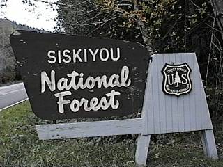
STATE: Oregon
REGION: Pacific Northwest
RANGER DISTRICT: Wild Rivers - Galice Office
NEAREST CITY/TOWN: Merlin
RESERVATIONS: No
DIRECTIONS:
From Merlin, OR, at intersection of Merlin, Galice, and Pleasant
Valley Roads, take Galice Rd. 8.5 miles to Forest Rt. 25 sign.
Turn left at sign onto Rt. 25 (Briggs Valley Rd.) and go 12.4
miles to campground on right.
NOTE: Forest Rt. 25 is a paved, single-lane road with turnouts.
GENERAL COMMENTS:
The elevation is 2,100 ft.
The campground is a single loop through a majestic stand of
beautiful fir and Ponderosa pine trees. Most of these trees are
big and grand specimens, giving the campground lots of character.
A variety of deciduous trees provide fair to good privacy and
nice fall colors. Several campsites back up to Myers Creek and
some parking aprons are not level making leveling RVs a
challenge. The campground has a tranquil, elfen feel. Exploring
the Big Pine Loop Trail is a must do.
This is bear country; practice safe food storage techniques.
SEASONS
Open Seasonal: Yes
Open All Year: No
Seasonal Comment:
Open Memorial Day weekend through October - weather dependent
NOTE: 2018 - Campground closed temporarily - hazard trees.
Contact ranger district office for status.
RATE AND MAXIMUM STAY PERMITTED
Rate: $5 per day - May through June 2
no charge - June 3 through October
Maximum Stay Permitted (days): 14
CAMPGROUND SITE CONFIGURATION
No. RV Sites: 0
No. Tent Sites: 3
No. Combined Sites (Tent or RV): 10
Total Sites: 13
Tent Pads: No
Open Sites: No
Wooded Sites: Yes
No. Tables on Sites: 13
No. Grilles on Sites: 13
Equestrian Camping: No
RV INFORMATION
Hookups: None
No. RV Pull Throughs: 0
Waste Station: No
Average Parking Apron Size: 16' X 42'
Comments:
The parking aprons are dirt. Grey water disposal sites are
located throughout campground.
FACILITIES
Vaults: Yes
Flush Toilets: No
Hot Showers: No
Wheelchair Friendly Toilets: Yes
Public Phone: No
Playground: No
No. Water Spigots (non-site): 1
No. Threaded: 0
Comments:
The water spigot is a handpump.
WATER SPORTS - None
HIKING
Big Pine Loop (foot) - 2 miles
Sunshine Loop (foot) - 0.5 miles
Challenge Loop (foot) - 0.75
Creek Loop (foot) - 0.2 miles
Big Pine Spur (foot, horse & mountain bike) - provides
access to a network of trails.
FISHING - No

CAMPGROUND NAME: Bolan Lake

VISIT DATE: 08/13/2005

UPDATE DATE: 7/10/2024

STATE: Oregon

REGION: Pacific Northwest

RANGER DISTRICT: Wild Rivers - Illinois Valley Office

NEAREST CITY/TOWN: Cave Junction

RESERVATIONS: No

DIRECTIONS:
In Cave Junction, OR, at intersection of US Rt. 199 and State Rt.
46, take Rt. 46 east and go 1.7 mile to Holland Loop Rd.  Turn
right onto Holland Loop Rd. and go 1.8 miles to an intersection.
Turn right onto Takilma Rd. and go 4.6 miles to another
intersection.  Turn left onto Happy Camp Rd. and go 12.4 miles to
campground sign.  Turn left after sign onto Forest Rt. 4812 and
go 4 miles to another campground sign.  Continue straight onto
Bolan Lake Rd. (Forest Rt. 040) and go 1 miles to a "T"
intersection.  Turn right, continueing on Rt. 040, and go 0.5
miles to campground.

NOTE: The last 5.5 miles are gravel, single-lane.

GENERAL COMMENTS:
The elevation is 5,400 ft.

This tent campground hugs the shore of the little olive-green
Bolan Lake.  Since no motors are permitted on the lake, it is
considered an excellent canoeing lake.  Located in a natural
bowl and surrounded by a dense growth of fir trees, most
campsites have ample shade and good views.  However, the sites
tend to be rocky with few level places for pitching a tent.  The
drive to campground is very scenic.

SEASONS
Open Seasonal: Yes
Open All Year: No

Seasonal Comment:
Open June 15 through Labor Day.

RATE AND MAXIMUM STAY PERMITTED
Rate: $10 per day
Maximum Stay Permitted (days): 14

CAMPGROUND SITE CONFIGURATION
No. RV Sites: 0
No. Tent Sites: 10
No. Combined Sites (Tent or RV): 0

   Total Sites: 10

Tent Pads: No
Open Sites: Yes
Wooded Sites: Yes

No. Tables on Sites: 10
No. Grilles on Sites: 10
Equestrian Camping:  No

FACILITIES
Vaults: Yes
Flush Toilets: No
Hot Showers: No
Wheelchair Friendly Toilets: No

Public Phone: No
Playground: No
No. Water Spigots (non-site): 0

WATER SPORTS
Lake: Yes
Swimming (provided): No
Sailing: No
Boat Ramp: No
Boat Carry Down Access: Yes
Power Boating: No
Boating (no power): Yes
Water Skiing: No
Rafting (whitewater): No
Kayaking (whitewater): No

Comments:
Bolan Lake is 4 acres - excellent canoeing lake.

HIKING - No

FISHING
Rainbow trout
CAMPGROUND NAME: Daphne Grove

VISIT DATE: 08/20/2005

UPDATE DATE: 7/10/2024

STATE: Oregon

REGION: Pacific Northwest

RANGER DISTRICT: Powers

NEAREST CITY/TOWN: Powers

RESERVATIONS: No

DIRECTIONS:
In Powers, OR, at intersection of 4th Ave and Popular St., take
4th Ave. south and go 14.1 miles to campground on right.

NOTE: 4th Ave. becomes Forest Rt. 33.

GENERAL COMMENTS:
The elevation is 800 ft.

The campground is a single loop beside the South Fork of Coquille
River in a pleasant riparian environment.  Most campsites have a
grass understory and are provided with good privacy by natural
hedges of deciduous trees and shrubs.  Towering Douglas fir offer
some shade.  The abundance of deciduous trees suggest this
campground would be a delight in the Fall.  Campsites along the
river side of campground have no view of river but are within a few
feet of it.  Look for man-planted redwood (Sequoia) tree in
campground.

SEASONS
Open Seasonal: Yes
Open All Year: Yes

Seasonal Comment:
Services provided from Memorial Day weekend through Labor Day.

RATE AND MAXIMUM STAY PERMITTED
Rate: $10 per day
Maximum Stay Permitted (days): 14

CAMPGROUND SITE CONFIGURATION
No. RV Sites: 0
No. Tent Sites: 0
No. Combined Sites (Tent or RV): 13

   Total Sites: 13

Tent Pads: No
Open Sites: Yes
Wooded Sites: Yes

No. Tables on Sites: 13
No. Grilles on Sites: 13
Equestrian Camping:  No

RV INFORMATION
Hookups: None
No. RV Pull Throughs: 0
Waste Station: No
Average Parking Apron Size: 14' X 48'

Comments:
The parking aprons are paved.  Grey water disposal sites are
scattered throughout campground.

FACILITIES
Vaults: Yes
Flush Toilets: No
Hot Showers: No
Wheelchair Friendly Toilets: Yes

Public Phone: No
Playground: No
No. Water Spigots (non-site): 0
  No. Threaded: 0

WATER SPORTS
Wading possible in river and there are some man-made shallow
pools to soak your feet.

HIKING
Daphne Grove Interpretive Trail (foot) - 0.25 miles

FISHING - No
CAMPGROUND NAME: Eden Valley

VISIT DATE: 08/20/2005

UPDATE DATE: 7/10/2024

STATE: Oregon

REGION: Pacific Northwest

RANGER DISTRICT: Powers

NEAREST CITY/TOWN: Powers

RESERVATIONS: No

DIRECTIONS:
In Powers, OR, at intersection of 4th Ave and Popular St., take
4th Ave. south and go 16.2 miles to campground sign.  Turn left
at sign onto Forest Rt. 3348 and go 13.2 miles to campground.

GENERAL COMMENTS:
The elevation is 2,400 ft.

NOTE: Because of the Blosson Wildfire, the authors did not survey
this campground.  Most information provided by the Powers Ranger
District Office.

The campground, best suited for tent campers, is a single loop in
a stand of Douglas fir, Alder and cedar trees.  Since the campground
is considered remote, it less visited, which increases visits by wildlife.
The South Fork of Coqille River is a short walk from campground.

SEASONS
Open Seasonal: Yes
Open All Year: No

Seasonal Comment:
Services provided Memorial Day weekend through Labor Day

RATE AND MAXIMUM STAY PERMITTED
Rate: No charge
Maximum Stay Permitted (days): 14

CAMPGROUND SITE CONFIGURATION
No. RV Sites: 0
No. Tent Sites: 0
No. Combined Sites (Tent or RV): 11

   Total Sites: 11

Tent Pads: No
Open Sites: Yes
Wooded Sites: Yes

No. Tables on Sites: 11
No. Grilles on Sites: 11
Equestrian Camping:  No

RV INFORMATION
Hookups: None
No. RV Pull Throughs: 0
Waste Station: No
Average Parking Apron Size: 10' X 24'

Comments:
The parking aprons are dirt.

FACILITIES
Vaults: Yes
Flush Toilets: No
Hot Showers: No
Wheelchair Friendly Toilets: No

Public Phone: No
Playground: No
No. Water Spigots (non-site): 0

WATER SPORTS - None

HIKING - No

FISHING - No
Fishing is available above Coquille Falls.
CAMPGROUND NAME: Grayback

VISIT DATE: 08/12/2005

UPDATE DATE: 7/10/2024

STATE: Oregon

REGION: Pacific Northwest

RANGER DISTRICT: Wild Rivers

NEAREST CITY/TOWN: Cave Junction

RESERVATIONS: No

DIRECTIONS:
In Cave Junction, OR, at intersection of US Rt. 199 and State Rt.
46, take Rt. 46 east and go 11.3 miles to campground sign.  Turn
right into campground.

GENERAL COMMENTS:
The elevation is 2,000 ft.

Originally built by the Civilian Conservation Corps (CCC) during
the 1930s, the campground has retained much of its charm.  Huge
grand old trees provide ample shade, which along with Sucker
Creek, helps keep campground comfortable on even the hottest days.
Some campsites overlook the creek.  Although the campground
features large trees and lots of shade, middlestory is limited
and so is privacy.  Although the campground has been around a
long time, it is reportedly rarely crowded.  Firewood is
available.  A possible day trip is to the Oregon Caves National
Monument, about 7 miles southeast of campground

SEASONS
Open Seasonal: Yes
Open All Year: No

Seasonal Comment:
Open Memorial Day weekend through September 30.

RATE AND MAXIMUM STAY PERMITTED
Rate: $15 per day
Maximum Stay Permitted (days): 14

CAMPGROUND SITE CONFIGURATION
No. RV Sites: 0
No. Tent Sites: 4
No. Combined Sites (Tent or RV): 32

   Total Sites: 36

Tent Pads: No
Open Sites: No
Wooded Sites: Yes

No. Tables on Sites: 36
No. Grilles on Sites: 36
Equestrian Camping:  No

RV INFORMATION
Hookups: None
No. RV Pull Throughs: 2
Waste Station: No
Average Parking Apron Size: 12' X 35'

Comments:
The parking aprons are paved.  An RV waste station, available
for a fee, is located at Shady Acres RV Park in Cave Junction,
OR.

FACILITIES
Vaults: Yes
Flush Toilets: No
Hot Showers: No
Wheelchair Friendly Toilets: Yes

Public Phone: No
Playground: No
No. Water Spigots (non-site): 3
  No. Threaded: 0

WATER SPORTS
There is a swimming hole 1/8th of a mile from campground.

HIKING
Hiking: Yes

Comments:
Grayback Interpretive Trail (foot) -1 mile

FISHING - No
CAMPGROUND NAME: Quosatana

VISIT DATE: 11/04/1997

UPDATE DATE: 7/10/2024

STATE: Oregon

REGION: Pacific Northwest

RANGER DISTRICT: Gold Beach

NEAREST CITY/TOWN: Gold Beach

RESERVATIONS: No

DIRECTIONS:
In Gold Beach, OR, take Forest Rt. 33 (not signed - paved road on
south side of Rogue River just before bridge) east 14.3 miles to
campground sign.  Turn left into campground.

GENERAL COMMENTS:
The elevation is 100 ft.

Campground is composed of two loops - Coho and Chinook.  Coho is
almost park-like with no understory and fragrant Myrtlewood trees
to shade the sites.  Chinook feels wilder with berry bushes and
Alder trees; some of its sites overlook the Rogue River. The
campground is the residence of many ground squirrels, a flock of
wild turkeys and a small herd of deer.  There is a neatly trimmed
grassy area ideal for a pick-up game of soccer, volleyball, etc.

SEASONS
Open Seasonal: No
Open All Year: Yes

RATE AND MAXIMUM STAY PERMITTED
Rate: $20 per day
Maximum Stay Permitted (days): 14

CAMPGROUND SITE CONFIGURATION
No. RV Sites: 0
No. Tent Sites: 4
No. Combined Sites (Tent or RV): 39

   Total Sites: 43

Tent Pads: No
Open Sites: Yes
Wooded Sites: Yes

No. Tables on Sites: 43
No. Grilles on Sites: 43
Equestrian Camping:  No

RV INFORMATION
Hookups: None
No. RV Pull Throughs: 4
Waste Station: Yes
Potable Water at Waste Station: No
Average Parking Apron Size: 12' X 49'

NOTE:  May 2021 - Dump station temporarily closed due to repairs
needed to the wastewater system.  Contact ranger district office for status.

Comments:
Most parking aprons are gravel but some are paved.  There are
gray water disposal facilities throughout the campground.

FACILITIES
Vaults: No
Flush Toilets: Yes
Hot Showers: No
Wheelchair Friendly Toilets: Yes

Public Phone: Yes
Playground: No
No. Water Spigots (non-site): 8
  No. Threaded: 0

WATER SPORTS
Lake: No
Swimming (provided): No
Sailing: No
Boat Ramp: Yes
Boat Carry Down Access: No
Power Boating: Yes
Boating (no power): Yes
Water Skiing: Yes
Rafting (whitewater): Yes
Kayaking (whitewater): Yes

Comments:
The Rogue River at the campground has no restrictions on water craft use.
However, a permit is required on the Wild Section beyond the campground.
Contact ranger district office to obtain a permit.

HIKING
There is an unmarked, paved walkway that circles the campground.

FISHING
Salmon, Steelhead, Cutthroat trout and Sturgeon.  There is a fish
cleaning shell in the campground.
CAMPGROUND NAME: Sam Brown

VISIT DATE: 08/12/2005

UPDATE DATE: 3/12/2018

STATE: Oregon

REGION: Pacific Northwest

RANGER DISTRICT: Wild Rivers - Galice Office

NEAREST CITY/TOWN: Merlin

RESERVATIONS: No

DIRECTIONS:
From Merlin, OR, at intersection of Merlin, Galice, and Pleasant
Valley Rds, take Galice Rd. 8.5 miles to Forest Rt. 25 sign.
Turn left at sign onto Route 25 (Briggs Valley Rd.) and go 13.4
miles to Sam Brown campground sign.  Turn right after sign onto
Forest Rt. 2512 and go 0.2 miles to campground sign.  Turn left
at sign into campground

GENERAL COMMENTS:
The elevation is 2,000 ft.

This attractive campground, on the former Ferrin Ranch land, is a
single loop that meanders down a hillside and through a stand of
fir and pine, providing ample shade.  The campsites are spacious
but a limited middlestory provides minimal privacy.  A head stone
near the picnic area is marked "Sam Brown."  Perhaps he was a
ranch foreman - no one knows for sure.  Although the campground
is the hub for several trails, it appears relatively undiscovered.
Occasionaly, elk have been sighted in adjacent meadow.  The
tent sites are all walk-in.

This is bear country; practice safe food storage techniques.

SEASONS
Open Seasonal: Yes
Open All Year: No

Seasonal Comment:
Open Memorial Day weekend through mid-October - weather dependent

RATE AND MAXIMUM STAY PERMITTED
Rate: no charge
Maximum Stay Permitted (days): 14

CAMPGROUND SITE CONFIGURATION
No. RV Sites: 0
No. Tent Sites: 0
No. Combined Sites (Tent or RV): 17

   Total Sites: 17

Tent Pads: No
Open Sites: Yes
Wooded Sites: No

No. Tables on Sites: 17
No. Grilles on Sites: 17
Equestrian Camping:  No

RV INFORMATION
Hookups: None
No. RV Pull Throughs: 0
Waste Station: No
Average Parking Apron Size: 12' X 45'

Comments:
The parking are dirt.  Grey water disposal sites are scattered
throughout campground.

FACILITIES
Vaults: Yes
Flush Toilets: No
Hot Showers: No
Wheelchair Friendly Toilets: No

Public Phone: No
Playground: No
No. Water Spigots (non-site): 0
  No. Threaded: 0

Comments:
A solar shower house is available.

WATER SPORTS - None

HIKING
Briggs Creek Trail #1132 (multi-use) - 9.5 miles
Taylor Creek Trail #1142 (multi-use) - 10.25 miles
      These trails provide access to a network of trails.

FISHING - No
|