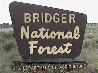
Campground List
CAMPGROUND NAME: Allred Flat

VISIT DATE: 07/27/2000

UPDATE DATE:  9/19/2020

STATE: Wyoming

REGION: Intermountain

RANGER DISTRICT: Kemmerer

NEAREST CITY/TOWN: Afton

RESERVATIONS: No

DIRECTIONS:
From Afton, WY, take US Rt. 89 south 19.3 miles to campground
sign.  Turn right at sign and go 0.3 miles to campground.

GENERAL COMMENTS:
The elevation is 6,500 ft.

The campground, adjacent to Little White Creek, is primarily a
single loop among Lodgepole pine and young Aspen trees.  Good
privacy between camping sites is provided by wild roses and other
shrubs.  The campground is adjacent to US Rt. 89 making it a good
overnight stop.  However, the campground has enough attractions
to stay more then one night.  Two of the attractions are two
trails created by the summer 2000 volunteer host and named for
his two dogs - Gnome and Elf.  Although horses are not permitted
in the campground, there are corrals at its entrance.  This
provides overnight lodging for the horses or riding the Spring
Creek trail, a short distance from the campground.  There is a
very good chance of observing beaver activity at the entrance to
campground.

SEASONS
Open Seasonal: Yes
Open All Year: No

Seasonal Comment:
Open Memorial Day weekend through Labor Day weekend - weather dependent

RATE AND MAXIMUM STAY PERMITTED
Rate: $10 per day
Maximum Stay Permitted (days): 10

CAMPGROUND SITE CONFIGURATION
No. RV Sites: 0
No. Tent Sites: 0
No. Combined Sites (Tent or RV): 31

   Total Sites: 31

Tent Pads: No
Open Sites: Yes
Wooded Sites: Yes

No. Tables on Sites: 31
No. Grilles on Sites: 31
Equestrian Camping:  No

RV INFORMATION
Hookups: None
No. RV Pull Throughs: 10
Waste Station: No
Average Parking Apron Size: 12' X 45'

Comments:
The parking aprons are grass, gravel and dirt.  There is an RV
waste available, no potable water, at the Afton Area Chamber of
Commerce in Afton, WY.

FACILITIES
Vaults: Yes
Flush Toilets: No
Hot Showers: No
Wheelchair Friendly Toilets: No

Public Phone: No
Playground: No
No. Water Spigots: 2
  No. Threaded: 0

Comments:
The water spigots are hand pumps.

WATER SPORTS - None

HIKING
Gnome Trail (foot) - 0.6 miles
Elf Trail (foot) - 0.8 miles
North Trail (foot) - 1 mile

The campground is convenient to Spring Creek Trail #26 (foot and
horse) - 14 miles

FISHING - No

CAMPGROUND NAME: Boulder Lake

VISIT DATE: 07/19/2000

UPDATE DATE:  9/19/2020

STATE: Wyoming

REGION: Intermountain

RANGER DISTRICT: Pinedale

NEAREST CITY/TOWN: Boulder

RESERVATIONS: No

DIRECTIONS:
In Boulder, WY, at the intersection of US Rt. 191 and State Rt. 353,
take Rt. 353 east 2.3 miles to Boulder Lake Boat Access sign (County
Rt. 125).  Turn left at sign onto Rt. 125 (dirt and gravel) and go
10.4 miles into campground.

GENERAL COMMENTS:
The elevation is 7,200 ft.

The campground, adjacent to the Bridger Wilderness and near the east
end of Boulder Lake and Boulder Creek, is a single loop tucked into a
grove of Aspen trees providing beautiful fall color.  The understory
is grass and heavy middlestory provides good privacy for most sites.
Some sites have a neglected appearance giving the campground wilderness
feel.  Pedestal grilles at each campsite.  Access to Boulder Lake is
2 miles west of campground but unsigned.  Although horses are not
permitted in campground, a corral is provided at the nearby trailhead.

This is bear country; practice proper food storage techniques.

SEASONS
Open Seasonal: Yes
Open All Year: No

Seasonal Comment:
Open June 1 through Labor Day weekend - weather permitting

RATE AND MAXIMUM STAY PERMITTED
Rate: $7 per day
Maximum Stay Permitted (days): 16

CAMPGROUND SITE CONFIGURATION
No. RV Sites: 0
No. Tent Sites: 0
No. Combined Sites (Tent or RV): 15

   Total Sites: 15

Tent Pads: No
Open Sites: Yes
Wooded Sites: Yes

No. Tables on Sites: 15
No. Grilles on Sites: 15
Equestrian Camping: No

RV INFORMATION
Hookups: None
No. RV Pull Throughs: 6
Waste Station: No
Average Parking Apron Size: 12' X 40'

Comments:
The parking aprons are dirt.  There are waste stations with potable
water available for a fee at Rim Station, north of Pinedale on US Hwy
191, milepost 129, and south of Pinedale, also on Hwy 191, at Highline
Trail RV Park and Wind River View Campground, both in Boulder, WY.

FACILITIES
Vaults: Yes
Flush Toilets: No
Hot Showers: No
Wheelchair Friendly Toilets: No

Public Phone: No
Playground: No
No. Water Spigots (non-site): 0

WATER SPORTS
The nearby Boulder Lake is 1,843 acres.

HIKING
Boulder Canyon Trail #113 (foot & horse) - 6 miles
North Fork Trail (foot & horse) - 6.5 miles

Both trails access the Bridger Wilderness.

FISHING
Brook, Lake, and Rainbow trout and Kokanee salmon
CAMPGROUND NAME: Cottonwood Lake

VISIT DATE: 07/27/2000

UPDATE DATE:  9/19/2020

STATE: Wyoming

REGION: Intermountain

RANGER DISTRICT: Greys River

NEAREST CITY/TOWN: Afton

RESERVATIONS: No

DIRECTIONS:
From Afton, WY, take US Rt. 89 south 7.1 miles to Cottonwood Lake
campground sign (County Rt. 153).  Turn left onto Rt. 153 and go
6.1 miles to campground.

NOTE: County Rt. 153 turns to gravel and dirt after 1 mile and
becomes Forest Rt. 10208, which is dirt and single-lane.

GENERAL COMMENTS:
The elevation is 7,200 ft.

The campground, split into two sections by the North Fork Creek,
is for both equestrian and non-equestrian campers.   Camping
sites 1 through 7 are in one section with hitching rails in six
of the sites.  There are also corrals in this section along with
the trail heads for the North Fork Cottonwood and Trail Fork
trails.  In the second section horses are not permitted and four
walk-in tent sites are located here.  Cottonwood Lake is next to
the campground, but none of the camping sites overlook the lake
or the creek.  The sites are shaded by spruce and fir trees.
With the surrounding mountains and beautiful trees, the
campground is very scenic.

SEASONS
Open Seasonal: Yes
Open All Year: No

Seasonal Comment:
Open Memorial Day weekend through Labor Day weekend -
weather dependent

RATE AND MAXIMUM STAY PERMITTED
Rate: $10 per day
Maximum Stay Permitted (days): 10

CAMPGROUND SITE CONFIGURATION
No. RV Sites: 0
No. Tent Sites: 5
No. Combined Sites (Tent or RV): 12

   Total Sites: 17

Tent Pads: No
Open Sites: Yes
Wooded Sites: Yes

No. Tables on Sites: 17
No. Grilles on Sites: 16
Equestrian Camping:  Yes

RV INFORMATION
Hookups: None
No. RV Pull Throughs: 2
Waste Station: No
Average Parking Apron Size: 12' X 38'

Comments:
The parking aprons are gravel.  There is an RV waste available, no
potable water, at the Afton Area Chamber of Commerce in Afton, WY.

FACILITIES
Vaults: Yes
Flush Toilets: No
Hot Showers: No
Wheelchair Friendly Toilets: Yes

Public Phone: No
Playground: No
No. Water Spigots: 1
  No. Threaded: 0

Comments:
The water spigot is a hand pump.

WATER SPORTS
Lake: Yes
Swimming (provided): No
Sailing: No
Boat Ramp: No
Boat Carry Down Access: No
Power Boating: Yes
Boating (no power): Yes
Water Skiing: No
Rafting (whitewater): No
Kayaking (whitewater): No

Comments:
Cottonwood Lake is 5 acres.  Although there are no boating
restrictions, power boats are not practical on the lake.  There
is boat carry-down access from the picnic area.

HIKING
North Fork Cottonwood Trail #36 (foot & horse) - 5 miles
Trail Fork Trail #37 (foot and horse) - 4.5 miles

Accesses a network of trails in the Salt River Range.

FISHING
Cutthroat and Brook trout
CAMPGROUND NAME: Forest Park

VISIT DATE: 07/15/2000

UPDATE DATE:  9/19/2020

STATE: Wyoming

REGION: Intermountain

RANGER DISTRICT: Greys River

NEAREST CITY/TOWN: Alpine

RESERVATIONS: No

DIRECTIONS:
In Alpine, WY, at intersection of US Rt. 89 South and Greys River
Rd., take Greys River Rd. east 35.2 miles to campground on left.

NOTE: Greys River Rd. becomes Forest Rt. 10138 and gravel after
0.8 miles.

GENERAL COMMENTS:
The elevation is 6,700 ft.

The campground is a single loop through a stand of mature
Lodgepole pine.  Other conifers are beginning to grow in the more
open areas.  A heavy grass understory provides limited privacy.
The campground stands in the middle of the Forest Park Elk Feed
Grounds. Although the drive is long, the campground is very
pleasant and tranquil.  Dispersed camping is plentiful along
Forest Rt. 10138.

This is bear country; practice safe food storage techniques.

SEASONS
Open Seasonal: Yes
Open All Year: No

Seasonal Comment:
Open May 1 through Labor Day weekend

RATE AND MAXIMUM STAY PERMITTED
Rate: $10 per day
Maximum Stay Permitted (days): 10

CAMPGROUND SITE CONFIGURATION
No. RV Sites: 0
No. Tent Sites: 0
No. Combined Sites (Tent or RV): 13

   Total Sites: 13

Tent Pads: No
Open Sites: Yes
Wooded Sites: Yes

No. Tables on Sites: 13
No. Grilles on Sites: 13
Equestrian Camping:  No

RV INFORMATION
Hookups: None
No. RV Pull Throughs: 3
Waste Station: No
Average Parking Apron Size: 14' X 50'

Comments:
The parking aprons are gravel.  There is an RV waste station
available, no potable water, at the Chevron gas station at the
intersection of US Rt. 26/89 and US Rt. 189/191 in Alpine Junction, WY.

FACILITIES
Vaults: Yes
Flush Toilets: No
Hot Showers: No
Wheelchair Friendly Toilets: Yes

Public Phone: No
Playground: No
No. Water Spigots: 1
  No. Threaded: 0

Comments:
The water spigot is a hand pump.

WATER SPORTS - None

HIKING - No

FISHING - No
CAMPGROUND NAME: Fremont Lake

VISIT DATE: 07/21/2000

UPDATE DATE: 9/19/2020

STATE: Wyoming

REGION: Intermountain

RANGER DISTRICT: Pinedale

NEAREST CITY/TOWN: Pinedale

RESERVATIONS: 1-877-444-6777 or make on-line reservation

DIRECTIONS:
In Pinedale, WY, at intersection of  US Rt. 191 and Fremont Lake Rd., take
Fremont Lake Rd. north 3.2 miles to Fremont Lake sign.  Turn left at sign
onto Forest Rt. 741 and go 0.2 miles to a "Y" intersection and Fremont Lake
Recreation Area sign.  Bear right, continuing on Rt. 741, and go 3.2 miles
to campground sign.  Bear left at sign into campground.

GENERAL COMMENTS:
The elevation is 7,000 ft.

The campground is terraced along a hillside on the eastern shore of Fremont
Lake in a series of overlapping loops.  The lake was naturally created by
receding glaciers some 70,000 years ago.  It is considered one of the top
ten cleanest lakes in the nation.  Although all camping sites are within
walking distance, most do not enjoy a view of the lake.  The camping sites
are located either in groves of Aspen trees or stands of Douglas fir and
some spruce.  The Aspen-shaded sites also have a heavy understory of wild
roses, currant and other shrubs providing good privacy.  Other sites are
in the open and have poor privacy.  Several sites are right on the lake
shore or across the interior campground road from the lake.  These sites
enjoy good views of the lake along with the capability of mooring boats at
or very close to the camping site.

The campground is very popular on weekends and holidays.  In Pinedale, WY,
during the second weekend (Thur - Sun) in July, attend the annual Green
River Rendezvous Days; "It relives the early Mountain Man history of the
area."  See http://www.tinyurl.com/kngp2b for more information.  Finally,
take a day and visit Mountain Man Museum, also in Pinedale.

This is bear country; practice safe food storage techniques.  Bear boxes
are scattered throughout campground.

SEASONS
Open Seasonal: Yes
Open All Year: No

Seasonal Comment:
Open May 1 through September 30

RATE AND MAXIMUM STAY PERMITTED
Rate: $12 per day - single
$24 per day - double
Maximum Stay Permitted (days): 16

CAMPGROUND SITE CONFIGURATION
No. RV Sites: 0
No. Tent Sites: 0
No. Combined Sites (Tent or RV): 50

   Total Sites: 50

Tent Pads: No
Open Sites: Yes
Wooded Sites: Yes

No. Tables on Sites: 50
No. Grilles on Sites: 50
Equestrian Camping: No

RV INFORMATION
Hookups: None
No. RV Pull Throughs: 24
Waste Station: No
Average Parking Apron Size: 12' X 45'

Comments:
The parking aprons are paved.  There are waste stations with potable
water available for a fee at Rim Station, north of Pinedale on US Hwy
191, milepost 129, and south of Pinedale, also on Hwy 191, at Highline
Trail RV Park and Wind River View Campground, both in Boulder, WY.

FACILITIES
Vaults: Yes
Flush Toilets: No
Hot Showers: No
Wheelchair Friendly Toilets: Yes

Public Phone: No
Playground: No
No. Water Spigots (non-site): 18
  No. Threaded: 0

WATER SPORTS
Lake: Yes
Swimming (provided): No
Sailing: Yes
Boat Ramp: Yes
Boat Carry Down Access: Yes
Power Boating: Yes
Boating (no power): Yes
Water Skiing: Yes
Rafting (whitewater): No
Kayaking (whitewater): No

Comments:
Fremont Lake is 4,996 acres.  The lake has 22 miles of shoreline and is
600 ft. deep.

HIKING None

FISHING
Brown, Lake, and Rainbow trout and Kokanee salmon
CAMPGROUND NAME: Green River Lake

VISIT DATE: 07/21/2000

UPDATE DATE:  9/19/2020

STATE: Wyoming

REGION: Intermountain

RANGER DISTRICT: Pinedale

NEAREST CITY/TOWN: Pinedale

RESERVATIONS: No

DIRECTIONS:
From Pinedale, WY, take US Rt. 191 north 5 miles to State Rt.
352.  Turn right onto Rt. 352 and go 28.5 miles to a "Y"
intersection (Forest Rt. 650).  Bear right onto Rt. 650 and go 16
miles to campground.

NOTE: After 26.7 miles, State Rt. 352 becomes Forest Rt. 600 and
dirt/gravel.

GENERAL COMMENTS:
The elevation is 7,800 ft.

This is a picturesque campground, near the Green River, with two
unnamed loops meandering up a hillside.  Although at the north
end of the Green River Lake, the dense Lodgepole Pine block any
view of the lake from the campground.  However, several camping
sites have a view of the towering Square Top Mountain.  There is
an Upper Green River Lake which is in the nearby Bridger
Wilderness.  Both Lakes are natural bodies of water formed by
receding glaciers some 70,000 years ago.  Both the lake (at the
campground) and the Green River offer excellent canoeing
opportunities.  The campground is pack it in, pack it out.

The log cabin near the boat ramp was the lodge for the exclusive
Gannett Peak Guest Ranch.  It now houses the host for the
campground.

This is Grizzly bear country; practice safe food storage
techniques.  There are bear-proof food containers at each camping
site.

SEASONS
Open Seasonal: Yes
Open All Year: No

Seasonal Comment:
Open last weekend of May through September 30

RATE AND MAXIMUM STAY PERMITTED
Rate: $12 per day
Maximum Stay Permitted (days): 10

CAMPGROUND SITE CONFIGURATION
No. RV Sites: 0
No. Tent Sites: 3
No. Combined Sites (Tent or RV): 36

   Total Sites: 39

Tent Pads: No
Open Sites: Yes
Wooded Sites: Yes

No. Tables on Sites: 39
No. Grilles on Sites: 39
Equestrian Camping:  No

RV INFORMATION
Hookups: None
No. RV Pull Throughs: 5
Waste Station: No
Average Parking Apron Size: 14' X 49'

Comments:
The parking aprons are gravel.  There are waste stations with
potable water available for a fee at Rim Station, north of
Pinedale on US Hwy 191, milepost 129, and south of Pinedale,
also on Hwy 191, at Highline Trail RV Park and Wind River
View Campground, both in Boulder, WY.

FACILITIES
Vaults: Yes
Flush Toilets: No
Hot Showers: No
Wheelchair Friendly Toilets: Yes

Public Phone: No
Playground: No
No. Water Spigots: 6
  No. Threaded: 0

WATER SPORTS
Lake: Yes
Swimming (provided): No
Sailing: No
Boat Ramp: Yes
Boat Carry Down Access: No
Power Boating: Yes
Boating (no power): Yes
Water Skiing: No
Rafting (whitewater): No
Kayaking (whitewater): No

Comments:
The 453-acre Green River Lake is partly in the Bridger
Wilderness.  No motors are permitted on the wilderness portion.
The boat ramp is extremely primitive.

HIKING
Highline Trail #1094 (foot & horse) - 2 miles
Lakeside Trail (foot & horse) - 2.5 miles

All trails access a network of trails in the Bridger Wilderness.

FISHING
Lake, Rainbow, Cutthroat, and Brook trout and Whitefish
CAMPGROUND NAME: Half Moon Lake

VISIT DATE: 07/19/2000

UPDATE DATE:  9/19/2020

STATE: Wyoming

REGION: Intermountain

RANGER DISTRICT: Pinedale

NEAREST CITY/TOWN: Pinedale

RESERVATIONS: 1-877-444-6777 or make on-line reservation

DIRECTIONS:
In Pinedale, WY, at intersection of US Rt. 191 and Fremont Lake Rd.,
take Fremont Lake Rd. north 6.9 miles to Half Moon Lake Resort sign.
Bear right at sign onto gravel road and go 1 mile to campground sign.
Turn right at sign into campground.

GENERAL COMMENTS:
The elevation is 7,600 ft.

The campground is on the shore of Half Moon Lake with two overlapping
loops in a heavy middlestory of willow and other shrubs.  The heavy
middlestory blocks views of the lake.  There is a nice sandy beach at
the back of some campsites where boats can be moored.  The interior
road is very tightly configured and the dense understory and
middlestory could make pitching a tent at some campsites a challenge.

In Pinedale, WY, during the second weekend (Thur - Sun) in July,
attend the annual Green River Rendezvous Days; "It relives the early
Mountain Man history of the area."  See http://www.tinyurl.com/kngp2b
for more information.  Finally, take a day and visit Mountain Man
Museum, also in Pinedale.

This is bear country; practise safe food storage techniques.

SEASONS
Open Seasonal: Yes
Open All Year: No

Seasonal Comment:
Open June 1 through Labor Day weekend

RATE AND MAXIMUM STAY PERMITTED
Rate: $7 per day
Maximum Stay Permitted (days): 16

CAMPGROUND SITE CONFIGURATION
No. RV Sites: 0
No. Tent Sites: 1
No. Combined Sites (Tent or RV): 16

   Total Sites: 17

Tent Pads: No
Open Sites: Yes
Wooded Sites: Yes

No. Tables on Sites: 17
No. Grilles on Sites: 17
Equestrian Camping: No

RV INFORMATION
Hookups: None
No. RV Pull Throughs: 6
Waste Station: No
Average Parking Apron Size: 12' X 44'

Comments:
The parking aprons are sandy.  There are waste stations with potable
water available for a fee at Rim Station, north of Pinedale on US Hwy
191, milepost 129, and south of Pinedale, also on Hwy 191, at Highline
Trail RV Park and Wind River View Campground, both in Boulder, WY.

FACILITIES
Vaults: Yes
Flush Toilets: No
Hot Showers: No
Wheelchair Friendly Toilets: Yes

Public Phone: No
Playground: No
No. Water Spigots (non-site): 0

WATER SPORTS
Lake: Yes
Swimming (provided): No
Sailing: Yes
Boat Ramp: No
Boat Carry Down Access: Yes
Power Boating: Yes
Boating (no power): Yes
Water Skiing: Yes
Rafting (whitewater): No
Kayaking (whitewater): No

Comments:
Half Moon Lake is 921 acres.  The boat ramp is 0.2 miles east of
campground.

HIKING
The campground is convenient to Half Moon Lake Trail #078, which
accesses other trails.

FISHING
Brown, Brook, Lake, and Rainbow trout and Whitefish
CAMPGROUND NAME: Hams Fork

VISIT DATE: 07/24/2000

UPDATE DATE:  9/19/2020

STATE: Wyoming

REGION: Intermountain

RANGER DISTRICT: Kemmerer

NEAREST CITY/TOWN: Kemmerer

RESERVATIONS: No

DIRECTIONS:
From Kemmerer, WY, take US Rt. 189 north 0.3 miles to State Rt.
233.  Turn left onto Rt. 233 and go 19.5 miles to the pavement
end.  Continue straight onto County Rt. 305 (gravel) and go 18.2
miles to campground sign.  The campground's sites are on both
sides of the road.

GENERAL COMMENTS:
The elevation is 7,700 ft.

The campground is split by the access road.  The two camp sites
on the western side of the road are nearest to Hams Fork River.
The eastern section has ten more campsites in a single loop through
a stand of mature Lodgepole pine with grass and wildflower understory.
Vault toilets are located in each section but the water is in the
eastern section only.  Overall, the campground offers solitude and
quiet and is well worth the drive on well maintained dirt roads.

SEASONS
Open Seasonal: Yes
Open All Year: No

Seasonal Comment:
Open Memorial Day weekend through Labor Day weekend -
weather dependent

RATE AND MAXIMUM STAY PERMITTED
Rate: $7 per day
Maximum Stay Permitted (days): 16

CAMPGROUND SITE CONFIGURATION
No. RV Sites: 0
No. Tent Sites: 0
No. Combined Sites (Tent or RV): 12

   Total Sites: 12

Tent Pads: No
Open Sites: Yes
Wooded Sites: Yes

No. Tables on Sites: 12
No. Grilles on Sites: 12
Equestrian Camping:  No

RV INFORMATION
Hookups: None
No. RV Pull Throughs: 0
Waste Station: No
Average Parking Apron Size: 15' X 45'

Comments:
The parking aprons are dirt.

FACILITIES
Vaults: Yes
Flush Toilets: No
Hot Showers: No
Wheelchair Friendly Toilets: No

Public Phone: No
Playground: No
No. Water Spigots: 3
  No. Threaded: 2

Comments:
One of the water spigots is a hand pump.

WATER SPORTS - None

HIKING - No

FISHING - No

Comments:
The campground is convenient for fishing in the Hams Fork River.
CAMPGROUND NAME: Hobble Creek

VISIT DATE: 07/24/2000

UPDATE DATE:  9/19/2020

STATE: Wyoming

REGION: Intermountain

RANGER DISTRICT: Kemmerer

NEAREST CITY/TOWN: Cokeville

RESERVATIONS: No

DIRECTIONS:
In Cokeville, WY, at the intersection of US Rt. 30 and State Rt.
232, turn onto Rt. 232 and go 12.6 miles to Hobble Creek sign and
"Y" intersection (Forest Rt. 10062).  Bear right onto Rt. 10062
(dirt and rocky) and go 8.4 miles to another "Y" intersection and
Hobble Creek campground sign.  Bear right and go 4.9 miles to an
Alice Lake sign.  Turn left at sign and go 9.1 miles to
campground.

NOTE: In the forest portion of these roads, there are long
sections of rough and very rocky, dirt surfaces, single-lane
and few turnouts.  The last 0.2 miles of State Rt. 232 are
gravel.  This campground is NOT recommended for RVs.

GENERAL COMMENTS:
The elevation is 7,100 ft.

The campground is at the end of a very long, rough drive located
next to Hobble Creek in a sparse stand on Lodgepole pine.  Two
nice size corrals are located within the campground near Lake
Alice Trail.  The campground has an unkept appearance and is
under-maintained.

SEASONS
Open Seasonal: Yes
Open All Year: No

Seasonal Comment:
Open May 1 through Labor Day weekend - weather dependent

NOTE: Because of a creek's high water, campground may be
inaccessible until mid-July.  Check status with Kemmerer Ranger
District Office.

RATE AND MAXIMUM STAY PERMITTED
Rate: $7 per day
Maximum Stay Permitted (days): 16

CAMPGROUND SITE CONFIGURATION
No. RV Sites: 0
No. Tent Sites: 2
No. Combined Sites (Tent or RV): 10

   Total Sites: 12

Tent Pads: No
Open Sites: Yes
Wooded Sites: Yes

No. Tables on Sites: 12
No. Grilles on Sites: 12
Equestrian Camping:  No

RV INFORMATION
Hookups: None
No. RV Pull Throughs: 2
Waste Station: No
Average Parking Apron Size: 15' X 45'

Comments:
The parking aprons are grass and gravel.  Because of the
condition of access roads, sharp turn onto a bridge and high
water over low-water bridge, the campground is not recommended for RVs.

FACILITIES
Vaults: Yes
Flush Toilets: No
Hot Showers: No
Wheelchair Friendly Toilets: No

Public Phone: No
Playground: No
No. Water Spigots (non-site): 1
  No. Threaded: 0

Comments:
The water spigot is a hand pump.

WATER SPORTS - None

HIKING
Lake Alice Trail (foot & horse) - 1.5 miles

FISHING
Brown, Rainbow, and Bonneville Cutthroat trout
CAMPGROUND NAME: Moose Flat

VISIT DATE: 07/15/2000

UPDATE DATE:  2/20/2025

STATE: Wyoming

REGION: Intermountain

RANGER DISTRICT: Greys River

NEAREST CITY/TOWN: Alpine

RESERVATIONS: No

DIRECTIONS:
In Alpine, WY, at intersection of US Rt. 89 South and Greys River
Rd., take Greys River Rd. east 22.9 miles to campground on right.

NOTE: Greys River Rd. becomes Forest Rt. 10138 and gravel after
0.8 miles.

GENERAL COMMENTS:
The elevation is 6,200 ft.

The campground stretches along Greys River with the camping sites
tucked among Engelmann spruce and Lodgepole pine.  Dense
middlestory (including wild roses) provides lots of privacy for
the closely spaced sites.  There are only nine available sites if
campground host is present.  Dispersed camping is plentiful along
Forest Rt. 10138.

SEASONS
Open Seasonal: Yes
Open All Year: No

Seasonal Comment:
Open May 1 through Labor Day weekend - weather dependent

RATE AND MAXIMUM STAY PERMITTED
Rate: $10 per day
Maximum Stay Permitted (days): 10

CAMPGROUND SITE CONFIGURATION
No. RV Sites: 0
No. Tent Sites: 0
No. Combined Sites (Tent or RV): 10

   Total Sites: 10

Tent Pads: No
Open Sites: Yes
Wooded Sites: Yes

No. Tables on Sites: 9
No. Grilles on Sites: 10
Equestrian Camping:  No

RV INFORMATION
Hookups: None
No. RV Pull Throughs: 5
Waste Station: No
Average Parking Apron Size: 15' X 41'

Comments:
The parking aprons are gravel.  An RV waste station with no potable water
or fee is available at the Chevron gas station at the intersection of
US Rt. 26/89 and US Rt. 189/191 in Alpine Junction, WY.

FACILITIES
Vaults: Yes
Flush Toilets: No
Hot Showers: No
Wheelchair Friendly Toilets: Yes

Public Phone: No
Playground: No
No. Water Spigots: 1
  No. Threaded: 0

Comments:
The water spigot is a hand pump.

WATER SPORTS - None

HIKING
Pearson Creek Trail #38 (foot and horse) - 1.5 miles

Accesses the Way Trail #79 - 4.9 miles

FISHING
Cutthroat and Brown trout
CAMPGROUND NAME: Murphy Creek

VISIT DATE: 07/15/2000

UPDATE DATE:  2/20/2025

STATE: Wyoming

REGION: Intermountain

RANGER DISTRICT: Greys River

NEAREST CITY/TOWN: Alpine

RESERVATIONS: No

DIRECTIONS:
In Alpine, WY, at the intersection of US Rt. 89 South and Greys
River Rd., take Greys River Rd. east 14.4 miles to campground on
right.

NOTE: Greys River Rd. becomes Forest Rt. 10138 and gravel after
0.8 miles.

GENERAL COMMENTS:
The elevation is 6,000 ft.

The campground stretches along Greys River with some camping
sites adjacent to the river (which is not actually visible from
the sites) Lodgepole pines and grass understory.  The sites are
widely spaced providing good privacy and the campground is far
enough from the road to be pleasantly quiet.  Dispersed camping
is plentiful along Forest Rt. 10138.

SEASONS
Open Seasonal: Yes
Open All Year: No

Seasonal Comment:
Open May 1 through September 30 - weather dependent

RATE AND MAXIMUM STAY PERMITTED
Rate: $7 per day
Maximum Stay Permitted (days): 10

CAMPGROUND SITE CONFIGURATION
No. RV Sites: 0
No. Tent Sites: 0
No. Combined Sites (Tent or RV): 11

   Total Sites: 11

Tent Pads: No

Open Sites: Yes
Wooded Sites: Yes

No. Tables on Sites: 11
No. Grilles on Sites: 11
Equestrian Camping:  No

RV INFORMATION
Hookups: None
No. RV Pull Throughs: 3
Waste Station: No
Average Parking Apron Size: 12' X 46'

Comments:
The parking aprons are gravel.  There is an RV waste station
available at the Chevron gas station at the intersection of US
Rt. 26/89 and US Rt. 189/191 in Alpine Junction, WY.  There is no
fee and no potable water.

FACILITIES
Vaults: Yes
Flush Toilets: No
Hot Showers: No
Wheelchair Friendly Toilets: Yes

Public Phone: No
Playground: No
No. Water Spigots: 3
  No. Threaded: 3

WATER SPORTS - None

HIKING - No

FISHING
Cutthroat and Brown trout
CAMPGROUND NAME: Narrows

VISIT DATE: 07/21/2000

UPDATE DATE:  9/19/2020

STATE: Wyoming

REGION: Intermountain

RANGER DISTRICT: Pinedale

NEAREST CITY/TOWN: Pinedale

RESERVATIONS: 1-877-444-6777 or make on-line reservation

DIRECTIONS:
From Pinedale, WY, take US Rt. 191 north 5 miles to State Rt.
352.  Turn right onto Rt. 352 and go 14.5 miles to New Fork Lake
Rd. sign (County Rt. 162).  Turn right at sign onto Rt. 162
(gravel) and go 6.1 miles to campground.

GENERAL COMMENTS:
The elevation is 7,600 ft.

This pretty campground, adjacent to the narrows or neck of New Fork Lake
and Bridger Wilderness, is composed of two separate spurs.  One
is nearer the lake than the other, but both have camping sites
overlooking the lake.  The campground is located in a grove of
Aspen trees with a grass understory.  Although there is heavy
understory, the camping sites are close together providing
limited privacy.  Corrals and trailer parking space are provided
at the New Fork trail head.

This is bear country; proper food storage is required.  Contact
Ranger district office for more information.

SEASONS
Open Seasonal: Yes
Open All Year: No

Seasonal Comment:
Open last weekend in May through September 30

RATE AND MAXIMUM STAY PERMITTED
Rate: $12 per day
Maximum Stay Permitted (days): 16

CAMPGROUND SITE CONFIGURATION
No. RV Sites: 0
No. Tent Sites: 0
No. Combined Sites (Tent or RV): 18

   Total Sites: 18

Tent Pads: No
Open Sites: Yes
Wooded Sites: Yes

No. Tables on Sites: 18
No. Grilles on Sites: 18
Equestrian Camping:  No

RV INFORMATION
Hookups: None
No. RV Pull Throughs: 2
Waste Station: No
Average Parking Apron Size: 14' X 38'

Comments:
The parking aprons are dirt.  The interior road and some
parking aprons show signs of serious errosion.  There are
waste stations with potable water available for a fee at
Rim Station, north of Pinedale on US Hwy 191, milepost 129,
and south of Pinedale, also on Hwy 191, at Highline Trail
RV Park and Wind River View Campground, both in Boulder, WY.

FACILITIES
Vaults: Yes
Flush Toilets: No
Hot Showers: No
Wheelchair Friendly Toilets: No

Public Phone: No
Playground: No
No. Water Spigots: 3
  No. Threaded: 3

Comments:
In 2013 there were issues with the water system.  Water was
available but had to be treated.  Recommend bring drinking
water or contact the district ranger office for status.

WATER SPORTS
Lake: Yes
Swimming (provided): No
Sailing: Yes
Boat Ramp: No
Boat Carry Down Access: No
Power Boating: Yes
Boating (no power): Yes
Water Skiing: No
Rafting (whitewater): No
Kayaking (whitewater): No

Comments:
New Fork Lake is 1,070 acres.  Jet skiing is not permitted.  A
primitive boat ramp is located 1 mile from the campground.

HIKING
New Fork Trail #137 (foot & horse) - 16 miles

The trail leads into the Bridger Wilderness and a network of
trails.

FISHING
Brook, Lake, and Rainbow trout and Kokanee salmon
CAMPGROUND NAME: New Fork Lake

VISIT DATE: 07/21/2000

UPDATE DATE:  9/19/2020

STATE: Wyoming

REGION: Intermountain

RANGER DISTRICT: Pinedale

NEAREST CITY/TOWN: Pinedale

RESERVATIONS: No

DIRECTIONS:
From Pinedale, WY, take US Rt. 191 north 5 miles to State Rt. 352.
Turn right onto Rt. 352 and go 14.3 miles to New Fork Lake Rd. sign
(County Rt. 162).  Turn right at sign onto Rt. 162 (gravel) and go
3.3 miles to campground sign (Forest Rt. 753).  Turn right then left
at campground sign into campground.

GENERAL COMMENTS:
The elevation is 7,900 ft.

The campground, on the southern shore of New Fork Lake, is a single
loop through a stand of young Aspen trees.  A dense middlestory and
good spacing of camping sites, provide good privacy.  Several camping
sites have a good view of the lake or New Fork Canyon.  The interior
road is rocky and eroded.  The campground is best suited for tent,
car and slide-in camper.

NOTE:  The campground is classified tent-only because of the condition
of the interior road.  If the interior road is improved, campers with
medium or larger trailers (10 by 35-feet) are advised to walk through
campground before driving in - very tight configuration.

In Pinedale, WY, during the second weekend (Thur - Sun) in July, attend
the annual Green River Rendezvous Days; "It relives the early Mountain
Man history of the area."  See http://www.tinyurl.com/kngp2b for more
information.  Finally, take a day and visit Mountain Man Museum, also
in Pinedale.

This is bear country; practice safe food storage techniques.

SEASONS
Open Seasonal: Yes
Open All Year: No

Seasonal Comment:
Open June 1 through Labor Day weekend

RATE AND MAXIMUM STAY PERMITTED
Rate: $7 per day
Maximum Stay Permitted (days): 16

CAMPGROUND SITE CONFIGURATION
No. RV Sites: 0
No. Tent Sites: 15
No. Combined Sites (Tent or RV): 0

   Total Sites: 15

Tent Pads: No
Open Sites: Yes
Wooded Sites: No

No. Tables on Sites: 14
No. Grilles on Sites: 15
Equestrian Camping: No

FACILITIES
Vaults: Yes
Flush Toilets: No
Hot Showers: No
Wheelchair Friendly Toilets: No

Public Phone: No
Playground: No
No. Water Spigots (non-site): 0

WATER SPORTS
Lake: Yes
Swimming (provided): No
Sailing: No
Boat Ramp: Yes
Boat Carry Down Access: No
Power Boating: Yes
Boating (no power): Yes
Water Skiing: No
Rafting (whitewater): No
Kayaking (whitewater): No

Comments:
New Fork Lake is 1,070 acres.  Jet Skiis are not permitted.  A boat
ramp is available 1.4 miles north of campground between New Fork Lake
and Narrows campgrounds.

HIKING - No

FISHING
Brook, Lake, and Rainbow trout and Kokanee salmon
CAMPGROUND NAME: Sacajawea

VISIT DATE: 07/20/2000

UPDATE DATE:  9/19/2020

STATE: Wyoming

REGION: Intermountain

RANGER DISTRICT: Big Piney

NEAREST CITY/TOWN: Big Piney

RESERVATIONS: No

DIRECTIONS:
In Big Piney, WY, at intersection of US Rt. 189 and State Rt.
350, take Rt. 350 west 22.6 miles to a "Y" intersection.  Bear
left at intersection and go 1.5 miles to campground sign.  Bear
left at sign and go 0.2 miles to campground.

NOTE: State Rt. 350 becomes dirt after 10.6 miles.

GENERAL COMMENTS:
The elevation is 8,100 ft.

The campground is a single loop through a stand of Subalpine fir
and Lodgepole pine with some sites near the Middle Piney Creek.
This is a quiet little campground set in a picturesque dell and
has the feel of being an undiscovered gem.  The understory is
grass with fair privacy between camping sites.  Two interesting
day trips are to the Red Castles rock formation off Forest Rt.
10046 and the graves of immigrants along Lander Cut-off - Forest
Rt. 10128.

SEASONS
Open Seasonal: Yes
Open All Year: No

Seasonal Comment:
Open July 1 through September 30

RATE AND MAXIMUM STAY PERMITTED
Rate: $7 per day
Maximum Stay Permitted (days): 16

CAMPGROUND SITE CONFIGURATION
No. RV Sites: 0
No. Tent Sites: 1
No. Combined Sites (Tent or RV): 22

   Total Sites: 23

Tent Pads: No
Open Sites: Yes
Wooded Sites: Yes

No. Tables on Sites: 23
No. Grilles on Sites: 23
Equestrian Camping:  No

RV INFORMATION
Hookups: None
No. RV Pull Throughs: 3
Waste Station: No
Average Parking Apron Size: 14' X 40'

Comments:
The parking aprons are dirt, rock and wood chips.  An RV waste
station with no potable water is available for a fee at Harper's
RV Park in Marbleton, WY located on the corner of US Rt. 189 and
Third St.

FACILITIES
Vaults: Yes
Flush Toilets: No
Hot Showers: No
Wheelchair Friendly Toilets: No

Public Phone: No
Playground: No
No. Water Spigots: 6
  No. Threaded: 1

WATER SPORTS - None

HIKING - No

Comments:
Convenient to the campground is the Middle Piney Trail which
accesses the 80-mile Wyoming Range National Recreation Trail.

FISHING
Brown, Brook and Rainbow trout
|