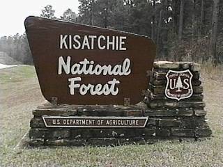
Campground List
CAMPGROUND NAME: Beaver Dam

VISIT DATE: 02/13/97

UPDATE DATE: 8/22/2020

STATE: Louisiana

REGION: Southern

RANGER DISTRICT: Caney

NEAREST CITY/TOWN: Minden

RESERVATIONS: 1-877-444-6777 or make on-line reservation

DIRECTIONS:
In Minden, LA, at intersection of US 79 and State Rt. 159, take
Rt. 159 north 4.7 miles to Caney Lakes Recreation Area sign
(County Rt. 111 - Caney Lake Rd.).  Turn left onto Rt. 111 and go
2.4 miles to Caney Lake campground sign (Forest Rt. 810).  Turn
left onto Rt. 810.  Bear left just past Caney Lakes entrance
kiosk and go about 1 mile to campground entrance on the right.

GENERAL COMMENTS:
The elevation is 160 ft.

The campground, one of the best kept secrets in the state, is one of two
campgrounds in the Caney Lakes Recreation Area and adjacent to Upper
Caney Lake.  Originally sugar cane and cotton fields, this single loop
campground is now surrounded with tall pines.  Oak, maples, and other
hardwoods fill in and provide fair to excellent privacy.  Some sites overlook
the lake.  The combination of pines and hardwoods make this campground
very scenic, especially in the fall when the leaves change their colors.
The campsites are spacious with good separaton between them.

Sites 15, 16 and 17 are located in a culdesac, each with a beautiful overlook
of the lake.  Although each is a single site, the combination of sites make a
marvelous location for a group of RVrs or tenters.

Caney Lakes Recreation Area features two side-by-side lakes.  The small,
Upper Caney Lake, is the quieter lake with lily pads and an irregular shoreline.
This lake appears well suited for canoes and a leisure float.  Lower Caney Lake
is twice the size, attracts water skiing enthusiasts and is noisier.

SEASONS
Open Seasonal: No
Open All Year: Yes

RATE AND MAXIMUM STAY PERMITTED
Rate: $25 per day
Maximum Stay Permitted (days): 14

CAMPGROUND SITE CONFIGURATION
No. RV Sites: 0
No. Tent Sites: 0
No. Combined Sites (Tent or RV): 28

   Total Sites: 28

Tent Pads: Yes
Open Sites: Yes
Wooded Sites: Yes

No. Tables on Sites: 28
No. Grilles on Sites: 28
Equestrian Camping: No

RV INFORMATION
No. Full Hookups (includes waste): 0
No. Water and Electric Only: 28
No. Water Only: 0
No. Electric Only: 0

No. RV Pull Throughs: 0
Waste Station: Yes
Potable Water at Waste Station: No
Parking Apron Size: See Comments

Comments:
Parking aprons are paved and accommodate any size RV.
Each site has 30 and 50 amp shore power.

BATH AND SHOWER FACILITIES
Vaults: No
Flush Toilets: Yes
Hot Showers: Yes

OTHER FACILITIES
Playground: No
Public Phone: No
No. Water Spigots (non-site): 2
  No. Threaded: 1
Wheelchair Friendly Toilets: No

WATER SPORTS
Lake: Yes
Swimming (provided): Yes
Sailing: Yes
Boat Ramp: Yes
Boat Carry Down Access: Yes
Power Boating: Yes
Boating (no power): Yes
Water Skiing: Yes
Rafting (whitewater): No
Kayaking (whitewater): No

Comments:
Upper Caney Lake is 125 acres.  Large and sandy swimming beach is
on the Lower Caney Lake.  Water skiing permitted only on the 250-acre
Lower Caney Lake.

HIKING
Sugar Cane Trail (loop - foot and mountain bike) - 5.7 miles.
Lost Man Loop (foot and mountain bike) - 2 miles
Beach Bottom Loop (foot and mountain bike) - 1.7 miles

FISHING
Bass, crappie, catfish, bluegill and Sandbass.  There is a large, multi-directional
open and covered fishing pier.

CAMPGROUND NAME: Cloud Crossing

VISIT DATE: 02/12/1997

UPDATE DATE: 8/22/2020

STATE: Louisiana

REGION: Southern

RANGER DISTRICT: Winn

NEAREST CITY/TOWN: Goldonna

RESERVATIONS: No

DIRECTIONS:
From Goldonna, LA, take State Rt. 156 east for 2.2 miles to State
Rt. 1233.  Turn left into State Rt. 1233 and go 7.7 miles to
Cloud Crossing National Forest Recreation sign.  Turn left at
sign and go 0.5 miles to a "Y" intersection.  At this
intersection, bear right (onto a dirt road) and go 0.9 miles to
campground.

GENERAL COMMENTS:
The campground is adjacent to the Saline Bayou National River Corridor
in mature pines and hardwoods.  Saline Bayou is a floatable river
throughout the summer.  Saline Bayou National River Corridor is 21 miles,
marked with blue paint on tree trunks; check with Ranger District Office
for conditions.  Excellent put in/take out location for canoeists.

SEASONS
Open Seasonal: No
Open All Year: Yes

RATE AND MAXIMUM STAY PERMITTED
Rate: No charge
Maximum Stay Permitted (days): 14

CAMPGROUND SITE CONFIGURATION
No. RV Sites: 0
No. Tent Sites: 0
No. Combined Sites (Tent or RV): 13

   Total Sites: 13

Tent Pads: Yes
Open Sites: No
Wooded Sites: Yes

No. Tables on Sites: 13
No. Grilles on Sites: 12
Equestrian Camping: No

RV INFORMATION
Hookups: None
No. RV Pull Throughs: 1
Waste Station: No
Largest Parking Apron Size: 20' X 60'

Comments:
Parking aprons are gravel.

BATH AND SHOWER FACILITIES
Vaults: Yes
Flush Toilets: No
Hot Showers: No

OTHER FACILITIES
Playground: No
Public Phone: No
No. Water Spigots (non-site): 0
  No. Threaded: 0
Wheelchair Friendly Toilets: Yes

WATER SPORTS
Lake: No
Swimming (provided): No
Sailing: No
Boat Ramp: Yes
Boat Carry Down Access: Yes
Power Boating: Yes
Boating (no power): Yes
Water Skiing: No
Rafting (whitewater): No
Kayaking (whitewater): No

Comments:
No motors allowed north of campground.  Limit south of campground
is 25 HP.  Canoes can be rented at local outfitter - Pat's
Country Corner in Goldonna, LA (318-727-4865).

HIKING
Pearfiled Trail - 3 miles
Saline Bayou Canoe Trail (canoe) - 20 miles

FISHING
Catfish and Bream

CAMPGROUND NAME: Gum Springs

VISIT DATE: 02/12/1997

UPDATE DATE: 8/22/2020

STATE: Louisiana

REGION: Southern

RANGER DISTRICT: Winn

NEAREST CITY/TOWN: Winnfield

RESERVATIONS: No

DIRECTIONS:
From Winnfield, LA, take US Rt. 84 west for 7.3 miles to Gum
Springs Recreation Area sign.  Turn left at sign into campground.

GENERAL COMMENTS:
The elevation is 180 ft.

The campground, designed and built by the Civilian Conservation
Corps (CCC) in the 1930s, is located in mixed woods.  Some of
the sites are terraced.  The Gum Springs Horse Trail trailhead is
directly across from campground entrance; horse trailers and
camping are permitted there, but no horses in campground.

SEASONS
Open Seasonal: No
Open All Year: Yes

RATE AND MAXIMUM STAY PERMITTED
Rate: $10 per day
Maximum Stay Permitted (days): 14

CAMPGROUND SITE CONFIGURATION
No. RV Sites: 0
No. Tent Sites: 0
No. Combined Sites (Tent or RV): 16

   Total Sites: 16

Tent Pads: Yes
Open Sites: No
Wooded Sites: Yes

No. Tables on Sites: 16
No. Grilles on Sites: 16
Equestrian Camping: No

RV INFORMATION
Hookups: None
No. RV Pull Throughs: 0
Waste Station: No
Largest Parking Apron Size: 16.5' X 65'

Comments:
Parking aprons are paved

BATH AND SHOWER FACILITIES
Vaults: Yes
Flush Toilets: No
Hot Showers: No

OTHER FACILITIES
Playground: No
Public Phone: No
No. Water Spigots (non-site): 1
  No. Threaded: 0
Wheelchair Friendly Toilets: No

WATER SPORTS - None

HIKING
Gum Springs Horse Trail - (foot, horse & mountain bikers)
   Blue Loop - 5.2 miles
   Yellow Loop - 19 miles

FISHING - No

CAMPGROUND NAME: Kincaid

VISIT DATE: 02/08/1997

UPDATE DATE: 8/22/2020

STATE: Louisiana

REGION: Southern

RANGER DISTRICT: Calcasieu

NEAREST CITY/TOWN: Gardner

RESERVATIONS: No

DIRECTIONS:
In Gardner, LA, take State Rt. 121 south for 0.3 miles to
Kincaid/Valentine Lakes sign.  At sign turn, turn left and go 4
miles to Kincaid sign (Forest Rt. 205).  At sign, turn left onto
Rt. 205 and go 3 miles to campground entrance.

GENERAL COMMENTS:
The elevation is 127 ft.

The campground, located in mixed woods above Kincaid Reservoir,
is comprised of two loops.  Besides a variety of hardwoods and
pines, the campground has lots of magnolia and dogwood trees.
Expect colorful Fall colors.  Lots of hiking trails, good fishing, water
sports, and hot showers, make this a good campground for the whole
family.  Some campsites have a limited view of the reservoir.  No
middlestory and grass understory make privacy between campsites
poor to fair.

In addition to a fire pit and grille at each campsite, there is also a
pedestal grille.

SEASONS
Open Seasonal: No
Open All Year: Yes

RATE AND MAXIMUM STAY PERMITTED
Rate: $10 per day - primative
$25 per day - single
$30 per day - double
Maximum Stay Permitted (days): 14

CAMPGROUND SITE CONFIGURATION
No. RV Sites: 0
No. Tent Sites: 0
No. Combined Sites (Tent or RV): 40

   Total Sites: 40

Tent Pads: Yes
Open Sites: No
Wooded Sites: Yes

No. Tables on Sites: 40
No. Grilles on Sites: 40
Equestrian Camping: No

RV INFORMATION
No. Full Hookups (includes waste): 0
No. Water and Electric Only: 40
No. Water Only: 0
No. Electric Only: 0

No. RV Pull Throughs: 1
Waste Station: Yes
Potable Water at Waste Station: Yes
Average Parking Apron Size: 10.5' X 62'

Comments:
Parking aprons are paved.

BATH AND SHOWER FACILITIES
Vaults: No
Flush Toilets: Yes
Hot Showers: Yes

OTHER FACILITIES
Playground: Yes
Public Phone: No
No. Water Spigots (non-site): 1
  No. Threaded: 1
Wheelchair Friendly Toilets: Yes

WATER SPORTS
Lake: Yes
Swimming (provided): Yes
Sailing: Yes
Boat Ramp: Yes
Boat Carry Down Access: Yes
Power Boating: Yes
Boating (no power): Yes
Water Skiing: Yes
Rafting (whitewater): No
Kayaking (whitewater): No

Comments:
Kincaid Reservoir 2,600 acres.  Swimming beach is large and
sandy.

HIKING
All the following trails are foot and mountain biking:

Wild Azalea Trail - 26 miles
Indian Ridge Trail - 0.5 miles
Kincaid Trail - 9 miles
Lamotte Creek Trail - 2.6 miles
Lakeshore Trail - 7 miles
Wild Azalea Trail spur - 2 miles

FISHING
Largemouth Bass, Sun perch and Blue Catfish

There are three fishing piers and landing docks at day-use area.

CAMPGROUND NAME: Kisatchie Bayou

VISIT DATE: 02/10/1997

UPDATE DATE: 8/22/2020

STATE: Louisiana

REGION: Southern

RANGER DISTRICT: Kisatchie

NEAREST CITY/TOWN: Provencal

RESERVATIONS: No

DIRECTIONS:
From Provencal, LA, take State Rt. 117 south for 11.8 miles to
Kisatchie Bayou sign (Forest Rt. 59).  Turn left onto Rt. 59 and
go 7.4 miles Kisatchie Bayou sign (Forest Rt. 321).  Turn right
onto Rt. 321 and go 4.4 miles to another Kisatchie Bayou sign
(Forest Rt. 366).  Turn right onto Rt. 366 and go 2 miles to
campground.

GENERAL COMMENTS:
All sites at the campground are walk-in, situated in heavily
wooded area and adjacent to Kisatchie Bayou.

SEASONS
Open Seasonal: No
Open All Year: Yes

RATE AND MAXIMUM STAY PERMITTED
Rate: $2 per vehicle per day
Maximum Stay Permitted (days): 14

CAMPGROUND SITE CONFIGURATION
No. RV Sites: 0
No. Tent Sites: 16
No. Combined Sites (Tent or RV): 0

   Total Sites: 16

Tent Pads: Yes
Open Sites: No
Wooded Sites: Yes

No. Tables on Sites: 13
No. Grilles on Sites: 9
Equestrian Camping: No

BATH AND SHOWER FACILITIES
Vaults: Yes
Flush Toilets: No
Hot Showers: No

OTHER FACILITIES
Playground: No
Public Phone: No
No. Water Spigots (non-site): 0
  No. Threaded: 0
Wheelchair Friendly Toilets: Yes

WATER SPORTS
Lake: No
Swimming (provided): No
Sailing: No
Boat Ramp: No
Boat Carry Down Access: Yes
Power Boating: No
Boating (no power): Yes
Water Skiing: No
Rafting (whitewater): No
Kayaking (whitewater): Yes

Comments:
Canoeing, kayaking and floating are active when Kisatchie Bayou
River running high - check with District Ranger for water level.

HIKING - No

Comments:
Caroline Dorman Trail (foot, horse & mountain bike) - 10.5 miles

FISHING
Bass and Sunfish

CAMPGROUND NAME: Valentine Lake

VISIT DATE: 02/08/1997

UPDATE DATE: 8/22/2020

STATE: Louisiana

REGION: Southern

RANGER DISTRICT: Calcasieu

NEAREST CITY/TOWN: Gardner

RESERVATIONS: No

DIRECTIONS:
In Gardner, LA, take State Rt. 121 south for 0.3 miles to
Kincaid/Valentine Lakes sign.  At sign turn, turn left and go 0.5
miles to Valentine Lake sign (Forest Rt. 282).  At sign, turn
right onto Rt. 282 and go 1.1 to Valentine North Shore section or
2.7 miles to Valentine South Shore section.

GENERAL COMMENTS:
The single section campground is in mixed, mature woods on Valentine
Lake.  It has a  day-use area and beach.  Some sites are terraced
and many overlook Valentine Lake.  The campground was constructed by
the Civilian Conservation Corps (CCC) in the mid-1930s. To retain the
campground's peaceful and secluded atmosphere motorized boating is not
allowed. This make Valentine Lake a good canoe experience.

SEASONS
Open Seasonal: No
Open All Year: Yes

RATE AND MAXIMUM STAY PERMITTED
Rate: $10 per day
Maximum Stay Permitted (days): 14

CAMPGROUND SITE CONFIGURATION
No. RV Sites: 0
No. Tent Sites: 0
No. Combined Sites (Tent or RV): 15

   Total Sites: 15

Tent Pads: Yes
Open Sites: No
Wooded Sites: Yes

No. Tables on Sites: 15
No. Grilles on Sites: 15
Equestrian Camping: No

RV INFORMATION
Hookups: None
No. RV Pull Throughs: 0
Waste Station: Yes
Potable Water at Waste Station: No
Average Parking Apron Size: 10' X 60'

Comments:
The parking aprons are paved.

BATH AND SHOWER FACILITIES
Vaults: Yes
Flush Toilets: Yes
Hot Showers: Yes

Comments:
North Shore Section has one flush toilet on the lower side of
the loop. South Shore Section has flush toilets and hot showers.

OTHER FACILITIES
Playground: No
Public Phone: No
No. Water Spigots (non-site): 4
  No. Threaded: 0
Wheelchair Friendly Toilets: No

Comments:
North Shore Section has one flush toilet on the lower side of the loop.
Hot showers are available at nearby national forest Kincaid campground.

WATER SPORTS
Lake: Yes
Swimming (provided): Yes
Sailing: No
Boat Ramp: No
Boat Carry Down Access: Yes
Power Boating: Yes
Boating (no power): Yes
Water Skiing: No
Rafting (whitewater): No
Kayaking (whitewater): No

Comments:
Valentine Lake is 46 acres. Power boats limited to electric motors.
Sandy beach is near South Shore section.

HIKING
Wild Azalea Trail (foot and mountain bike) - 26 miles
Valentine Nature Trail (foot and mountain bike) - 3 miles

FISHING
Largemouth bass, Sun perch and Blue catfish
|