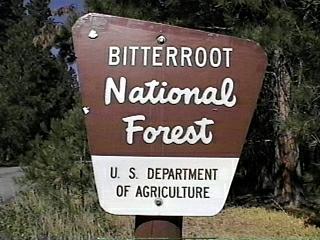
Campground List
CAMPGROUND NAME: Alta

VISIT DATE: 08/22/1997

UPDATE DATE: 12/24/2021

STATE: Montana

REGION: Northern

RANGER DISTRICT: West Fork

NEAREST CITY/TOWN: Darby

RESERVATIONS: 1-877-444-6777 or make on-line reservation

DIRECTIONS:
From Darby, MT, take US Rt. 93 south 3.7 miles to West Fork
Rd. (State Rt. 473).  Turn right onto Rt. 473 and go 30 miles
to campground.

GENERAL COMMENTS:
The elevation is 4,580 ft.

The campground is located among a variety of pine especially
huge Ponderosa and is located on the West Fork of the
Bitterroot River.  Look for the "Indian Trees" that are
Ponderosa with large scars about shoulder height.  The bark was
stripped back by the Nez Perce Indians to extract cambium - a
chewy, sweet delicacy.  The Hughes Creek is also a location
where placer gold mining occurred.

North of the campground is Forest Rt. 5703.  Go up this dirt
road a mile or so and view groves (or plots) of huge, majestic
Ponderosa Pines, some of which are in the Kramer Memorial Pine
Grove.  There is also dispersed camping along Forest Rt. 5703.

SEASONS
Open Seasonal: Yes
Open All Year: Yes

Seasonal Comment:
Services provided May 27 through September 5.  No fee
from November 1 to April 30.

RATE AND MAXIMUM STAY PERMITTED
Rate: $15 per day
Maximum Stay Permitted (days): 14

CAMPGROUND SITE CONFIGURATION
No. RV Sites: 0
No. Tent Sites: 0
No. Combined Sites (Tent or RV): 15

   Total Sites: 15

Tent Pads: No
Open Sites: No
Wooded Sites: Yes

No. Tables on Sites: 14
No. Grilles on Sites: 15
Equestrian Camping:  No

RV INFORMATION
Hookups: None
No. RV Pull Throughs: 1
Waste Station: No
Average Parking Apron Size: 12' X 53'

Comments:
The parking aprons are grass and gravel.  There is a waste
station available for a fee at the West Fork Lodge, 4.7 miles
from the Sam Billings campground (National Forest) on State
Rt. 473 (West Fork Rd.).

FACILITIES
Vaults: Yes
Flush Toilets: No
Hot Showers: No
Wheelchair Friendly Toilets: No

Public Phone: No
Playground: No
No. Water Spigots: 3
  No. Threaded: 0

WATER SPORTS
Lake: No
Swimming (provided): No
Sailing: No
Boat Ramp: No
Boat Carry Down Access: Yes
Power Boating: No
Boating (no power): Yes
Water Skiing: No
Rafting (whitewater): Yes
Kayaking (whitewater): Yes

Comments:
Wading in West Fork of Bitterroot River.  Floating
activities possible during high water periods.

HIKING - No

FISHING
Rainbow and Brook Trout and Mountain Whitefish.  Bull and
Cutthroat Trout are catch and release.

CAMPGROUND NAME: Charles Waters Campground

VISIT DATE: 08/26/1997

UPDATE DATE: 12/24/2021

STATE: Montana

REGION: Northern

RANGER DISTRICT: Stevensville

NEAREST CITY/TOWN: Florence

RESERVATIONS: No

DIRECTIONS:
From Florence, MT, take US Rt. 93 south 3.1 miles to "Recreation
Site Bass Creek" sign.  Turn right after sign (comes up quickly)
onto Bass Cr Rd. and go 2 miles to campground on left.

GENERAL COMMENTS:
The elevation is 3,520 ft.

The campground, once the outdoor laboratory for Dr. Charles
Waters research on the life history and control of forest tree
diseases, consists of a spur next to a large grass meadow and a
loop passing through a pleasant blend of deciduous and conifer
trees.  Some sites are adjacent to Bass Creek, while others
especially along the spur, have views of the Selway-Bitterroot
Wilderness.  One campsite is dedicated to bicycle campers.
Because of the excellent hiking and day trip opportunities
(Missoula for one), this is an excellent destination
campground.

For great views of of Bitterroot Valley and Bass Creek Canyon,
take Forest Rt. 1136
(turn left when exiting campground) for about 7 miles to the
"overlook."  (Turn left at "T" intersection, about 1.6 miles
from start.)  The road is dirt, single-lane and winds its way
up the mountainside to 6,100 ft.  The drive up takes one
through a variety of trees from aspen and Ponderosa pine to
Lodgepole pine and Western larch.  Take a picnic lunch and
enjoy the viewing surprises at the "overlook."

This is bear country; practice safe storage techniques.

SEASONS
Open Seasonal: Yes
Open All Year: Yes

Seasonal Comment:
Services provided Memorial Day through Labor Day
- weather dependent

RATE AND MAXIMUM STAY PERMITTED
Rate: $15 per day
Maximum Stay Permitted (days): 14

CAMPGROUND SITE CONFIGURATION
No. RV Sites: 0
No. Tent Sites: 1
No. Combined Sites (Tent or RV): 24

   Total Sites: 25

Tent Pads: No
Open Sites: No
Wooded Sites: Yes

No. Tables on Sites: 25
No. Grilles on Sites: 25
Equestrian Camping:  No

RV INFORMATION
Hookups: None
No. RV Pull Throughs: 8
Waste Station: No
Average Parking Apron Size: See RV Comments below

Comments:
The parking aprons are paved and can accommodate any size RV.

FACILITIES
Vaults: Yes
Flush Toilets: No
Hot Showers: No
Wheelchair Friendly Toilets: Yes

Public Phone: No
Playground: No
No. Water Spigots: 6
  No. Threaded: 0

WATER SPORTS - None

HIKING
Bass Creek Trail (horse & foot - into the Bitterroot-Selway
Wilderness) - 12 miles
Fitness Trail (loop-foot) - 0.25 miles
Nature Trail (loop-foot) - 0.5 miles
Ecology Trail (loop-foot) - 2.5 miles
Day Use Trail (loop - foot, mountain bike & horse) - 6 miles

FISHING
Rainbow, Cutthroat and Brook Trout

CAMPGROUND NAME: Indian Trees

VISIT DATE: 08/22/1997

UPDATE DATE: 12/24/2021

STATE: Montana

REGION: Northern

RANGER DISTRICT: Sula

NEAREST CITY/TOWN: Sula

RESERVATIONS: 1-877-444-6777 or make on-line reservation

DIRECTIONS:
From Sula, MT, take US Rt. 93 south 6 miles to campground sign.
Turn right at sign and go 0.7 miles to "Y" intersection.  Bear
right at intersection into campground.

GENERAL COMMENTS:
The elevation is 4,840 ft.

Campground is conveniently located next to US Rt. 93 under old
Ponderosa pines.  The campground gets its name from the "Indian
Trees" that are Ponderosa with large scars about shoulder height.
The bark was stripped back by the Nez Perce Indians to extract
cambium - a chewy, sweet delicacy.  The Ponderosa and Camp Creek
make this campground pleasantly scenic.

NOTE: One site is reserved for a bicyclist(s).

SEASONS
Open Seasonal: Yes
Open All Year: No

Seasonal Comment:
Open May 27 through September 30

RATE AND MAXIMUM STAY PERMITTED
Rate: $15 per day
Maximum Stay Permitted (days): 14

CAMPGROUND SITE CONFIGURATION
No. RV Sites: 0
No. Tent Sites: 0
No. Combined Sites (Tent or RV): 16

   Total Sites: 16

Tent Pads: No
Open Sites: No
Wooded Sites: Yes

No. Tables on Sites: 16
No. Grilles on Sites: 16
Equestrian Camping:  No

RV INFORMATION
Hookups: None
No. RV Pull Throughs: 4
Waste Station: No
Average Parking Apron Size: 12' X 53'

Comments:
The parking aprons are paved.

FACILITIES
Vaults: Yes
Flush Toilets: No
Hot Showers: No
Wheelchair Friendly Toilets: Yes

Public Phone: No
Playground: No
No. Water Spigots: 2
  No. Threaded: 0

WATER SPORTS - None

HIKING - No

FISHING
Cutthroat Trout

CAMPGROUND NAME: Lake Como

VISIT DATE: 08/21/1997

UPDATE DATE: 12/24/2021

STATE: Montana

REGION: Northern

RANGER DISTRICT: Darby

NEAREST CITY/TOWN: Darby

RESERVATIONS: No

DIRECTIONS:
From Darby, MT, take US Rt. 93 north 3.6 miles to Lake Como sign.
Turn left at sign and go 2.9 miles to Lake Como Recreation Area
sign.  At the intersection after the sign, turn right and go 0.6
miles to another intersection.  Turn left and immediately left
again into campground.

GENERAL COMMENTS:
The elevation is 4,300 ft.

The campground, a.k.a. Lower Como, is a single loop through a
stand of mixed pine and fir trees and one of three campgrounds
in the Lake Como Recreation Area, is located below Lake Como.
The understory is grass
with good privacy between campsites.  Excellent RV sites.

This is bear country; practice safe food storage techniques.

SEASONS
Open Seasonal: Yes
Open All Year: No

Seasonal Comment:
Open Memorial Day through Labor Day.

RATE AND MAXIMUM STAY PERMITTED
Rate: $25 per day plus $5 per day surcharge for hookups.  No
discount on surcharge.
Maximum Stay Permitted (days): 14

CAMPGROUND SITE CONFIGURATION
No. RV Sites: 0
No. Tent Sites: 0
No. Combined Sites (Tent or RV): 12

   Total Sites: 12

Tent Pads: No
Open Sites: No
Wooded Sites: Yes

No. Tables on Sites: 12
No. Grilles on Sites: 12
Equestrian Camping:  No

RV INFORMATION
No. Full Hookups (includes waste): 0
No. Water and Electric Only: 12
No. Water Only: 0
No. Electric Only: 0

No. RV Pull Throughs: 12
Waste Station: No
Average Parking Apron Size: See RV Comments

Comments:
Parking aprons are paved.  All sites will take any size RV.
A waste station, available for a fee, is located at Angler's
Roost (private), south of Hamilton, MT on US Rt. 93.

FACILITIES
Vaults: Yes
Flush Toilets: No
Hot Showers: No
Wheelchair Friendly Toilets: Yes

Public Phone: Yes
Playground: No
No. Water Spigots: 4
  No. Threaded: 0

WATER SPORTS
Lake: Yes
Swimming (provided): Yes
Sailing: No
Boat Ramp: Yes
Boat Carry Down Access: No
Power Boating: Yes
Boating (no power): Yes
Water Skiing: Yes
Rafting (whitewater): No
Kayaking (whitewater): No

Comments:
Lake Como is 913 acres.  It is popular for canoeing.  The
beach is large and sandy.  The boat ramp is located at south
side of dam.

HIKING
Kramis Pond Trail (loop) - 0.1 miles
Lake Como Loop - 8 miles
Rock Creek Trail No. 580 - 14 miles

FISHING
Rainbow and Cutthroat Trout and Kokanee Salmon

CAMPGROUND NAME: Rock Creek Horse Camp

VISIT DATE: 08/19/1997

UPDATE DATE: 3/4/2021

STATE: Montana

REGION: Northern

RANGER DISTRICT: Darby

NEAREST CITY/TOWN: Darby

RESERVATIONS: No

DIRECTIONS:
From Darby, MT, take US Rt. 93 north 3.6 miles to Lake Como
sign.  Turn left at sign onto Lake Como Rd. and go 3.3 miles to
campground sign.  Turn left at sign into campground.

GENERAL COMMENTS:
The elevation is 4,200 ft.

The campground is located on south end of Lake Como and is one
of three campgrounds in the Lake Como Recreation Area.  It is a
single loop through Lodgepole and Ponderosa pines with some
firs and shrubs scattered around the campground.  There are
hitching rails and feeders for horses and other stock.  There
is also a wheelchair friendly loading ramp.  Rocky ground makes
pitching a tent a challenge.

SEASONS
Open Seasonal: Yes
Open All Year: Yes

Comments: Services provided Memorial Day through Labor Day

RATE AND MAXIMUM STAY PERMITTED
Rate: $12 per day
Maximum Stay Permitted (days): 14

CAMPGROUND SITE CONFIGURATION
No. RV Sites: 0
No. Tent Sites: 1
No. Combined Sites (Tent or RV): 10

   Total Sites: 11

Tent Pads: No
Open Sites: No
Wooded Sites: Yes

No. Tables on Sites: 11
No. Grilles on Sites: 11
Equestrian Camping:  Yes

RV INFORMATION
Hookups: None
No. RV Pull Throughs: 7
Waste Station: No
Average Parking Apron Size: 14' X 40'

Comments:
The parking aprons are gravel.  There is a waste station,
available for a fee, at Angler's Roost (private), south of
Hamilton, MT on US Rt. 93.

FACILITIES
Vaults: Yes
Flush Toilets: No
Hot Showers: No
Wheelchair Friendly Toilets: Yes

Public Phone: No
Playground: No
No. Water Spigots: 0

Comments:
Water available at Upper Como and Lake Como campgrounds.

WATER SPORTS
Lake: Yes
Swimming (provided): Yes
Sailing: No
Boat Ramp: Yes
Boat Carry Down Access: No
Power Boating: Yes
Boating (no power): Yes
Water Skiing: Yes
Rafting (whitewater): No
Kayaking (whitewater): No

Comments:
Lake Como is 913 acres.  It is popular for canoeing.  The beach
is large and sandy beach.  Boat ramp is located at south side of
dam.

HIKING
Rock Creek Trail No. 580 - 14 miles

FISHING
Rainbow and Cutthroat Trout and Kokanee Salmon

CAMPGROUND NAME: Rombo

VISIT DATE: 08/22/1997

UPDATE DATE: 12/24/2021

STATE: Montana

REGION: Northern

RANGER DISTRICT: West Fork

NEAREST CITY/TOWN: Darby

RESERVATIONS: 1-877-444-6777 or make on-line reservation

DIRECTIONS:
From Darby, MT, take US Rt. 93 south 3.7 miles to West Fork Rd.
(State Rt. 473 south).  Turn right onto Rt. 473 and go 18.1 miles
to campground sign.  Turn right at sign into campground.

GENERAL COMMENTS:
The elevation is 4,600 ft.

The campground, friendly for RVs, stretches along the West Fork
of Bitterroot River and is about 4 miles north of the Painted
Rocks Lake.  There are various species of pines and some sites
overlook the river.  The understory is grass, knicknick, and
other shrubs.  Pine, fir, and various deciduous trees provide
ample shade to campsites.

SEASONS
Open Seasonal: Yes
Open All Year: Yes

Seasonal Comment:
Services provided May 20 through September 5

RATE AND MAXIMUM STAY PERMITTED
Rate: $15 per day
Maximum Stay Permitted (days): 14

CAMPGROUND SITE CONFIGURATION
No. RV Sites: 0
No. Tent Sites: 0
No. Combined Sites (Tent or RV): 15

   Total Sites: 15

Tent Pads: No
Open Sites: Yes
Wooded Sites: Yes

No. Tables on Sites: 15
No. Grilles on Sites: 15
Equestrian Camping: No

RV INFORMATION
Hookups: None
No. RV Pull Throughs: 0
Waste Station: No
Average Parking Apron Size: 13' X 50'

Comments:
The parking aprons are gravel.  An RV waste station with no
potable water, is available for a fee at Buds and Shirley's
Motel at intersection of Main St. and Missoula Ave., Darby, MT.
Ask in cafe for location.  Threaded water spigot for RVs is
located next to site #16.

FACILITIES
Vaults: Yes
Flush Toilets: No
Hot Showers: No
Wheelchair Friendly Toilets: Yes

Public Phone: No
Playground: No
No. Water Spigots: 6
  No. Threaded: 1

Comments:
Threaded water spigot for RVs is located next to site #16.

WATER SPORTS
Lake: No
Swimming (provided): No
Sailing: No
Boat Ramp: No
Boat Carry Down Access: Yes
Power Boating: No
Boating (no power): Yes
Water Skiing: No
Rafting (whitewater): Yes
Kayaking (whitewater): Yes

Comments:
Wading in the river.  Canoeing and rafting possible
during high-water period.  Not a rated rafting river.

HIKING - No

FISHING
Rainbow, Brook Trout, Bull and Cutthroat Trout and
Mountain Whitefish.  Bull and Cutthroat Trout are
catch and release.

CAMPGROUND NAME: Sam Billings Memorial

VISIT DATE: 08/22/1997

UPDATE DATE: 3/4/2021

STATE: Montana

REGION: Northern

RANGER DISTRICT: West Fork

NEAREST CITY/TOWN: Darby

RESERVATIONS: 1-877-444-6777 or make on-line reservation

DIRECTIONS:
From Darby, MT, take US Rt. 93 south 3.7 miles to West Fork
Rd.  (State Rt. 473).  Turn right onto Rt. 473 and go 13.4
miles Sam Billings Recreation Site sign (Forest Rt. 5631).  Turn
right at sign onto Rt. 5631 (dirt, single-lane) and go 0.8 miles
to another campground sign.  Turn left at sign into campground.

NOTE: Forest Rt. 5631 is single lane with turnouts.

GENERAL COMMENTS:
The elevation is 4,500 ft.

The campground, stretching out 0.4 miles, is adjacent to Boulder
Creek and Selway-Bitterroot Wilderness and is pack it in, pack
it out.  It is set in  various species of pines and is rustic
and peaceful.  Some sites are located on the creek.  The
understory is grass and pine needles.  Privacy between campsites
is good with very nice shade provided by the pines.  Moose, Elk,
and deer are occasional visitors.

This is bear country; practice safe food storage techniques.

SEASONS
Open Seasonal: No
Open All Year: Yes

RATE AND MAXIMUM STAY PERMITTED
Rate: $10 per day
Maximum Stay Permitted (days): 14

CAMPGROUND SITE CONFIGURATION
No. RV Sites: 0
No. Tent Sites: 0
No. Combined Sites (Tent or RV): 12

   Total Sites: 12

Tent Pads: No
Open Sites: No
Wooded Sites: Yes

No. Tables on Sites: 12
No. Grilles on Sites: 12
Equestrian Camping:  No

RV INFORMATION
Hookups: None
No. RV Pull Throughs: 0
Waste Station: No
Average Parking Apron Size: 12' X 48'

Comments:
The parking aprons are gravel and the interior road is also
gravel and tight.  An RV waste station, with no potable water,
is available for a fee at Bud's and Shirley's
Motel - intersection of Main St. and Missoula Ave., Darby, MT.

FACILITIES
Vaults: Yes
Flush Toilets: No
Hot Showers: No
Wheelchair Friendly Toilets: Yes

Public Phone: No
Playground: No
No. Water Spigots: 0

WATER SPORTS - None

HIKING
Boulder Creek Trail #617 - foot and horse (through
Selway-Bitterroot Wilderness) - 27 miles.  Boulder Falls is
4 miles from trail head.

FISHING
Brook, Rainbow and Cutthroat Trout

CAMPGROUND NAME: Spring Gulch

VISIT DATE: 08/22/1997

UPDATE DATE: 12/24/2021

STATE: Montana

REGION: Northern

RANGER DISTRICT: Sula

NEAREST CITY/TOWN: Sula

RESERVATIONS: 1-877-444-6777 or make on-line reservation

DIRECTIONS:
From Sula, MT, take US Rt. 93 north 2.9 miles to campground sign.
Turn right at sign into campground.

GENERAL COMMENTS:
The elevation is 4,100 ft.

The campground is located between the East Fork of the
Bitterroot River and US Rt. 93.  Grass in the campground is
cut giving the campground an open, spacious feel.  Some sites
overlook the river.

SEASONS
Open Seasonal: Yes
Open All Year: No

Seasonal Comment:
Open May 26 through September 4 - weather dependent

NOTE:  Campground may be closed due to Springtime flooding.
Contact District Ranger office for status.

RATE AND MAXIMUM STAY PERMITTED
Rate: $15 per day
Maximum Stay Permitted (days): 14

CAMPGROUND SITE CONFIGURATION
No. RV Sites: 0
No. Tent Sites: 0
No. Combined Sites (Tent or RV): 12

   Total Sites: 12

Tent Pads: No
Open Sites: Yes
Wooded Sites: Yes

No. Tables on Sites: 12
No. Grilles on Sites: 12
Equestrian Camping: No

RV INFORMATION
Hookups: None
No. RV Pull Throughs: 1
Waste Station: No
Average Parking Apron Size: 14' X 63'

Comments:
The parking aprons are paved.  There is waste station,
available for a fee, at the Moosehead Gallery and Store located
at the corner of US Rt. 93 and Forest Rt. 5728.

FACILITIES
Vaults: Yes
Flush Toilets: No
Hot Showers: No
Wheelchair Friendly Toilets: Yes

Public Phone: No
Playground: No
No. Water Spigots: 4
  No. Threaded: 1

WATER SPORTS - None

HIKING - No

Comments:
There is a 0.1 mile paved path along East Fork of the Bitterroot
River.

FISHING
Cutthroat Trout.  There is wheelchair friendly fishing pier.

CAMPGROUND NAME: Three Frogs

VISIT DATE: 08/21/1997

UPDATE DATE: 3/4/2021

STATE: Montana

REGION: Northern

RANGER DISTRICT: Darby

NEAREST CITY/TOWN: Darby

RESERVATIONS: No

DIRECTIONS:
From Darby, MT, take US Rt. 93 north 3.6 miles to Lake Como
sign.  Turn left at sign onto Lake Como Rd. and go 2.8 miles to
Lake Como Recreation Area sign.  At the intersection after sign,
turn right go 0.6 miles to another intersection.  Turn left and
then immediately right and go 0.5 miles to campground.

NOTE: Last 0.3 miles is a single-lane, gravel road.

GENERAL COMMENTS:
The elevation is 4,400 ft.

The campground has two loops and is one of three located in the
Lake Como Recreation Area.  It is the furthest from the dam with
some sites overlooking the lake.  Kramis Pond, at the entrance to
campground, is frequently visited by moose.  The campsites are
nestled among aspen, pine and boulders.  The campground was
formerly named Upper Como.

SEASONS
Open Seasonal: Yes
Open All Year: Yes

Seasonal Comment:
Open Memorial Day weekend through Labor Day weekend

RATE AND MAXIMUM STAY PERMITTED
Rate: $15 per day
Maximum Stay Permitted (days): 14

CAMPGROUND SITE CONFIGURATION
No. RV Sites: 0
No. Tent Sites: 4
No. Combined Sites (Tent or RV): 16

   Total Sites: 20

Tent Pads: Yes
Open Sites: Yes
Wooded Sites: Yes

No. Tables on Sites: 20
No. Grilles on Sites: 20
Equestrian Camping: No

RV INFORMATION
Hookups: None
No. RV Pull Throughs: 0
Waste Station: No
Average Parking Apron Size: 12' X 30'

Comments:
The parking aprons are gravel.  A waste station, available for a
fee, is located at Angler's Roost (private), south of Hamilton, MT
on US Rt. 93.

FACILITIES
Vaults: Yes
Flush Toilets: No
Hot Showers: No
Wheelchair Friendly Toilets: Yes

Public Phone: No
Playground: No
No. Water Spigots: 3
  No. Threaded: 2

Comments:
One spigot is at the host site, one is before the Woods Cabin
entrance and the other is at the trailhead parking area.

WATER SPORTS
Lake: Yes
Swimming (provided): Yes
Sailing: No
Boat Ramp: Yes
Boat Carry Down Access: Yes
Power Boating: Yes
Boating (no power): Yes
Water Skiing: Yes
Rafting (whitewater): No
Kayaking (whitewater): No

Comments:
Lake Como is 913 acres.  Lake is popular for canoeing.  There
is large sandy beach.  Boat ramp is located at south side of dam.

HIKING
Kramis Pond Trail (loop) - 0.1 miles
Lake Como Loop - 8 miles
Rock Creek Trail No. 580 - 14 miles

FISHING
Rainbow and Cutthroat Trout and Kokanee Salmon

CAMPGROUND NAME: Warm Springs

VISIT DATE: 08/22/1997

UPDATE DATE: 3/4/2021

STATE: Montana

REGION: Northern

RANGER DISTRICT: Sula

NEAREST CITY/TOWN: Sula

RESERVATIONS: No

DIRECTIONS:
From Sula, MT, take US Rt. 93 north 2.9 miles to campground
sign.  Turn left at sign and go 1.3 miles to another campground
sign.  Turn left at sign into campground.

GENERAL COMMENTS:
The elevation is 4,240 ft.

Campground is located along the Warm Springs Creek with some
sites on the creek.  The campground has a peaceful setting,
nestled among various species of pine.

SEASONS
Open Seasonal: Yes
Open All Year: No

Seasonal Comment:
Open May 26 through September 4

RATE AND MAXIMUM STAY PERMITTED
Rate: $12 per day
Maximum Stay Permitted (days): 14

CAMPGROUND SITE CONFIGURATION
No. RV Sites: 0
No. Tent Sites: 0
No. Combined Sites (Tent or RV): 13

   Total Sites: 13

Tent Pads: No
Open Sites: No
Wooded Sites: Yes

No. Tables on Sites: 13
No. Grilles on Sites: 13
Equestrian Camping: No

RV INFORMATION
Hookups: None

No. RV Pull Throughs: 0
Waste Station: No
Average Parking Apron Size: 12' X 48'

Comments:
Parking aprons are gravel and asphalt.  There is waste station
at the Moosehead Gallery and Store located at the corner of US
Rt. 93 and Forest Rt. 5728 - $5 fee.

FACILITIES
Vaults: Yes
Flush Toilets: No
Hot Showers: No
Wheelchair Friendly Toilets: Yes

Public Phone: No
Playground: No
No. Water Spigots: 2
  No. Threaded: 1

WATER SPORTS - None

HIKING - No

FISHING
Cutthroat Trout
|